Canyons of the Waterpocket Fold: The Other Grand Gulch
Friday – Monday, March 18-21, 2022
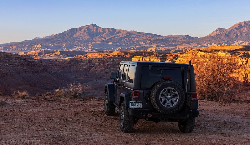
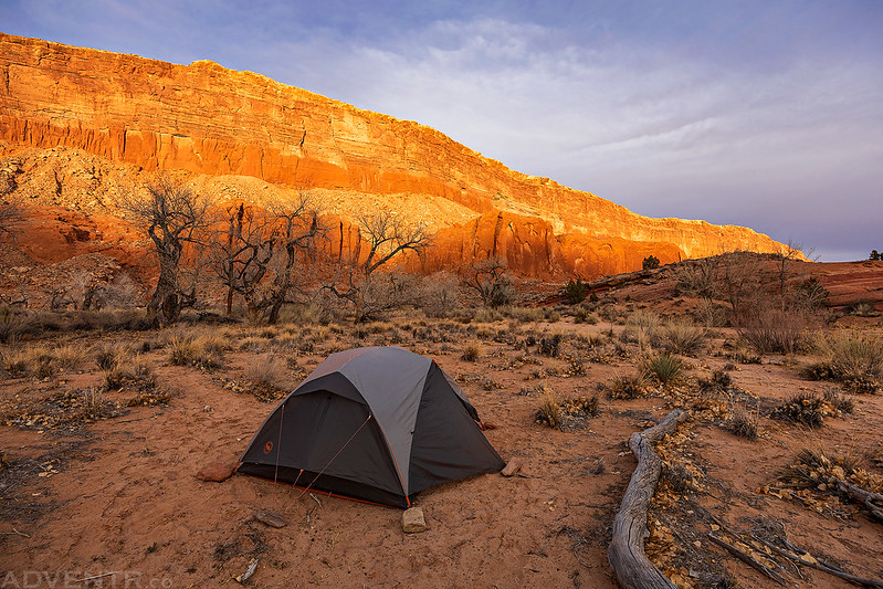
This weekend I finally had the opportunity to hike into the Halls Creek Narrows which are located at the very southern tip of Capitol Reef National Park, as I continue to work my way through the many interesting Canyons of the Waterpocket Fold. This hike has been long overdue for me as I’ve tentatively planned to go here almost every year for at least the last five years, but it seems that something has always come up that made me cancel those plans- usually the weather forecast. Since Diane had a couple days off from school for a short spring break after this weekend she would also be able to join me on this three day backpacking trip. I left early from work on Friday afternoon and we made our way into Utah after Diane was finished taking her latest exam. I stopped to grab an early dinner from Stan’s in Hanksville and topped off my gas tank at $4.89 per gallon before we continued on past Trachyte Creek and Ticaboo to the Burr Trail Road where we found a great campsite overlooking Bullfrog Creek to the Henry Mountains. We set up our tent at the rim of the canyon and relaxed around camp for the remainder of the evening before going to bed early after photographing a pretty lackluster sunset.
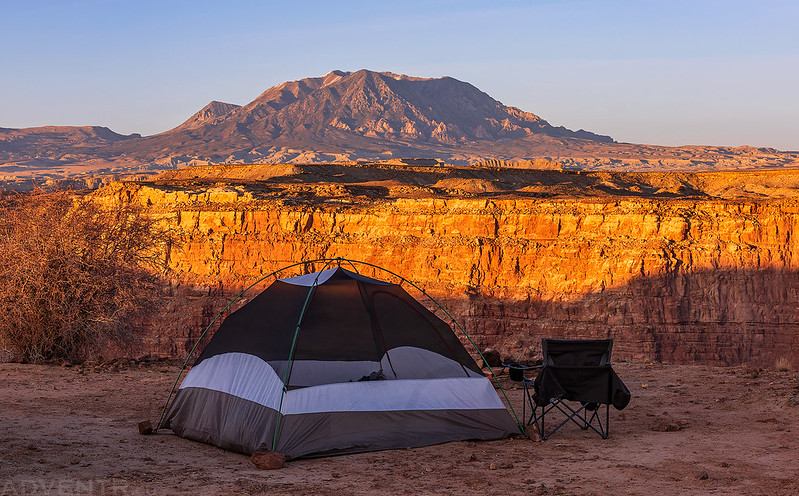
An evening view of Mount Pennell from our campsite at the edge of Bullfrog Creek.
Evening light on the rim of the canyon with Mount Hillers above.
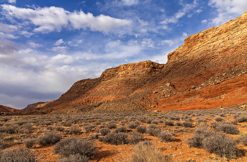
Bullfrog Creek Below

Bullfrog Creek Overlook

Bullfrog Creek at Dusk

We both slept very well overnight as the air was calm and the temperature was comfortable and only dropped down into the lower 40’s. I woke up shortly before sunrise to take a few photos and noticed there was already a thin layer of clouds in the sky. The sun did peek out for a bit but then the sky became even more overcast as we packed up camp and drove the rest of the way to the Halls Creek Overlook.
Morning light from the rim of Bullfrog Creek Canyon.

Morning Light at Camp
As we started our descent to Halls Creek across from Deer Point there was a little bit of blue left in the sky, but it didn’t stick around long.

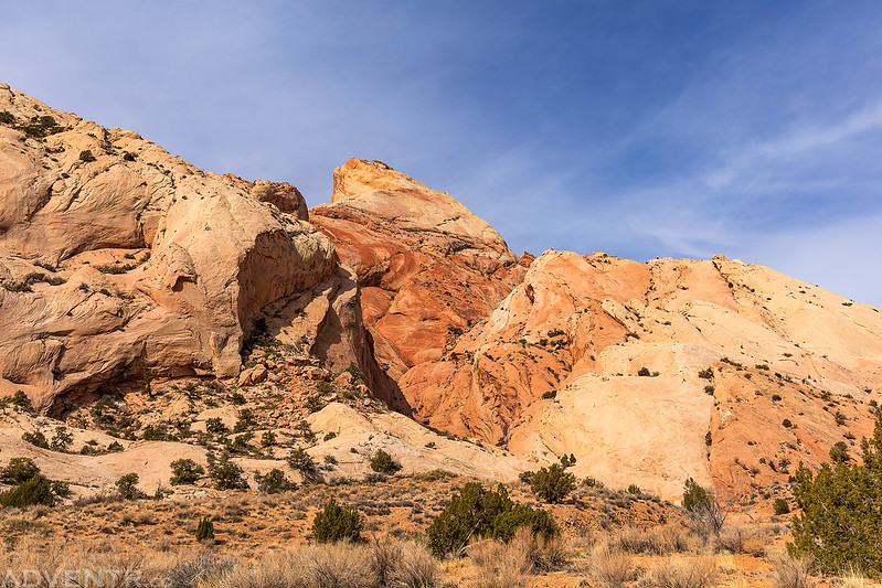
We passed the Red Slide and Fountain Tanks as we followed the route of the historic Halls Road through Grand Gulch. We had also followed other sections of the Halls Wagon Road when we hiked through Silver Falls Creek and Lower Muley Twist Canyon, so it was nice to check out yet another segment.
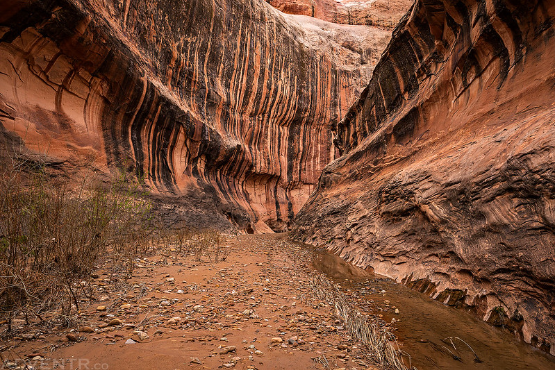
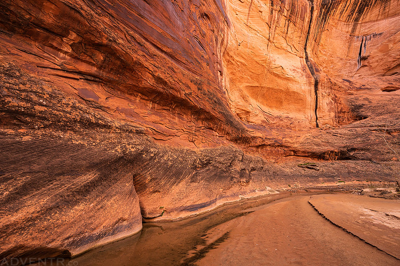
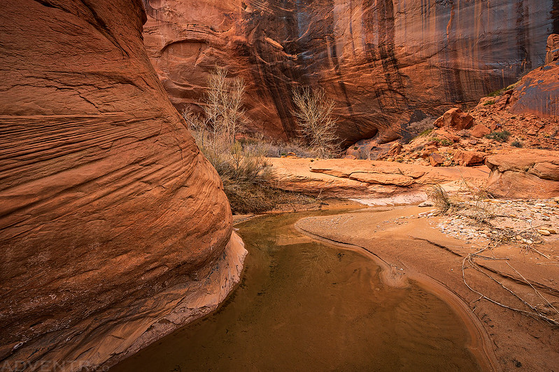
Shortly before reaching the Halls Creek Narrows, which is where Halls Creek makes a turn to the west and cuts a couple of deep meanders into the Waterpocket Fold, we found a nice sandy campsite and set up our tent. Diane rested at camp while I hiked into the narrows until I couldn’t go any further without getting my feet wet. The sky was still overcast, so the light in the canyon was not great and I didn’t take many photos hoping that the light would be better on Sunday.
Rocky Narrows
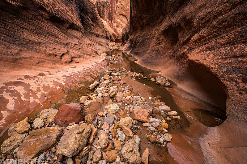
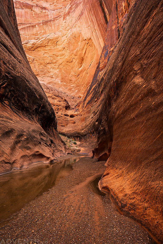
Looking into the narrows at my turn-around point.

After returning to camp and eating dinner, the sun did make a surprise visit shortly before sunset, so I grabbed my camera and wandered across the sandstone surrounding our campsite near the Hall Divide.

Looking into the beginning of the Halls Creek Narrows from above.
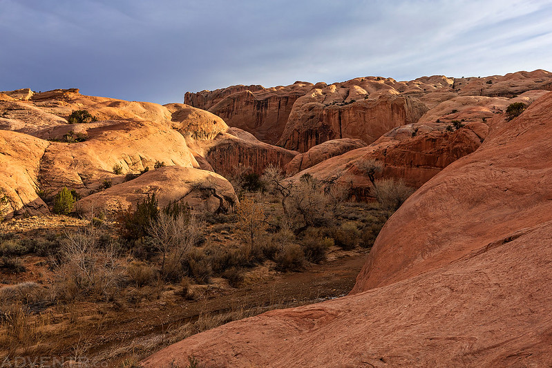
Wandering the sandstone at the base of the Waterpocket Fold.

I’m used to spending a lot of time exploring the Grand Gulch of Cedar Mesa, but this is the other Grand Gulch in Utah.

Our sandy campsite below the cliffs of Hall Mesa just before the sun disappeared for good.
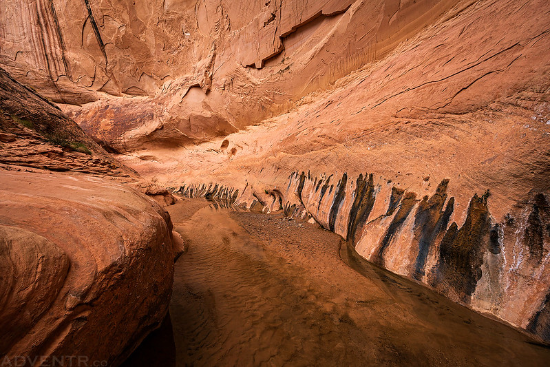
Unfortunately, we did not sleep as well on Saturday night as we had on Friday night, especially when the wind started to gust loudly overnight. Although the temperature was still pretty warm out in the morning, the sky was darkly overcast which made me a little hesitant about entering the narrows today without being able to check an updated weather forecast. We took our time getting ready and then slowly started hiking into the narrows hoping that the sky would clear, but it didn’t. When we reached the point I had turned around the evening before I still was not comfortable continuing on, so I thought we better return to camp and then hike the other direction over the Hall Divide to see if the sky would clear or maybe we could get cell signal on top to check the weather. Although my phone never got any signal on top of the Hall Divide, Diane got one bar and was able to text a friend for an updated weather forecast. There was only a 1% chance of rain today which made me more comfortable proceeding into the canyon. We continued down the other side of the divide and then started hiking back up Halls Creek through the narrows.
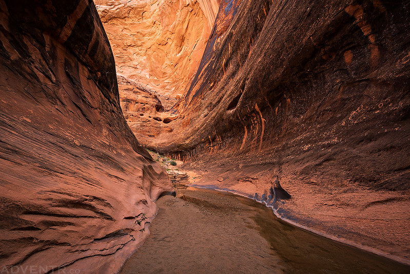
Entering the Halls Creek Narrows
Around the first big bend.

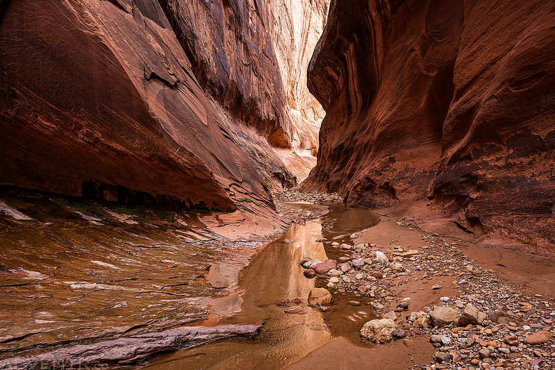
We knew the deepest water of the hike was going to be at this end of the narrows, so it wasn’t a surprise when we quickly reached it.

This was the deepest pool of the hike which was below waist-deep for us.

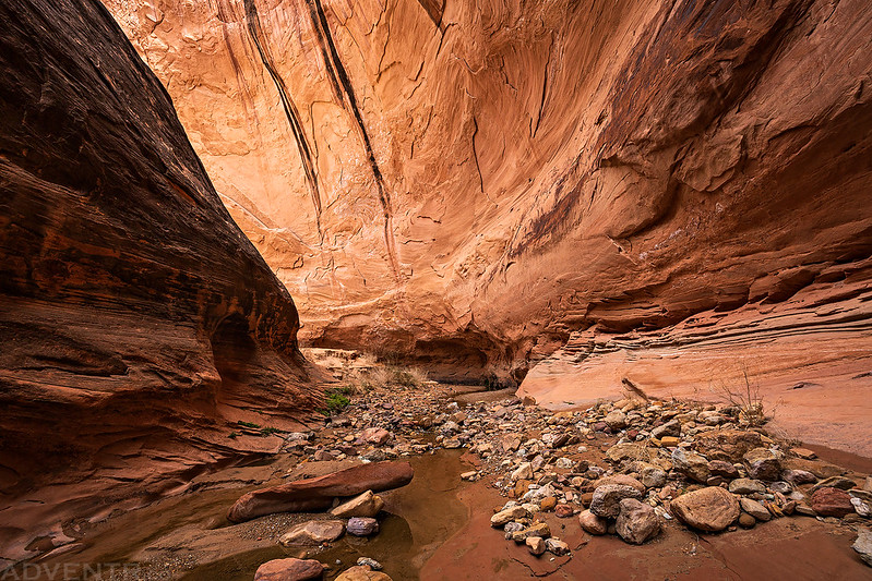
Narrows & Seeps

Although the overcast conditions didn’t make for great photos in the canyon, it was still a beautiful and enjoyable hike.

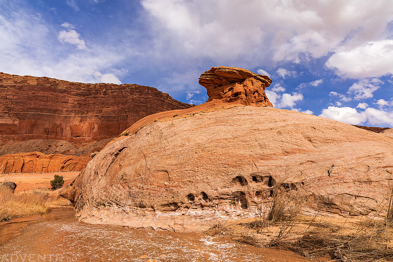
We even started to see a little blue sky by the time we reached this large fin above the canyon.
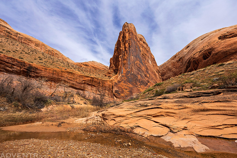
With the blue sky came a bit more sunlight which added some nice colors to the canyon as we continued upstream.

The blue in the sky was a welcomed sight!


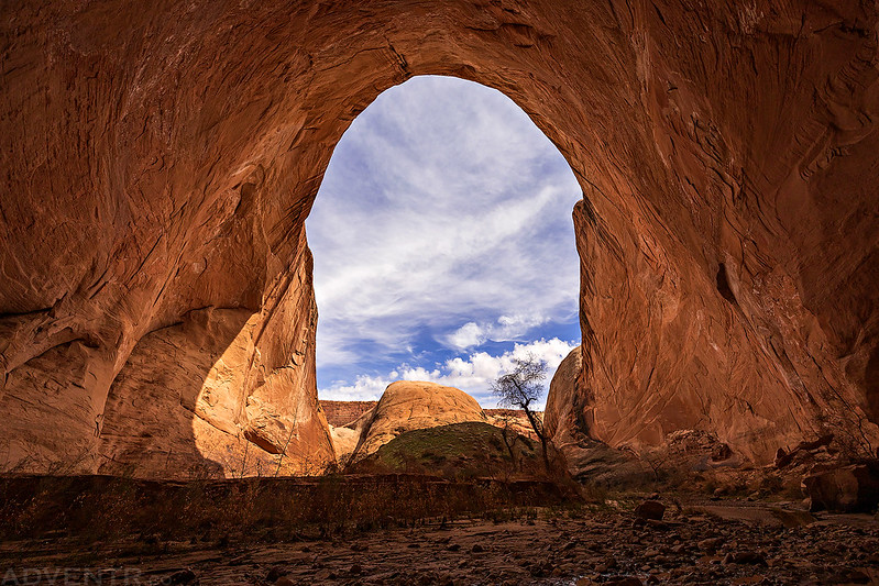
As we neared the point I had turned around twice coming downstream, we entered this large alcove.

Then we returned to this massive alcove, which was even larger!
We were tired when we returned to camp, since we had hiked longer than I had planned after changing directions early in the morning, so we filtered some water and rested for a bit. We weren’t looking forward to a long hike with a steep climb out on Monday morning, so we decided instead of hanging around camp all evening that we would pack up and hike about halfway out to the Fountain Tanks instead.
Leaving the narrows on our way back up Halls Creek.
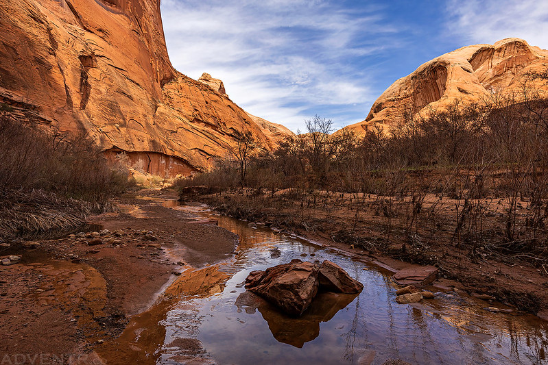
At least the clouds were looking nicer above Grand Gulch this evening.
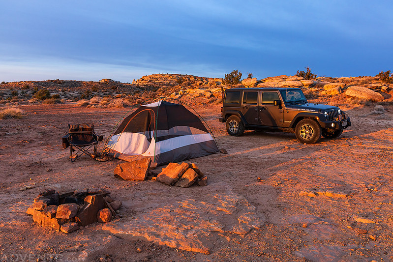
We made it to the Fountain Tanks and set up our tent shortly before sunset.

Shortly before sunset the wind really started to pick up and it stayed windy all night and into the morning. I’m glad I had brought earplugs along since I really needed them this night. Shortly after the sun set it started to rain for a couple of hours and then continued on and off a couple more times during the night. Although the storm and clouds were starting to clear by the time we got up before sunrise on Monday morning, the temperature had dropped significantly and the wind was cold as we started our hike out.
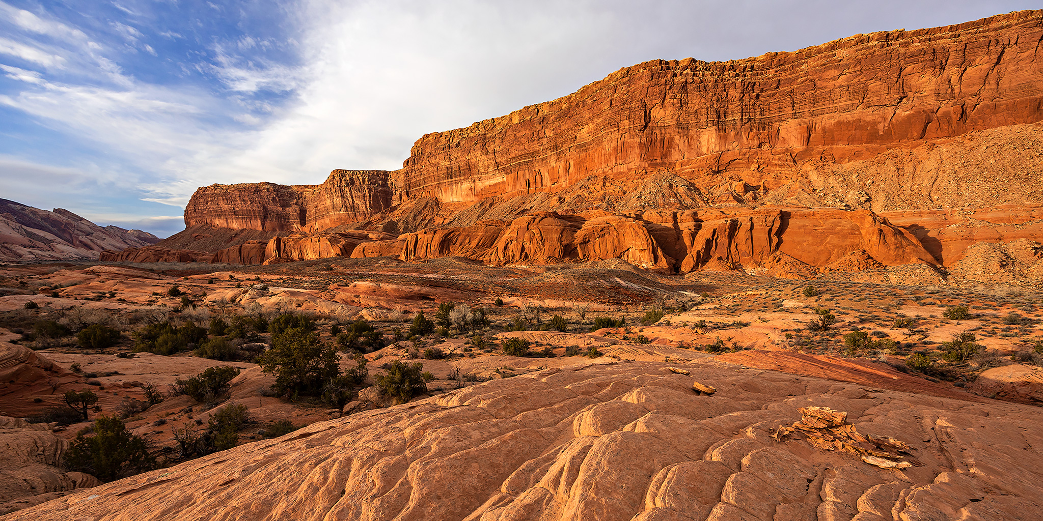
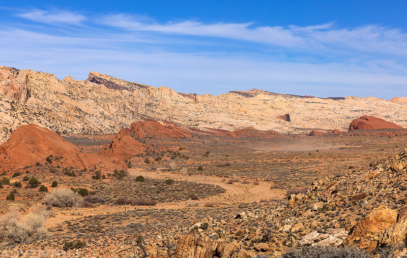
Spotted light on the Waterpocket Fold as we started our hike back up Halls Creek past the Red Slide.

The Waterpocket Fold

Here you can see the wind blowing the dust around below as we started the climb back up to the Halls Creek Overlook. It was very windy out this morning!
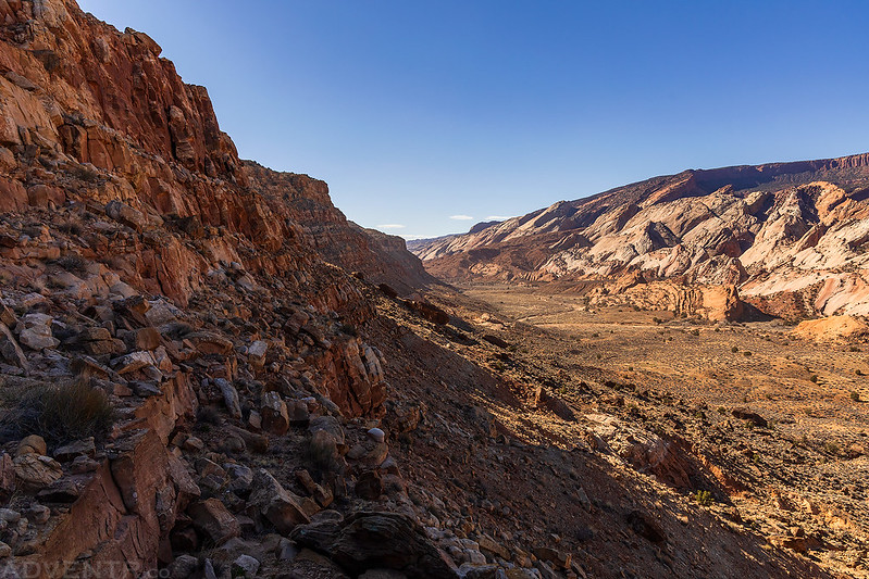
Following the trail up the cliffs and out of Grand Gulch.
Next time you might consider using the Airport route to get down into Hals Creek, makes for a considerably shorter (albeit, more technical) approach. Also it’s fun to climb on top of the domes of the narrows and look down into them from 500 feet above.
I had considered that route, but didn’t want to attempt it with a large pack, so we took the longer but easier route.