Black Ridge Canyons Wilderness: West Fork of Jones Canyon
Saturday, April 18, 2020
Hiking to Perseverance Arch in the Black Ridge Canyons Wilderness area has been on my to-do list for a long time. I’ve always thought that I would do it as an overnight backpacking trip since it’s a pretty long hike, which is part of the reason why I kept putting it off. Now that I’ve been having to stay closer to home during the quarantine, I’ve been going through my list of local hikes that I never made time for in the past, and I decided that it was finally time for me to visit Perseverance Arch and cross it off my list! I figured that this long and remote hike would offer me plenty of solitude near home on a Saturday when it seems like more people than ever are getting outdoors in the area. I left home well before sunrise on Saturday morning and drove up to the trailhead in Glade Park so I could get an early start.
I arrived at the Jones Canyon Trailhead near Glade Park shorty after sunrise. Although I had passed by a number of occupied campsites along the way, my Jeep was the only vehicle at the trailhead this morning.

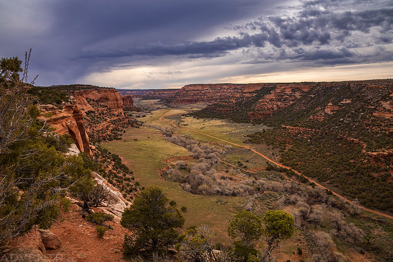
When I first started hiking down the old closed road there were dark clouds around and it looked like it was raining off in the distance. I hoped these clouds were going to clear out a little by the time I made it to Perseverance Arch since the weather forecast was calling for partly cloudy skies today.

From near the junction with the Jones Overlook Trail there was a distant view over to the butte and spire that Diane and I explored a few years ago.

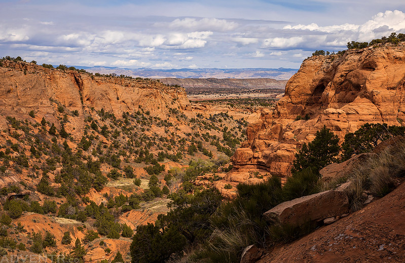
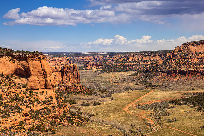
While the old road I hiked along follows close to the rim of the Little Dolores River Canyon, it was far enough away from the edge that there weren’t many views to be had into the canyon, so I would occasionally walk over to the edge for a look. Here’s a view into the mouth of Kings Canyon.

The Little Dolores River Canyon
After crossing the state line into Utah, the old road I had been following all morning ended at a grassy airstrip. From that point on there was no trail to follow the rest of the way to the arch, other than the occasional game trail.
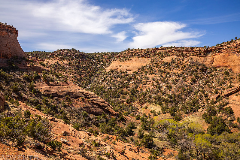
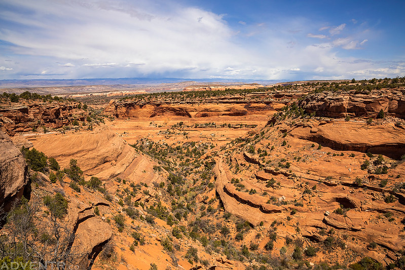
I soon found myself at the rim of the West Fork of Jones Canyon looking across to Perseverance Arch. I had to be careful while climbing down a steep and loose slope into the canyon so I could visit the arch on the other side.

I noticed the cottonwood trees in the canyon are starting to turn green for the season.

Once I reached the bottom of the canyon I crossed to the other side and started following and climbing the ledges on my way to the arch.

Hiking these ledges reminded me a little bit of exploring Cedar Mesa, which I’m missing right now.

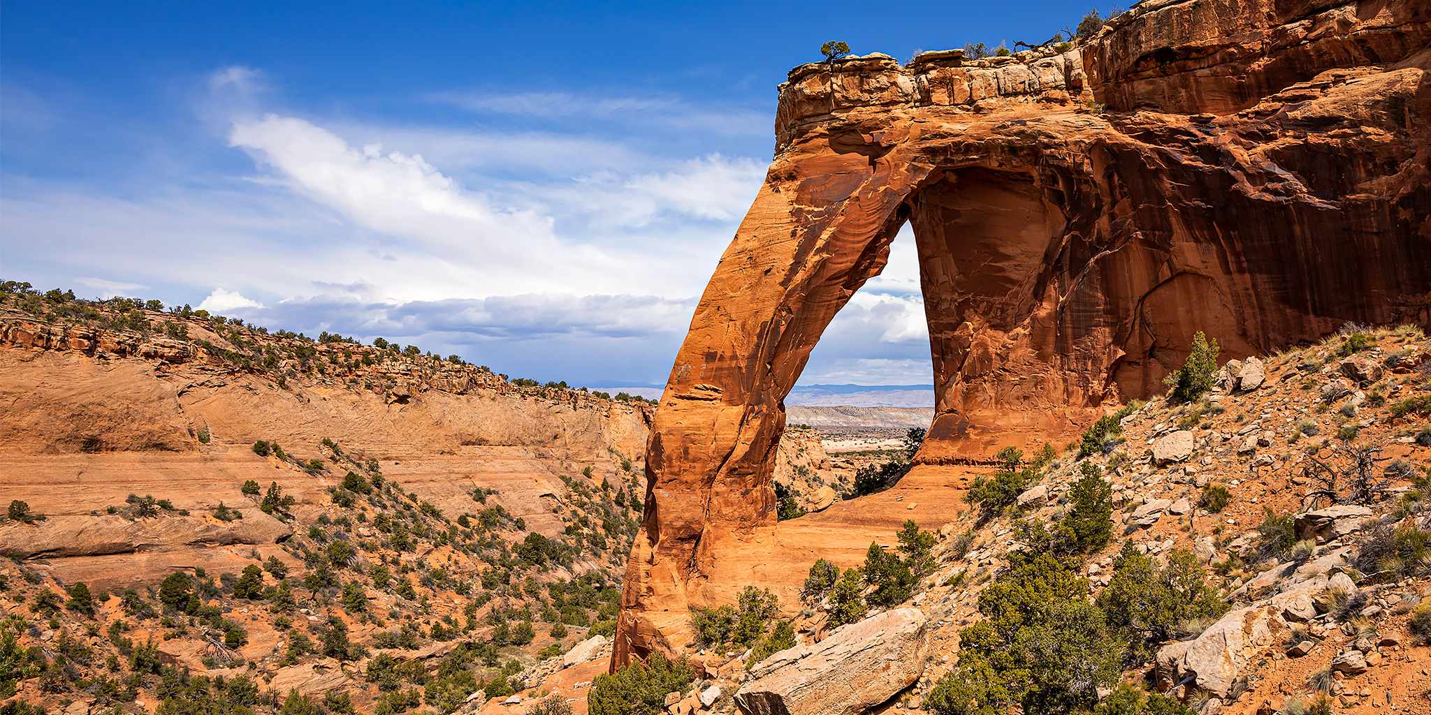
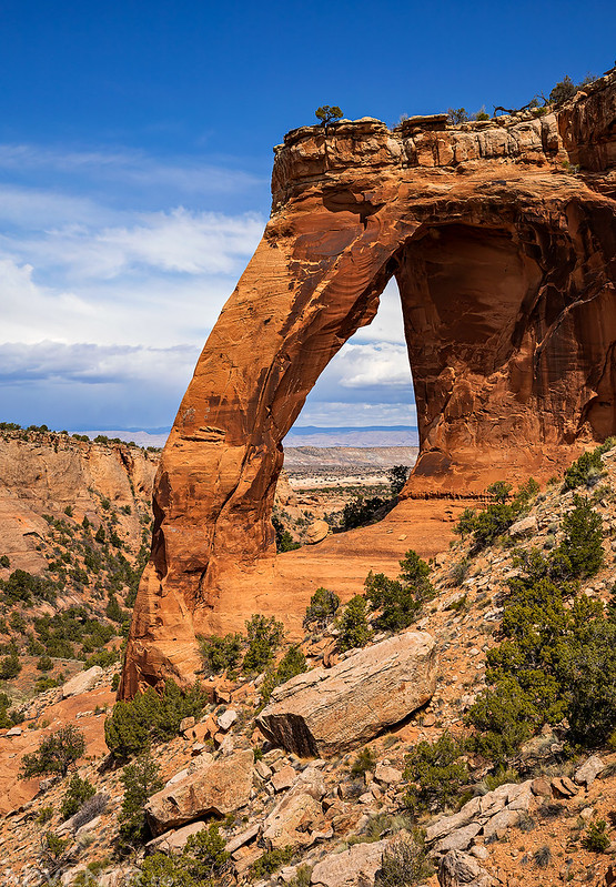
Approaching Perseverance Arch

I made my way below Perseverance Arch for a closer look.

I walked underneath this massive and amazing arch!

Then I continued through for a view from the other side.

Looking down-canyon from underneath the arch.
Seriously, this has got to be one of the best arches in the area that I have visited!

Looking back up-canyon from near the arch you can see the steep rocky slope I used to climb down into the canyon just left of center.
I climbed up to a high ledge across from the arch for a view of the canyon through the arch and stopped to have some lunch while I was up there.
After exploring around the arch for a while it was time to start heading back.

The climb out of the canyon was much easier for me than the steep descent into it was.

Leaving the West Fork of Jones Canyon as I started to find my way back to the airstrip and old road.
I stopped for a couple more views over the Little Dolores River on my way back, too.
The old road passed right next to this little sandstone knoll.

The last two miles of the hike followed along this ridge. My legs were getting tired and I slowed down a bit during these last two miles…

This was my last view over Wrigley Mesa and Westwater Mesa to the Book Cliffs and Roan Cliffs in the distance.
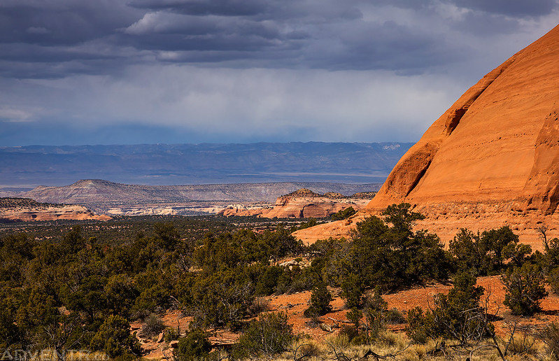
While following old Bs Road back to the trailhead, it looked like it was raining in the distance again.

Coming in at about 19 miles, I believe this is the third longest day hike (my longest hike just happened in February of this year) I have ever done. While it was a lot of miles, most of the hike followed an easy but mostly boring closed road. Visiting the impressive Perseverance Arch at the end was well worth all the miles! Plus, I didn’t see another person all day, which means it was another great place to practice social distancing in western Colorado!
Thanks for sharing.
Great pix as always. Thanks for feeding my desert deficiency! Are bikes not allowed on the old road?
I always thought bikes were allowed on this old road, so I had always planned to make this a bikepacking trip. But I recently looked into it and found out that bikes are not allowed, which is why I finally decided just to hike it.