Weminuche Wanderings | Thirteeners Around the Deer Park Cirque
Saturday & Sunday, August 29-30, 2020
This weekend I was originally planning to leave right after work on Friday like I usually do, so I could climb three thirteeners along the edge of the Weminuche Wilderness near Silverton on Saturday morning and then head back home in the afternoon so I could prepare for an upcoming trip later in the week. However, after looking at the weather forecast for Saturday and seeing that it was supposed to rain and storm for most of the day, I shuffled my plans around a bit since the weather on Sunday morning was looking like a safer bet for hiking in the San Juan Mountains. Since I was now home on Saturday morning, Diane and I ended up going for a bike ride in the rain along the Colorado River near our home instead. It was one of the coolest days of the summer so far and was a nice way to start the day.
Later on Saturday afternoon I left home and made my way over Red Mountain Pass to Silverton. As I approached Ridgway the Sneffels Range was engulfed in a much-needed rain storm and as I drove through Ouray it appeared that they had just received a good drenching, too, since there were large puddles of water everywhere and recent rockfall on the road. This was now my third weekend in a row driving through the single-lane construction zone of the Million Dollar Highway, and this time as I passed the vehicles waiting in the northbound lane I was surprised by how many rental Jeeps were out! I guess I rarely drive this road on a Saturday evening when everyone is headed back to Ouray after a day in the mountains. As soon as I reached the top of the switchbacks into Ironton Park traffic came to another standstill and I wasn’t sure why? After being stopped for a little bit we finally started moving again and it appeared that the road had been closed down while they were filming something, possibly a car commercial? After crossing over red Mountain Pass the sun started to come out again and the sky began to clear. When I reached Silverton I checked the most recent weather forecast one more time and it was looking good for Sunday morning. I had definitely made a good decision to change up my weekend plans! Then I started driving up the Kendall Mountain Road on my way to Deer Park.
Surprisingly, the spot I wanted to camp at was open when I arrived in Deer Park about an hour before sunset! As a bonus, I had a good view of all three peaks that I planned to hike in the morning.

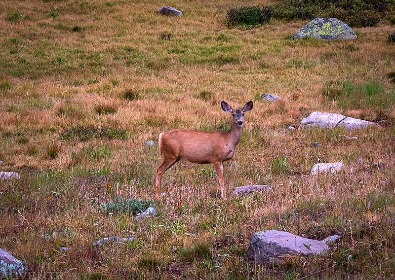
There were a few deer hanging out in Deer Park…
Shortly after I arrived I looked to the west and saw that there were some darker storm clouds headed my way.

Yep, it rained for a little while.

Soon the rain stopped and the sky started to clear up again. There was even a faint rainbow for a brief few seconds, but it was gone before I could get my camera turned on.
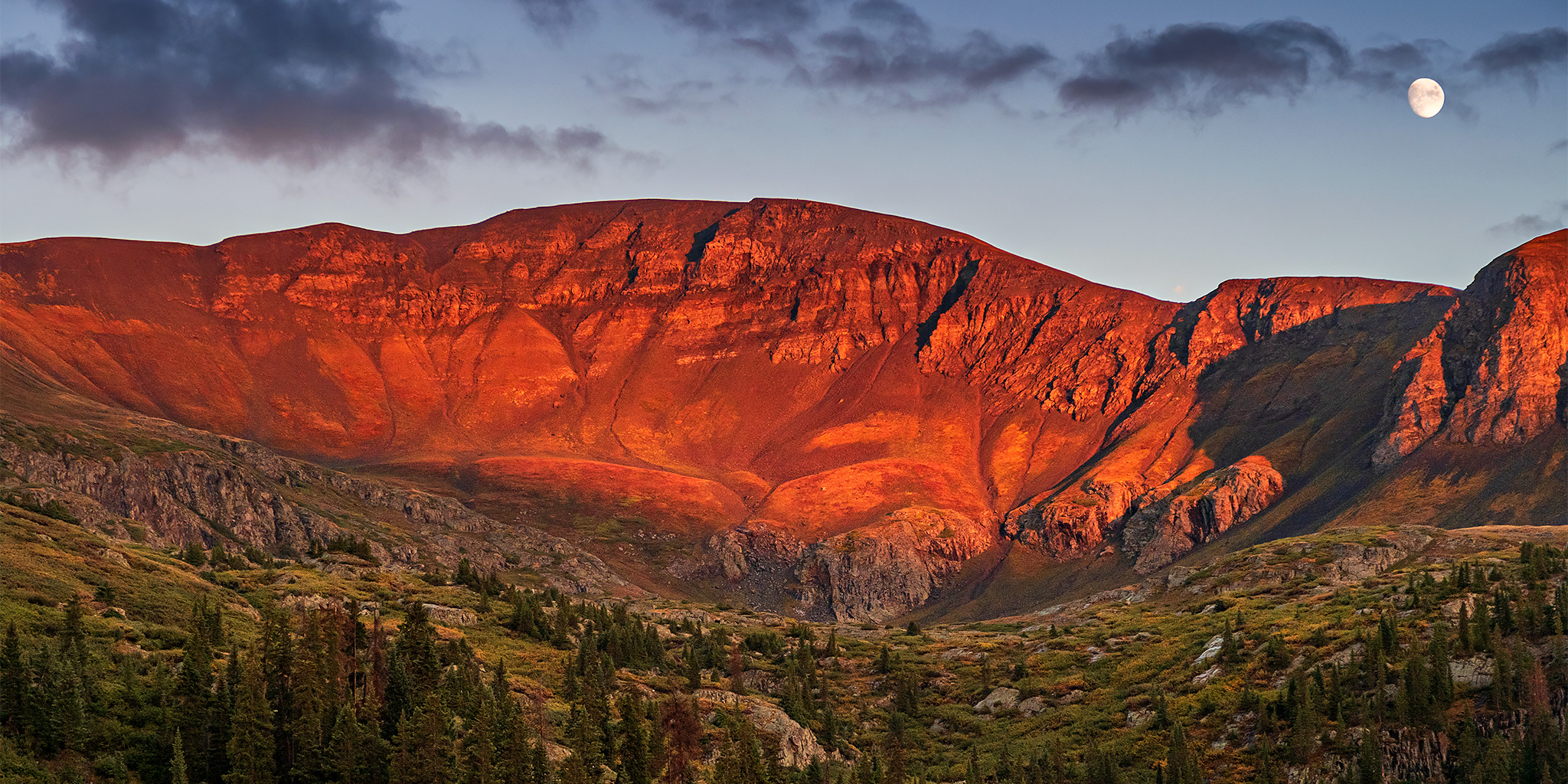
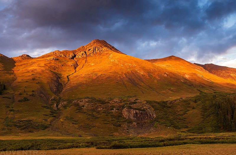
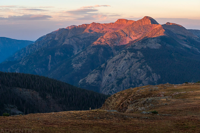
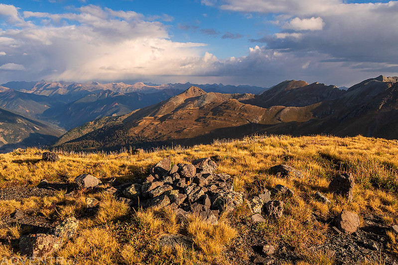
Evening light on the peak above my campsite with the clouds clearing out above it. At least the storms today cleared out the smoke that has been around for a while.

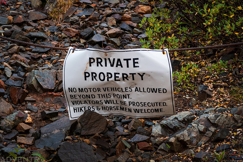
Shortly before sunset I walked down to the end of the road to scout out the trailhead for the morning and found that the old bus that used to be there is now gone.
My heart sank a little when I spotted this Private Property sign at the beginning of the trail, but I was relieved when I got close enough to read the bottom.
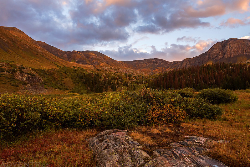
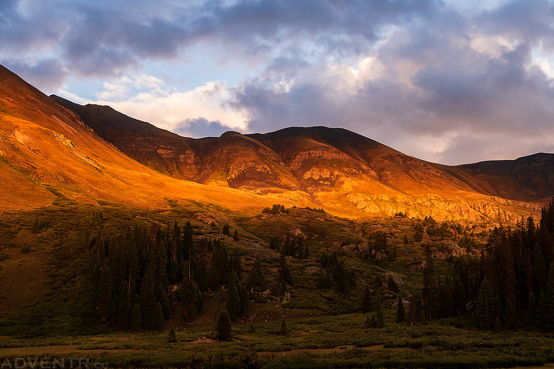
As I walked back to my Jeep for the night, the spectacular light show on the surrounding mountains was just beginning!
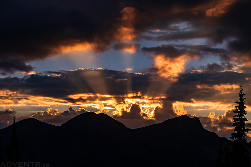
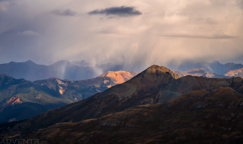
I turned around to see bright sun rays emanating from behind Grand Turk and Sultan Mountain.
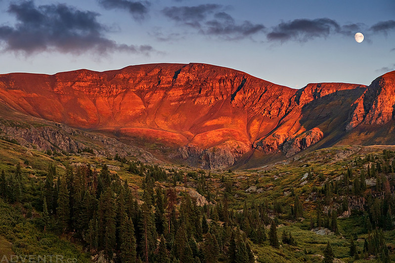
When I got back to camp I noticed the almost-full moon rising to the right of Whitehead Peak.

Light on the Ridge

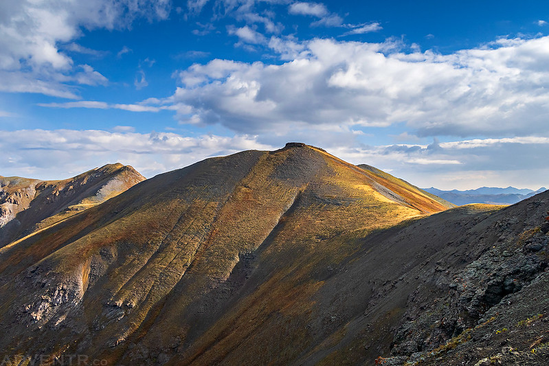
A touch of light on the peak above.

Whitehead Peak (13,259) and the Rising Moon
Last Light on PT 13109


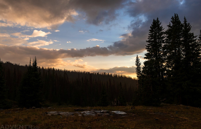
Here’s one last look at the colorful sky to the west before I got into my sleeping bag for the night. It was a beautiful evening!

It was 37 degrees out when I woke up about an hour before sunrise on Sunday morning. I drove to the end of the road and started hiking up the Whitehead Trail at dawn. There were some willows along the beginning of the trail that were wet from the rain the previous evening which got my pants a little wet, but once I got above treeline the hiking was across the open tundra on a good trail.
I had a nice view over Molas Pass to Engineer Mountain (12,968) just before the sun started to come up for the day.

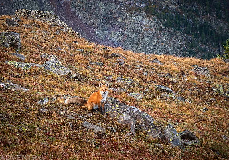
I also had a good view of the West Needle Mountains from the trail. Look closely in the tundra below the peaks and you might notice two foxes looking back at me!
Grand Turk and Sultan Mountain were looking nice behind me at sunrise.

The two foxes I saw were pretty interested in checking me out, and as long as I stood still they came closer to see what I was up to.

Here’s a short video clip of one of the foxes checking me out.
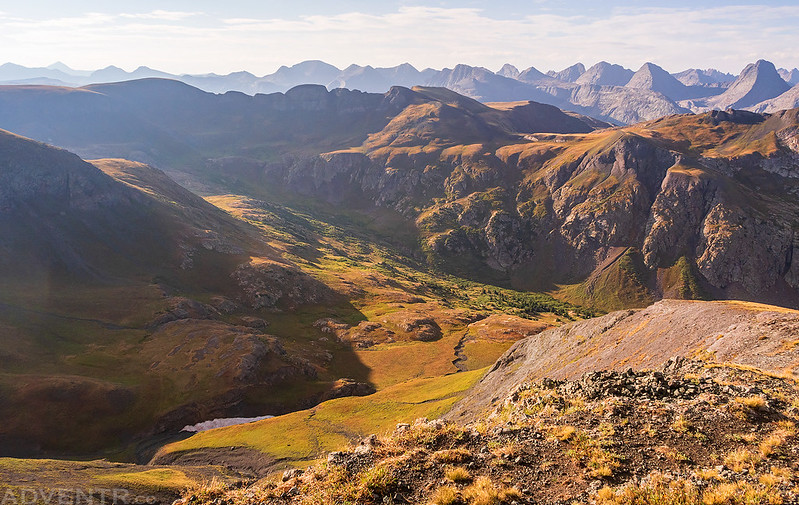
After leaving the foxes behind I hiked a little further along the trail and then looked down into Whitehead Gulch only to see three mountain goats below, two of which appear to be kids.

Morning light streaming into Whitehead Gulch

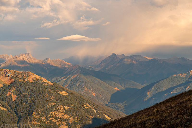
Soon I left the trail and started hiking up the southwest ridge to the summit of PT 13109. When I got a view over the ridge to the north it looked like it might be raining or snowing over there.
On the summit of PT 13109
Looking the other direction from the summit deeper into the Weminuche Wilderness.
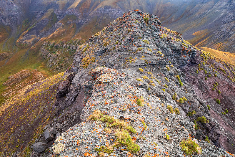
My plan from here was to follow the ridge over to the summit of Whitehead Peak, but I wasn’t expecting this narrow section of the ridge that almost stopped me!

This was the narrowest part of the ridge. Although it probably doesn’t look that bad in this photo, there was a big drop-off on both sides that worked up my fear of exposure. I almost turned around and headed back down the way I had come, but I stopped to compose myself and then slowly made it across this section of the ridge. Once on the other side it was an easy walk the rest of the way to Whitehead Peak.
It looked like there was more snow falling off in the distance.
Here’s another look down into Whitehead Gulch as I made my way over to Whitehead Peak.

Looking back to PT 13109 as I started climbing the ridge up to the summit of Whitehead Peak.

The snow was getting closer as I reached the summit and I even had a few flurries fall on me, but it didn’t last long.

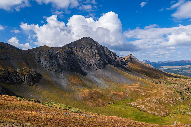
The view from the summit of Whitehead Peak to Mount Rhoda (13,402), my next and final destination of the morning.
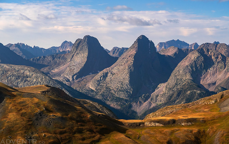
The views of the Grenadier Range including Arrow Peak and Vestal Peak from up here were pretty awesome!
Looking back to Whitehead Peak as I walked the easy ridge to Mount Rhoda.

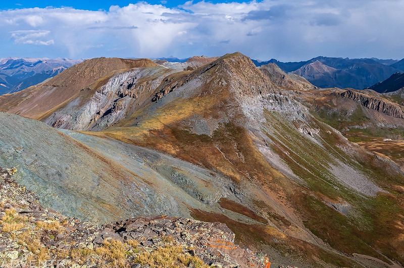
PT 13109 looks a lot more rugged from this angle.

It didn’t take me very long to reach the summit of Mount Rhoda.

The view down into Spencer Basin and over Sugarloaf (12,754) on the other side was pretty nice.

Looking to the north from the summit of Mount Rhoda.
After taking in the views from the summit I returned to the saddle and decided to try to descend from here to make a loop back through Deer Park. At first the descent wasn’t too steep, but it got a bit steeper and looser the further I went. Luckily, I was able to find a few faint game trails that helped me get down through the steepest parts.

One last view of PT 13109 after I made it down through the steepest part of the descent. From here it was a pretty easy hike back to the road.
Following the road through Deer Park back to my Jeep to complete the loop.

WOW! You had a lot of amazing things going on! Gorgeous light on mountains, storm clouds, foxes…! The switch in plans was indeed fortuitous. Thanks for the story and pics!
Beautiful pix. Loved seeing critters, too.