Saturday & Sunday, January 25-26, 2020
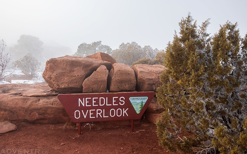
After spending a couple hours at the Ouray Ice Festival in the morning it was time to head west into Utah so I could get some hiking in the desert in this weekend. From Ridgway I crossed the Dallas Divide and followed the San Miguel River to Norwood, then crossed a couple large valleys and the Dolores River on my way to Dove Creek and finally stopped in Monticello for an early dinner. From there I was originally planning on heading into The Needles for the evening and was thinking about hiking the short Slickrock or Pothole Point trails to hopefully catch a nice sunset. However, as I was driving down Highway 211 I quickly decided I didn’t feel like driving all that way for a short hike and turned around at Photograph Gap. Instead, I thought it would be nice to spend the evening at the Needles Overlook in the Canyon Rims Recreation Area since it’s been a long time since I visited that viewpoint at the edge of Hatch Point. This turned out to be an excellent last minute change of plans!
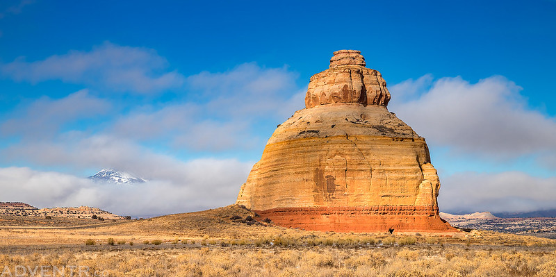
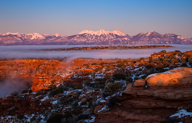
I have many photos of Church Rock from over the years, but I liked how the Las Sal Mountains were barely peeking through the low clouds in the background when I drove by this time.
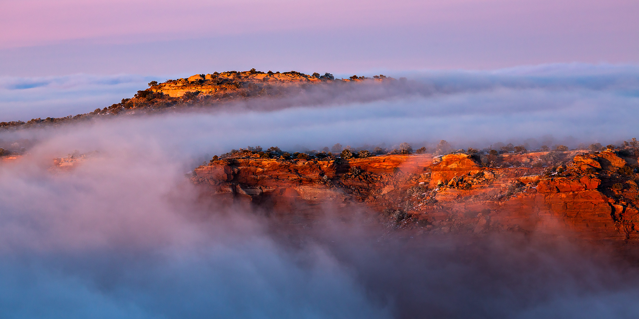
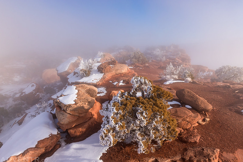
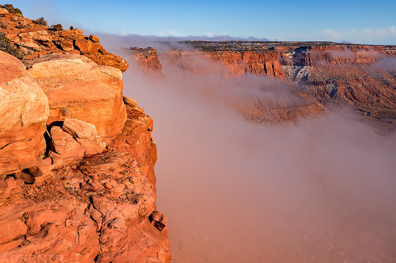
As I neared the Needles Overlook I drove right into a thick layer of fog and all the vegetation along the road was coated with a thick hoar frost. I was worried my decision to come up here had been a bad one, but I parked my Jeep and walked around to the different viewpoints anyway, which didn’t offer much of a view at the time. However, after waiting around for a little bit the fog and clouds started to move out and I was able to see the amazing views! The clouds continued to move in and out for the remainder of the evening while I ran around taking photos, being careful not to walk right off the edge! These are my favorite kinds of conditions to photograph and they made for some spectacular scenes this evening! I also saw a few different atmospheric optics this evening including my third Brocken Spectre (I actually saw quite a few of them) and my first Solar Corona, not to mention a beautiful sunset!
Welcome to the Needles Overlook shrouded in clouds.
There was not much of a view from the overlook when I first arrived…

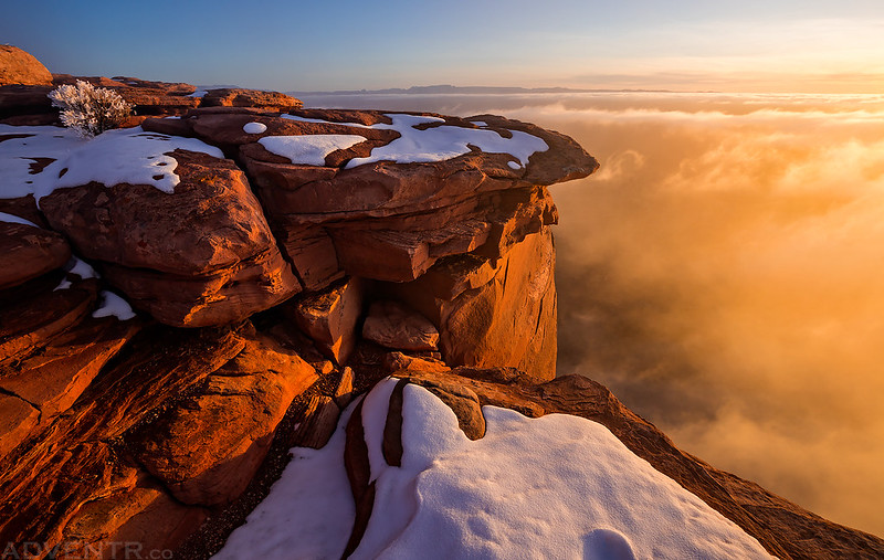
Walking along the edge of the cliff through the clouds to the end of the point. Watch your step, it’s a long way down!

I started to get my hopes up when I first saw a piece of blue sky above the fog.
Then there was more blue sky above me with clouds still below.

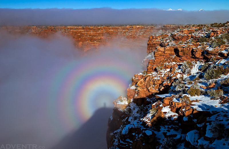
Since I now have a little experience photographing the Brocken Spectre, I knew I had to get to a high place where the sun would cast my shadow onto a cloud. I found a great spot and it worked wonderfully! This is by far the largest Brocken Spectre I have seen so far!
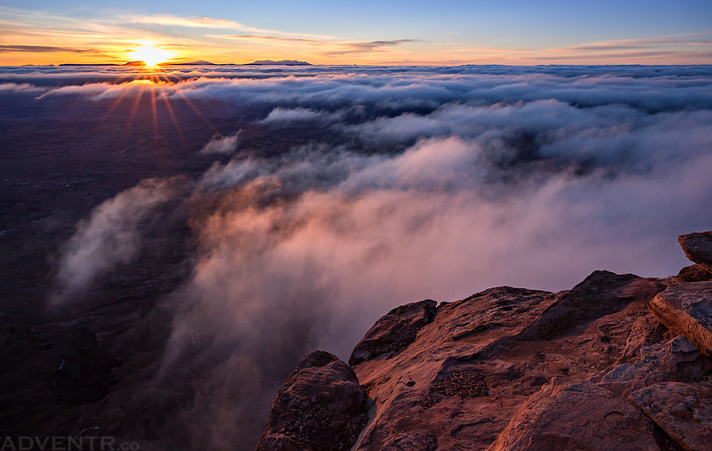
Soon the clouds almost completely cleared out and I had an unobstructed view over Indian Creek and The Needles to the Abajo Mountains. I was actually a little worried the clouds had disappeared for good and wouldn’t be around for sunset.

I was wrong and the clouds started to move back in again.
I returned to my high point so I could photograph another Brocken Spectre. This never gets old!
A Brocken Spectre from the Needles Overlook with the La Sal Mountains peeking up above the clouds. What a scene!

Soon the overlook was engulfed in clouds again.

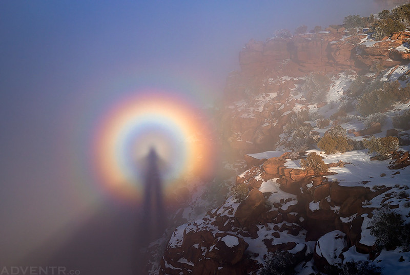
When the sun was shining on me and there were clouds behind me, the Brocken Spectre followed me around as I walked along the edge of the overlook.

The clouds clearing off the cliffs of Hatch Point again. This happened a few times.

Twin Rocks View

As I was waiting to photograph the actual sunset, I turned around to see one last Brocken Spectre. I also liked the way the boulders in front were arranged and lit up.

When I turned around I saw my very first Solar Corona. I don’t recall every seeing anything like this before. It was pretty cool and visible like this for a while.

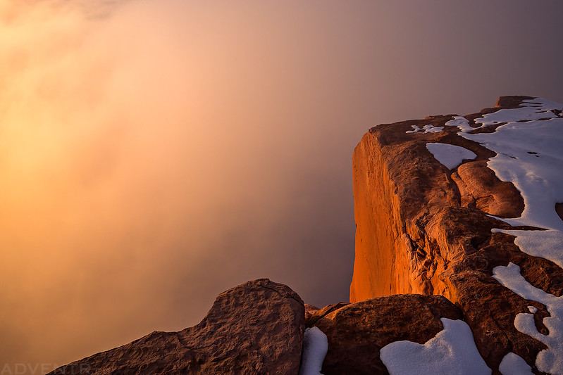
The light on the clouds below the cliffs really started to get nice shortly before sunset.
Over The Edge Sunset
Sea Of Clouds

Hatch Point engulfed by clouds.

Turning around I had a great view of the La Sal Mountains rising from the clouds.
Sunlight Above The Clouds

Here’s one last shot of the sun just before it disappeared behind the Henry Mountains.
Dissipating clouds at dusk.


After the sun was down and the light was gone, I got back in my Jeep and headed back out to the highway and then towards Moab. Before descending Blue Hill into Spanish Valley I turned off onto the Behind The Rocks road and found a campsite at the base of Bridger Jack Mesa for the night. It had been a long and exciting day and I went to bed early so I could get up early on Sunday for one long hike before heading back home.
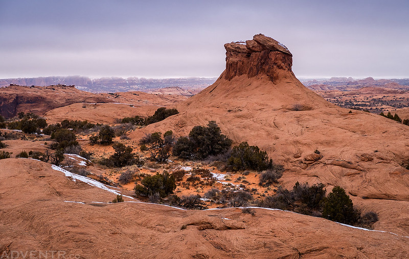
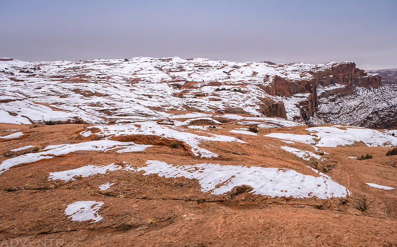
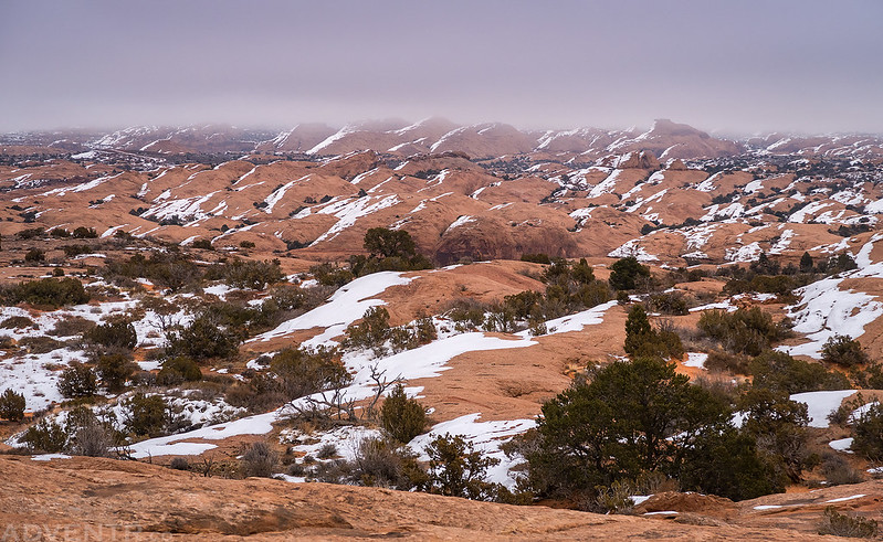
On Sunday morning I woke up early and finished the drive into Moab where I grabbed a quick breakfast and then drove up into the Sand Flats Recreation Area so I could hike the Slickrock Bike Trail. Just like Grand Junction, Moab had been stuck under an inversion for the last few weeks and it was still overcast and cold there today. I was hoping for the partly cloudy skies during my hike that the weather forecast had predicted, but it never happened. There were patches of snow on the Slickrock Trail here and there, but nothing that prevented me from hiking the trail at first. When I reached the loop split in the trail I decided to hike it counter-clockwise and took the right fork. Soon I passed by Shrimp Rock and had a nice view over the Colorado River Gorge and across to the Courthouse Towers in Arches National Park. Unfortunately, shortly after the trail passed Shrimp Rock and started climbing higher towards the ridge above Moab, it became increasingly covered in snow until I could no longer follow the painted dashed lines on the sandstone that marked the trail and I had to turn around.
Main Trail Loop

The Colorado River coming into view.
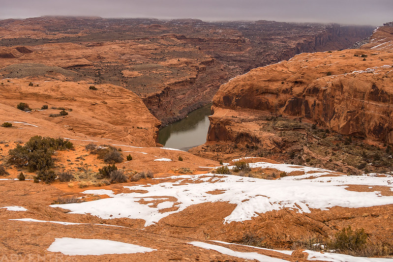
Overlooking the Colorado River Canyon.

After taking in this view I decided to take that road home after the hike since it had been a while.

The trail circles around Shrimp Rock.
It was about here that I noticed there was a lot more snow on the slickrock. I continued to follow the trail, but lost it a few times and then completely lost it and decided to turn around and head back the way I had come.
Sandstone & Low Clouds
Since I had to turn around, I was unable to hike the entire Slickrock Bike Trail loop. I will have to return another day for the rest of the trail…

When I returned to my Jeep I had hiked just over 11 miles and my legs were tired from all the ups and downs along the way. I drove back down the Sand Flats Road and grabbed a burger for lunch from Milt’s before heading home. It was another exciting weekend on the Colorado Plateau!
>> The Needles Overlook & Slickrock Bike Trail Photo Gallery
Been following you awhile to get my red rock fix, but this was utterly beyond spectacular
What a spectre! I’ve never seen such. It isn’t luck that you captured your shadow there. You
know how to be in the moment. Amazing capture.