Bonanza Bridge to the Enron Ramp | Fantasy Canyon & Goblin City
Friday – Sunday, June 28-30, 2019 | Average CFS: 2,745
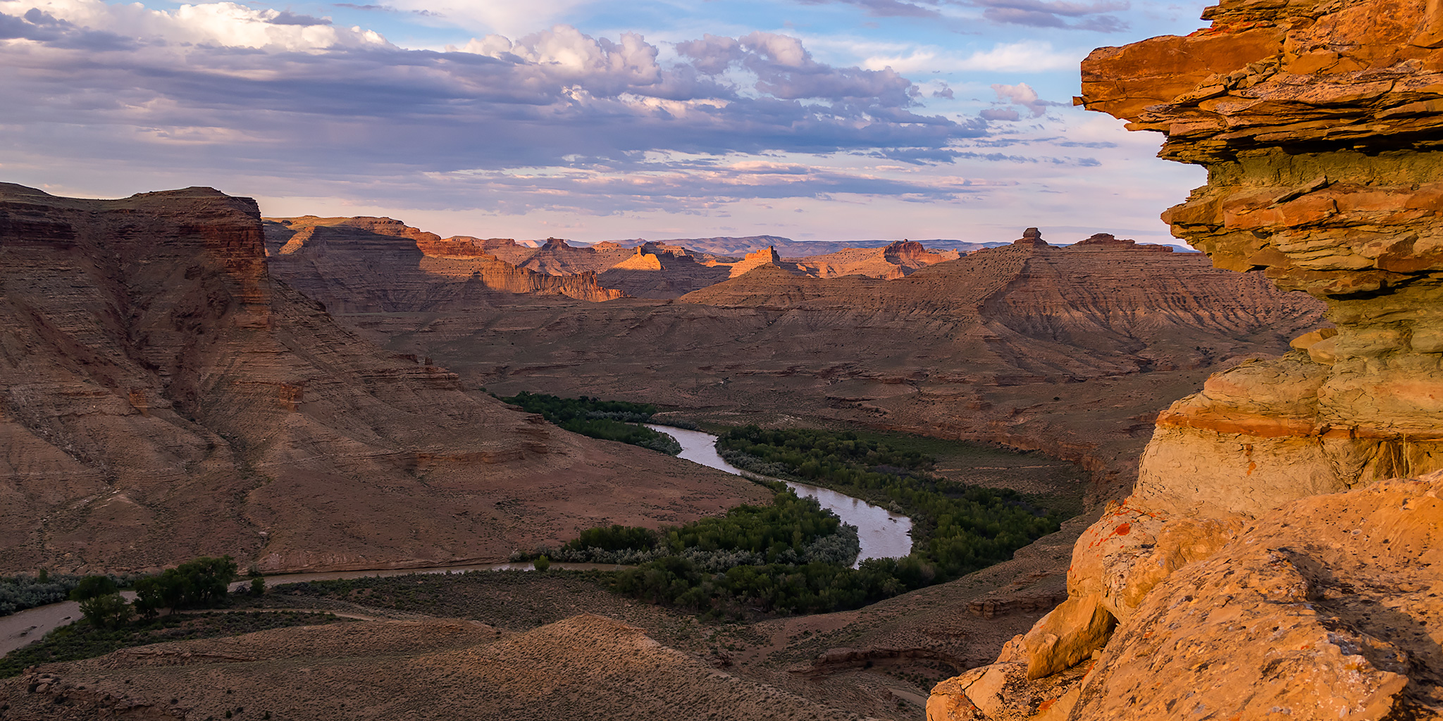
For the last weekend of National Rivers Month I definitely wanted to keep the streak going and get out on the river one last time before I started heading up into the mountains. I wanted to go somewhere new that wasn’t going to be crowded and that didn’t require a permit, so after looking at my options I decided to give the White River in Utah a try. There’s not too much information out there about this stretch of river, but from what I could find it looked like this would be a nice relaxing desert trip that doesn’t see too many people. The White River is born from snowmelt in mountain headwaters of the Flat Tops in western Colorado near where we hiked Sleepy Cat Peak early last summer, and then it flows west through Meeker and Rangely before entering Utah. From the state line it continues winding its way through the gas fields of the Uinta Basin along the northern edge of the East Tavaputs Plateau and joins the Green River in the Uintah and Ouray Indian Reservation. Our journey this weekend would begin at the Bonanza Bridge and end at the Enron Boat Ramp, which is about 35 miles of the river.
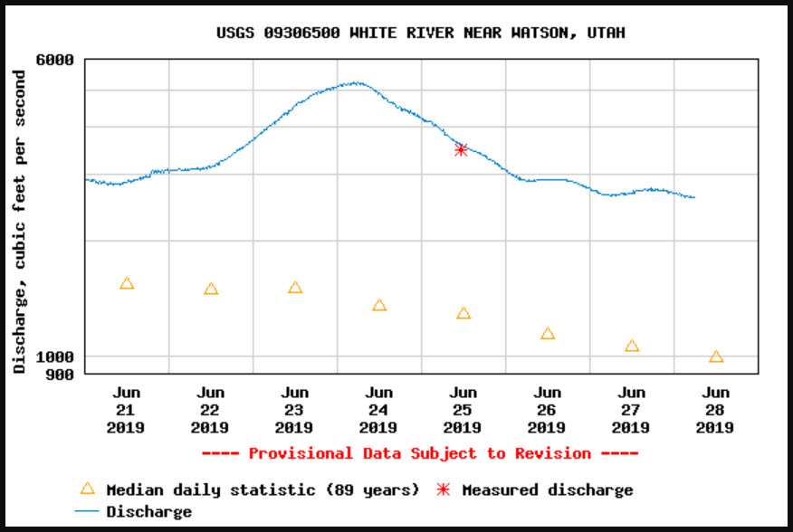
The weekend before our trip the White River shot up over 5200cfs which almost made us reconsider going on this trip since we didn’t have any idea what the river would be like at that level, but during the week the flow came back down to a more reasonable 2600cfs when we got on the river Saturday morning.
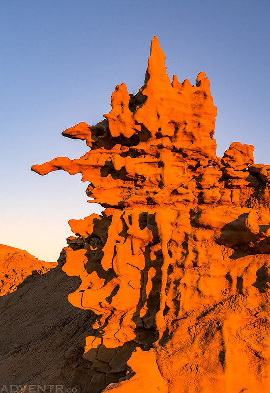
I left after work on Friday and met up with Jackson in Rangely before heading west into Utah to Bonanza, where we took a short detour to check out the river at our put-in site near the bridge. Then we followed the maze of roads through the Chapita Wells Gas Field to the Enron Boat Ramp, where we planned to take-out on Sunday, so we could check that out, too. Along the way we passed a number of pronghorn who were just hanging out along the roads in this area. While there are a couple of campsites located near the take-out we decided to head over to Fantasy Canyon to spend the night there since it was only a few miles away and we hoped there would be less mosquitoes further away from the river. Plus, it would be nice to photograph the unusual shale formations at sunset and sunrise since I hadn’t visited Fantasy Canyon for almost ten years! Unfortunately, there were plenty of mosquitoes and gnats there, but the sunset was pretty nice even though there were no clouds in the sky. I definitely got better photos this time than I did on my last visit here and I was even able to see the top of Kings Peak on the horizon as I wandered around this interesting area.
Fantasy Canyon Evening
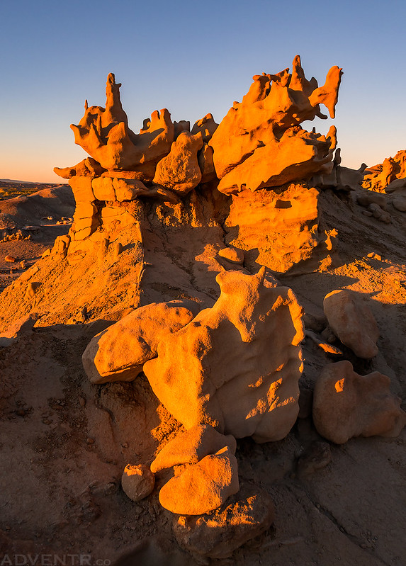
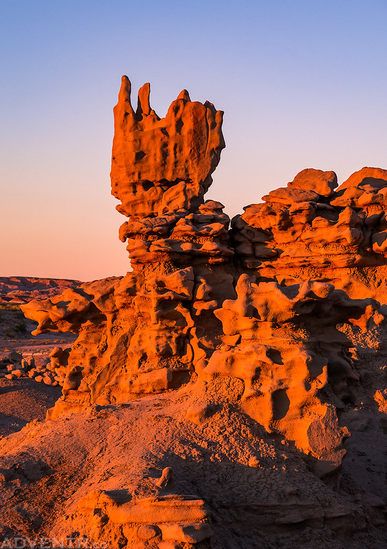
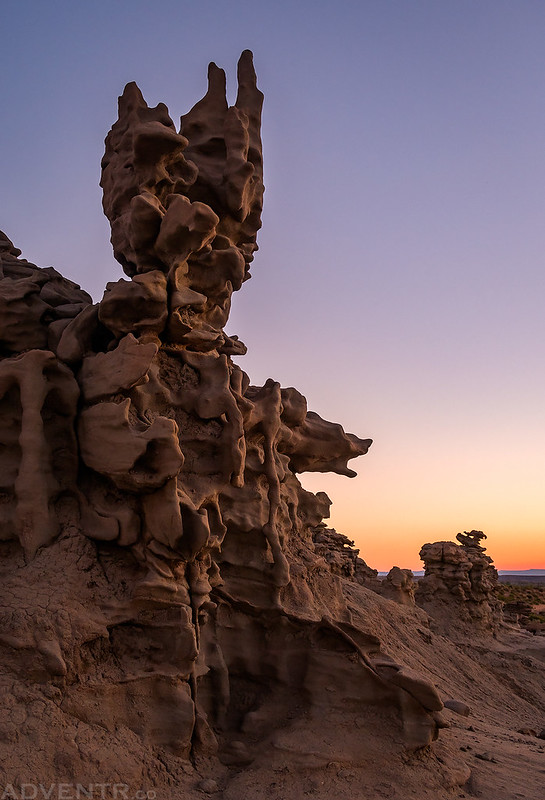
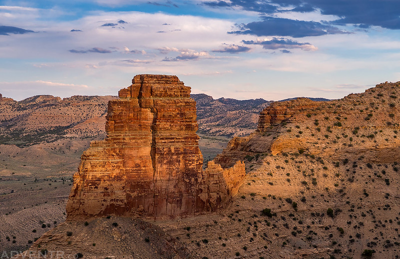
The Witches Head
The Goblins

Fantasy Canyon Evening Light
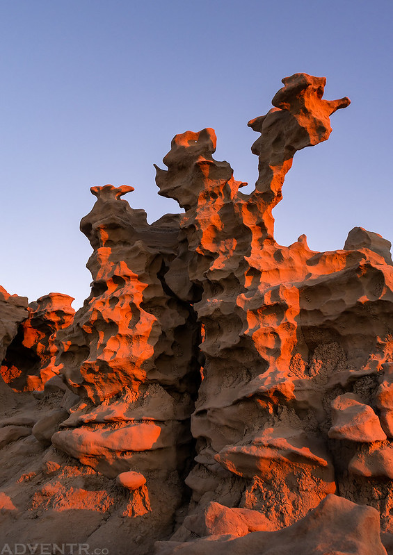
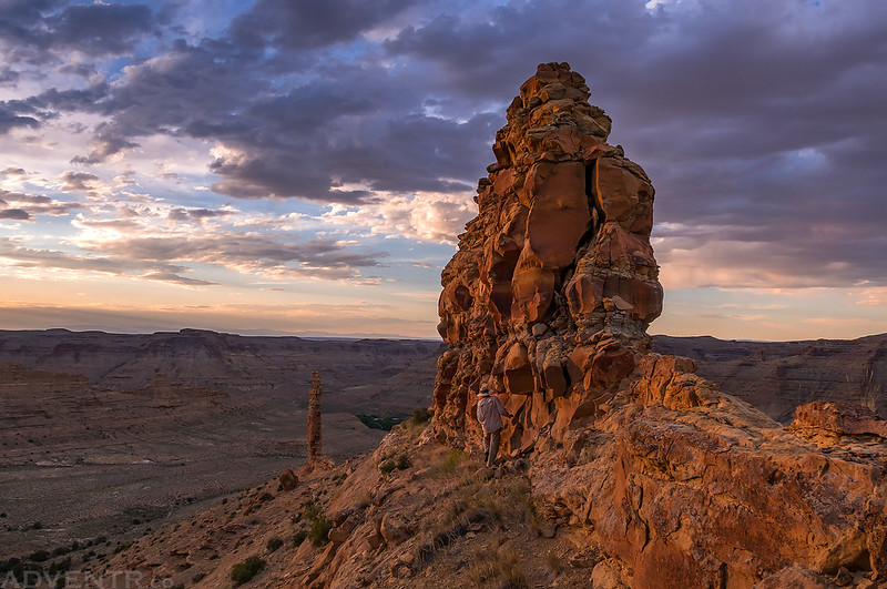
Fantasy Arch

The Giraffe
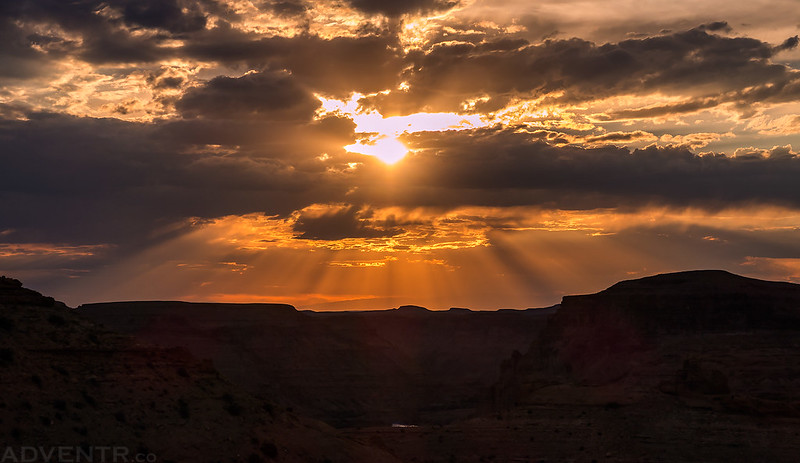
There was a strong alpenglow cast across the badlands above the canyon for a while after sunset.
Last light at Fantasy Canyon
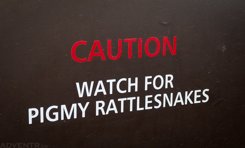
Not a sign you like to see on the door of a pit toilet…
Since the bugs were pretty bad here, I quickly got into my tent after taking these photos and went right to bed. On Saturday morning we woke up with the sunrise and I got out to take a couple more photos before we packed up camp and headed back over to the White River.
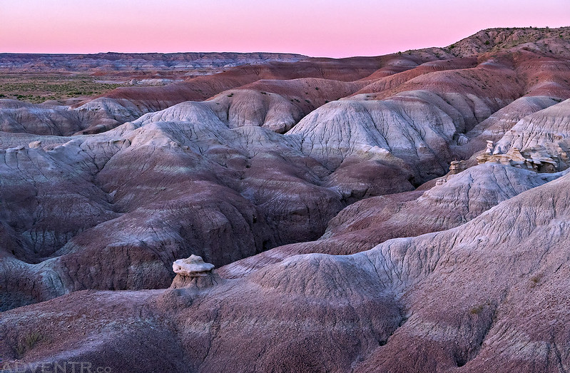
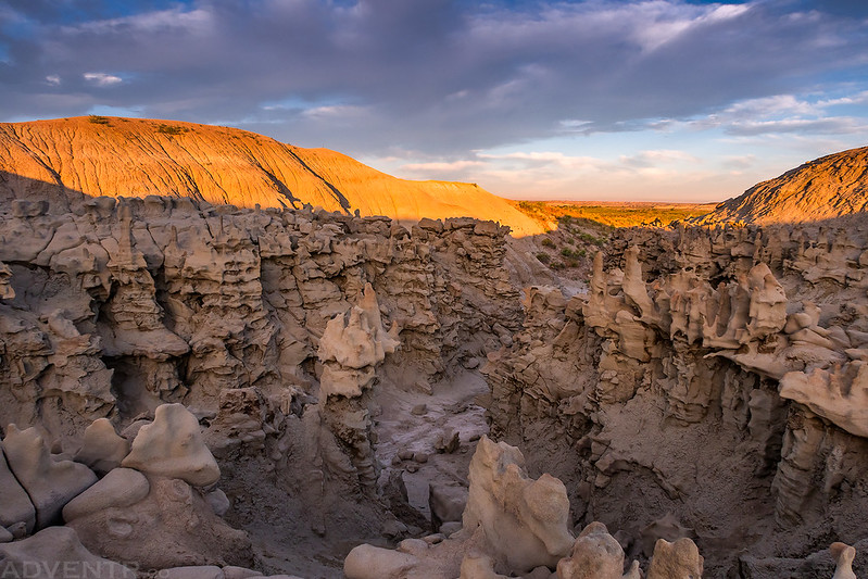
Morning light at Fantasy Canyon

Fragile Morning

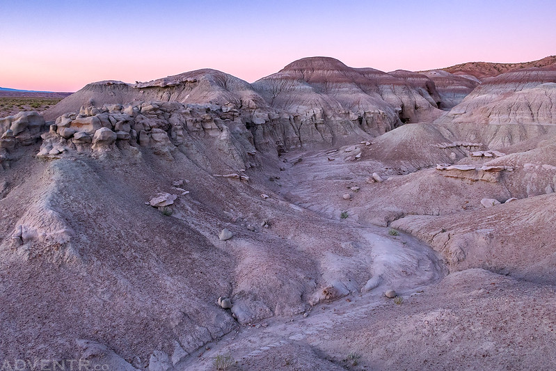
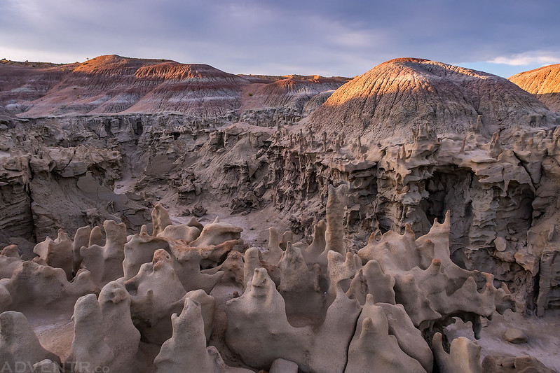
An overview of Fantasy Canyon.
Hiking through the little canyon on my way back to the trailhead.


Our campsite at the Fantasy Canyon trailhead.

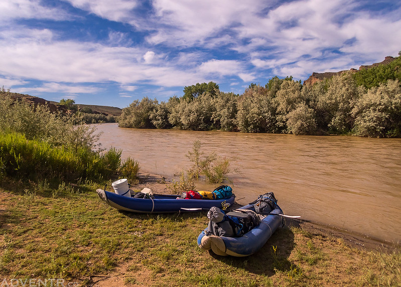
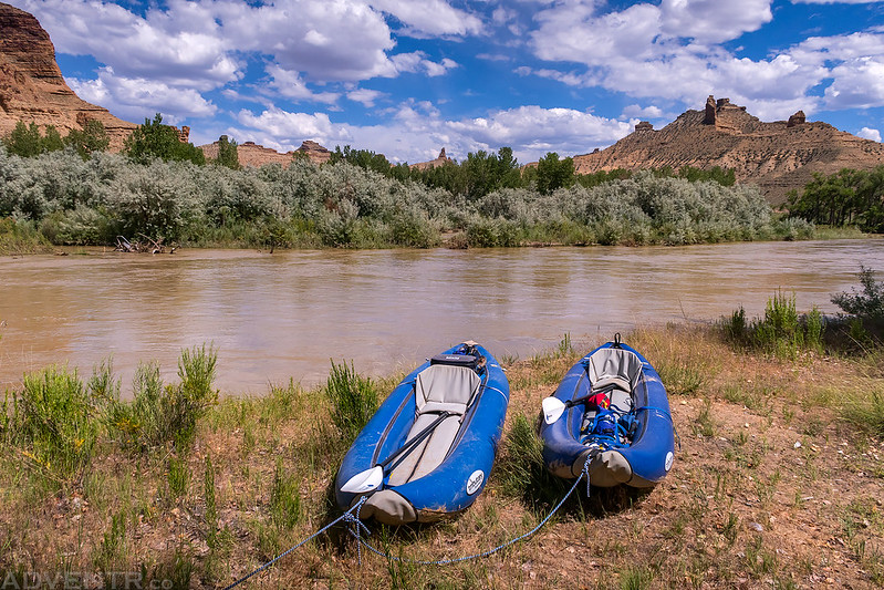
After I was done taking photos and had some breakfast we packed up camp and headed back over to the Enron Boat Ramp where we left Jackson’s car. We got into my Jeep and drove back to Ignacio Park located just below the Bonanza Bridge, rigged up our boats and were on the river by 9:00am. It was going to be a warm day in the mid to upper 90’s, but there were some nice clouds in the sky for much of our float which helped keep the direct sunlight off of us and made it feel not as hot out. The bugs were bad along the bank of the river while we were rigging up our boat this morning, but as soon as we were on the water we didn’t have any problems with them until we had stopped again at camp for the rest of the evening. We weren’t exactly sure what to expect from the river at this level since it’s not a popular place and there’s not much information about it, but it turned out to be a nice relaxing float, which was a nice change of pace from some of my recent river trips…
Here’s a view of the Enron Boat Ramp which would be our take-out location on Sunday. There was a nice concrete ramp, but it was covered in mud from the river being higher recently.

If you don’t take out at this boat ramp, then you will continue into the Uintah and Ouray Indian Reservation which starts just downstream and requires a permit.

Ready to get on the river at Ignacio Park just below the Bonanza Bridge.
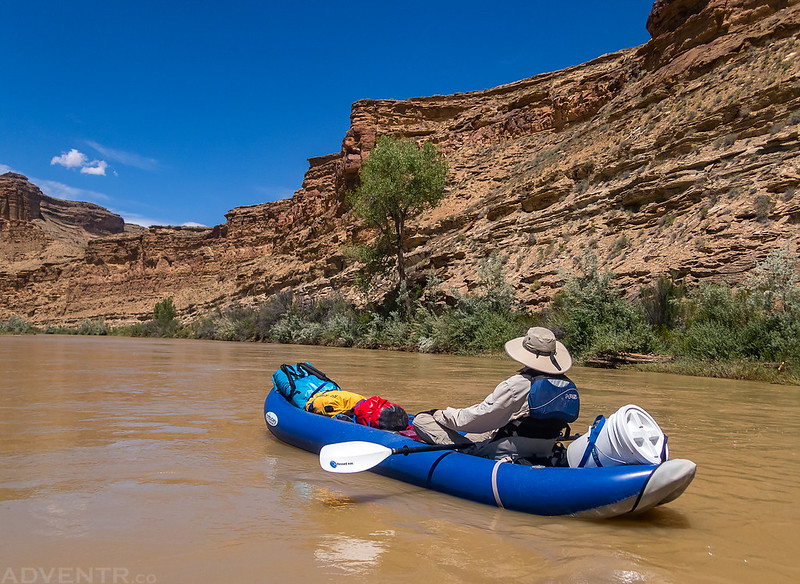
It was a great morning for a float!

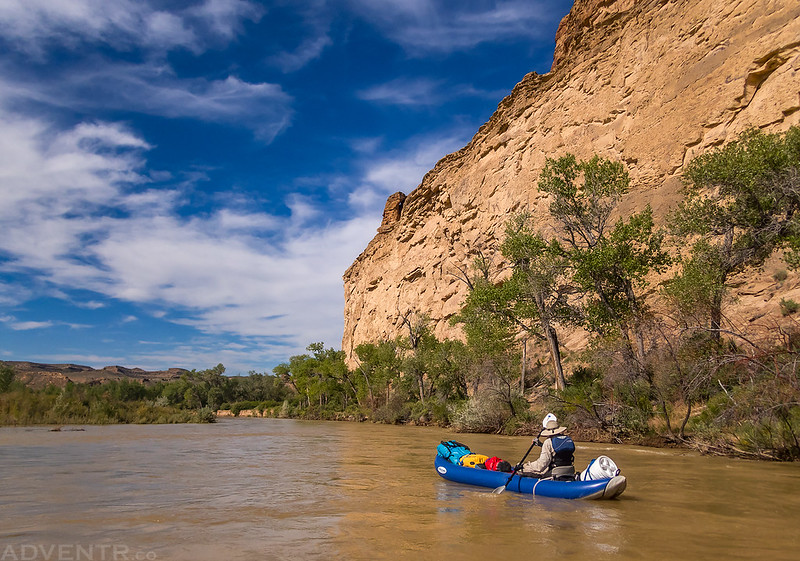
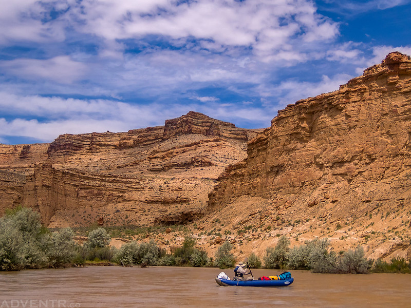
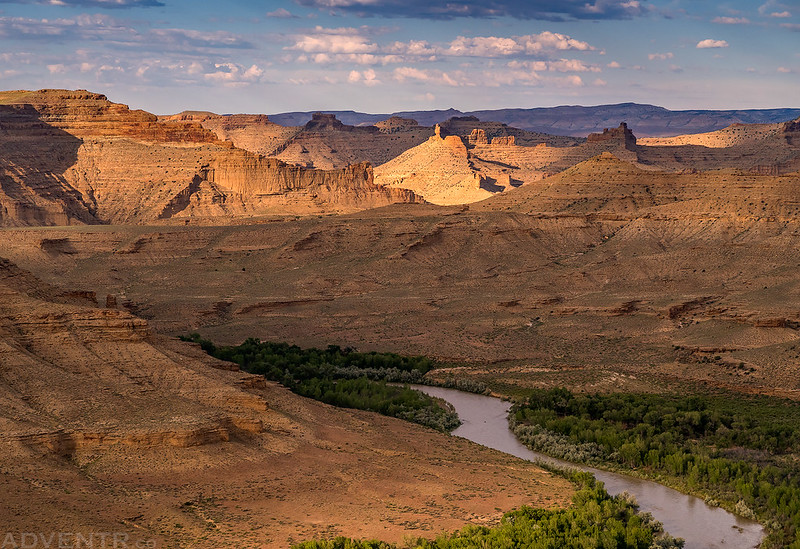
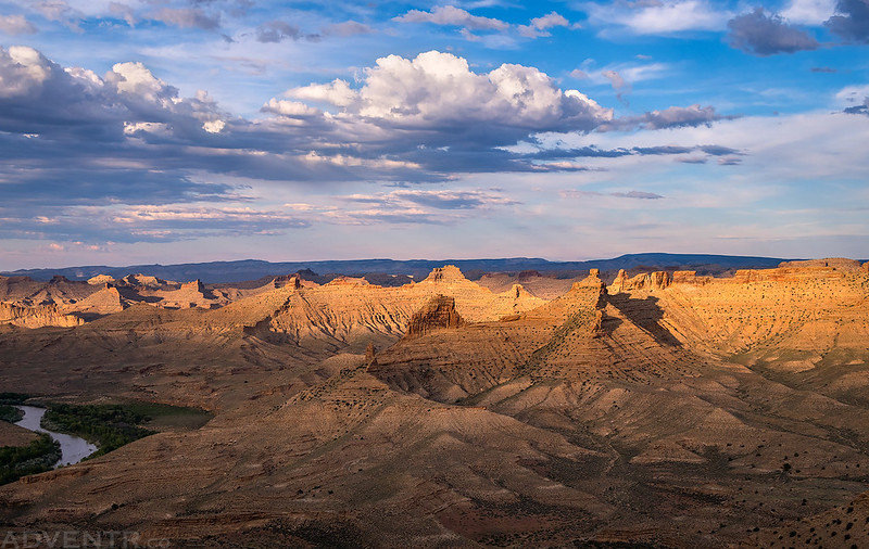
The scenery in this canyon was very beautiful.


Even though we knew that the gas rigs and roads were surrounding the canyon above, we could not see any of that from the river and it turned out to be a very nice canyon to float through.
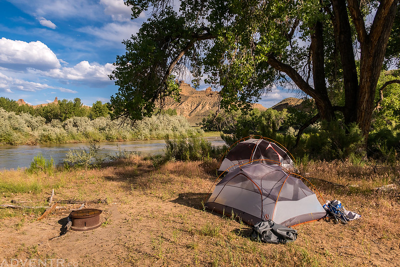
We had hoped to camp somewhere between Atchees Wash and Saddletree Draw so we could hike the Goblin City Trail while we were there. We were pretty sure that no one else was on this section of the river today and were pretty certain we would be able to find a campsite there, but what we weren’t expecting was to find all the possible campsites covered with cheatgrass and other sharp pointy vegetation. I guess that’s what happens when not many people are using these campsites frequently. We ended up finding the ‘best’ campsite at the trailhead for the Goblin City Trail and there was even a metal fire pit there. Unfortunately, I was unable to find a spot to setup my tent that didn’t have plenty of sharp points sticking up through the floor, and I really didn’t want to get a hole in my Therm-A-Rest sleeping pad, so I decided that I would just sleep on the ground on a thick dry bag that night. It wasn’t the most comfortable night camping, but it wasn’t terrible either.
We were surprised to find that there was actually a sign at the trailhead for Goblin City.

Our view across the river from camp.
Our campsite along the White River just downstream from Atchees Wash.
After I got my tent setup I got inside to get away from the bugs for a little while and ended up taking a short nap. Afterwards we had some dinner and then started our hike up the Goblin City Trail in the late afternoon when it was finally starting to cool down a little, although it was still pretty hot out!
The Goblin City Trail is just over a mile and a half long and climbs about 1,000 feet to the top of the ridge between Atchees Wash and Saddletree Draw where there is a great view of the surrounding landscape. This viewpoint was visited by three men from John Wesley Powell’s second expedition down the Green River in 1871 which then became a lost feature until it was relocated by Clay Johnson in 1989. Frederick S. Dellenbaugh, an artist and assistant topographer with Powell’s expedition, mentions this visit to Goblin City in his book A Canyon Voyage, which was originally published in 1908.
On the next Monday, Cap., Steward, and I with five days’ rations on our backs as well as blankets enough for the warm nights, and our rifles, started on a journey up White River to a place called Goblin City by one of the earlier explorers who had crossed the valley.
– Frederick S. Dellenbaugh
Today we started our own journey to visit Goblin City.
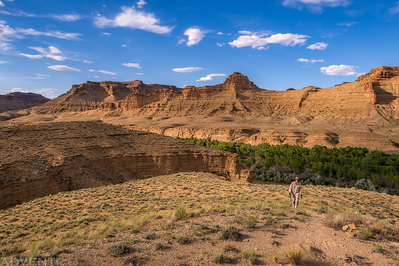
Here’s a look up to the ridge that we would be following to the top.

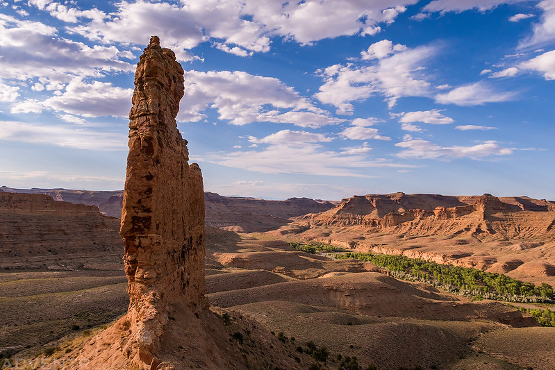
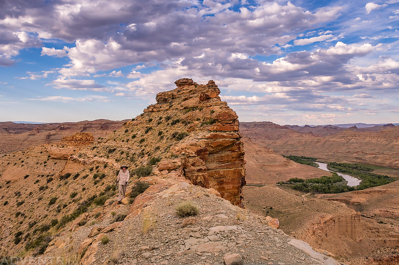
The view past this large spire to the White River was pretty great!
There were outstanding views of the White River canyon all along the route.

Jackson follows the faint and non-existant trail along the top of the ridge. While we were able to follow the faint trail and cairns found along the route (with a couple of errors), it was obvious that this trail does not see very much use. A lot of the route was loose scree and off-camber which made travel slow, especially since I wasn’t wearing the proper footwear to hike this trail. I would certainly not recommend hiking this trail in Chaco sandals like I did!
Almost to the top of the ridge.

From the top we had a nice view over Saddletree Draw.
Jackson stands next to the large cairn marking the summit at the top of the trail.

When we finally came in sight of the Goblin City it was six o’clock of the second day and we had traveled steadily. At the farther end of a level little valley surrounded by cliffs were numerous small buttes and square rocks, almost in rows and about the size of small buildings, so that there was a striking suggestion of a town.
– Frederick S. Dellenbaugh
Looking down into Atchees Wash as we started our hike back down.
Following along the crest of the narrow ridge. The right side of the ridge was a sheer drop-off in most places.

I’m glad we started the hike later in the evening since the light was very nice while we were up there.

Jackson crossing one of the narrower parts of the trail.
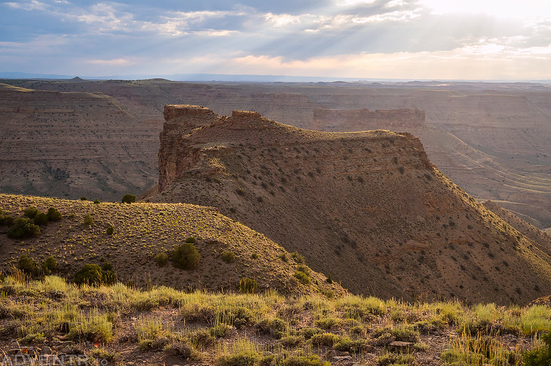
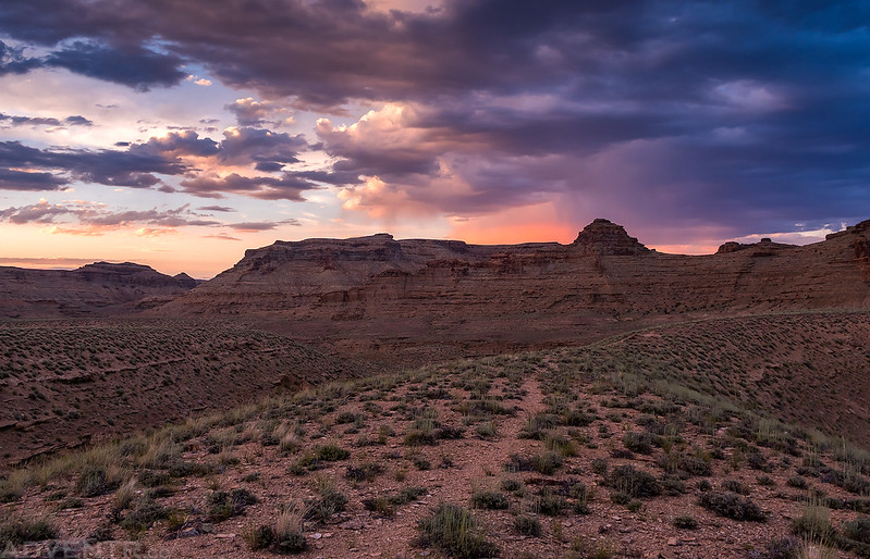
The light and crepuscular rays were looking nice this evening.
A look back at the ridge we had just followed down. Shortly after taking this photo I was rattled at by a little rattlesnake that crossed the trail in front of me. If it had not made any sound I’m not sure that I would have seen it…


Following the faint trail back to camp shortly before sunset. We arrived at camp just as it was getting dark out and we ended up startling a few elk who had wandered near our camp while we were gone.
It had been a long hot day and after the hike we were pretty exhausted, so we went right to bed when we got back to camp. While we were up on the ridge we had cell signal and were able to check the weather which said there was zero chance of rain, so we didn’t bother putting the rainflys on our tents. But of course, just like on our backpacking trip to Keet Seel earlier this month, I was awakened by raindrops falling on my face around 2:30am. I quickly threw the rainfly on my tent and went back to sleep. It would rain on and off throughout the rest of the night and was still raining up until I finally woke up a little before 6:00am. We wanted to make this a short day so we could get home early, so we were back on the river by 7:00am and made it to the take-out by 10:00am.
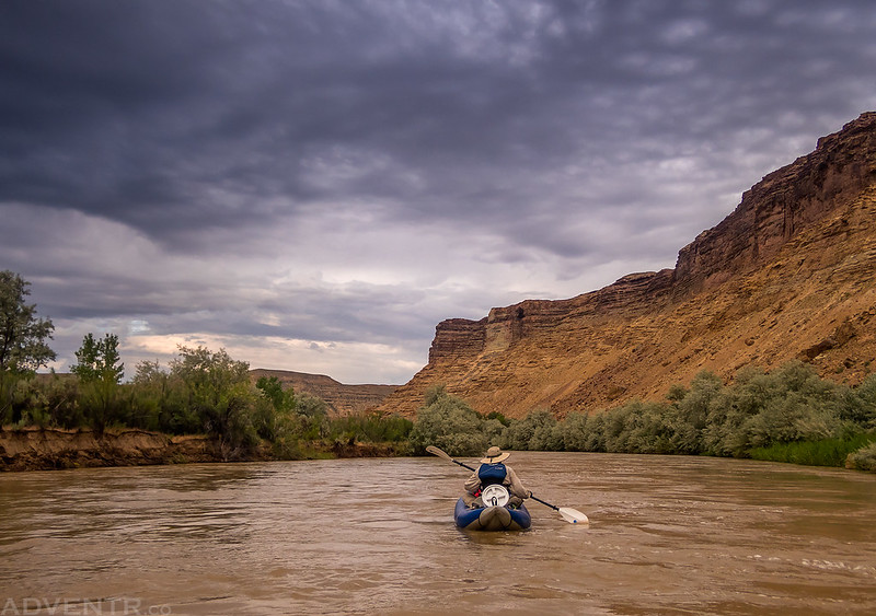
There was a little blue sky above when we first got on the river, but it quickly became completely overcast and would stay that way for the rest of our float. It was certainly much cooler out this morning than it had been on Saturday.

Along the Wall

Floating under a cloudy sky.
After making it to the take-out, we loaded our gear into Jackson’s car and drove back to the Bonanza Bridge to pick up my Jeep before heading home. Although the mosquitoes and gnats were pretty bad (I’m glad I had my head net with me) and the temperature was pretty warm on Saturday, we still had a great trip and didn’t see another person all weekend!
>> The White River Photo Gallery
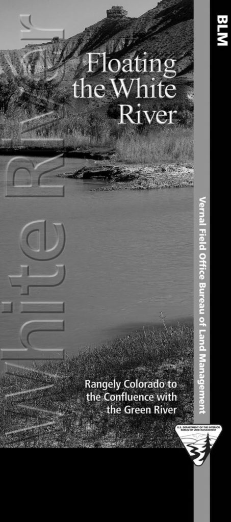
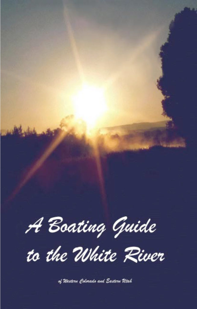
If you are interested in floating the White River here are a couple of the resources that are available to help plan your trip. On the left is a brochure that was put out by the BLM and on the right is an older guide that was written by Ken Parsons in 2004. Just click on each one to download the PDF files.
Since the trail to the Goblin City viewpoint was hard to follow and not very well-used, I have also included a map of our GPS track below for anyone else interested in hiking this historic and beautiful route.
I really enjoyed this look at a place I’d never heard of. Had to look this one up on the map. The Goblin City trail is really scenic.
Amazing trip! I live in Vernal and wander around the White River corridor, Atchee Wash, and Saddletree every now and then. I’ll be sure to bring a good tarp or ground cloth for underneath my tent when I finally get around to floating it. And thanks for the GPS track for the trail. I’ve wandered around those ridges before on various sheep trails, but never knew if it was in the ballpark of the “official” trail. It’s a beautiful area, especially if you’re trying to escape the presence of other humans.
Thanks Louis! It was a great trip that I’d like to do again!
Really enjoyed the pictures. Worked for the conservation corps and worked on the White for a summer. The entire summer we ran unto two other groups (both DNR). This river is a headin gem. Last unaltered/ natural river in Utah!!!