Southern Utah Wanderings | Thursday, October 4, 2018
After driving into The Needles on Wednesday morning and spending the day exploring the fringes of Canyonlands National Park, it was time for us to spend our first full day hiking into Starvation Pocket. We had originally thought about doing this hike as an overnight backpack, but we were running short on time this trip and already had a different overnight trip planned, so we decided to just do this one as a long day-hike instead. In hindsight it probably would have been better to do this one as an overnighter since we found a lot of cool stuff and were unable to explore the whole area we wanted to. I guess that just means I will have to return again in the future for another hike here!
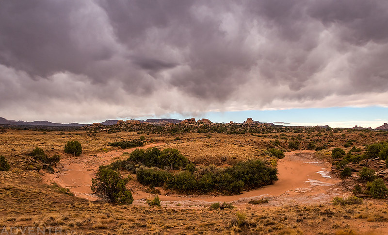
Even though we were completely surrounded by distant lightning as we got ready for bed on Wednesday night, there were no storms overnight. However, shortly before sunrise it did finally start to rain lightly for a little bit. When I poked my head out of the tent I could see that there was a strong storm with a lot of lightning coming right for us.
Of course, I grabbed my camera and started taking photos of the amazing sky at sunrise! The storm was moving very fast and conditions were constantly changing.
The sun came out for a little bit and there was rain on the way.

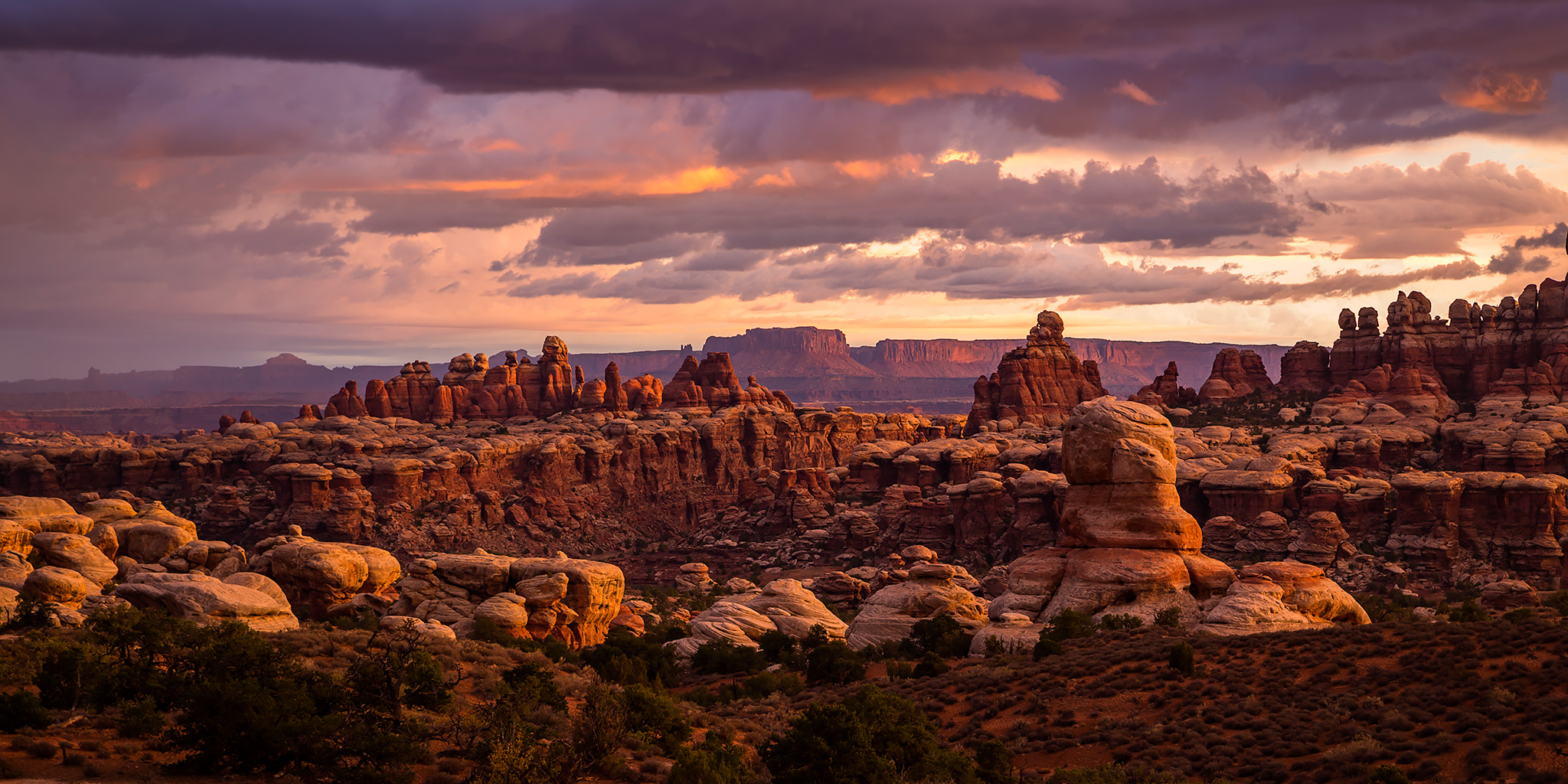
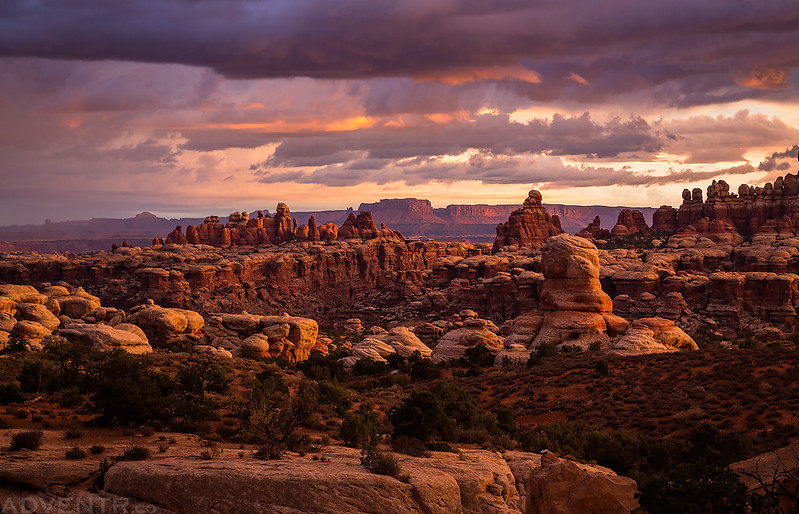
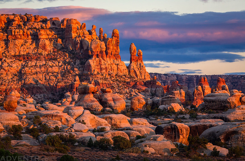
What an amazing Canyonlands view! Horsehoof is definitely now one of my favorite campsites in Canyonlands National Park!
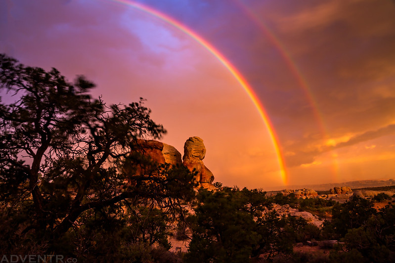
As the rain got closer a double rainbow began to appear.
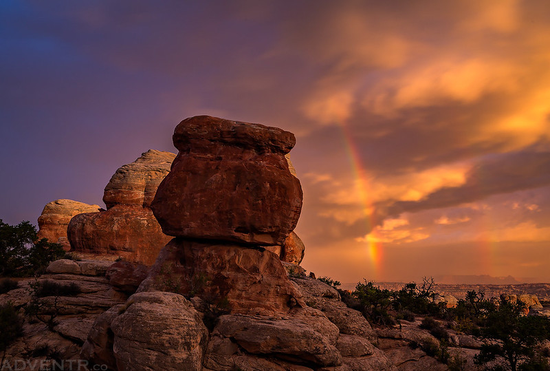
This was the last photo I took before the storm was right on top of me and I had to grab my camera and make a run for the Jeep. The wind was blowing hard when I took this shot, which is why the tree on the left is blurred. I was taking a longer exposure to try and catch a lightning bolt with the rainbow, but the timing was never right.
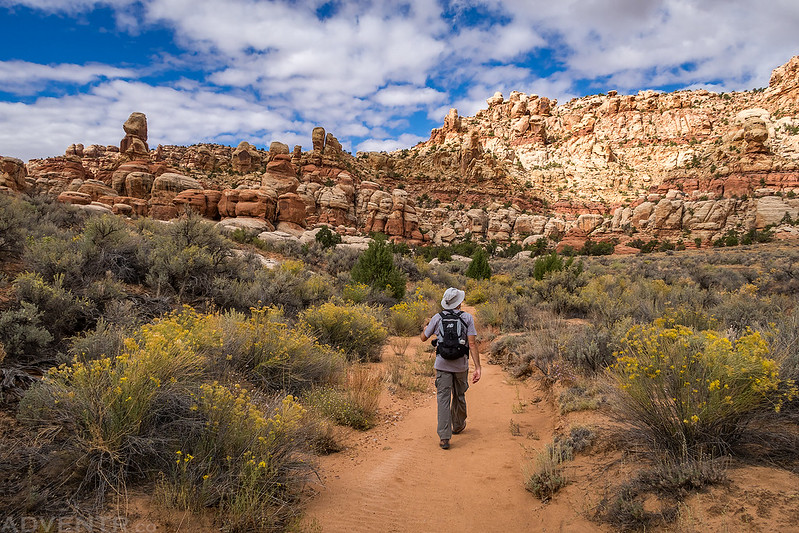
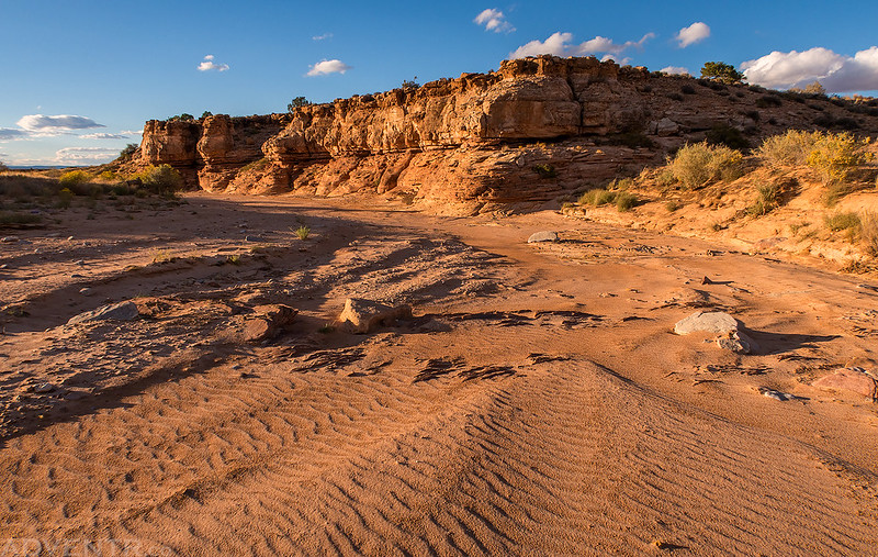
After waiting out the rain for about an hour in my Jeep the storm finally moved past us and the rain stopped. We drove over to the the trailhead and started our hike. Along the way we found a future ‘Horseshoe Bend’ as we hiked near this wash.
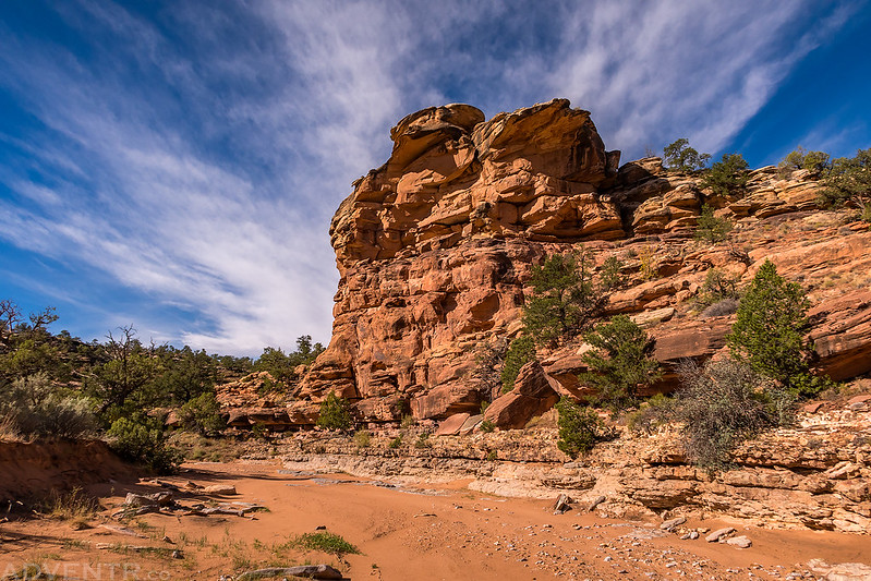
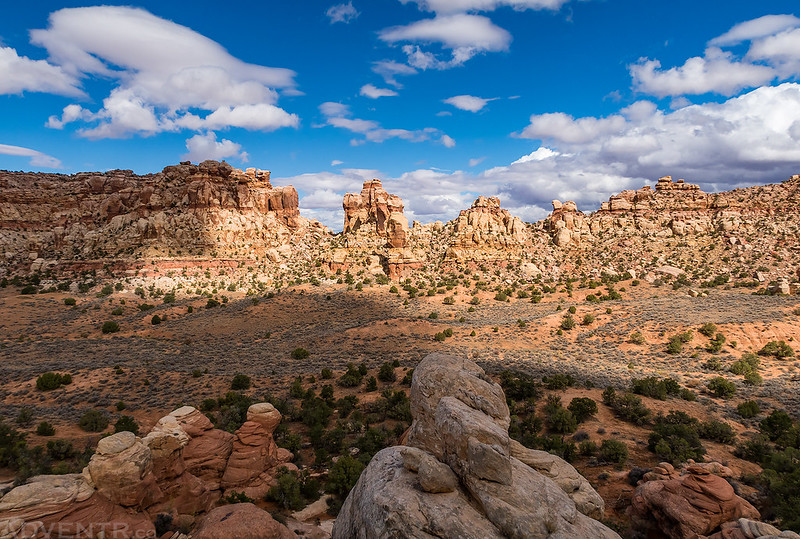
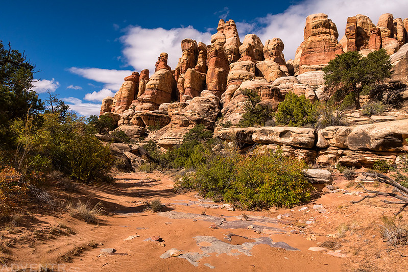
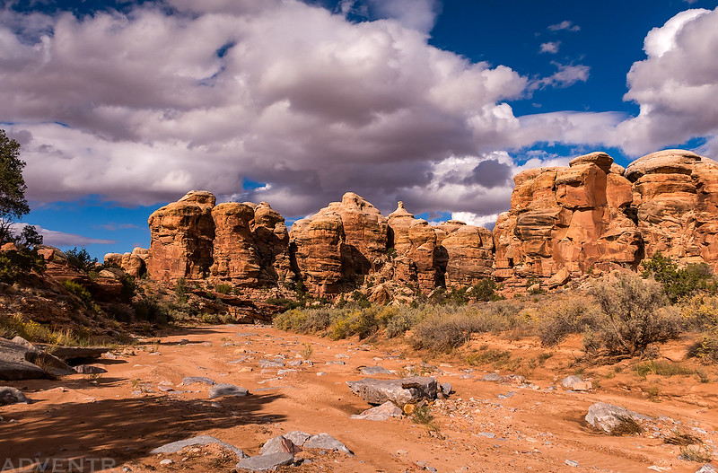
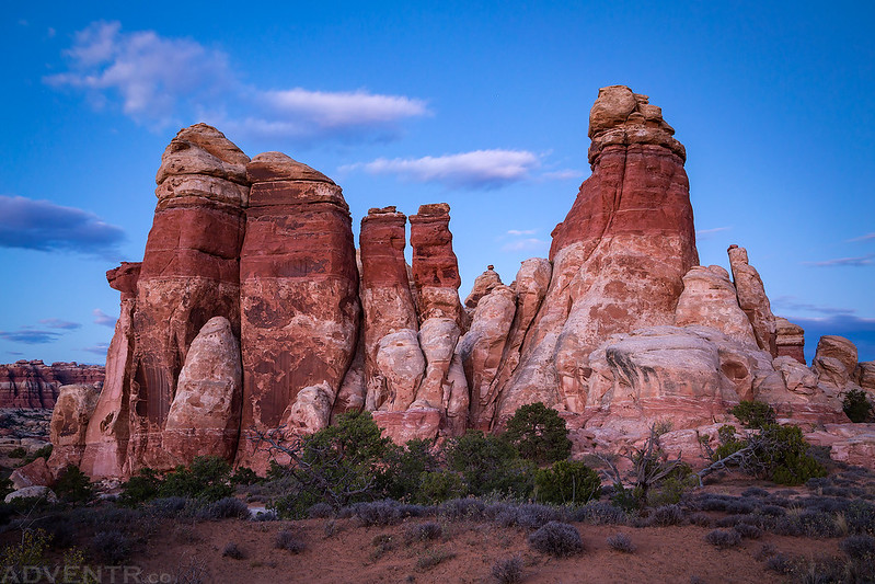
As we hiked further up the wash we came across this group of needles as the clouds continued to clear out.
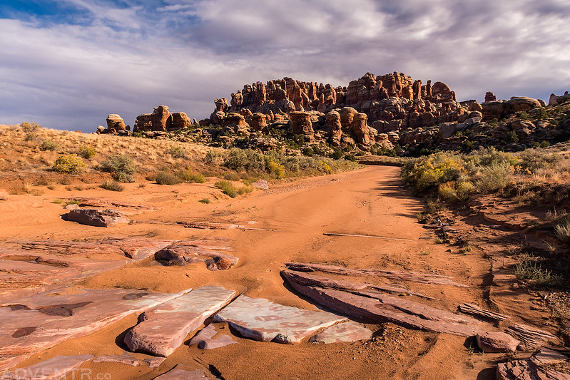
The morning rain helped make the sand in the wash firm which made for easier hiking.
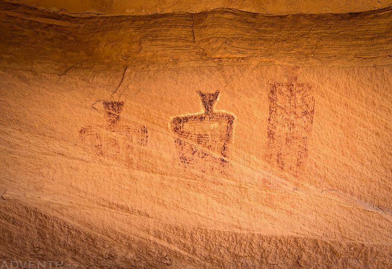
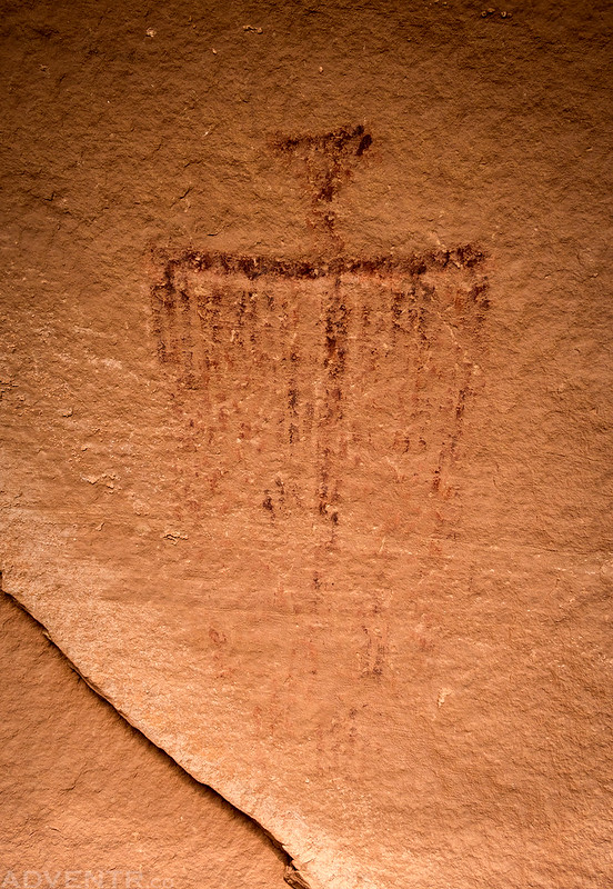
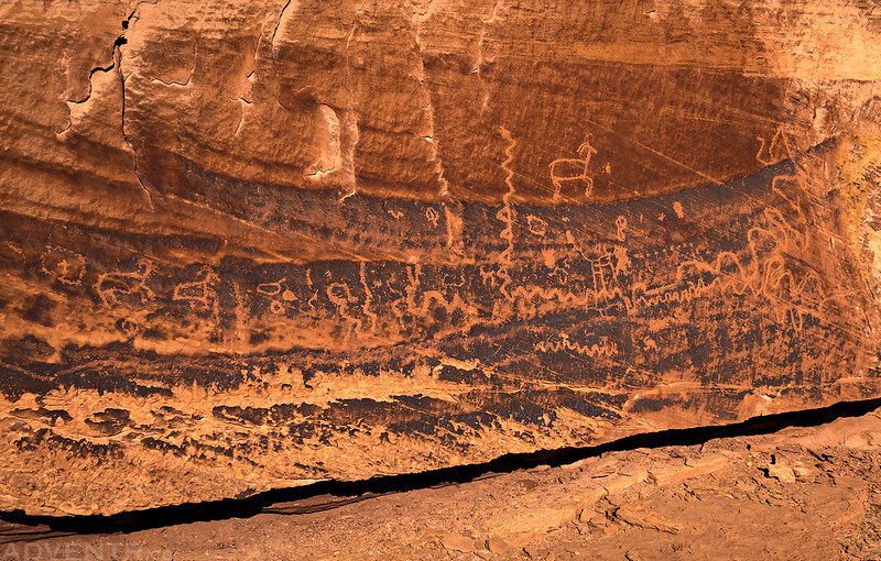
This was the first Barrier Canyon Style pictograph panel we spotted.
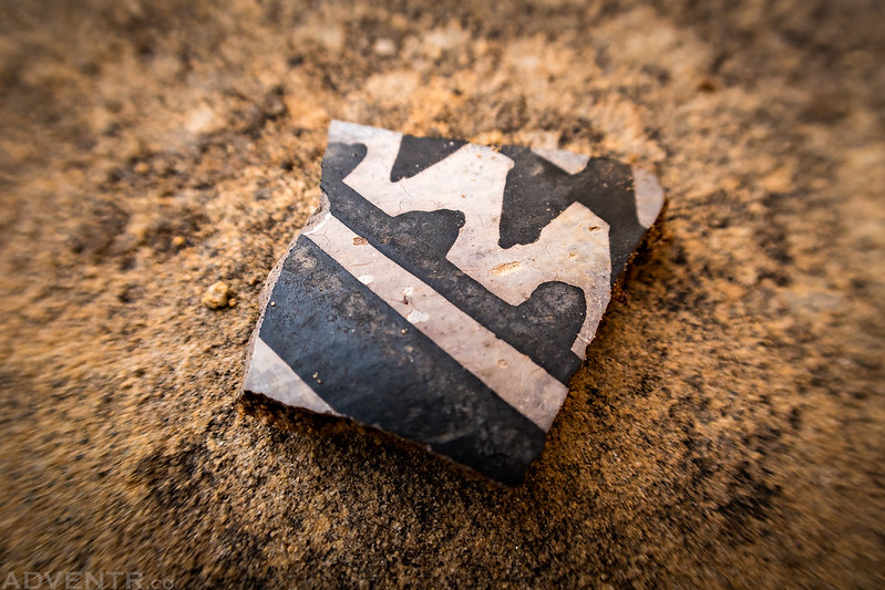
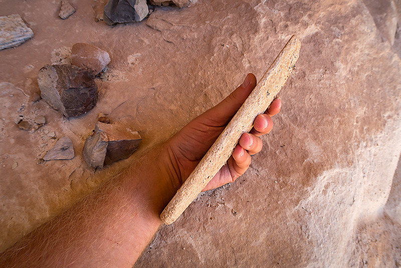
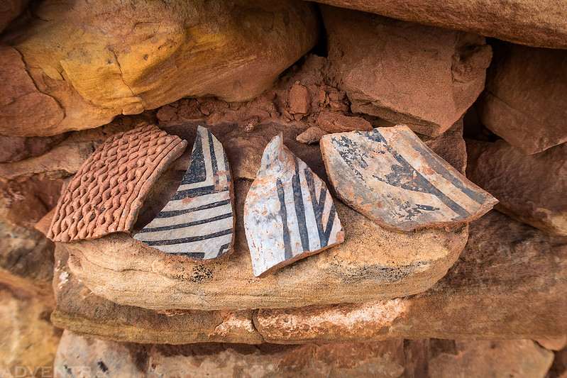
We also found our first potsherd nearby- a good sign that we were on the right path!
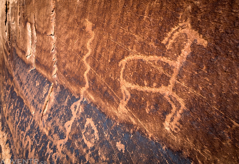
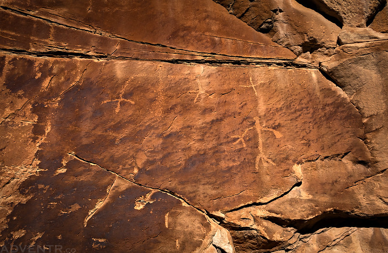
I liked how this petroglyph of a sheep appears to be walking on the natural line in the sandstone.
Another large Barrier Canyon Style pictograph we came across.
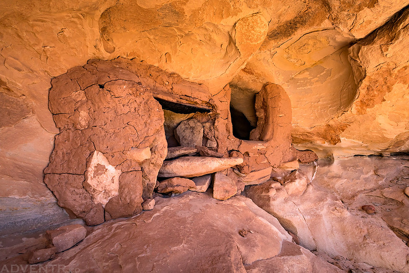
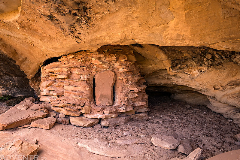
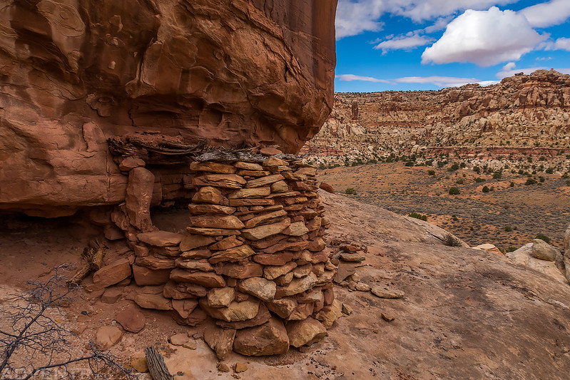
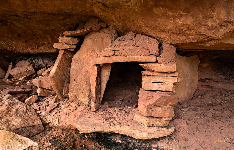
After climbing up a ledge I spotted what looked like some stacked rocks in an alcove and thought I should check them out. When I went to investigate I came across these nice granaries.
Near the granaries I found this slab of sandstone that was perfectly flat on one side and rounded on the other.
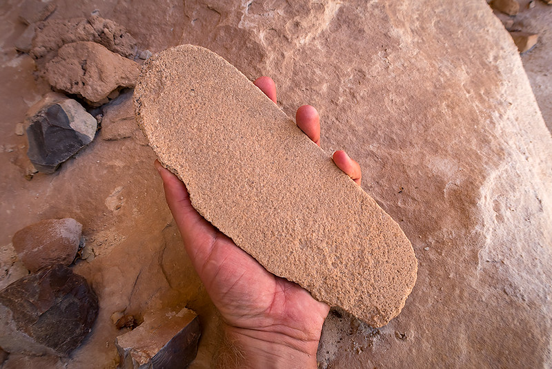
I’ve been told it might have been a mano that was used until it was too thin to use any longer. What do you think?
This is a faint panel of petroglyphs we hiked past.
We came across this round ruin that had a door in place.
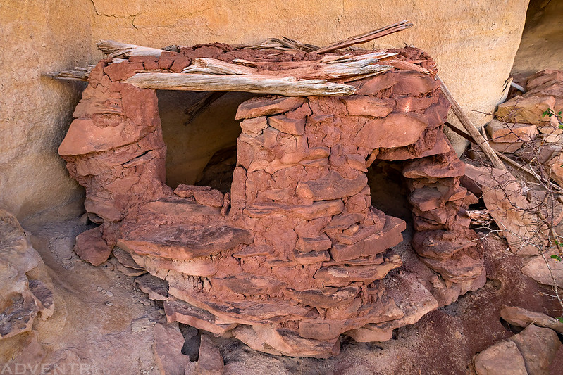
Jared spotted this tiny granary in a little nook behind a tree. I had walked right past it…
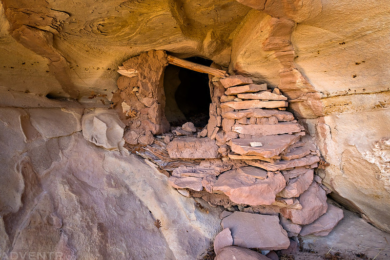
As we climbed up to a high ruin we spotted from below, we passed this ruin that still had a roof on top.
It was a windy afternoon with fast-moving clouds in the sky. These conditions created this nice spotted light on the landscape.
We climbed up to this ruin that was at the base of a large sandstone needle.
We found some nice large painted potsherds in the area. These are just a few.
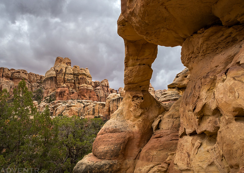
Starvation Pocket Arch
Jared hikes ahead of me as we continued to explore Starvation Pocket.
The construction of the doorway on this little granary was unusual.
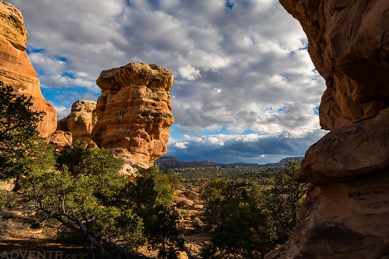
Aside from the ruins and rock art we found, the scenery in this area was very nice, too!
The Water Panel
Hiking back down the wash in the late afternoon as clouds continued to build overhead again.
So many great places to explore…
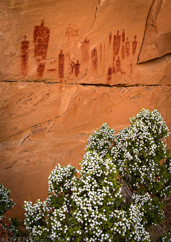
I took Jared to see The Stellar Panel, plus I wanted to see it again, too!
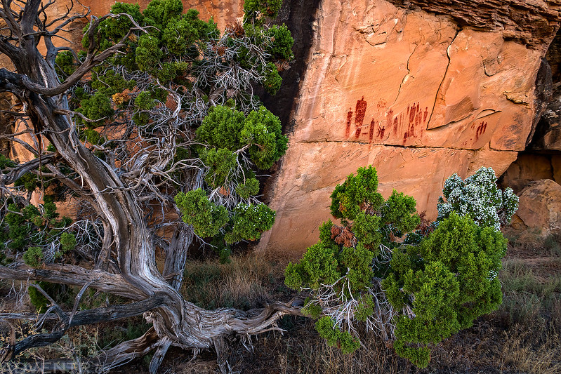
There were a lot of Juniper Berries on the tree in front of the panel. It makes you wonder if that could be a reason this panel is found here?
Hiking along another sandy wash late in the evening.
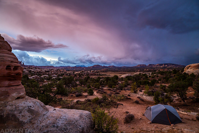
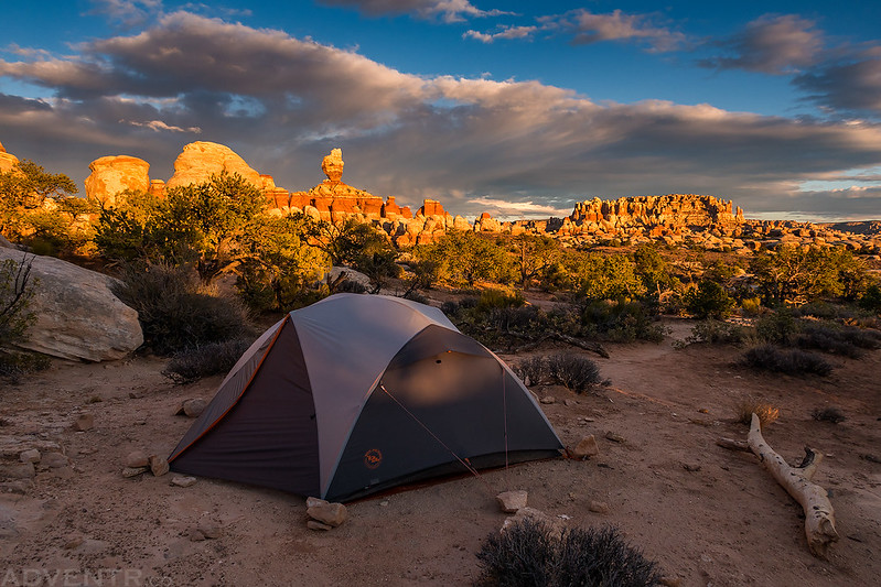
We made it back to camp just in time to watch a beautiful sunset.
Looking through a sandstone window from camp.
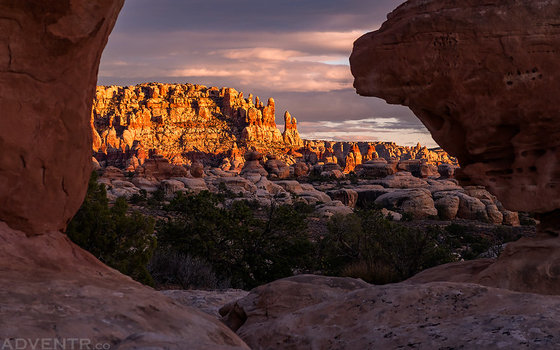
This has always been one of my favorite needles, and we had a good view of it from camp.
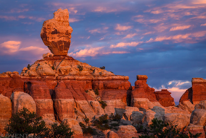
The light was pretty amazing this evening…
The clouds weren’t too bad, either!
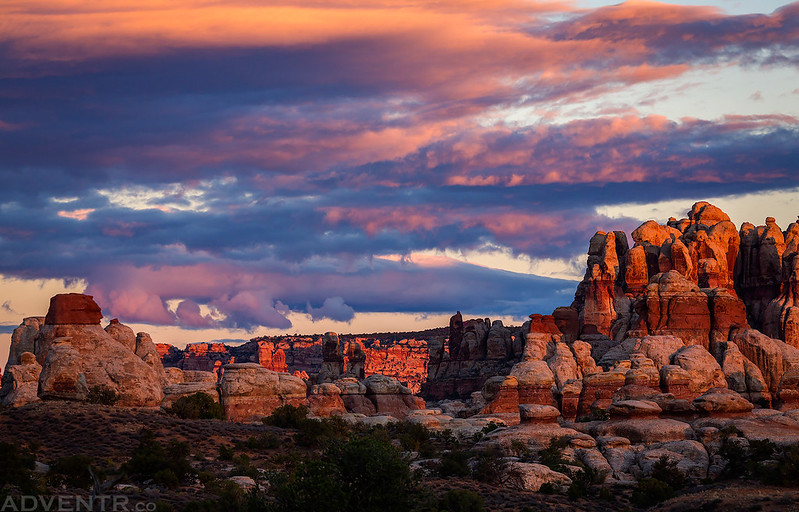
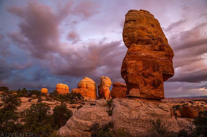
Needles at Dusk
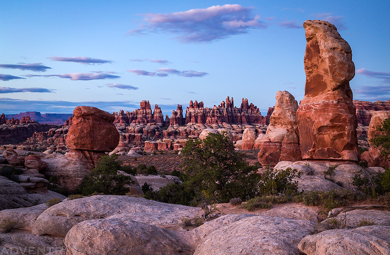
These were the needles right next to our campsite.
After the light was gone we had a late dinner and then went to bed early since it had been another long day. It had also been an awesome day of exploring The Needles and we still had two more days to go!
Very jealous. Looks like fun, great job.
Beautiful scenery and photos. I love the framing of the first Stellar Panel and the
close up of the glyphs because of the berries. Thanks!
I backpacked to Starvation Pocket and camped there in the Spring of 1966 with a group of students from Colorado Rocky Mtn. School. The Park was only a couple of years old and we drove a 50 mile gravel road to reach the ranger station which was a trailer. The Ranger there said that only 2 people had visited the previous month (January). He said we wouldn’t find any significant artifacts, paintings or petroglyphs, but we did, setting out the pottery we found so future explorers could see them plainly. It was a life changing trip and one I treasure. We spent a week backpacking and met another group from the school in SP where water had been cached for us by Jeep earlier. You could drive all the way into SP in those days. I don’t know about that now. We exchanged truck keys and continued on to where the other group had left their vehicles and they continued on the route to our parking site.
I remember near the end we hiked up through a smallish slot canyon to a large spring where we washed up and found our transportation. Incredible. This high desert is indescribable.
Thanks for the great photos.
Thanks for sharing your story Brad! It sounds like it was an amazing experience for you! And you are correct, no one can drive into Starvation Pocket any longer.
Love the photos! Seems like a great adventure too. Which trailhead did you use?