Friday – Sunday, September 7-9, 2018
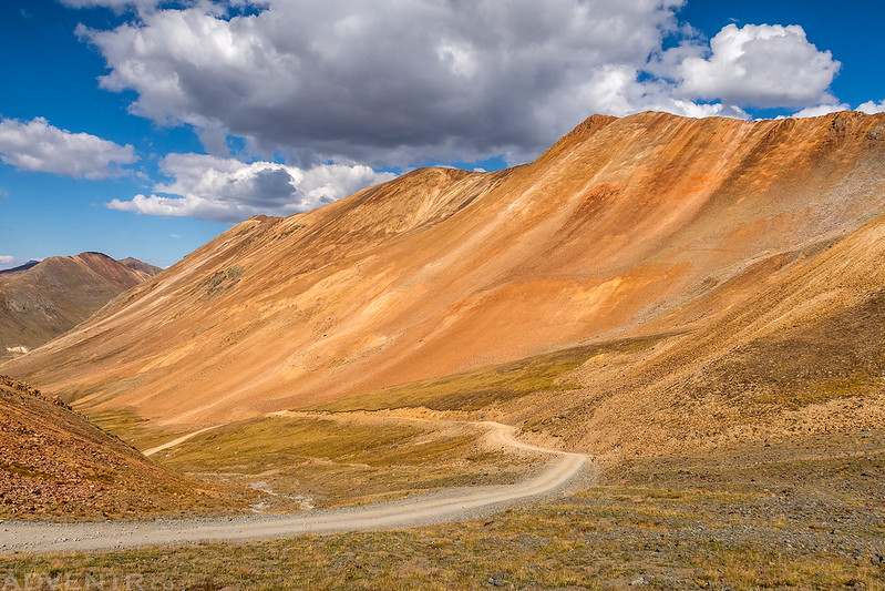
After visiting the High Uintas Wilderness for the first time last weekend, I figured I’d stay a little closer to home this weekend to spend some quality time back in the San Juan Mountains. The summer season in the mountains is coming to an end soon and I’ll be heading off to explore the Colorado Plateau on my weekends in just a few short weeks. Midddle to late September is actually my favorite time to hike in the mountains since they are less crowded after Labor Day, the alpine tundra is already changing color, the aspen trees usually start to change color, and there are less worries about afternoon thunderstorms since the monsoon season is coming to an end. It’s a great time of the year to get in some peak bagging! Last September I headed up to Engineer Pass for a little hiking around this time of the year, so I thought I would return to the area and hit up Cinnamon Pass this time. Although I hiked to Cinnamon Mountain from the pass a few years ago, there were still a couple of peaks nearby that I hadn’t got to yet.
As usual, I left after work on Friday afternoon, grabbed some dinner in Delta and then continued south over Red Mountain Pass to Silverton. Then I followed the Animas River to the ghost town of Animas Forks and found a nice spot to camp below the old abandoned mining town.
A nice view of Kendall Mountain as I made my way into Silverton late in the day on Friday.
There was a nice sunset this evening as I drove up the road to Animas Forks, but I wasn’t in the greatest spot to photograph it. Here’s my view from the road looking back.
Looking up into Burns Gulch from Animas Forks at dusk.
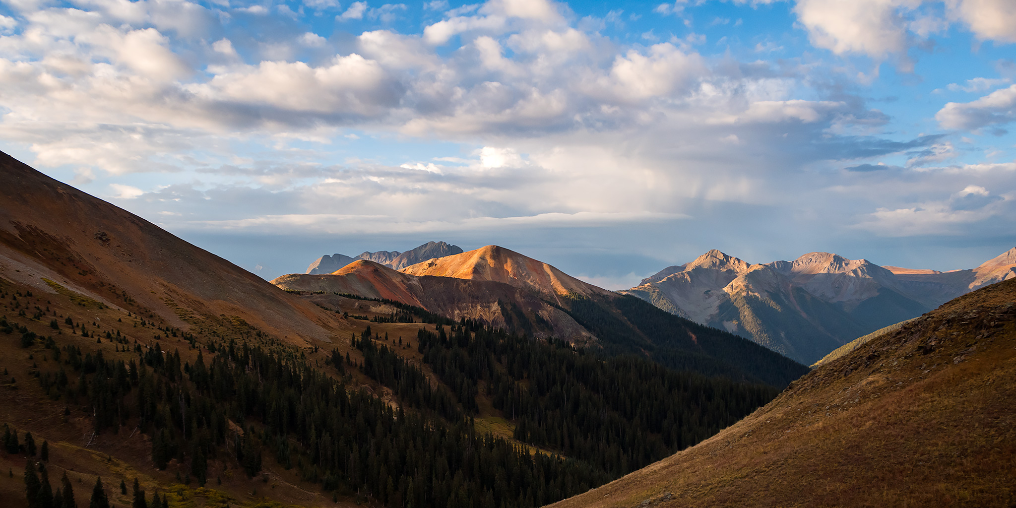
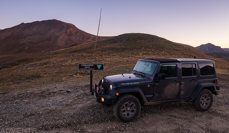
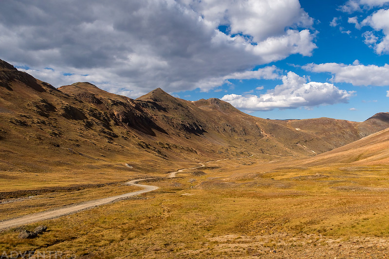
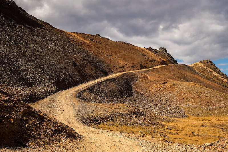
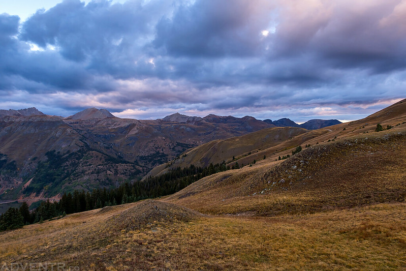
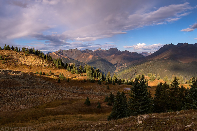
I woke up about an hour before sunrise on Saturday morning, packed up my camp, and then drove the rest of the way up to Cinnamon Pass. I arrived shortly before sunrise and started hiking to the summit of Wood Mountain. As I hiked along the ridge I had nice views of Animas Forks Mountain, Cinnamon Mountain, Handies Peak, Redcloud Peak and Sunshine Peak during the sunrise.
Up at Cinnamon Pass before sunrise.
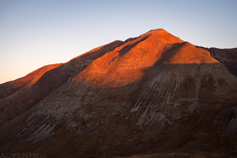
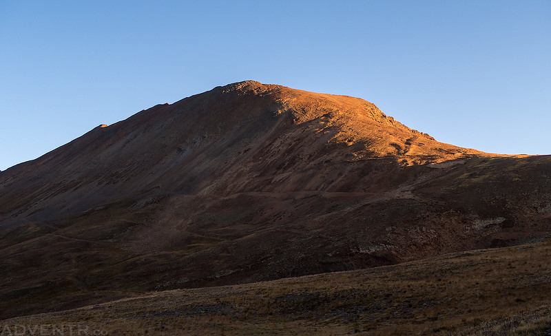
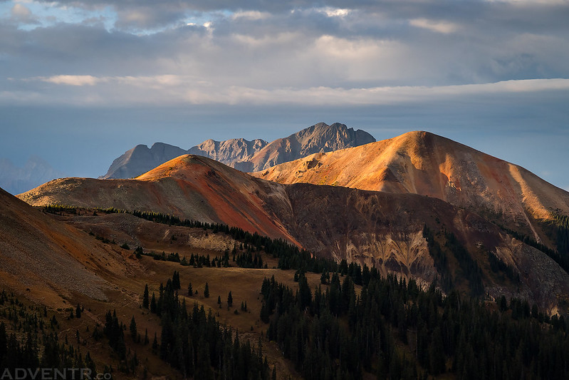
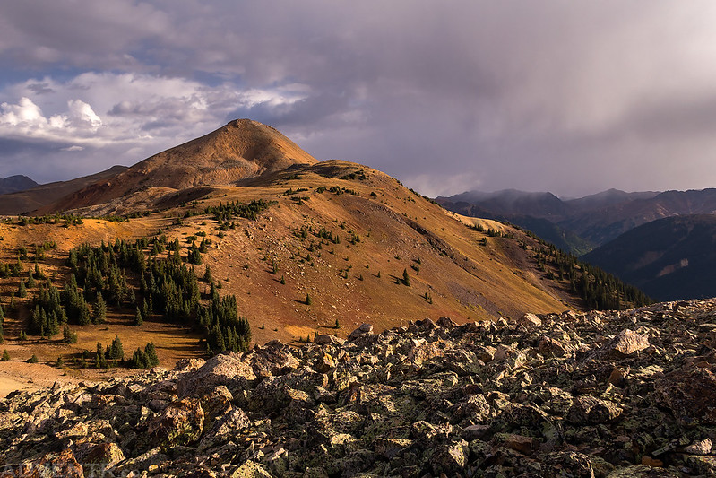
The first light of the day strikes Animas Forks Mountain (13,722).
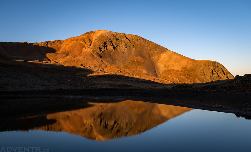
I hiked past this small tarn above Cinnamon Pass and caught this reflection of Cinnamon Mountain (13,328) at sunrise.
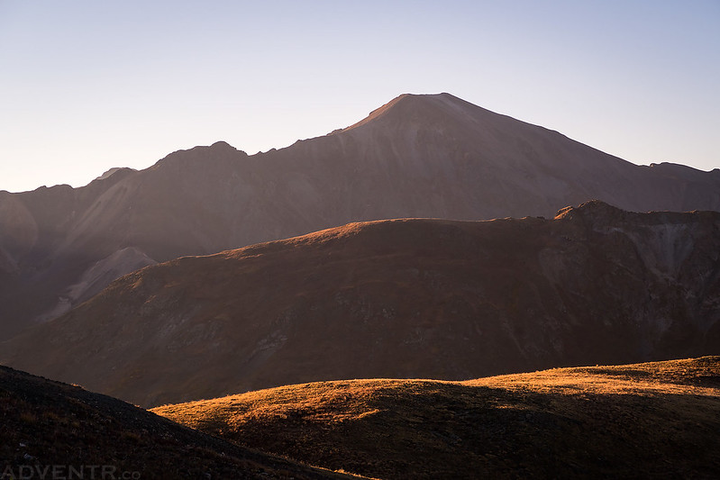
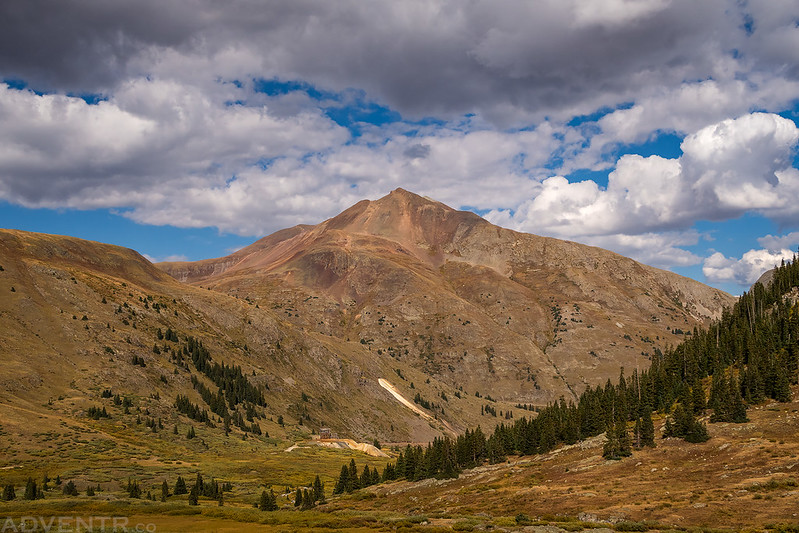
I had a pretty good view of Handies Peak (14,048) from different angles throughout the morning.
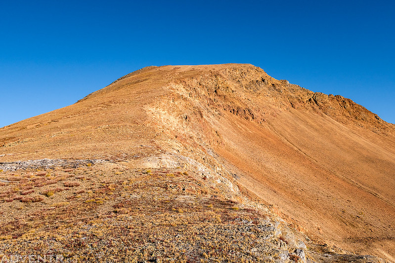
Light on the ridge of Wood Mountain that I would be hiking up.
Edith Mountain (12,620) below on this hazy morning.
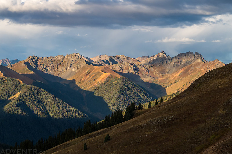
Whitecross Mountain (13,542) on the right with Sunshine Peak (14,001) behind it.
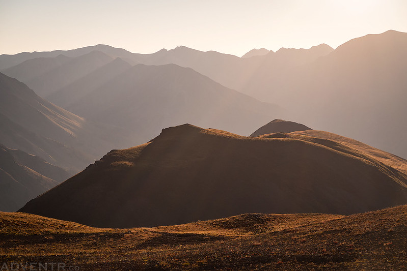
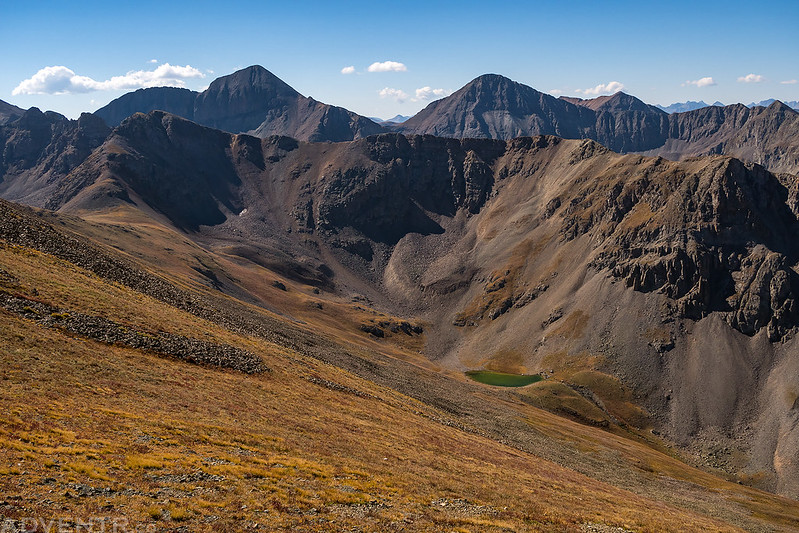
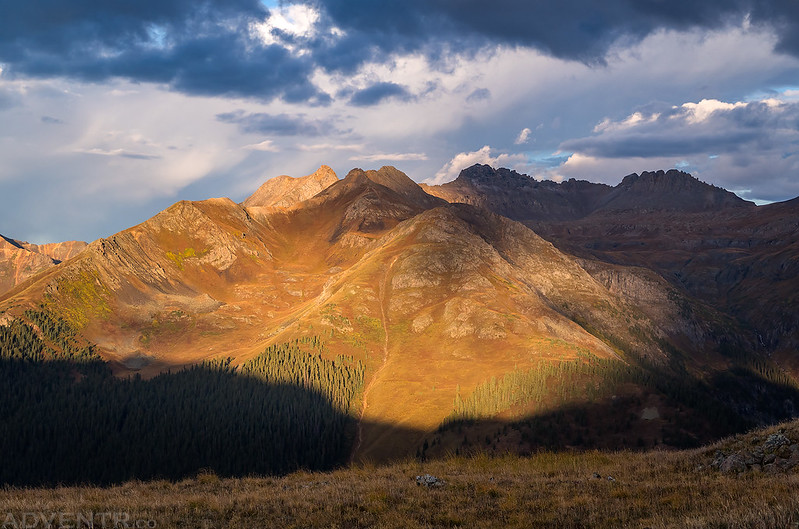
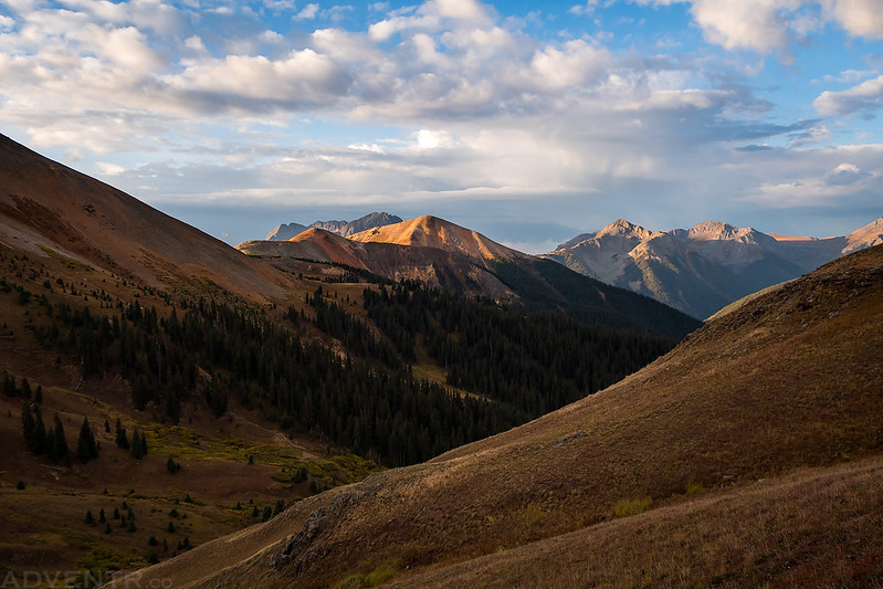
From the ridge I had a good view down into Cleveland Gulch and Burrows Park beyond.
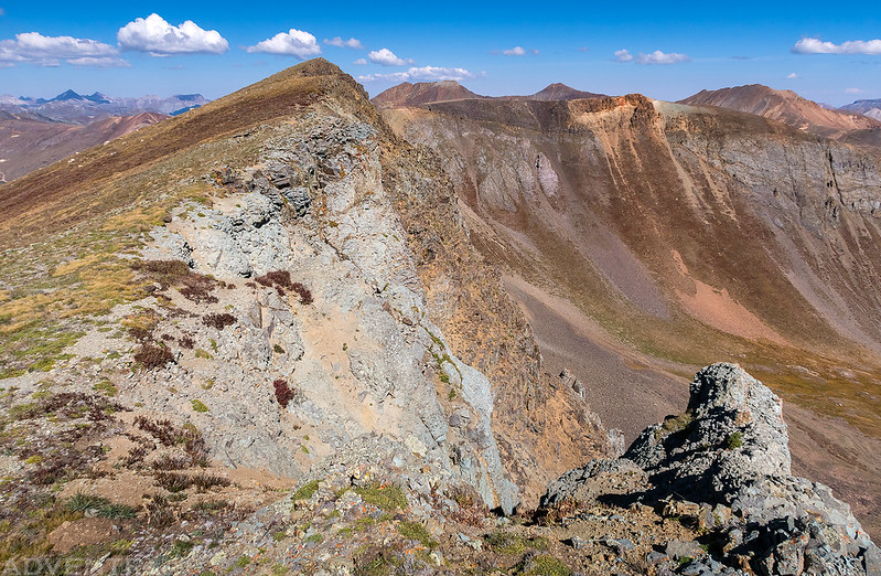
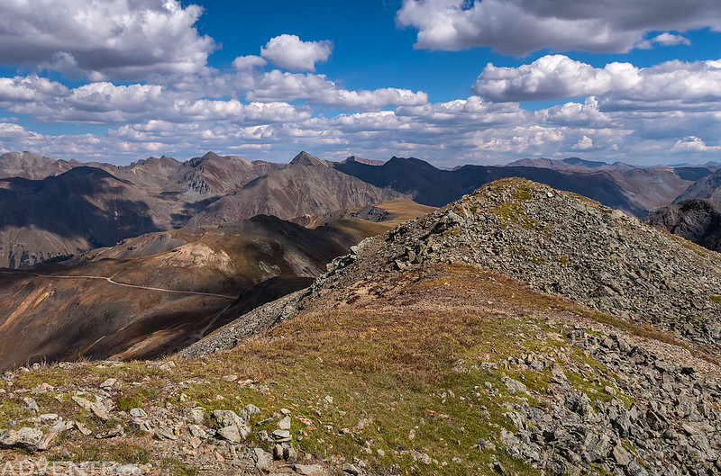
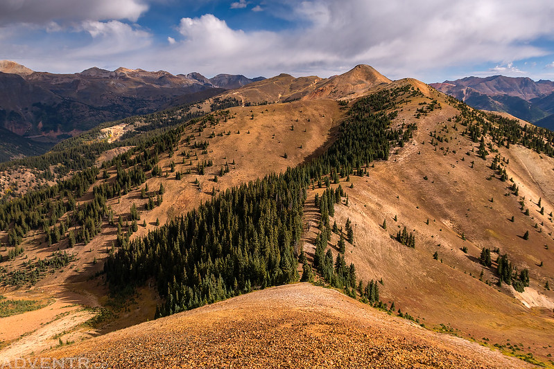
Following the easy ridge to the top of Wood Mountain.
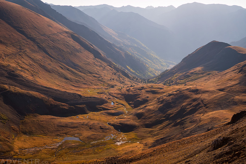
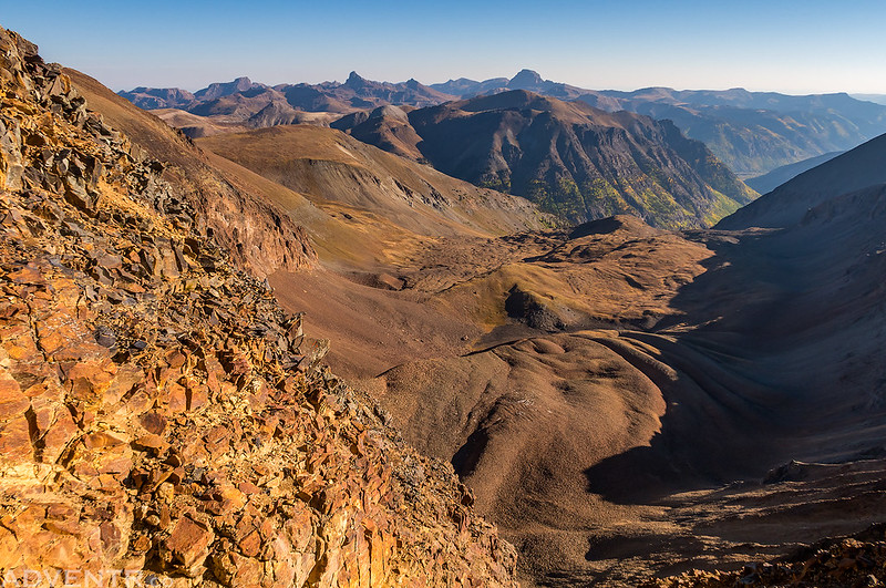
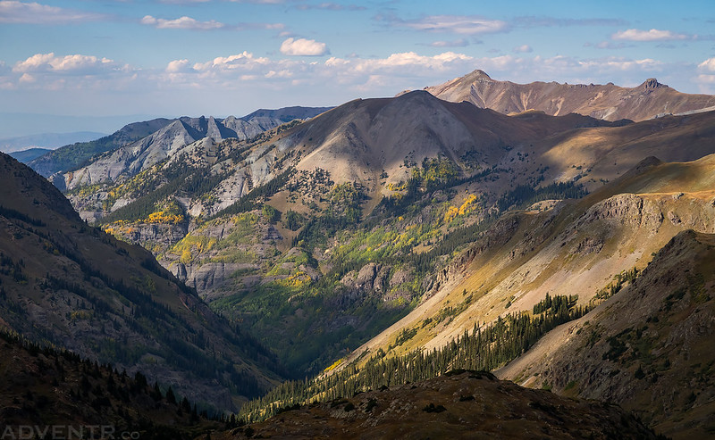
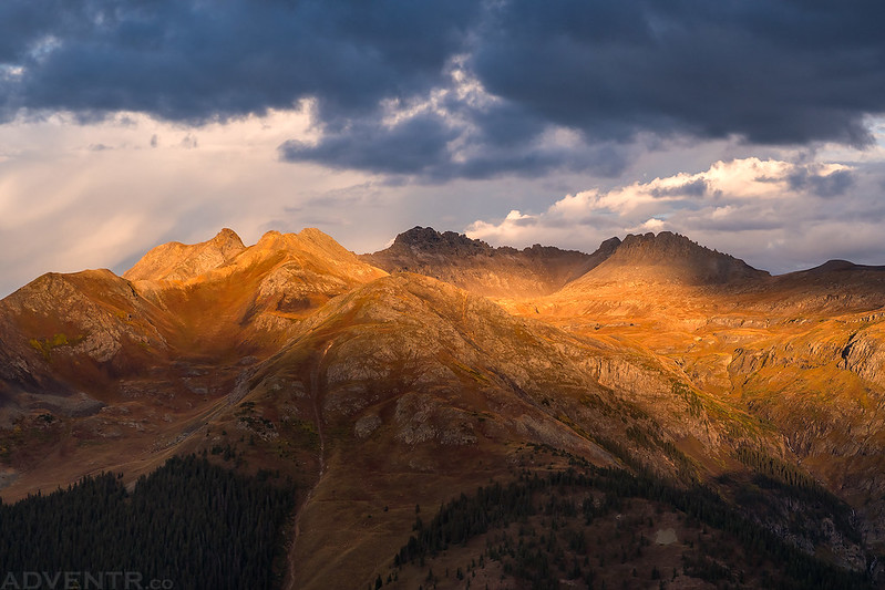
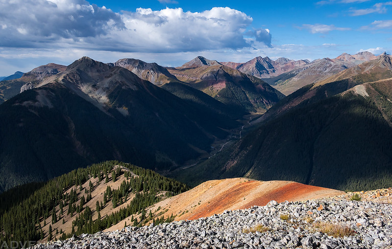
Near the summit I got a good look into Horseshoe Basin. In the distance you can see the fall colors beginning down along Henson Creek along with Uncompahgre Peak (14,309) on the horizon.
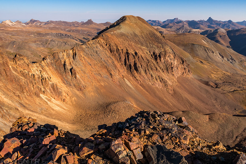
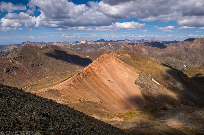
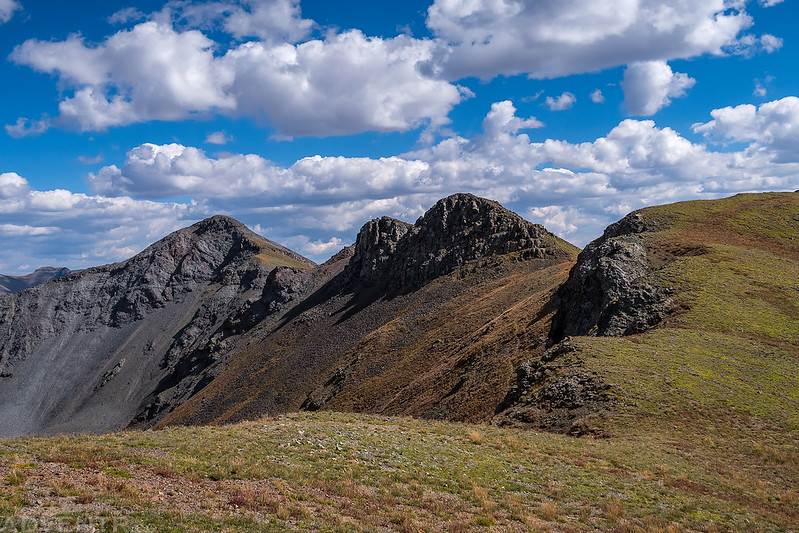
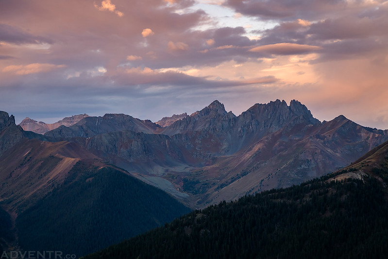
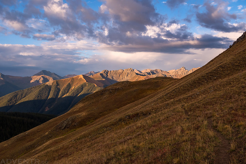
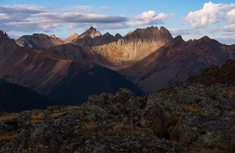
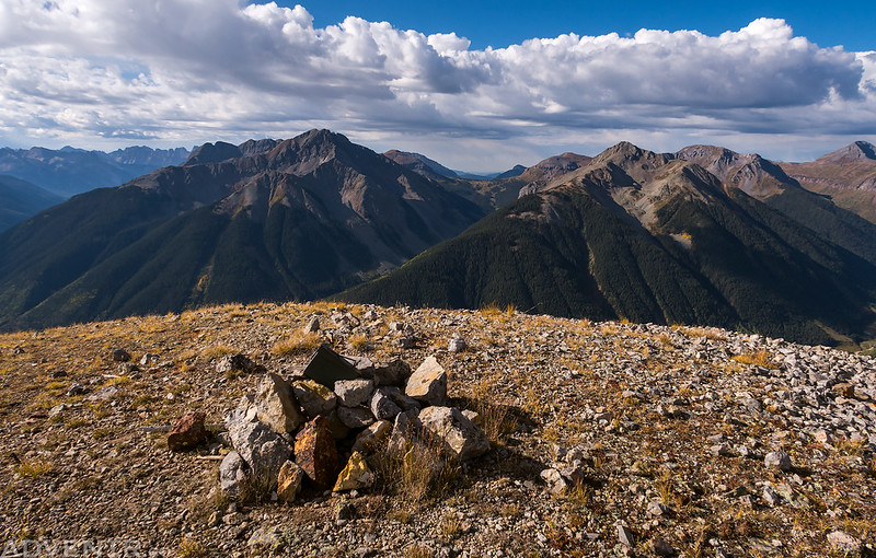
A view from the summit of Wood Mountain (13,660) toward the peaks of the Uncompahgre Wilderness on the horizon including Darley Mountain (13,260), Wildhorse Peak (13,266), The Coxcomb (13,656), and Wetterhorn Peak (14,015).
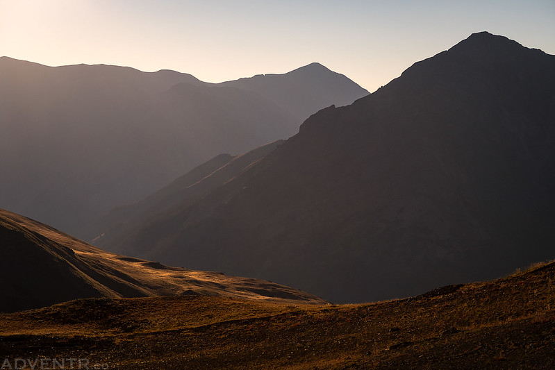
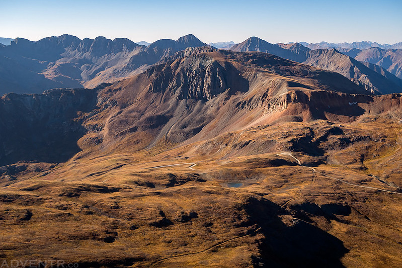
Looking back the other direction over Cinnamon Pass.
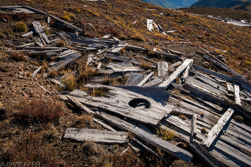
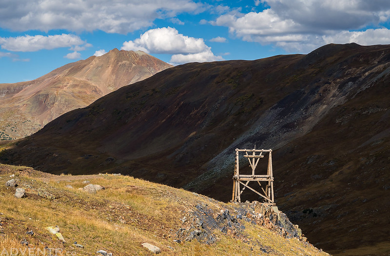
On my way back down I stopped to check out some old mining ruins and found the outhouse.
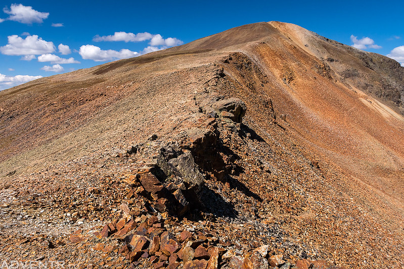
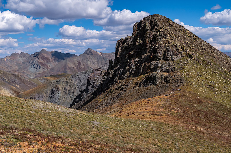
After returning to Cinnamon Pass I started hiking up the other side. Although I had hiked to the summit of Cinnamon Mountain a few years back, I had skipped visiting PT 13535 on that trip, so I figured I’d hike to that one today. Surprisingly, this is actually the first unnamed peak I have hiked this year!
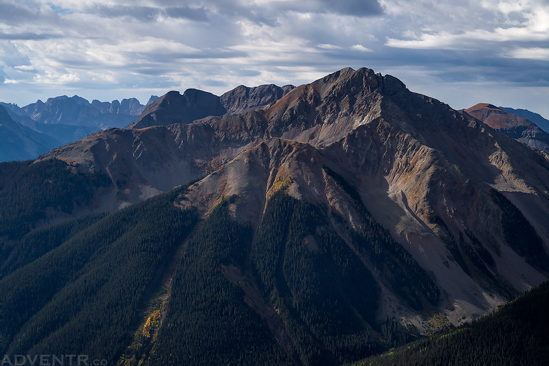
During my hike to the summit of PT 13535 I had a nice view into Grouse Gulch.
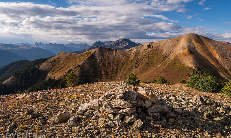
On the ridge above American Basin near the summit of PT 13535.
One last view of Cinnamon Mountain as I hiked back down to the pass.
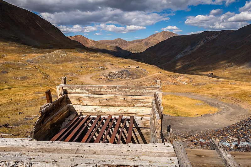
A few more mining ruins along the way near Cinnamon Pass.
After returning to my Jeep I drove back down to Silverton and grabbed a burger from the Kendall Mountain Cafe before they closed. While I was in town I checked the weather to figure out what I’d do for the rest of the day. The forecast was looking good, so I decided to return near Animas Forks to try Hanson Peak, since I was chased off that one by weather last year when I attempted it. I followed the Animas River back toward Animas Forks again, but before reaching the ghost town I took the road up Picayune Gulch and around Treasure Mountain (12,900) and parked on an old mining road below Hanson Peak.
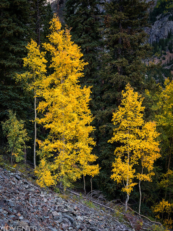
There were definitely some nice patches of fall color found in the area.
Following the ridge to the summit of Hanson Peak. It was about here that I turned around last time.
Spotlight on California Mountain (13,220) below.
A great view from the summit of Hanson Peak (13,454).
Following the ridge back down.
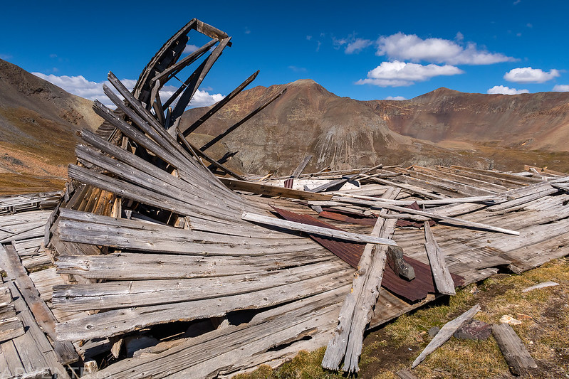
On my way back I came across this old collapsed tower with a few sections of ladders on the ground.

Back to the saddle that I would take down.
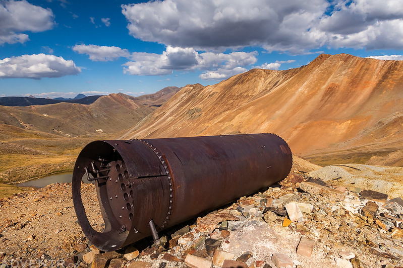
After returning to my Jeep I decided to take the scenic route back to Silverton over California Pass and Hurricane Pass. I stopped at the Gold Prince Mine in Placer Gulch first.
An old tram tower in Placer Gulch.
One last look at Animas Forks Mountain. I had hoped to climb that one today, but I guess it will have to wait until next year.
The road through California Gulch.
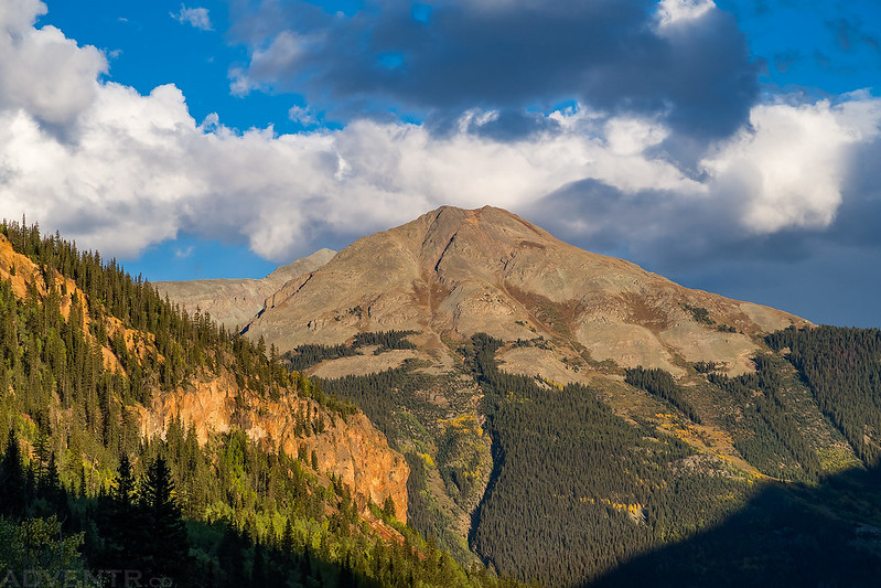
California Mountain towers above California Gulch.
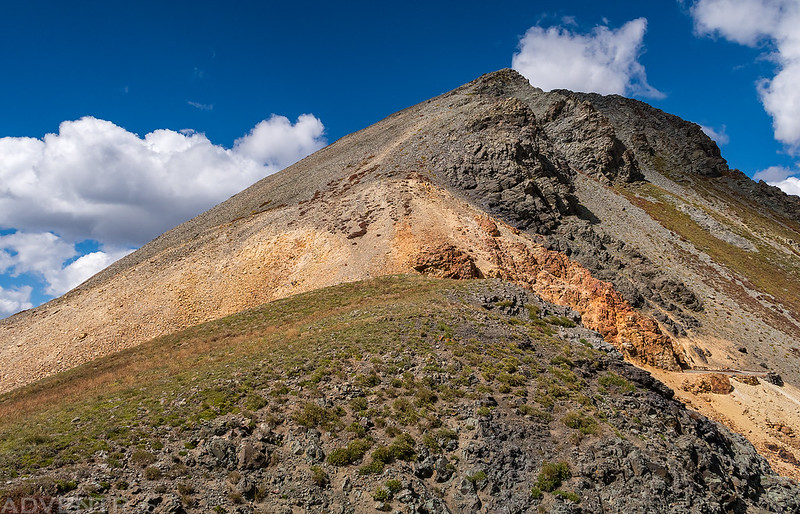
Going up to California Pass.
An old boiler near the pass.
I could see the start of the fall colors down along the Uncompahgre River, too.
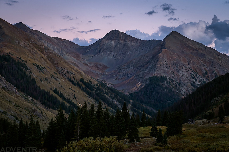
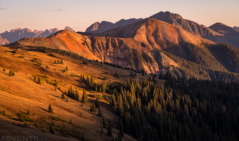
I stopped in Silverton for a quick dinner and then drove up into US Basin above Red Mountain Pass and found a spot to camp at around 12,000 feet. From my campsite I had a nice view over to Anvil Mountain at sunset, which would be my destination on Sunday morning.
A sunset view of Anvil Mountain with Grand Turk (13,180) and Sultan Mountain (13,368) located right behind it.
I got into my sleeping bag shortly after sunset but was unable to fall asleep for a while. At least I was able to look up at the clear sky and see all the bright stars and milky way. That never gets old! I did eventually fall asleep, but was awakened later in the night to the sound of falling rain and I was a little worried that it might impact my hiking plans later in the morning. When I finally got up shortly before sunrise I could see that it was still pretty cloudy out, but it appeared the clouds were not threatening and starting to break up, so I decided to carry on with the hike. It was a good decision since I was treated to some beautiful light and clouds during sunrise as I hiked to the summit of North Anvil (Nancy’s Grassy Peak) and Anvil Mountain.
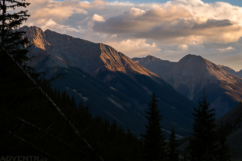
It was pretty cloudy out this morning when I started hiking. This view is looking north over Red Mountain Pass to Trico Peak (13,321) and Telluride Peak (13,509).
There was touch of pink on the clouds over South Lookout Peak (13,380) and Ulysses S. Grant Peak (13,767) across the valley.
Some nice spotlight did eventually start to get through the clouds!
Sunrise on Anvil Mountain, which is one of the peaks that surrounds Silverton.
North Anvil is the smaller red peak on the left and Anvil Mountain is the red peak the right. Behind them is Grand Turk and Sultan Mountain.
Most of the hike followed the ample animal trails found up in this area.
There were good views across the valley to the peaks that surround the popular Ice Lake Basin.
The morning light interacting with the clearing clouds put on a nice show during the hike.
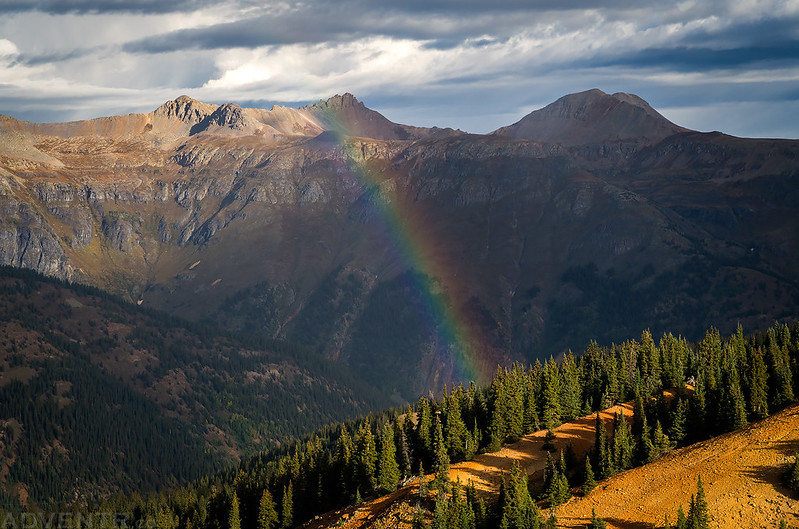
I even got to see two rainbows this morning! This was the better one.
On the summit of North Anvil (12,296) looking over to Anvil Mountain.
Looking back to Ohio Peak (12,673), which I hiked around this time since I already climbed it a few years back.
View from the summit of Anvil Mountain (12,537). The route to the top was pretty steep and loose, so I had to take my time. Now I have hiked all the peaks on the main ridge to the east of the Million Dollar Highway between Ouray and Silverton except for Red Mountain #2 (12,219). I guess I will have to try to get that one next year.
Looking up South Mineral Creek from the summit of Anvil Mountain.
A closer look at Sultan Mountain.
I took my time on the loose descent from Anvil Mountain as I started my hike back down.
I hiked back over North Anvil (Nancy’s Grassy Peak) and then returned to my Jeep at the trailhead above Browns Gulch so I could start my drive back home. It had been another nice weekend in the San Juan Mountains!
Awesome report and images as usual Randy, and you are a hiking machine! 🙂
My husband and I so enjoy your posts. What amazes us is how often you get out and the wide range of areas you go to!