Mexican Hat to Clay Hills Crossing
Tuesday – Saturday, May 12-16, 2015 | Average CFS: 1,051
For the past two years a few friends and I have floated the upper section of the San Juan River from Sand Island to Mexican Hat during the month of May. It’s a very nice section of river, but this year we wanted to do something different, so we attempted to get a permit for the lower section of the San Juan River from Mexican Hat to Clay Hills Crossing. My friend Jackson was lucky in the permit lottery and we received our first choice of dates on the river, plus we were even able to secure our preferred reserved campsite, too. For once our plans came together nicely and easily!
I left work Tuesday afternoon and started the drive to Moab where I had planned to stop for dinner before continuing on towards Blanding and finding a place to camp for the night. Unfortunately, about 30 miles outside of Moab I noticed a big cloud of smoke behind my Jeep and thought something was on fire. I quickly pulled over and grabbed my fire extinguisher to check things out. My Jeep wasn’t on fire, but it appeared to have lost most of it’s transmission fluid which was hitting the hot catalytic converter and exhaust, causing the smoke. Without transmission fluid, I couldn’t drive my Jeep any further and had to call a tow truck from Moab to pick up my Jeep and bring it to a shop in town, which was already closed since it was later in the day. My friends Jackson and Steve had left Grand Junction after me and were on their way, so I contacted them to let them know what was going on. Our original plan was to meet in Blanding for breakfast the following morning, but now they met me at the auto shop instead. I transferred my camping and rafting gear into Steve’s truck and then we stopped at Zax for a quick dinner. We still had to find a place to camp for the night. We needed to be near town so I could get back to the auto shop first thing in the morning, so we ended up at the Moab KOA. It’s not a great place to camp in a tent, but it was convenient for our needs this time.
My Jeep’s first ride on a tow truck…
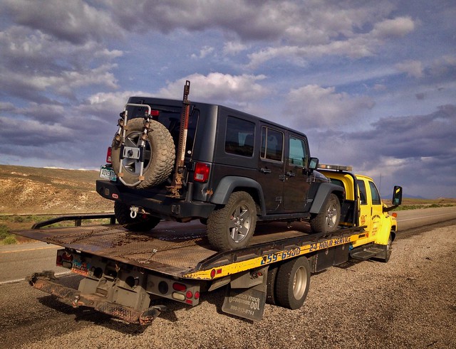
Technical Difficulties by Randy Langstraat, on Flickr
In the morning we had an early breakfast at the Moab Diner and then returned to the auto shop after they opened. I asked if it would be OK for me to leave my Jeep with them to fix the problem while I was on the river until Saturday, and they agreed. Before leaving the shop I crawled under the Jeep and saw that the problem was most likely a broken cooler line into the transmission which eased my mind about the cost of repair a little. Finally, we were on our way to Mexican Hat, just a little bit later than we planned.
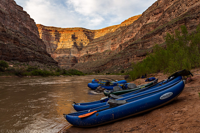
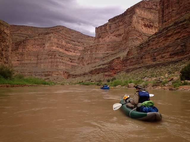
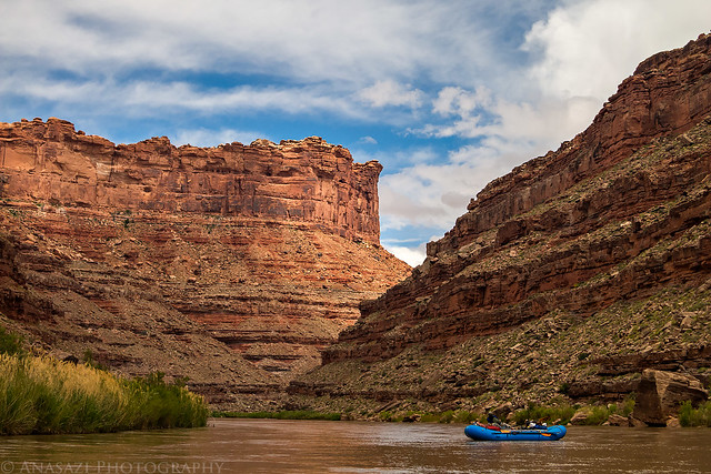
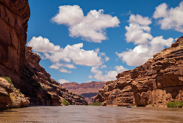
After a few more hours of driving we met up with the rest of our party at the boat ramp in Mexican Hat and started preparing for the trip down the river. We would be spending the next 4 days and 3 nights on this 56 mile stretch of the San Juan. After meeting up with the shuttle driver, we were on the river around 12:30pm. Since we were starting a little later than planned, we had to make up some time on the river because today was our longest day with about 18 miles to cover. It also turned out to be the nicest day on the trip with plenty of sunshine and warmer temperatures.
Preparing to launch at the Mexican Hat boat ramp.
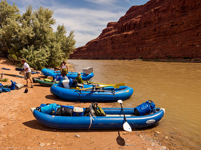
Launching by Randy Langstraat, on Flickr
Floating under the Mexican Hat bridge before leaving town.
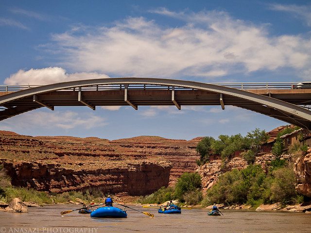
Mexican Hat Bridge by Randy Langstraat, on Flickr
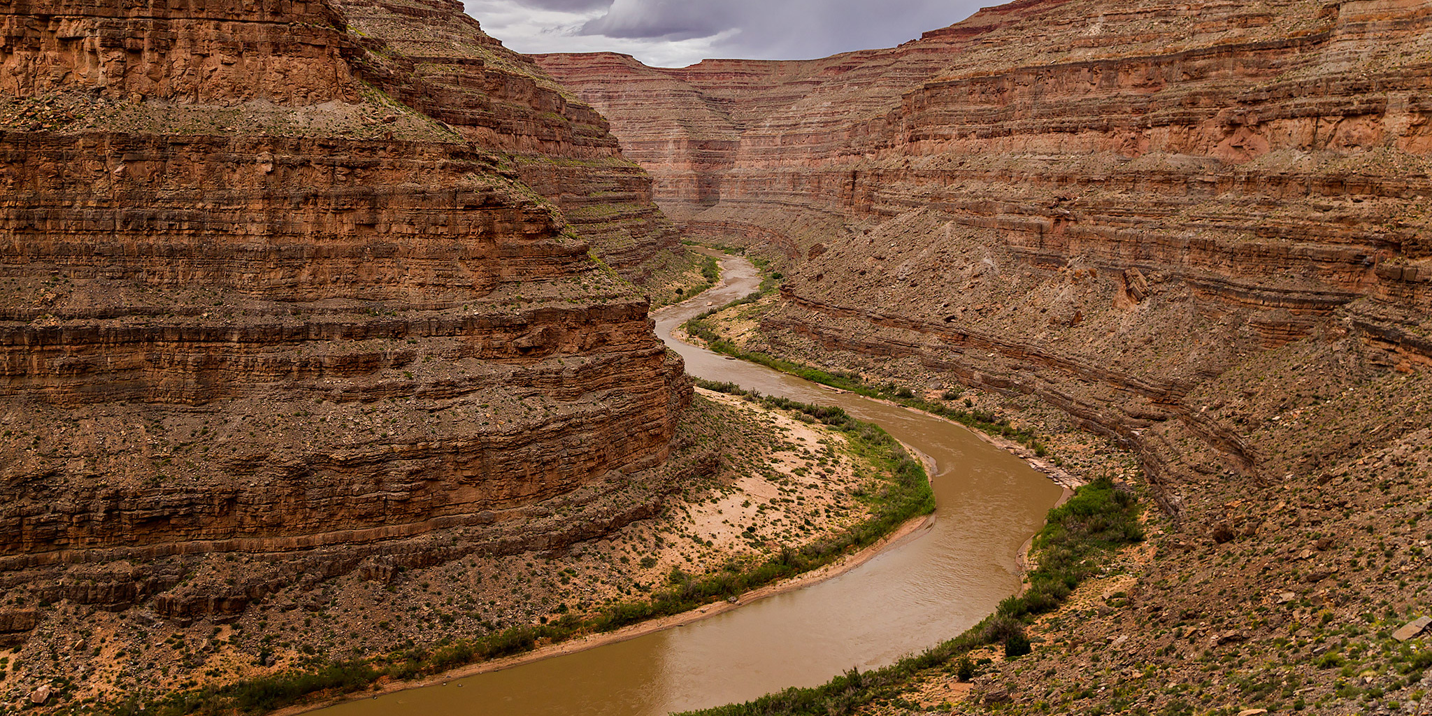
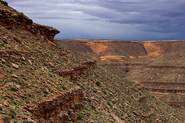
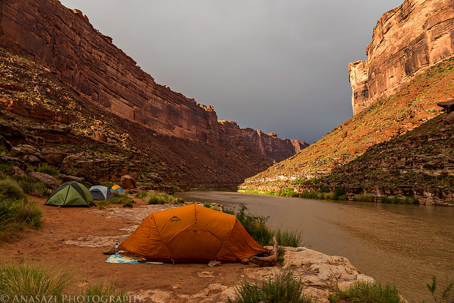
One of the highlights on this day (besides the beautiful canyon scenery) was floating through The Goosenecks of the San Juan which I have viewed many times from above at the popular Goosenecks State Park. We reached our intended stop at the bottom of the Honaker Trail in the early evening and found a very nice campsite without any trouble. We quickly got our camp setup and had BBQ Beef with coleslaw for dinner after a long afternoon on the river. It was a beautiful clear evening full of stars, so we didn’t bother to put the rainflys on our tents this night.
Our campsite near the bottom of the Honaker Trail.
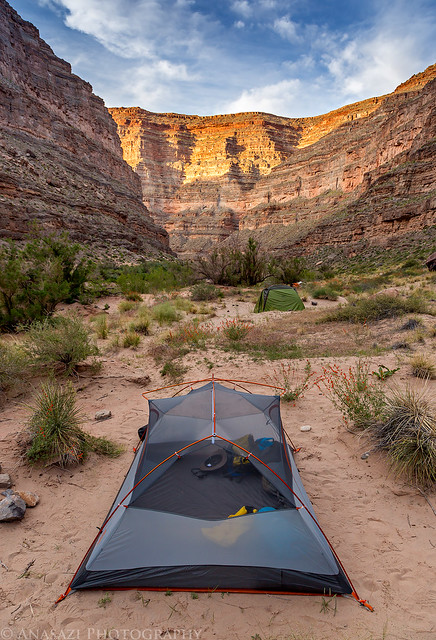
Honaker Camp by Randy Langstraat, on Flickr
Evening light along the San Juan.
First Stop by Randy Langstraat, on Flickr
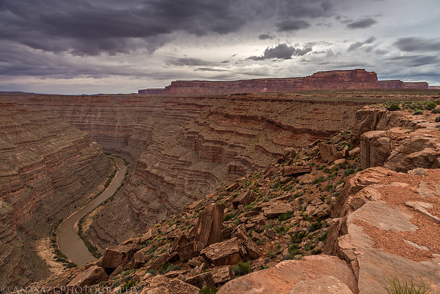
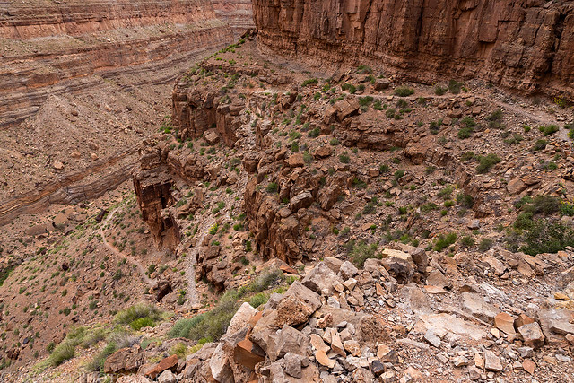
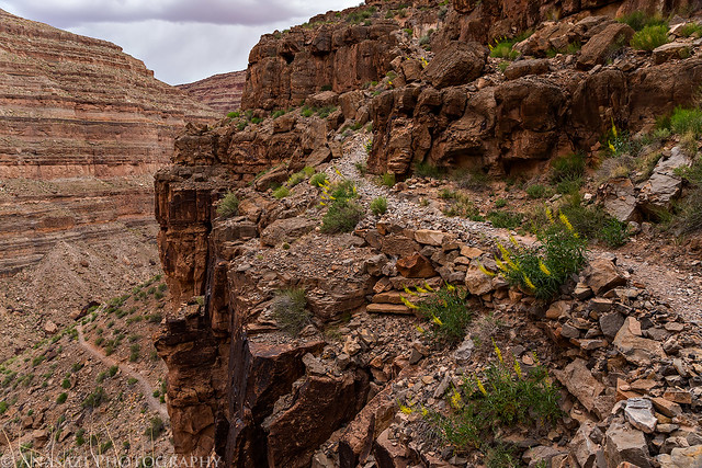
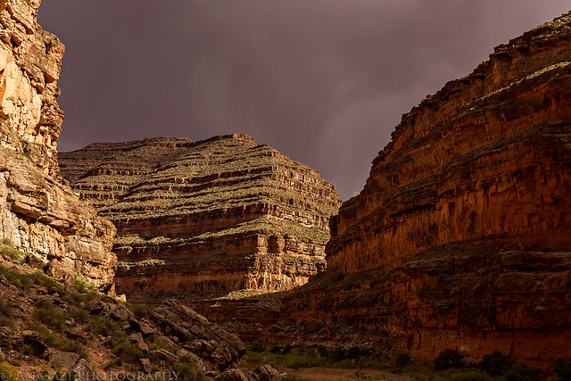
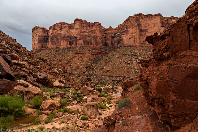
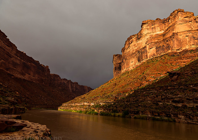
I woke up just before sunrise on Thursday morning to an overcast sky. The clear sky we had the night before was gone and would not return again for the remainder of our journey. Everyone else was sleeping in a little later this morning, but I wanted to hike to the top of the Honaker Trail before we got back on the river. After hiking about a quarter of a mile, I looked at the sky and thought it looked like rain might be in our future. I had left my tent setup with my down sleeping bag and all my other gear inside and thought I had better return and put on my rainfly, just in case. It was a good decision, because after resuming my hike, it started to sprinkle a little bit. The Honaker Trail is a very cool trail that was originally built in the late 1800’s by a gold miner named Augustus Honaker and was used to reach his mining claim at river mile 44. The trail makes use of a few long switchbacks along the natural benches of the canyon with a few constructed sections of trail near the point. Throughout my hike I heard a few rumbles of thunder in the distance that seemed to be getting closer. When I reached the rim of the canyon, I was able to check the weather on my phone and it did not look good. The forecast was calling for thunderstorms, a high chance of rain, strong wind and cooler temperatures. Exactly the kind of weather I don’t like when on a river trip. This would be the last time I would have any signal on this remote stretch of the river, so I wouldn’t be able to check the forecast again. With a storm moving in, I didn’t stick around at the top of the trail for too long and hurried my way back down to the river. The hike ended up being about 5 miles long with around 1,200 feet of elevation gain, and I completed it in less than two hours.
The San Juan River under cloudy skies.
Stormy San Juan Morning by Randy Langstraat, on Flickr
The Honaker Trail following a bench above the river.
Above the River by Randy Langstraat, on Flickr
A little spotlight on the canyon under dark clouds.
Spotlight by Randy Langstraat, on Flickr
A big cairn marking the top of the Honaker Trail.
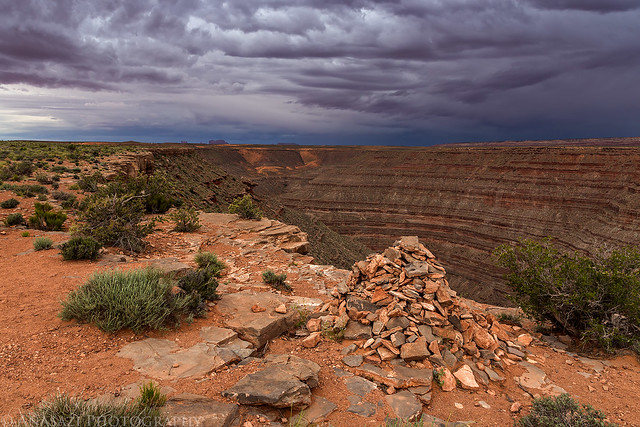
Top of the Honaker Trail by Randy Langstraat, on Flickr
Cedar Mesa above the San Juan River.
Cedar Mesa by Randy Langstraat, on Flickr
Following the switchbacks down.
Big Switchbacks by Randy Langstraat, on Flickr
Prince’s Plume was blooming all over the canyon throughout the trip and there was plenty of it along the trail. I had to brush past so much of it during the hike that my pants turned yellow from all the pollen. It’s a good thing I’m not allergic to it!
Honaker Trail Ledges by Randy Langstraat, on Flickr
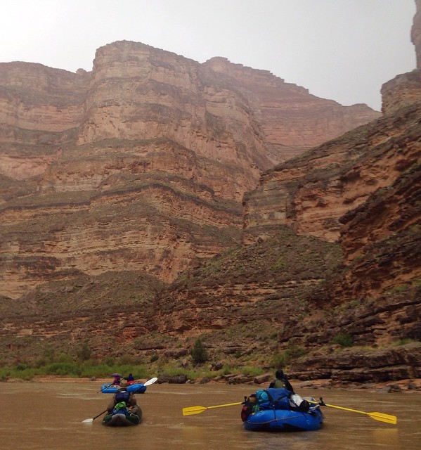
As I arrived back in camp the wind picked up and it felt like it could start raining at any second. I tried to quickly pack up my gear and tent before it started, but was a little late and my tent got a bit wet. We finished loading the rafts in the rain and continued down the river towards our next destination. We would be treated to the sound of rolling thunder through the canyon for a while as we floated along.
Back on the river again on a cooler and cloudier day.
San Juan Canyon by Randy Langstraat, on Flickr
Paddling through another rainstorm.
Rainstorm by Randy Langstraat, on Flickr
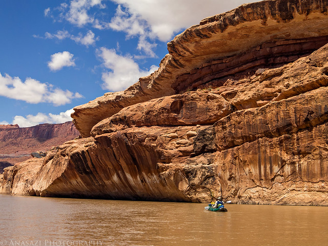
After a few miles we would reach an area known as the Twin Canyons where we found ourselves picking lines through a rapid (possible Class II+ or even III) that was unmarked in our guides and looked like it might be relatively new. It appears that a flash flood down the upper Twin Canyon has dumped a lot of debris into the river here forcing the river into a narrow and rocky channel. We all made it through without any issues aside from getting myself pretty wet, but it hardly mattered since I was already soaked from the rain and the river water felt warmer anyway. I believe that Jackson got turned sideways going through this rapid, but he managed to keep his kayak upright. Since I’ve been home I searched for information about this new rapid and have found one mention of it in a trip report from September 2014, but that’s all. They referred to it as Upper Twin Canyon Rapid, which sounds like a good name to me.
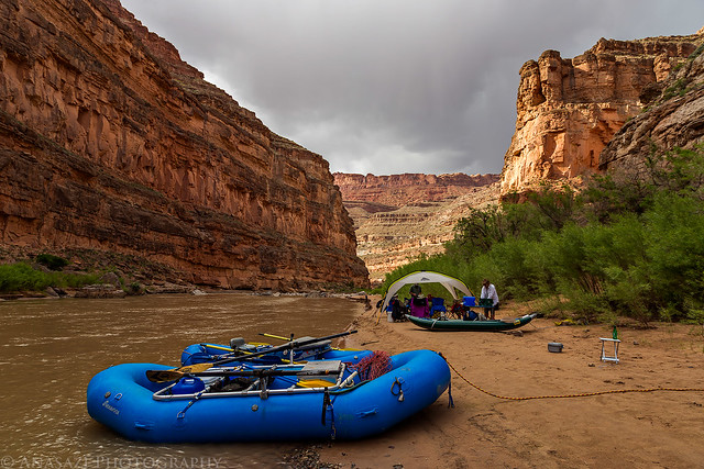
After a few more miles we reached Ross Rapid (Class II) which was super easy at this water level. We were making great time on this faster section of the river and ended up skipping a lunch stop since we made it to our intended campsite, 14 miles from our previous camp, just above the mouth of Johns Canyon around 1:00pm. This was another excellent campsite, and with our early arrival we had plenty of time to explore the area, make friends with the local wildlife and just have a relaxing afternoon. There were a couple of brief rain showers this evening that sent us under the small shelter we had setup, but for the most part it was a very nice evening. After our dinner of nachos and chicken fajitas we sat around the fire to keep warm until we went to sleep early.
A large pourover at the mouth of Johns Canyon.
Johns Canyon Panorama by Randy Langstraat, on Flickr
A friendly goose that hung out in camp most of the evening.
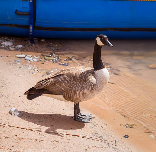
Camp Goose by Randy Langstraat, on Flickr
Our campsite near the mouth of Johns Canyon. The kitchen was on the beach and the tents all had nice sites up behind the tamarisk.
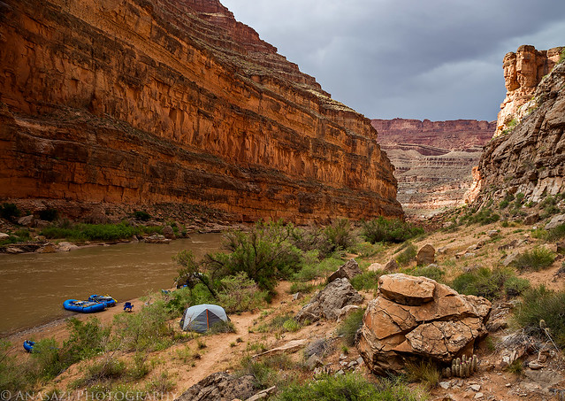
Johns Canyon Camp by Randy Langstraat, on Flickr
Preparing dinner.
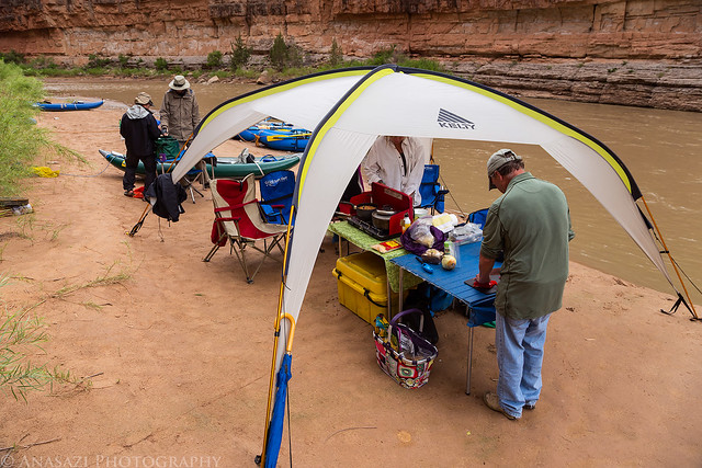
Dinner Time by Randy Langstraat, on Flickr
After Dinner by Randy Langstraat, on Flickr
There was even a nice light show before sunset.
Storm Light by Randy Langstraat, on Flickr
I slept in later Friday morning and we were back on the river again after breakfast and packing up camp. We only had to travel 12 miles today to reach our reserved campsite at the mouth of Grand Gulch, but we planned to spend some time exploring Slickhorn Canyon on the way. It was another overcast day, but would start to clear a little when we reached Slickhorn Canyon. When we reached Government Rapid (Class III), we decided to stop on river left and scout it. That turned out to be a good decision since it was a little technical and there was really only one good line through, which would have been difficult to find without scouting it first. Getting out also gave me an opportunity to take a short video of Jackson going through the rapid in his inflatable kayak. I pretty much followed the same line as him, except that I got a little too close to the rock on the right and bounced off of it. It was a pretty fun rapid.
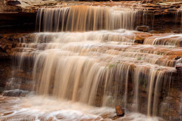
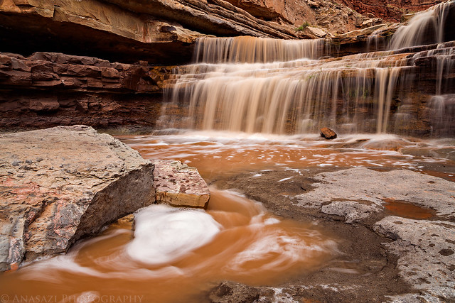
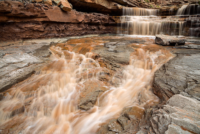
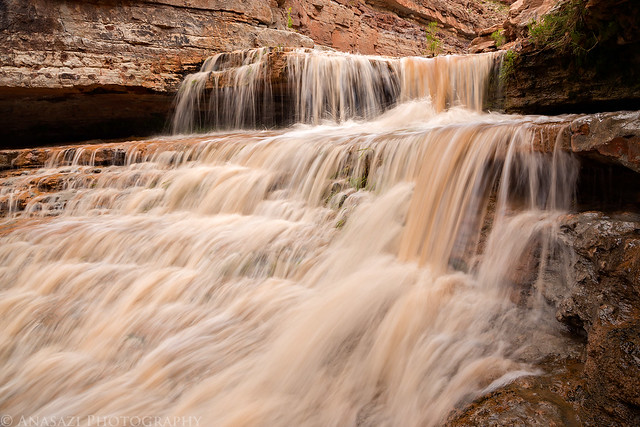
When we reached Slickhorn Canyon everyone started to get out their lunch, but I heard a roar coming from the mouth of the canyon and knew exactly what was going on. I skipped lunch, grabbed my camera and tripod and made my way up the canyon. The recent storms had caused Slickhorn to flash flood and there were a few nice waterfalls to photograph. It was an amazing sight! I just love photographing waterfalls, especially those that are only temporary.
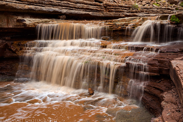
Flash Flood Falls by Randy Langstraat, on Flickr
Falling Water by Randy Langstraat, on Flickr
My favorite shot from the series.
Slickhorn Falls by Randy Langstraat, on Flickr
Slickhorn Canyon Flash Flood by Randy Langstraat, on Flickr
Flash Flood Cascades by Randy Langstraat, on Flickr
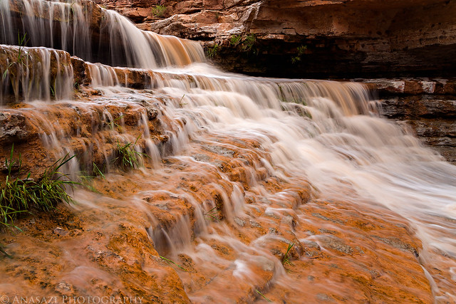
Slickhorn Cascade by Randy Langstraat, on Flickr
After I was done taking photos and the water level had started to drop, I hiked up the canyon to meet up with the rest of the group who had gone on to the plunge pools. Along the way I passed a few historic relics from oil drilling in the area. After floating past a few oil seeps that I could smell along the river earlier in the day, I understood why they had tried drilling here.
A view over the San Juan from Slickhorn Canyon as the sky started to clear a little.
Slickhorn View by Randy Langstraat, on Flickr
In 1907 Emery Goodridge built a road from Mexican Hat to to Slickhorn Canyon in order to transport oil drilling machinery into the canyon. Unfortunately, after carting the machinery across the rough country, it fell and broke beyond repair on the last steep grade into the canyon, causing Goodridge to abandon the site. This is part of that old drilling rig found below the steep grade.
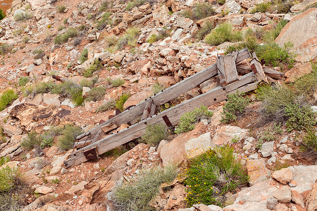
Drill Rig by Randy Langstraat, on Flickr
Jackson hiking through the rushing water in Slickhorn Canyon.

Flood Waters by Randy Langstraat, on Flickr
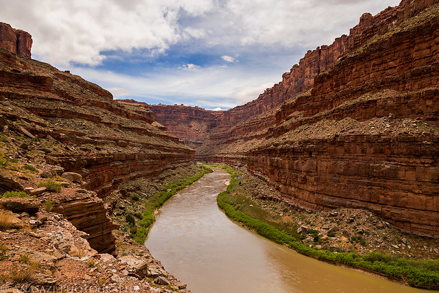
From Slickhorn Canyon we only had a few miles left to reach Grand Gulch, but the character of the river changed here thanks to Lake Powell reaching this point at high water in the past. What was previously a narrower and faster river channel quickly became wide and flat with shallow hidden sand bars that needed to be avoided. This slowed us down a little, but we still made it to Grand Gulch around 3:00pm.
Floating by Randy Langstraat, on Flickr
After backpacking into lower Grand Gulch from Collins Canyon a few weeks ago (I’ve spent a lot of time in Grand Gulch this spring), I was hoping to try and hike up the canyon from the river to meet the point we had turned around at. The ranger’s at the Kane Gulch Ranger Station had mentioned that the trail was washed out about a mile from the river and I wanted to find out for myself if it was true. Since it was getting later, I skipped setting up my tent right away and started on the hike. I was expecting to find a decent trail up the canyon like I’ve found elsewhere in Grand Gulch, but that was not the case. It was slow going hopping through boulder-fields, hiking around flash flood debris and impenetrable vegetation and just generally route-finding on the sections of trail that I did come across. After hiking for about a mile, I reached the spot that climbed up a large pourover and found that the trail was indeed washed out. It certainly wasn’t passable for me, but I’m sure someone with better climbing abilities and little fear of exposure could make it across. I turned around at this point and hiked back down to camp.
Hiking in lower Grand Gulch under cloudy skies as another storm system moved in. Thunder was rumbling in the distance during the hike.
Lower Grand Gulch by Randy Langstraat, on Flickr
Sacred Datura in Grand Gulch.
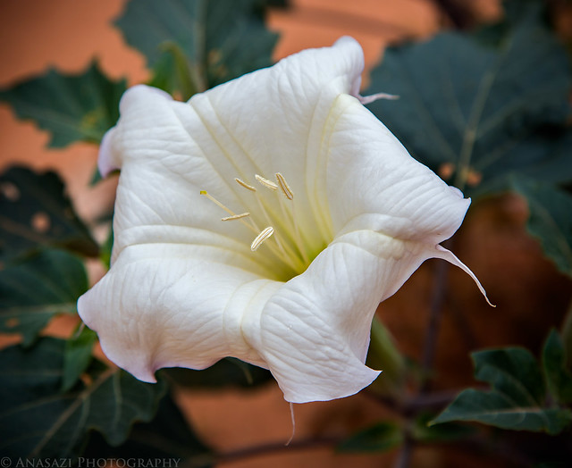
Sacred Datura by Randy Langstraat, on Flickr
I made it back to camp just in time for the heavy rain to start. I waited until the rain died down and tried to quickly setup my tent, but everything still got a little wet since it started to rain again as I was putting it up. It rained for quite a while and we tried to stay dry under the small shelter that covered the kitchen area. Dinner was cooked and consumed under the shelter during the storm this evening, but luckily we had spaghetti with meatballs which was easy to prepare. It stopped raining in time for us to have a fire so we could warm up and dry out before bed.
Our campsite at the mouth of Grand Gulch in the rain. It’s a very nice smaller site on a rock ledge above the river.
Grand Gulch Camp by Randy Langstraat, on Flickr
At least we had another nice light show before sunset.
Light Show by Randy Langstraat, on Flickr
There was more rain on and off during the night, but it finally stopped by the time the sun started to come up in the morning. We woke up to find that Grand Gulch was flowing a little bit from the precipitation during the night, but not very much. Still, a small waterfall had formed off the ledge at the mouth of the canyon that dropped into the river. We would have no more rain today and the sky would start to clear up nicely, but the cooler temperatures and a little bit of wind had stuck around.
View from the mouth of Grand Gulch looking down the San Juan River. Our campsite is hidden behind that large boulder near the middle of the photo.
Mouth of Grand Gulch by Randy Langstraat, on Flickr
A nice reflection and beautiful view looking up Grand Gulch.
Grand Gulch Reflection by Randy Langstraat, on Flickr
As I mentioned earlier, after passing Slickhorn Canyon the river became much flatter, wider and slower thanks to Lake Powell reaching this area and causing a lot of sediment buildup. It would stay this way for the remainder of the trip, which meant that today would be a much slower day covering the last 13 miles to Clay Hills Crossing and we had to do a lot more paddling to keep moving. We left camp at around 9:00am and finally made it to the boat ramp at about 2:00pm in the afternoon and we had lunch on our boats so we wouldn’t have to stop for long. It was a good upper-body workout the entire way. Besides the slow moving water, we also had to paddle from one side of the river to the other in order to avoid the many hidden sandbars along here. If we chose the wrong side, we would end up having to jump out of our boats and drag them across the shallow water until we reached the deeper channel again. Each of us had to do this at least a few times, but we got pretty good at avoiding them after a few errors.
Nice clouds above the river as the Red House Cliffs come into view during the last stretch of the river to the takeout.
Final Stretch by Randy Langstraat, on Flickr
Jackson floats by a large alcove in the Cedar Mesa sandstone along the river.
Cedar Mesa Sandstone by Randy Langstraat, on Flickr
Watching the geologic layers along this entire canyon was a very cool experience. My favorite part was watching the Cedar Mesa sandstone start off high above everything else (view of Cedar Point from the top of the Honaker Trail) and then end up diving below the river level just before the takeout. I’ve added this interesting graphic of the geologic profiles along the San Juan River that I thought was pretty interesting. Click on it for a larger view.

After reaching the takeout at Clay Hills Crossing we unloaded our boats and gear into our vehicles, which were waiting for us in the parking lot, and started the drive back home around 3:30pm. We reached Moab again around 6:00pm and I was able to pickup my repaired Jeep from the shop that I had left it at. I finished the drive home with no further mechanical issues. Even though the weather wasn’t necessarily ideal for a river trip, we were well-prepared and still had a great time on the San Juan River.
I enjoyed your story and pictures. Although I’ve been to the area several times, I doubt I’ll ever see what you did being on the river. Thanks for sharing!
Thanks AJ!
Wonderful website and fantastic photo! I get to be an armchair traveler until I can get out there myself now that I’m retired!
Looks like a fantastic trip. I’ve seen rafters from Goosenecks State Park, but never been on the river.
What was the source of the geological graphic showing the layers of rock in relation to the San Juan River? I’d be interested to see more geology info on the area.
David, the geological graphic came from this guide which I had with us on the river: San Juan River Guide by Lisa Kearsley
Cool, thanks!
Greetings. I have a launch on the same date exactly as yours two years ago. Do you recall the flow rate on your trip? Great tr by the way!
I don’t remember, but luckily my friend Jackson keeps track of that stuff and he just told me it was 1051 cfs.