
Canyonlands National Park’s 50th Birthday
Friday – Sunday, September 12-14, 2014
So far I’ve had a great year exploring many new areas of Canyonlands National Park. I was finally able to backpack through Salt Creek Canyon in The Needles, which had been a longtime goal of mine and one of the main reasons I started backpacking in the first place. Then I spent a nice weekend in The Maze with Diane and made it to the Maze Overlook and also discovered what a wonderful place Millard Canyon is. We even made it to The Great Gallery in Horseshoe Canyon on that trip so that Diane was able to view some of the magnificent rock art there for the first time. With all these great trips this year I thought I would try my luck again at completing the White Rim Road in the Island in the Sky, too.
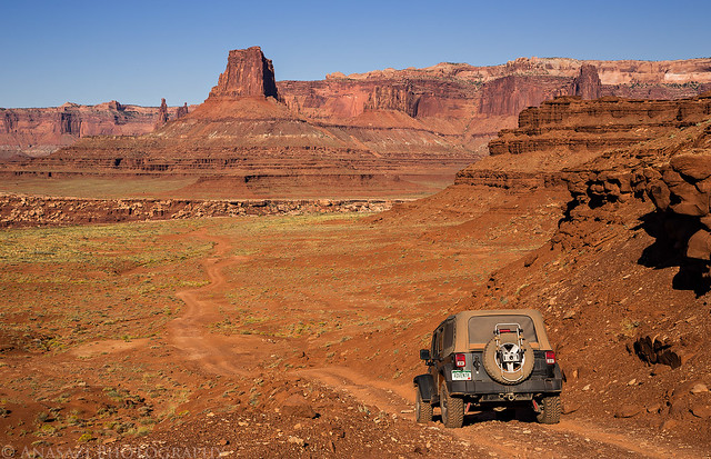
If you have been reading my blog for a while, you might know that completing the entire White Rim Road has been a goal that has eluded me for a while. I have not had much luck with this trail based on my previous unsuccessful attempts. The first time I broke a leaf spring on my Jeep Cherokee just past Musselman Arch and had to turn around and head home. The second time was when the Mineral Bottom Switchbacks got washed out pretty badly by a flash flood and were closed for a while. The last time I attempted the trail, it got washed out again and was partially closed. I still went that time, but only to the Murphy Hogback and then went back out the same way I had come.
As this trip’s date neared, I was a little concerned because quite a few heavy monsoon storms had washed out part of the trail and closed it again. I kept an eye on the park’s road status page and was happy to see that it opened again about a week before my trip. That was the week with all the serious flooding in Arizona and Nevada from former hurricane Norbert, so I was worried that those storms would wash it out yet again. Thankfully, that never happened and the status never changed again before I left. I would be good to go on this trip!
White Rim Road: open The White Rim Road is in rough condition, especially from Murphy Hogback to the western park boundary. It is very likely that vehicles without a 4-Low gear will not be able to complete the loop in its entirety. If you are going to attempt to drive the road in a vehicle that does not have a 4-Low gear, carry extra fuel and be prepared to self-rescue.
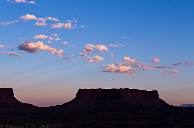
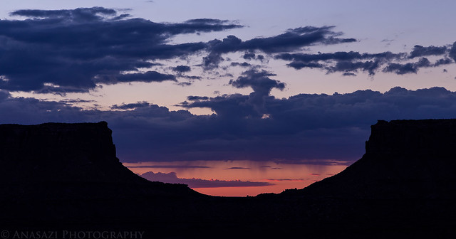
The only downside of all the big storms passing through earlier in the week was that they left behind clear skies, so I knew that catching an epic sunrise or sunset on this trip was probably going to be unlikely, but the upside is that the weather was looking perfect for sleeping under the stars. Always a trade-off.
As an added bonus, I would be starting this trip on the 50th birthday of Canyonlands becoming a National Park. While there would be plenty of celebratory activities throughout the park and in Moab, I would be able to properly celebrate this milestone along the White Rim by enjoying the backcountry of this awesome place.
In 1964, Congress set aside a hardscrabble piece of desert in southeast Utah “in order to preserve an area…possessing superlative scenic, scientific, and archaeological features for the inspiration, benefit, and use of the public.”
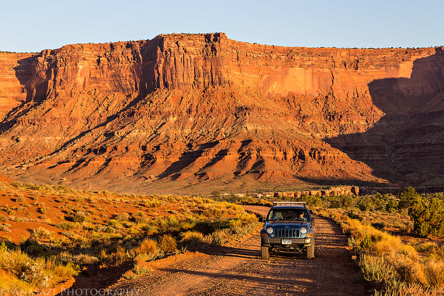
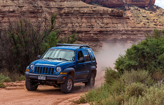
Since Diane had family visiting from out of town this weekend and would not be able to join me, I invited my friend Marty to come along. I left for Moab after work on Friday afternoon and met Marty at the Wendy’s for a quick dinner before heading over to the Island in the Sky. When I pulled into the parking lot I sent him a text to let him know I was there. Little did I know at the time, he was parked in the spot right next to me in a diesel blue Jeep Liberty. I had no idea he had bought a different vehicle and was expecting to see his red Grand Cherokee in the lot. After dinner I topped off my fuel tank and we left for Canyonlands.
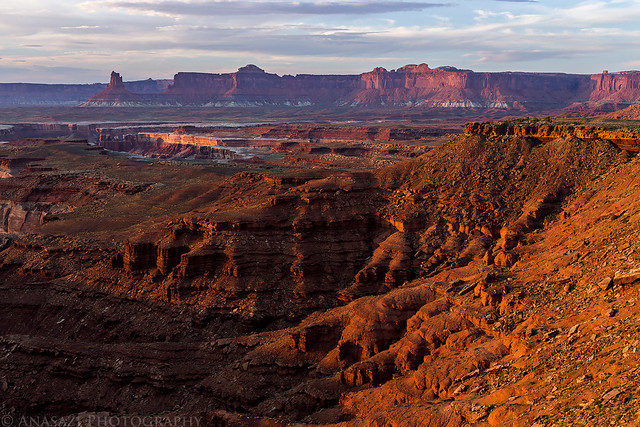
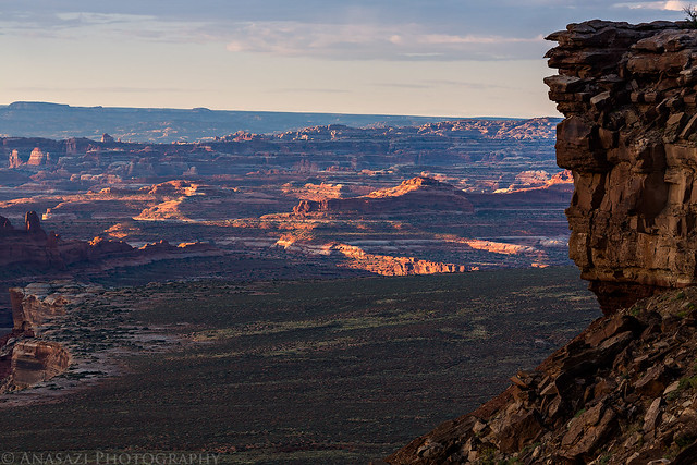
After entering the park we turned onto the Shafer Trail and were soon greeted with views over the beginning of the White Rim Road.
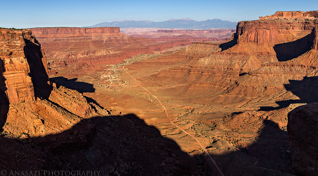
White Rim Below by IntrepidXJ, on Flickr
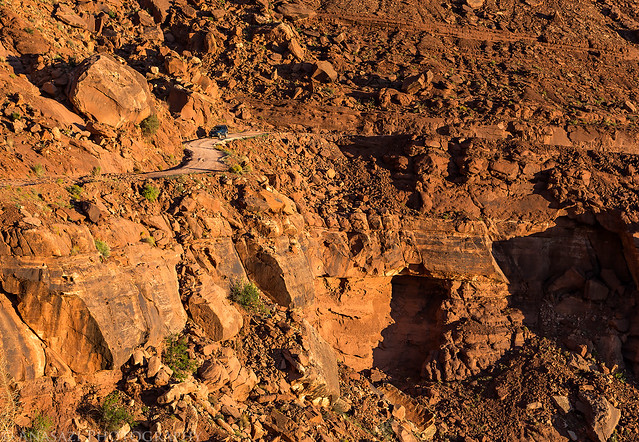
Then we reached the Shafer Switchbacks that would take us down to the White Rim.
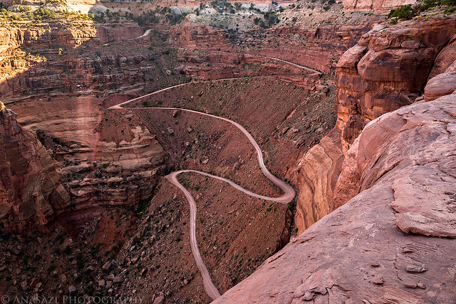
Shafer Trail Switchbacks by IntrepidXJ, on Flickr
Marty descending the switchbacks below me.
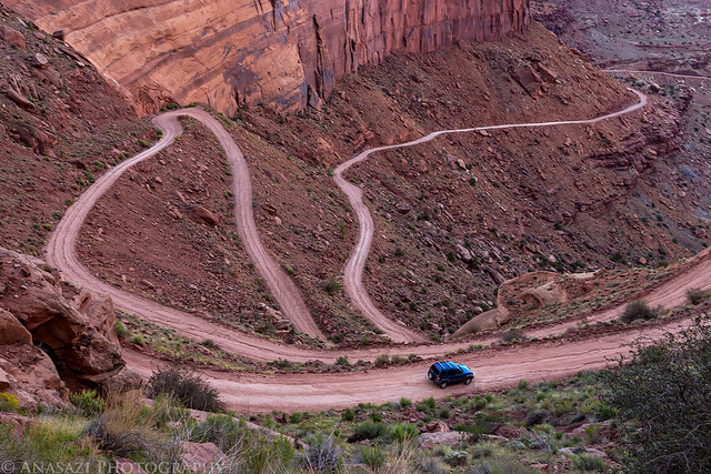
Going Down by IntrepidXJ, on Flickr
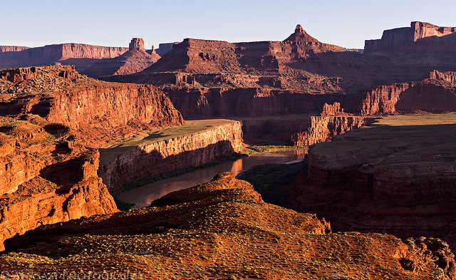
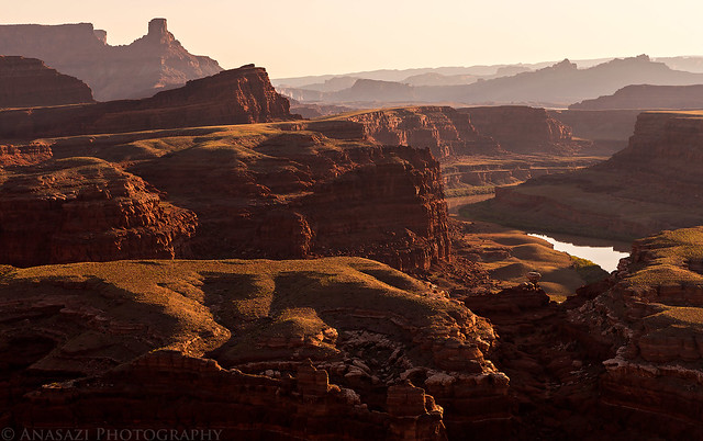
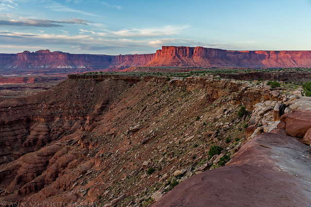
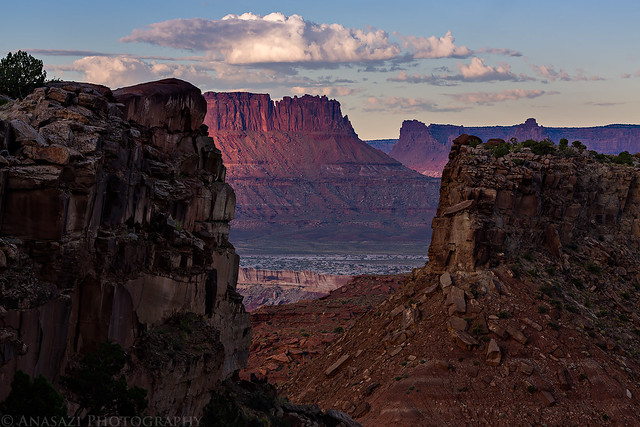
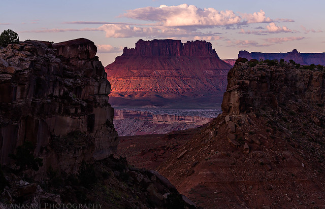
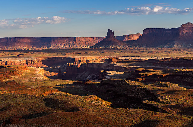
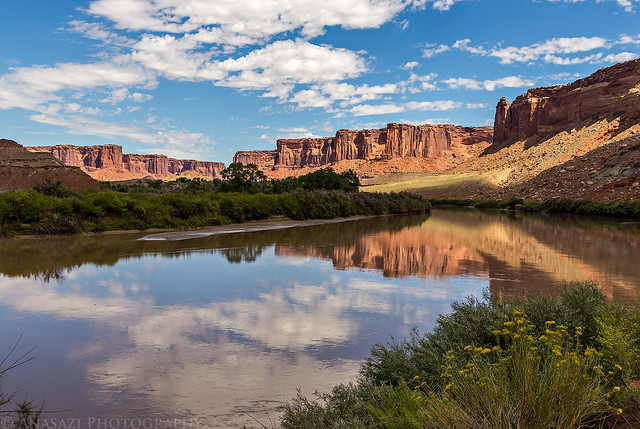
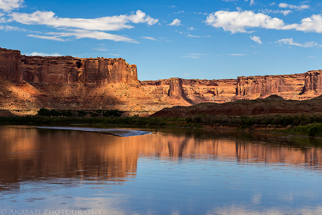
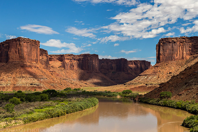
We had permits for the Shafer Camp this evening, which is a little off the main road on the Potash Road, but before going there we stopped at the Gooseneck Overlook for a short hike and a few photos.
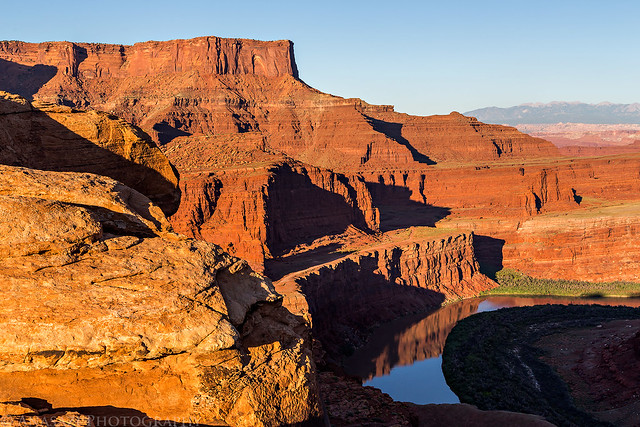
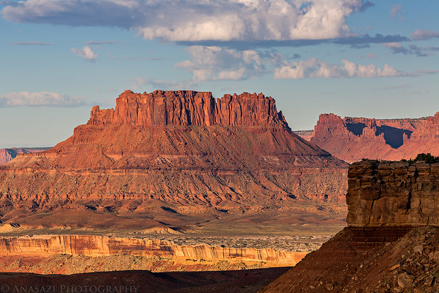
Looking over the Colorado River towards Hatch Point and the UN Tablet.
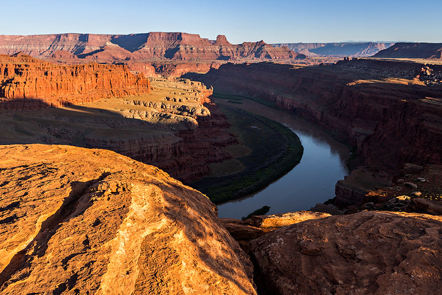
Gooseneck Overlook by IntrepidXJ, on Flickr
The other direction is Dead Horse Point.
Dead Horse Point by IntrepidXJ, on Flickr
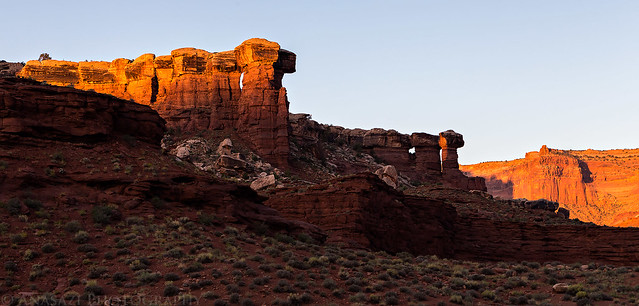
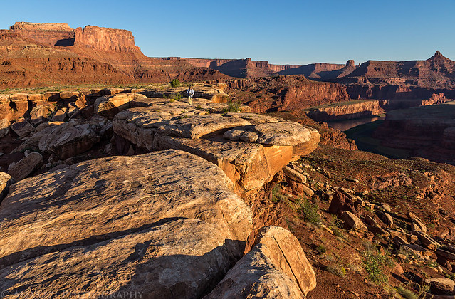
My shadow on a very large hoodoo capped with White Rim sandstone.
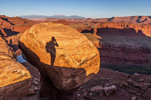
Hoodoo Shadow by IntrepidXJ, on Flickr
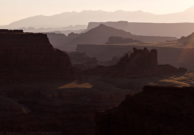
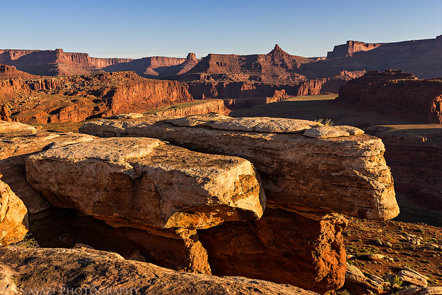
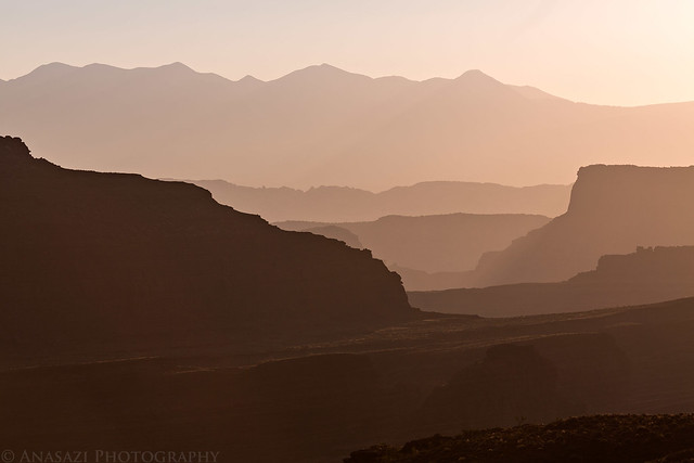
Shadows creep across the sandstone in the late evening.
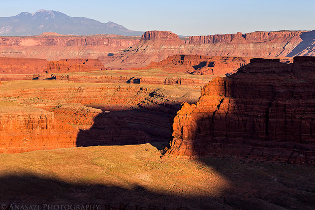
Goose Neck Shadow by IntrepidXJ, on Flickr
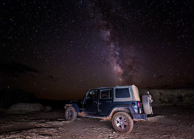
Since the sky was clear this evening, we stayed up late enough to photograph the Milky Way before the moon came up. It was a great night to sleep under the stars.
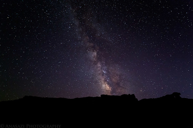
Shafer Camp Milky Way by IntrepidXJ, on Flickr
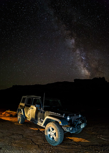
Rubicon Under the Milky Way by IntrepidXJ, on Flickr
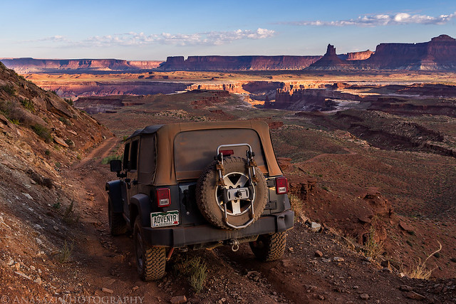
On Saturday morning we woke up just in time to catch the sunrise from camp and then drove over to the Colorado River Overlook so we could hike out to the Walking Rocks.
View from Shafer Camp.
Nuts & Bolts by IntrepidXJ, on Flickr
The Potash Road heading back to the White Rim Road from camp.
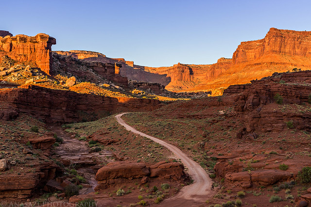
Potash Road by IntrepidXJ, on Flickr
Sunrise Drive by IntrepidXJ, on Flickr
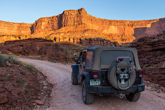
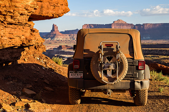
Marty on his way to the Colorado River Overlook.
Morning Drive by IntrepidXJ, on Flickr
On a shelf road above a canyon.
Shelf Road by IntrepidXJ, on Flickr
Lots of layers looking towards the La Sal Mountains.
Layers Upon Layers by IntrepidXJ, on Flickr
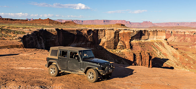
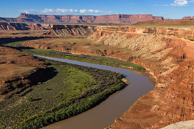
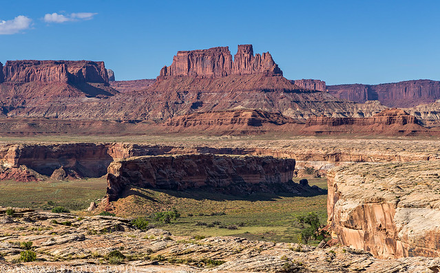
Parked at the edge of the Colorado River Overlook.
Colorado River Overlook by IntrepidXJ, on Flickr
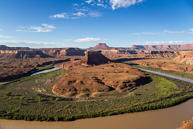
View from the overlook back towards Marlboro Point.
Overlook View by IntrepidXJ, on Flickr
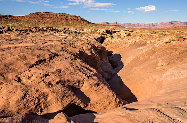
Marty hiking across the sandstone peninsula to the Walking Rocks.
Walking Rocks Exploring by IntrepidXJ, on Flickr
White Rim Slabs by IntrepidXJ, on Flickr
Walking Rocks at the end.
Walking Rocks by IntrepidXJ, on Flickr
Colorado View by IntrepidXJ, on Flickr
Sunrise Layers by IntrepidXJ, on Flickr
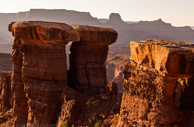
Next we made a quick stop at Musselman Arch.
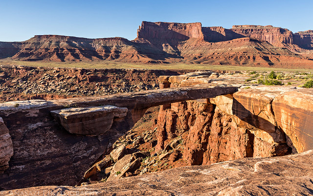
Musselman Arch by IntrepidXJ, on Flickr
Marty walking across the arch. I was actually able to walk across it for the first time, too.
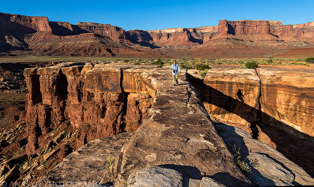
Crossing Musselman Arch by IntrepidXJ, on Flickr
From Musselman Arch we had a pretty uneventful drive to the White Crack and enjoyed the scenery along the way. We passed a few groups of mountains bikers with their support vehicles.
Layers in Blue by IntrepidXJ, on Flickr
Airport Tower comes into view as I descend from a small pass.
Airport Tower by IntrepidXJ, on Flickr
We passed underneath Monster Tower and Washer Woman Arch- two well-known spires that are usually shown in photos framed by Mesa Arch.
Monster Tower & Washer Woman by IntrepidXJ, on Flickr
Speaking of Mesa Arch, we saw it from below, too. If you look closely you can see a few people up there. I wonder how many photographers were lined up there this morning?
Reverse Mesa Arch by IntrepidXJ, on Flickr
We eventually reached the intersection for the White Crack and took the short spur road.
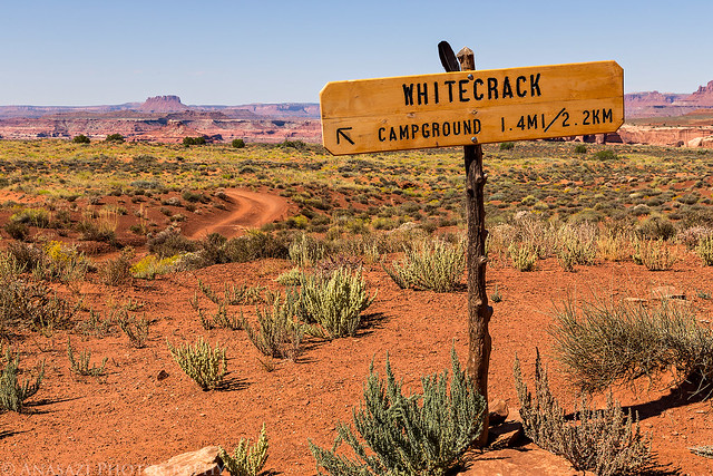
Whitecrack by IntrepidXJ, on Flickr
Marty follows me to the White Crack.
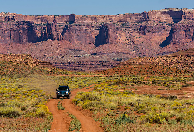
On the Road by IntrepidXJ, on Flickr
We spent a little time exploring the area around the White Crack and I even hiked down the old dugway a little bit while we were there.
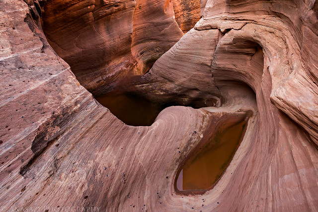
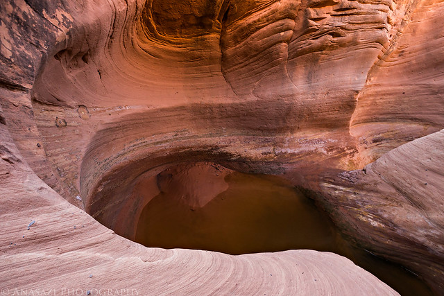
Many of the potholes in the area were full of water from the recent storms.
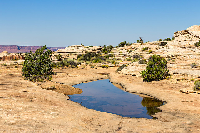
White Crack Pool by IntrepidXJ, on Flickr

White Crack Potholes by IntrepidXJ, on Flickr
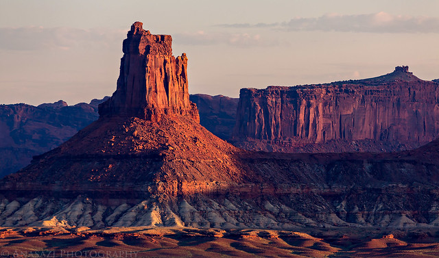
On our way to the Murphy Hogback we drove around Monument Basin which is filled with many of these sandstone spires.
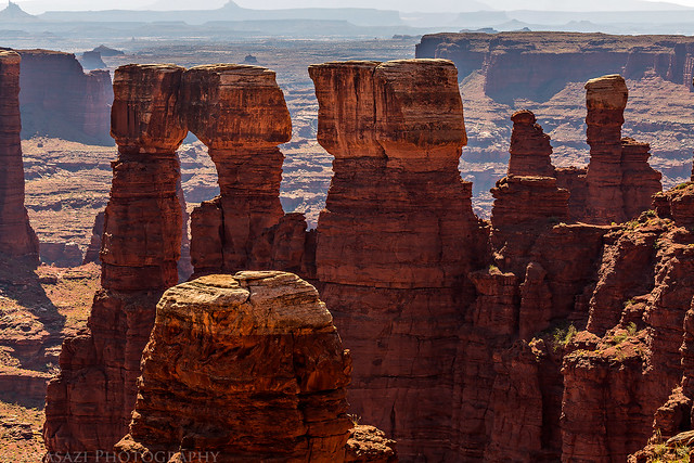
Monument Basin Towers by IntrepidXJ, on Flickr
As I rounded one of the bends in the road, this desert bighorn sheep was standing right in front of me. He continued to cross the road and then stopped about 100 yards away from me. Of course, I pulled out my long lens for a photo.
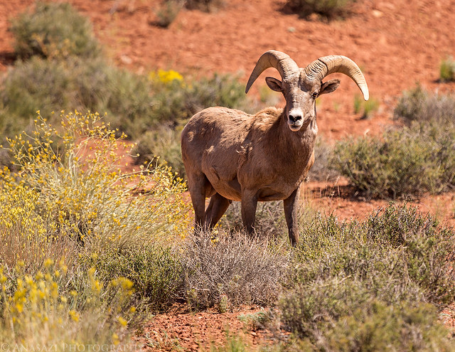
Stare Down by IntrepidXJ, on Flickr
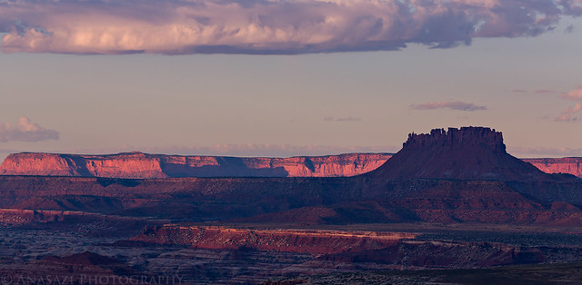
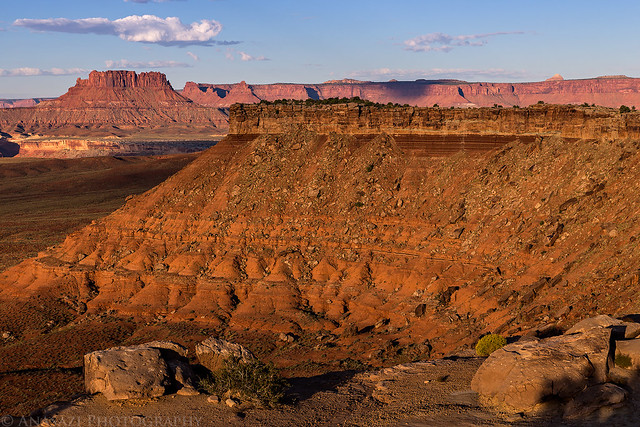
We eventually made it to our campsite on the Murphy Hogback and I quickly found some shade so I could take a little nap. While it was pretty hot in the direct sunlight, it was very comfortable in the shade and I slept well. When I woke up I had a little dinner and then went for a hike around the perimeter of the Murphy Hogback until sunset.
A few views from our camp at Murphy A.
Junction Butte Clouds by IntrepidXJ, on Flickr
Murphy Canyon by IntrepidXJ, on Flickr
Murphy Camp A View by IntrepidXJ, on Flickr
I planned to spend another night sleeping under the stars.
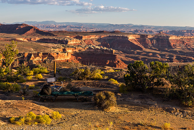
Murphy Camp A by IntrepidXJ, on Flickr
Light Below by IntrepidXJ, on Flickr
Grand View Point and Junction Butte.
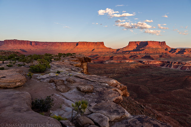
Grand View Point by IntrepidXJ, on Flickr
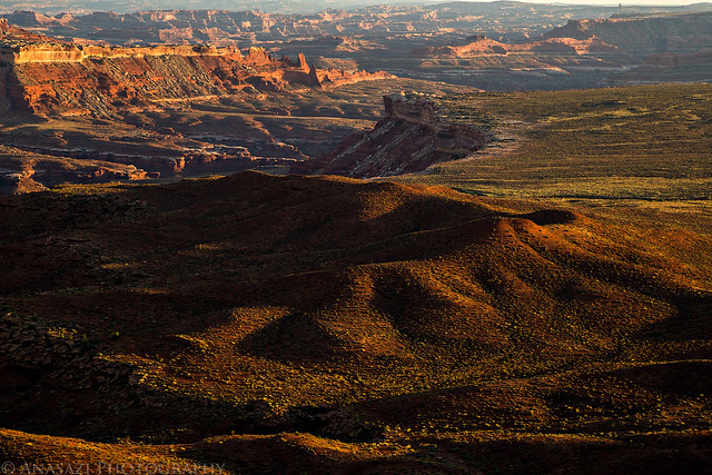
Nice light on the landscape below.
White Rim Sunset by IntrepidXJ, on Flickr
Candlestick Tower in the distance.
Island Light by IntrepidXJ, on Flickr
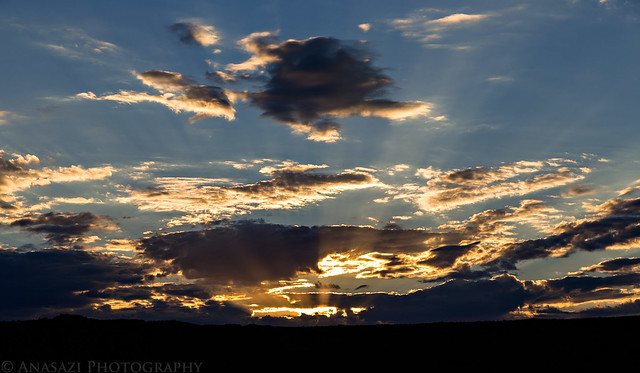
There were a few clouds in the sky this evening.
Junction Clouds by IntrepidXJ, on Flickr
View across the river towards the Orange Cliffs.
Orange Cliffs by IntrepidXJ, on Flickr
Evening Fire by IntrepidXJ, on Flickr
There was even a brief moment of alpenglow on Junction Butte this evening.
Junction Alpenglow by IntrepidXJ, on Flickr
The Milky Way was bright again this night, so I took a couple more photos over our vehicles at camp before the moon came out.
Under the Milky Way by IntrepidXJ, on Flickr
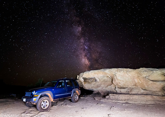
Liberty Under the Milky Way by IntrepidXJ, on Flickr
Since it was pretty clear out when we went to bed we both decided to sleep under the stars again this night. However, at around 1:00am we were awoken by raindrops falling from clouds that had moved in. I quickly got the tent part of my tentcot setup and was soon out of the rain. The precipitation didn’t last too long, but I decided to keep the tent up for the rest of the night- just in case. I recall hearing it rain a little later again, so it was probably a good decision.
On Sunday morning I woke up early enough to catch the sunrise and was pleasantly surprised to find that there were still some clouds in the sky. It would be a little nicer than another morning of clear skies. I hiked to the end of the peninsula near our camp to take a few photos and then returned to pack up camp and continue on our journey.
Hiking across the narrow neck of the peninsula of the Murphy Hogback at dawn with a little Earth Shadow over Ekker Butte in the distance.
Murphy Hogback Peninsula by IntrepidXJ, on Flickr
Magenta virga seen through the gap between Grand View Point and Junction Butte.
Virga in the Gap by IntrepidXJ, on Flickr
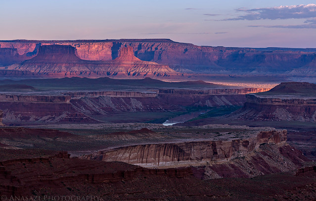
Morning light on Ekker Butte and the Orange Cliffs.
Pink Orange Cliffs by IntrepidXJ, on Flickr
Morning Shadows by IntrepidXJ, on Flickr
A little spot-lighting on the Buttes of the Cross.
Buttes of the Cross by IntrepidXJ, on Flickr
View through a gap in the Murphy Hogback with nice light on Ekker Butte.
Murphy Window by IntrepidXJ, on Flickr
Framed by IntrepidXJ, on Flickr
Sun rays above the Island in the Sky.
Sunrise by IntrepidXJ, on Flickr
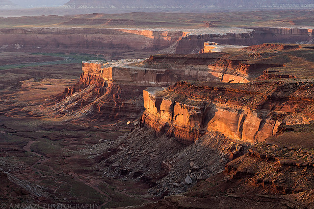
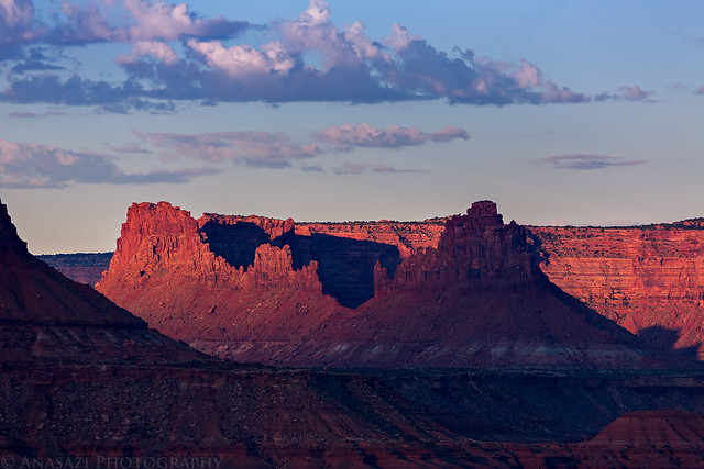
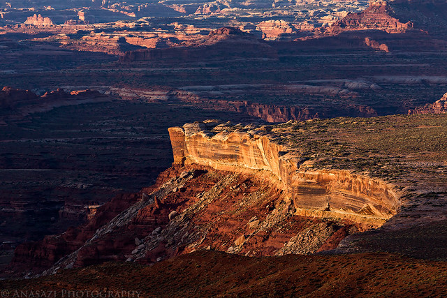
Looking over the Murphy Hogback towards The Maze with Ekker Butte and Elaterite Butte in view.
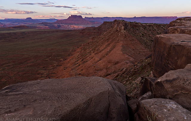
Murphy Hogback by IntrepidXJ, on Flickr
Over the Edge by IntrepidXJ, on Flickr
Murphy Hogback Morning by IntrepidXJ, on Flickr
Morning light on the Candlestick Tower.
Candlestick Tower by IntrepidXJ, on Flickr
White Rim Light by IntrepidXJ, on Flickr
Ekker Butte by IntrepidXJ, on Flickr
View over Soda Springs Basin.
Soda Springs Basin by IntrepidXJ, on Flickr
After packing up camp we descended off the other side of the Murphy Hogback.
Murphy Descent by IntrepidXJ, on Flickr
Dusty by IntrepidXJ, on Flickr
Around the Rim by IntrepidXJ, on Flickr
We passed the Turks Head.
Turks Head by IntrepidXJ, on Flickr
Green River by IntrepidXJ, on Flickr
After passing the Candlestick Camp we finally entered new territory for me, as I had driven this far on my previous attempt. A few miles later we stopped at the entrance of the Holeman Slot Canyon which I had hoped to hike this trip. Unfortunately, it was pretty full of water from all the recent storms and there was a drop early on that I didn’t think I’d be able to get back up with wet shoes, so I turned around and will have to try again on another day.
The beginning of the short slot canyon.
The Beginning by IntrepidXJ, on Flickr
Near the point where I decided to turn around.
Holeman Slot by IntrepidXJ, on Flickr
Full by IntrepidXJ, on Flickr
After leaving the Holeman Slot we passed by Anderson Bottom and The Frog on the other side of the river. Back over Memorial Day weekend Diane and I had hiked down there, so it interesting to see it from a different perspective.
The Frog by IntrepidXJ, on Flickr
Much of the remainder of the trail would follow closely to the Green River.
On the Edge by IntrepidXJ, on Flickr
We made another short stop to search for an old trunk that Marty had heard about. We easily found it’s location in a small alcove. According to some sources, this trunk was placed here in the 1930’s by a cowboy named Art Murray and was used to store his groceries and other belongings. It was definitely cool to see that it was still there, though I’m not sure how much longer it will be around since it appears that water has been flowing through the alcove recently.
Closeup of the front of the trunk.
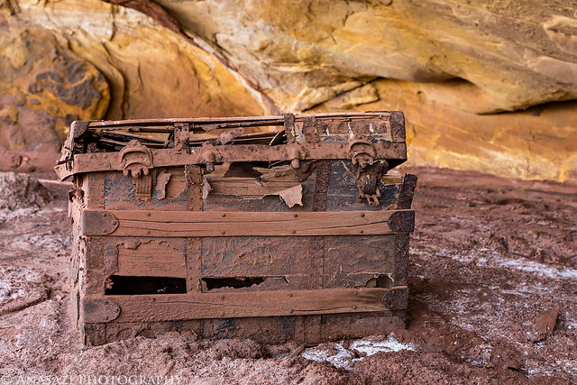
Hidden Treasure by IntrepidXJ, on Flickr
Here’s Marty taking a photo for a little scale of it’s size.
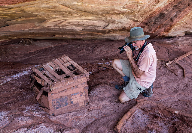
Marty for Scale by IntrepidXJ, on Flickr
Here’s the trunk with an overview of the small alcove it’s located in. You can see that water has been flowing through here.
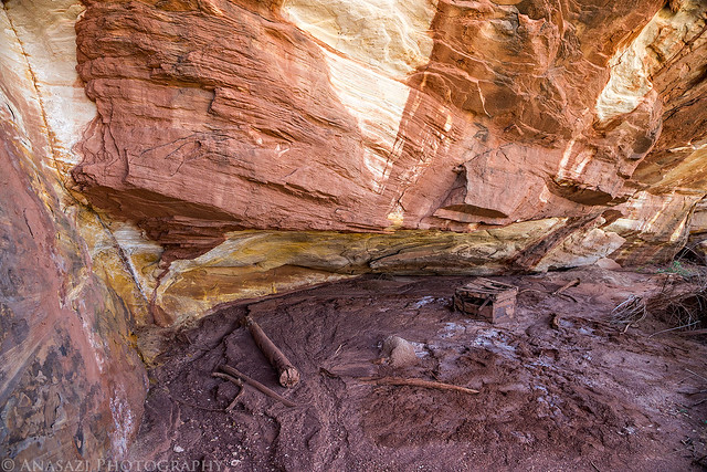
In Situ by IntrepidXJ, on Flickr
Marty starts the climb up Hardscrabble Hill.
Start of Hardscrabble Hill by IntrepidXJ, on Flickr
When we reached the top of Hardscrabble Hill under Bighorn Mesa we stopped to hike out to the ruins at Fort Bottom.
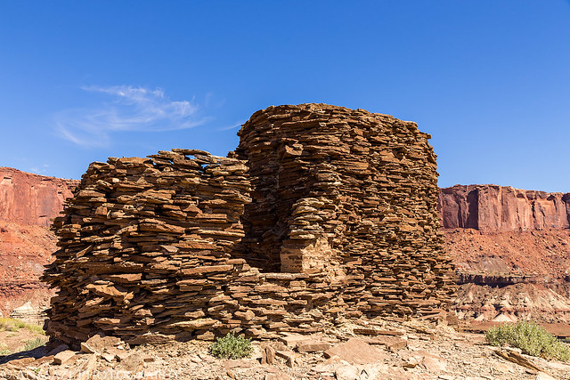
Fort Bottom Ruins by IntrepidXJ, on Flickr
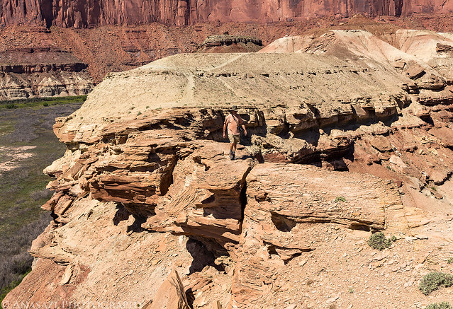
Marty crossing a narrow section of the hike on the way back. Look closely and you can see the ruins in the background.
Crossing the Ridge by IntrepidXJ, on Flickr
We spotted this lizard on the way back. While it looks similar to the standard Collared Lizards I typically see around here, I’d never seen one with these colors before. After asking around and checking photos online, it appears that this might be a Great Basin Collared Lizard?
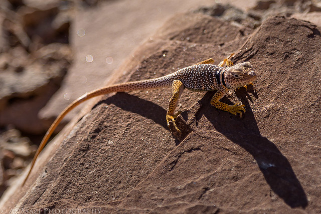
Great Basin Collared Lizard by IntrepidXJ, on Flickr
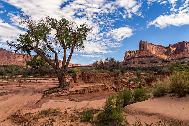
A large cottonwood tree in Upheaval Wash. The road drops down into the wash here and follows it for a little bit. We stopped here and hiked down the wash to the Green River in search of an old homestead, but were unable to find it this time in the overgrown brush.
Upheaval Wash Cottonwood by IntrepidXJ, on Flickr
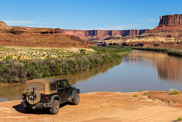
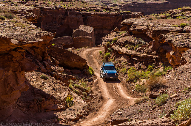
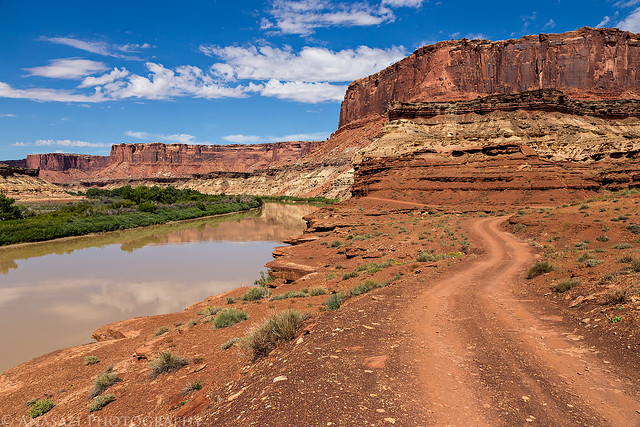
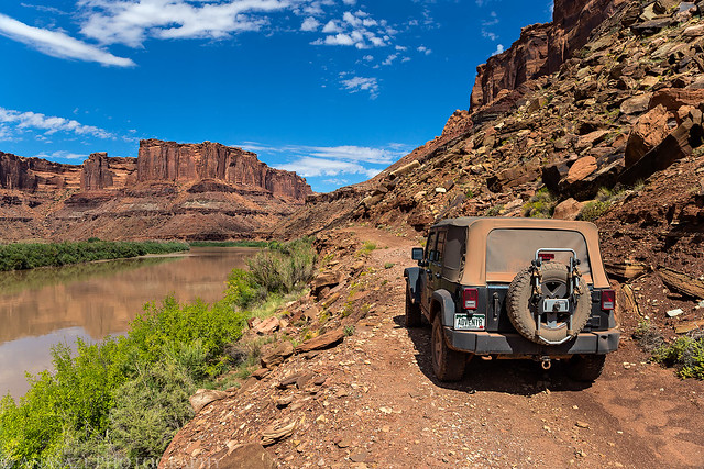
The rest of the drive along the Green River to Mineral Bottom was pretty uneventful. There were some nice reflections on the river and one large mud puddle what we had to drive through.
Kicking Up Dust by IntrepidXJ, on Flickr
Along the Green by IntrepidXJ, on Flickr
Leaving Canyonlands National Park.
Leaving Canyonlands by IntrepidXJ, on Flickr
Green River Road by IntrepidXJ, on Flickr
Marty crossing the mud puddle.
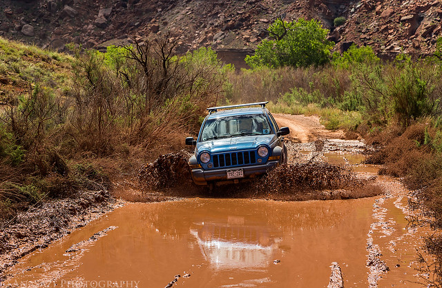
Puddle by IntrepidXJ, on Flickr
Green River Reflection by IntrepidXJ, on Flickr
Reflected Cliffs by IntrepidXJ, on Flickr
Before climbing up the Mineral Bottom Switchbacks we decided to continue up the river on a little-used road to Hell Roaring Canyon so we could visit the Denis Julien Inscription from 1836.
Green River Shadows by IntrepidXJ, on Flickr
Narrow road above the river. There were no other recent tracks on it.
Along the River by IntrepidXJ, on Flickr
The historic Denis Julien Inscription.
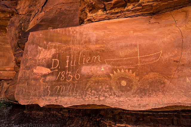
D. Julien, 1836 by IntrepidXJ, on Flickr
There was a sign near the inscription with a little additional information:
Denis Julien Inscription
Denis Julien was a French-Canadian fur trapper whose presence is best documented through his inscriptions. During a trapping expedition in 1836, he became the first white man of record to navigate Cataract Canyon and the lower reaches of the Green River.
The Denis Julien Inscription is on the National Register of Historic Places.
After checking out the inscription we drove back to the Mineral Bottom Switchbacks and took them up to the top of Horsethief Point. I actually had not been on these switchbacks since before they were washed out and reconstructed, so they were a little different this time. We finished the easy drive across Horsethief Point to the highway and then returned to Moab for dinner at The Blu Pig before finishing the drive back home. It was a very nice weekend in Canyonlands and I’m glad that I have finally been able to complete the entire White Rim loop.
Randy I have really enjoyed your trips this year, very envious, you are very blessed to go on these trips, you also must really research these trips, it is incredible the places you can take your jeep, love the shots at night under the stars. I have never seen Musselman canyon , great shot walking over the top. Just beautiful pictures, the lighting, the layers, stars, and as always the landscapes. Keep shooting.
Doug S
Thanks Doug!