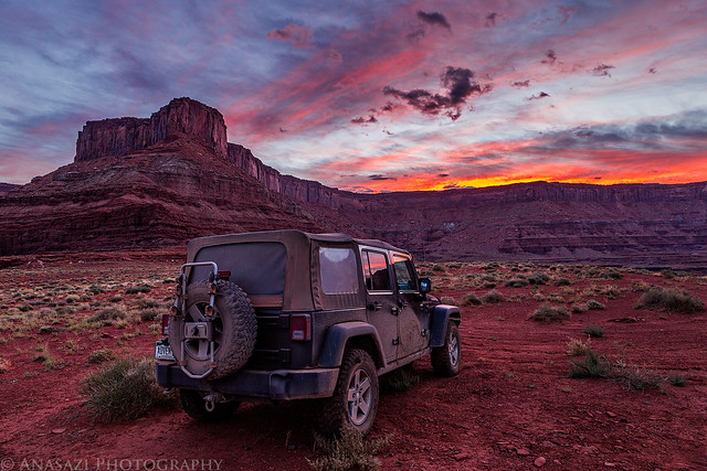
Wednesday, October 9, 2013
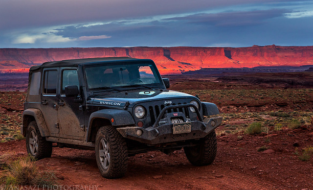
After watching a very colorful sunset the previous evening and having a great night camping under the stars along the Lockhart Basin Road, I woke up shortly before sunrise so I could watch a beautiful sunrise over Hatch Point. It’s hard for me to decide if this sunrise was better than the sunset the night before since they were both outstanding!
The magenta light reflecting off of the clouds above was very intense.
Dawn of a New Day by IntrepidXJ, on Flickr
I couldn’t have asked for a better scene to wake up to than this!
Lockhart Basin Sunrise by IntrepidXJ, on Flickr
Jeep Sunrise by IntrepidXJ, on Flickr
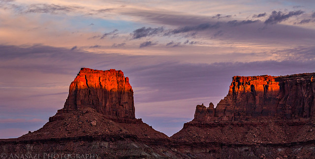
Junction Butte lit up across the Colorado River in Canyonlands National Park.
Junction Butte by IntrepidXJ, on Flickr
A wide panoramic image of the Island in the Sky catching the first light of the day. Click on the image for a larger version on Flickr.

The Island in the Sky by IntrepidXJ, on Flickr
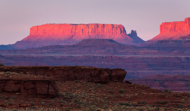
Light strikes the top of the UN Tablet and Hatch Point near the Canyonlands Overlook. I spent a great night camped up there in the spring.
Tablet by IntrepidXJ, on Flickr
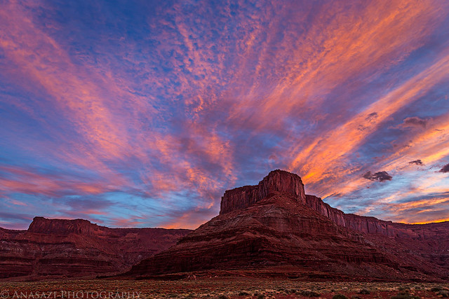
Soon some of the clouds turned from magenta to gold.
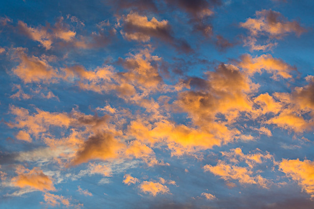
Morning Clouds by IntrepidXJ, on Flickr
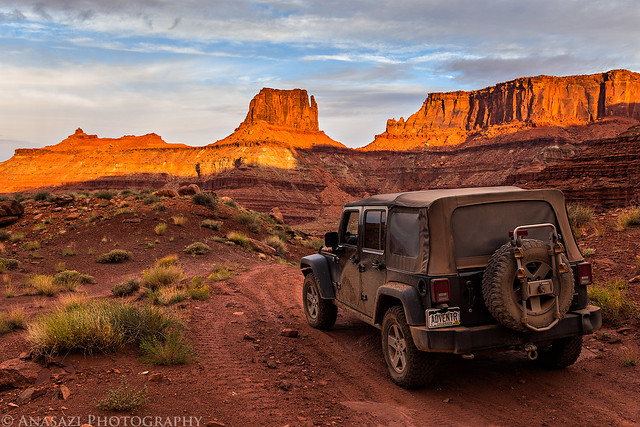
Ready to leave camp and finish the drive to Moab.
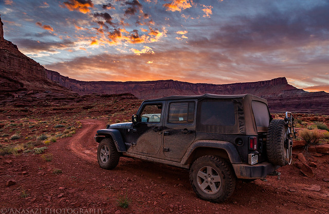
Leaving Camp by IntrepidXJ, on Flickr
Island Background by IntrepidXJ, on Flickr
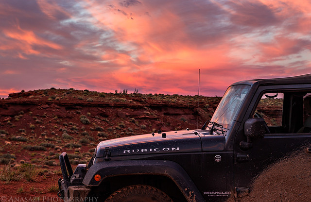
It was a beautiful morning! 🙂
Lockhart Road Morning by IntrepidXJ, on Flickr
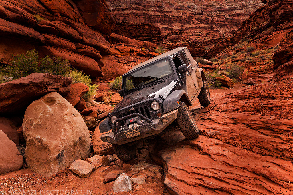
As I approached the end of the Lockhart Basin trail, I knew I would be driving through the roughest section. I wasn’t sure what to expect, but it wasn’t too difficult. I just wish my swaybar disconnect were working, because that would have helped a little bit in a few sections.
This was one of the more difficult sections which probably wouldn’t have given me any trouble had I managed to stay on the large rock on the left as I came down. Instead, I turned too soon and managed to land on my rock rail…but that’s why it’s there 😉

Coming Down by IntrepidXJ, on Flickr
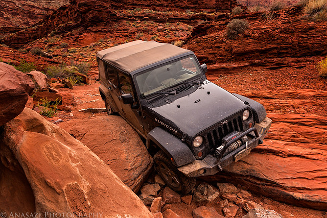
Rock Rail by IntrepidXJ, on Flickr
When I reached the intersection at the end of the trail, I decided to take the Chicken Corners trail out to the overlook at the end, since it has been a few years since I’ve been out here.
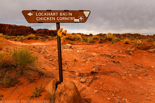
Chicken Corners by IntrepidXJ, on Flickr
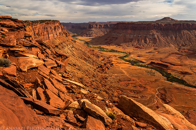
Great views over Meander Canyon of the Colorado River.
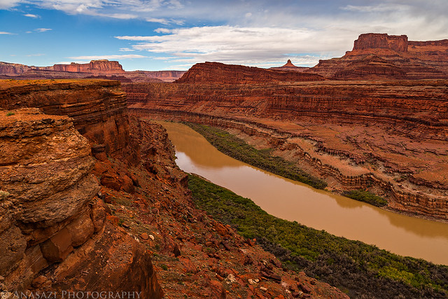
Colorado River by IntrepidXJ, on Flickr
Dead Horse Point on the other side.
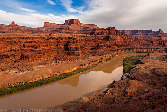
Dead Horse Point by IntrepidXJ, on Flickr
At the end of the road I hiked out to this corner, but didn’t go any further…it was a bit narrow.
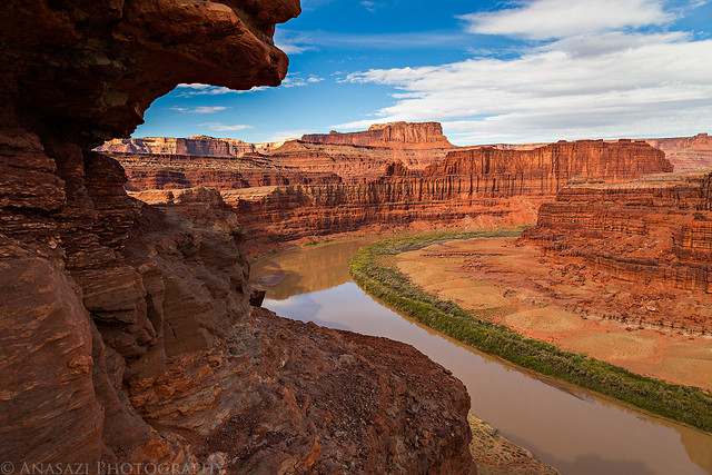
Chicken Corner by IntrepidXJ, on Flickr
On my way back to town I drove over Hurrah Pass and was treated to this view of Kane Creek Canyon.
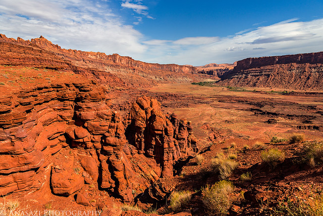
Kane Creek Canyon by IntrepidXJ, on Flickr
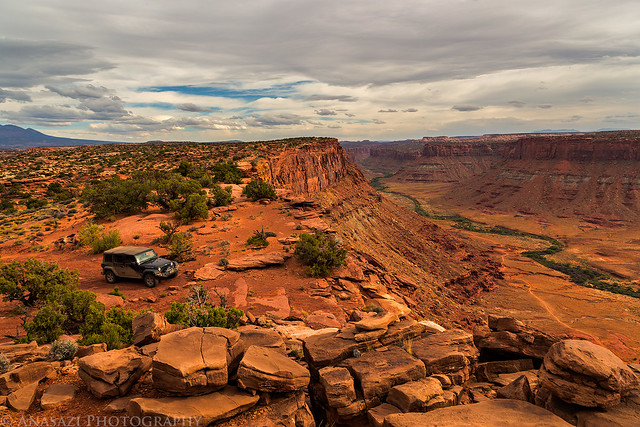
When I reached Moab I drove up to the Sand Flats Recreation Area so I could find a campsite close to town for the rest of the week. I managed to find a nice campsite, setup camp and then drove back down to town for some lunch. After lunch I went out to the Behind the Rock area so I could visit a viewpoint I’ve seen labeled on my maps for years but had never been to.
Two-Track by IntrepidXJ, on Flickr
The overlook was labeled ‘Highly Desirable Viewpoint’ on the map, and I’d say it’s a pretty nice one. I might need to catch a sunset up here sometime.
Highly Desirable Viewpoint by IntrepidXJ, on Flickr
At the Edge by IntrepidXJ, on Flickr
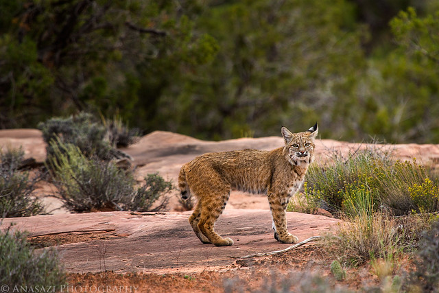
On my way back from the viewpoint something darted across the road about 100 yards in front of me. At first I assumed it was a coyote, but then it crossed the road again and I could tell it was running more like a cat. I drove a little further to where it had crossed the road and stopped to see if I could find it. I thought it would be long gone, but was surprised to find this bobcat staring back at me. This is the first time I’ve seen one in the wild, and I even had time to switch cameras so I could use my long lens for this shot.
Bobcat by IntrepidXJ, on Flickr
Then it sat down and kept watching me. I watched it for a while, but eventually I got tired of watching and decided to keep moving. When my Jeep started moving the cat took off into the desert.
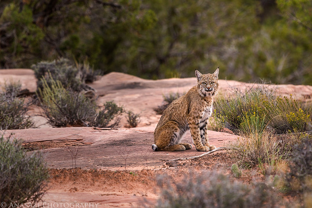
Resting by IntrepidXJ, on Flickr
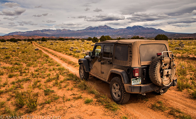
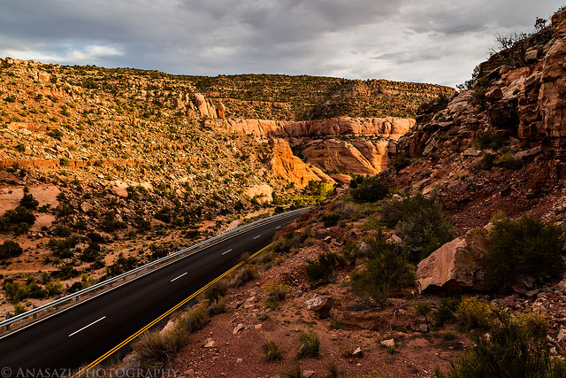
After making it back to the highway I went over to location I’ve wanted to photograph for a while. I’ve driven by this spot dozens of times and noticed there was a nice view of the La Sal Mountains from here that I’ve never seen photos of.
View of the highway below as I climbed to a spot with a better view.
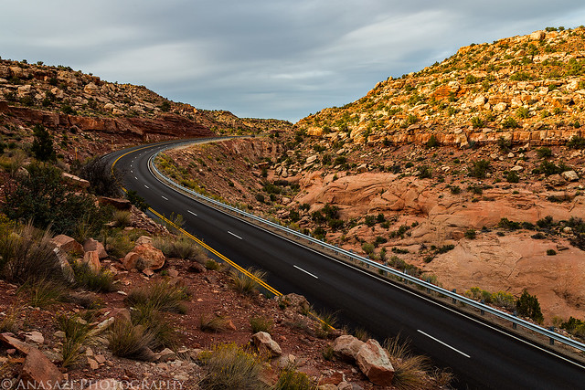
Highway by IntrepidXJ, on Flickr
South by IntrepidXJ, on Flickr
Just my luck, the La Sal Mountains were in the spotlight this evening!
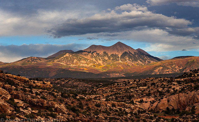
Light on the La Sals by IntrepidXJ, on Flickr
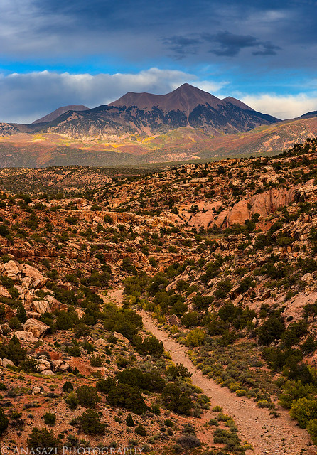
La Sal View by IntrepidXJ, on Flickr
Simply breathtaking, and outstanding images and post Randy!!! 🙂
Great stuff! Love it! Saw a bobcat once myself when I was driving on the Smoky Mountain Road across the Kaiparowits Plateau at dusk. Like the one you saw, it darted across the road in front of us as we were driving along. It was startled and dropped a rabbit it had in its mouth right on the road. So, how come everything always poses perfectly for you?! Even the La Sals! 😉
Awesome series of shots and a great write up made this a very interesting blog post. great that you got the Bob cat shots as they are very rare shots to get.
Beautiful pictures! How do you know the names of all of those places? They are on maps? Which maps?
Maps and guidebooks mostly. Check out the Latitude 40 maps and Kelsey guidebooks.