Heart of the World | Wednesday, November 19, 2025
I was hoping to get out hiking at least once between storm systems this week and finally made a last minute decision to head out to hike up the Fruita Dugway right after work today. Although this may not be an ‘official’ trail within the Colorado National Monument, I still wanted to include it in my Heart of the World project because not only is it a historic route through the area, it’s also probably my favorite hike in all of the Monument. I started the hike from the Kodels Canyon Trailhead, climbed up to the junction with the Black Ridge Trail and then returned mostly the same way. Early on the hike was a bit hot and humid while I was in the sun, but it got a bit chilly when the clouds started to block out the sun. Here are a few photos from my evening hike up and down the Fruita Dugway.
A little scenery along the K1 Trail as I followed it towards the mouth of Kodels Canyon.

Crossing Kodels Canyon

The steep trail follows alongside this sandstone fin for a little bit.

A view from along the sandstone wall…

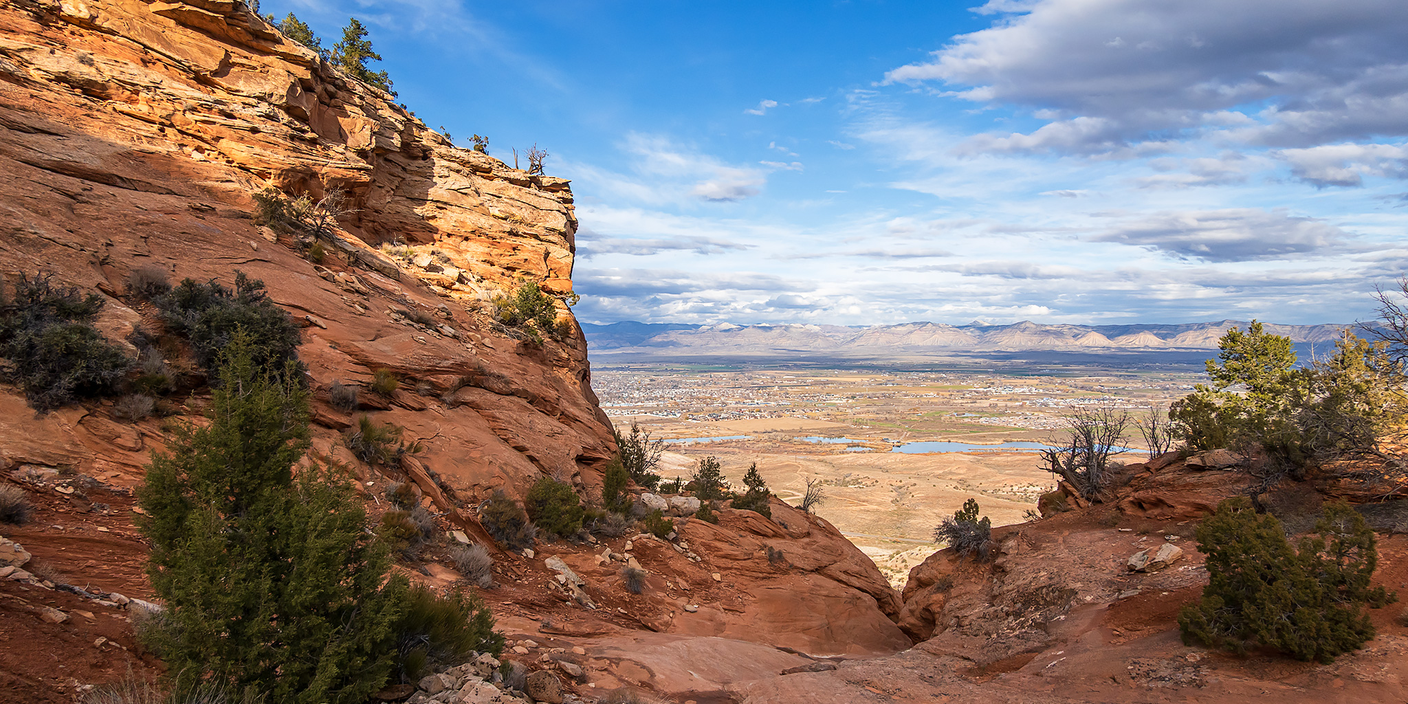
Above the point and overlooking the Grand Valley beyond.

Fruita Dugway Trail

Mount Garfield was catching some nice light beyond the canyon rim.

I stopped to check out the historic carvings found along the trail.

Switchback Canyon

Fruita Dugway Trail

Rim Rock Drive Overlook

Following the historic route along a narrow sandstone ledge.

I turned around where the trail met up with the Black Ridge Trail and there was a nice view over to the Grand Mesa.

Starting the descent of the upper Fruita Dugway Trail.

Following the old trail back into Switchback Canyon as the clouds started to get darker.

Historic Trail Descent

Kodels Canyon Overlook

On my way back down I actually tried to follow the original route of the Fruita Dugway on the east side of the sandstone fin. I initially thought it would end at private property and I would have to turn around and climb back up, but I was surprised to find that I was able to make it back to the highway. That left me with about a half-mile of road-walking to get back to my vehicle at the trailhead, but that was better than having to turn around and climb back up the hill again!
As I was following the shoulder of the highway back to the trailhead the sun briefly broke through the clouds above the canyons and lit up the sky for a few brief moments. Right afterwards it started to rain hard and I got pretty soaked as I finished the last quarter-mile walk back to my vehicle.
