Muddy Creek to the Little Wedge | San Rafael Swell Rock Art XVII
Friday – Sunday, April 21-23, 2023
As I was trying to figure out where I wanted to go this weekend, I realized that I had not been back to the San Rafael Swell since Diane and I did a little mountain biking on the Good Water Rim Trail over the Halloween weekend in 2021, and I thought that this would be a good time to finally get back out there to remedy that oversight. As usual, I left after work on Friday afternoon and headed west into Utah to the northwestern side of The Swell so I could spend the weekend hiking, Jeeping and searching for rock art between Muddy Creek and the Little Wedge. These are some photos from the weekend…
On my way to top off my gas tank in Ferron, I took the Millers Canyon exit and followed the Coal Cliffs and Muddy Creek for a little way. I have never actually driven this road before since the Moore Cutoff Road usually makes more sense to take, so it was nice to see some new country.

Leaving the Muddy Creek and driving up Miller Canyon towards Emery.
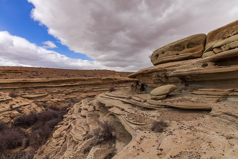
I passed beneath this hoodoo as I followed the Muddy Creek toward its headwaters on the Wasatch Plateau.

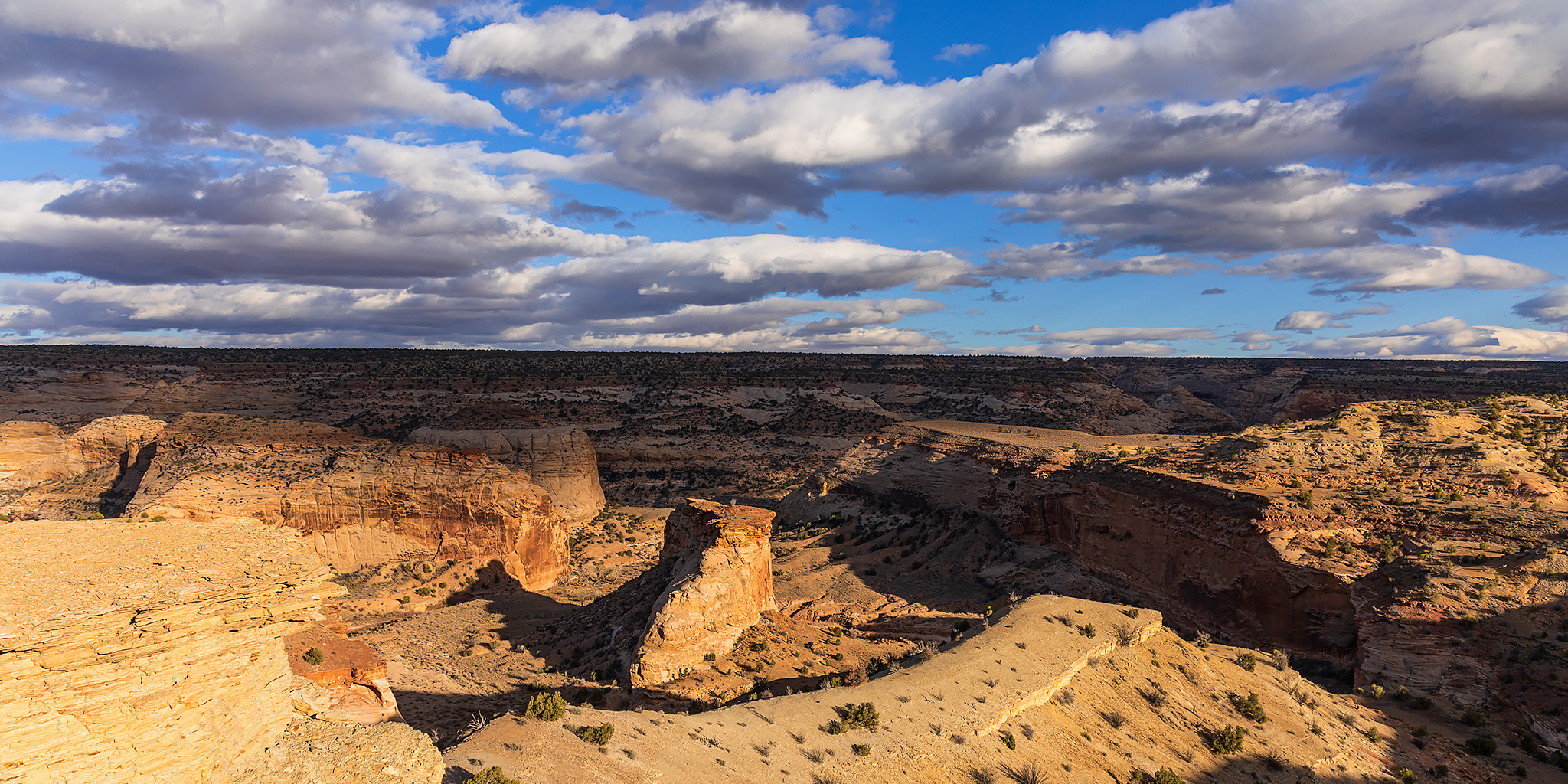
After getting gas in Ferron I headed back east down Horn Silver Gulch and found a great campsite above North Salt Wash along the edge of the Little Wedge. Unfortunately, it was a bit too cloudy out for a sunset this evening, so I read for a little while and then went to bed early.
After getting a good night of sleep I woke up to a cloudy sunrise, too. This time a little light got through to add some subtle colors to the clouds.

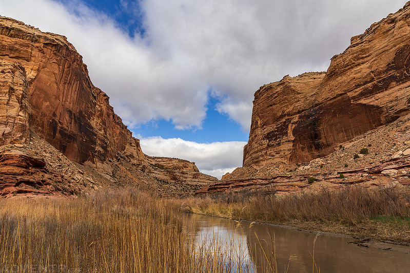
After breakfast I hiked down into North Salt Wash so I could follow it downstream to its confluence with the San Rafael River.

Although it was mostly cloudy out, the sun did peek through the clouds on occasion.


It didn’t take me very long to reach the San Rafael River, which looked like it was currently at a good level for floating.
Little Wedge Point

Although the hiking in North Salt Wash was pretty easy, there were a couple of beaver dams that made finding crossings of the creek a little tedious, especially since I didn’t really want to get my feet wet.
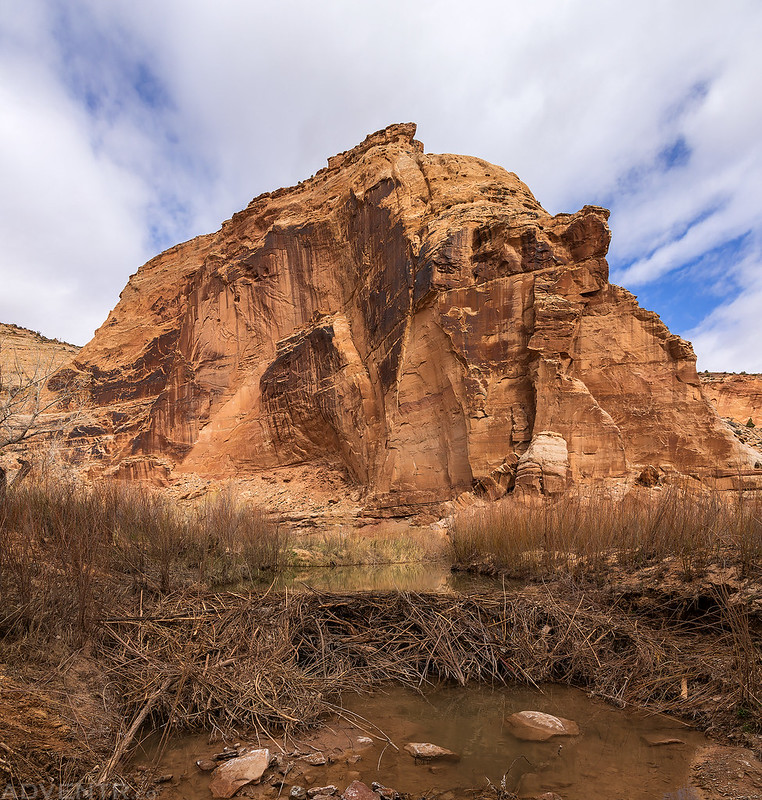
Hiking back up North Salt Wash.

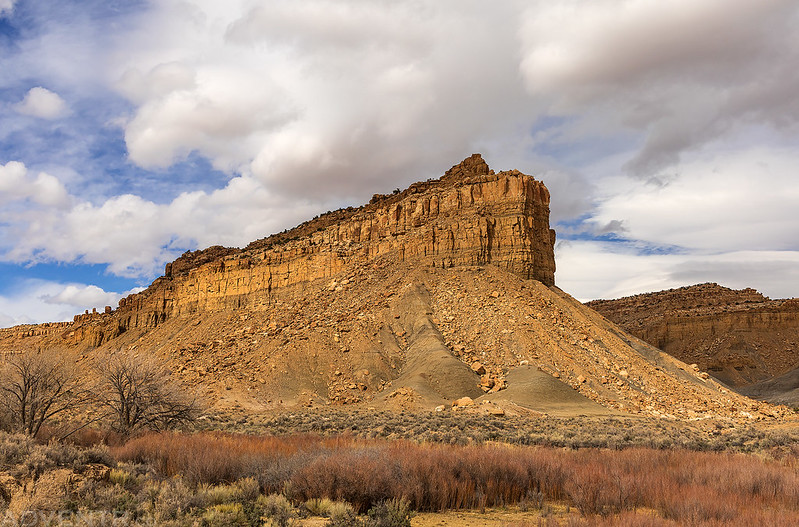
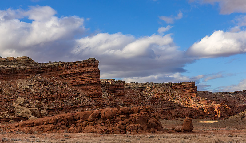
Exploring ledges of The Red Ledges.
The Red Ledges in the later afternoon.
I spent my second night at the same campsite with a great view over North Salt Wash. This time the light cooperated for a little while.

Sunday morning at the edge of the Little Wedge before sunrise.

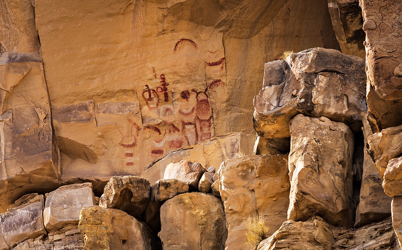
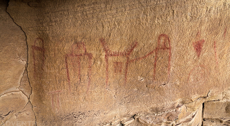
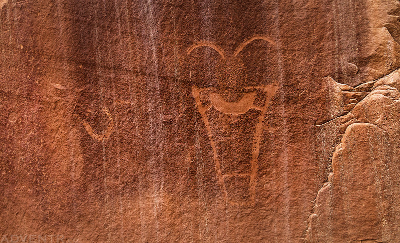
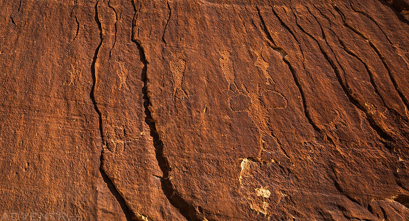
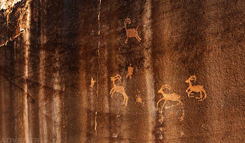
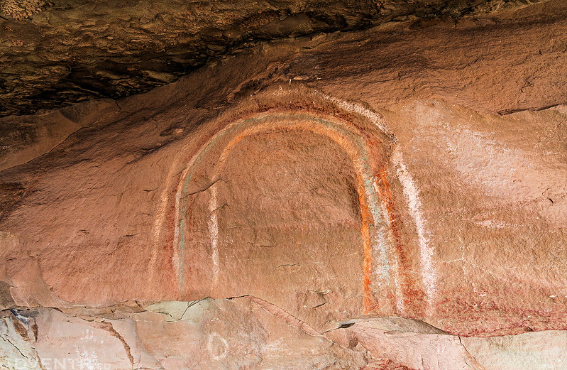
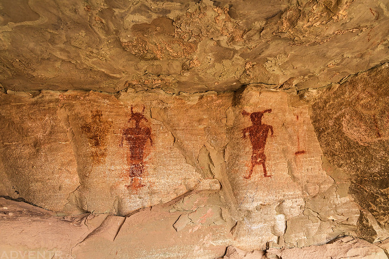
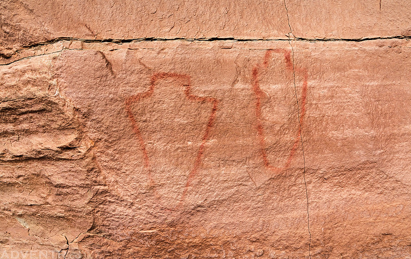
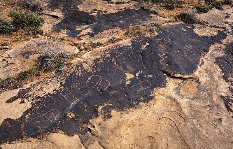
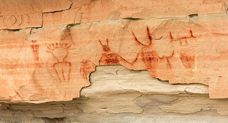
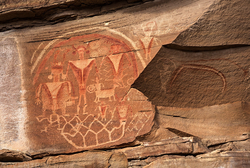
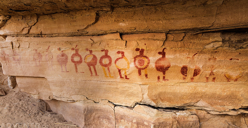
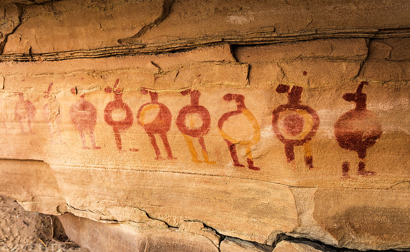
Rock Art of the San Rafael Swell
Throughout the weekend I found and visited some new rock art sites and also revisited others that were along the way. Here are some photos of the rock art I saw this weekend.


Wow, amazing rock art. Thanks for sharing