Canyons of the Escalante | Southern Utah Wanderings
Wednesday – Friday, October 5-7, 2022
After spending the last day and a half along the western end of the Vermilion Cliffs we headed back over the Paunsaugunt Plateau and returned to Escalante early on Wednesday afternoon. While we were in town we grabbed some dinner and topped off our fuel tanks before heading southeast down the Hole-in-the-Rock Road below the Straight Cliffs. Surprisingly, the road was in better condition than we were expecting and we made great time to the Davis Gulch Trailhead located just below Fiftymile Point. We still had plenty of time until sunset, so we decided to continue on to the very end of the road so we could maybe hike down the Hole-in-the-Rock to Lake Powell. I hadn’t been out to the end of the Hole-in-the-Rock Road since 2009, so it was nice to refresh my memory of the area.
The Hole-in-the-Rock
When we reached the Hole-in-the-Rock at the end of the road we were both feeling like a hike after driving for the last couple of hours, so we decided to head down.

Looking down the steep chute of the Hole-in-the-Rock.

A view out the notch across Lake Powell to the mouth of Cottonwood Canyon on the other side.

Unfortunately, it appears that the route has been washed out since there was a large ledge that neither of us would have been able to climb back up if we had proceeded past this point.

Looking back up the Hole-in-the-Rock as we returned to the top.

Another view from the top.

Hole-in-the-Rock Crossing Plaque

After our failed hike we drove back up the road in search of a campsite below Fiftymile Point.

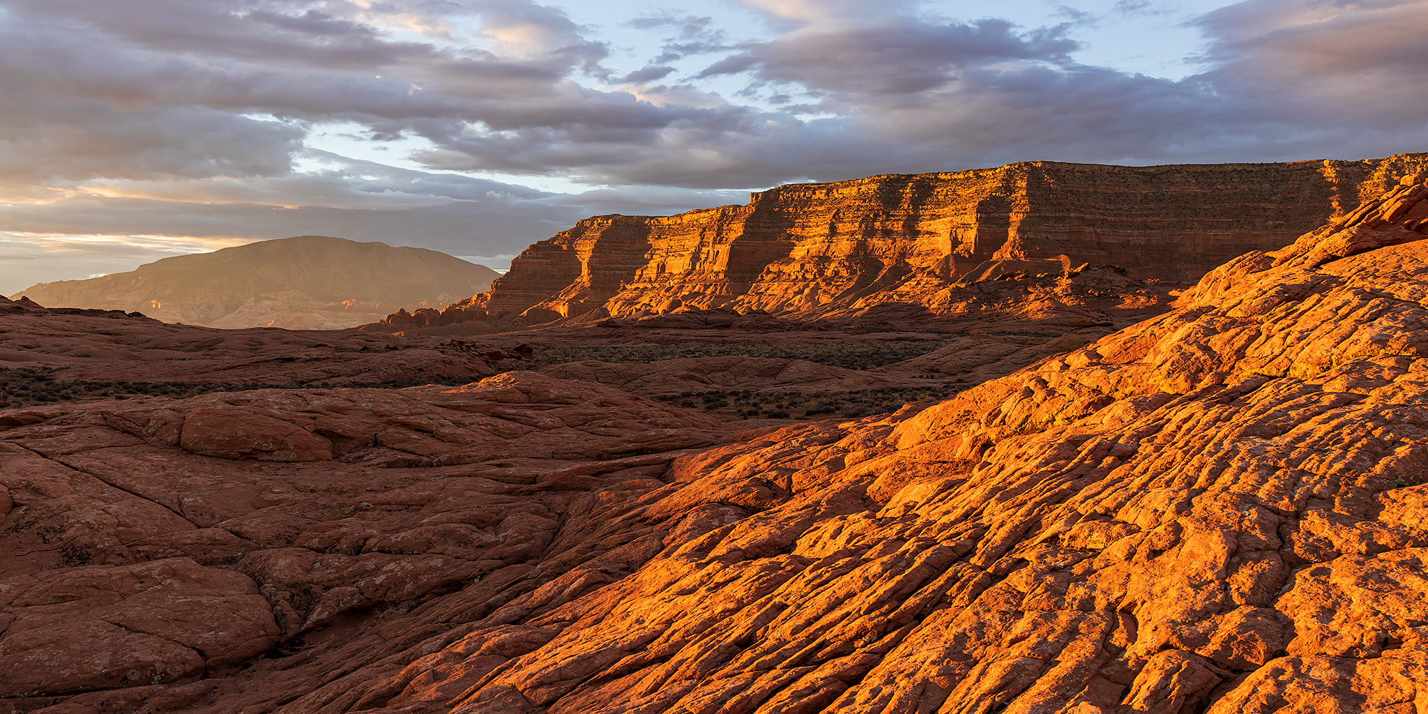
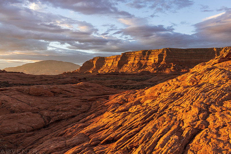
By this time of the evening we were driving in the shadows of Fiftymile Mountain as golden light bathed the slickrock domes.

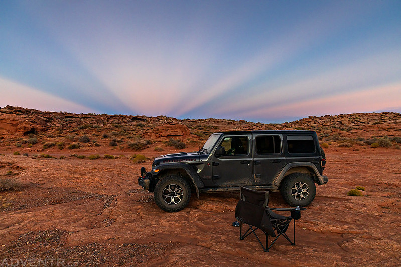
We found a campsite and got settled in just in time to see some Anticrepuscular Rays to the east.
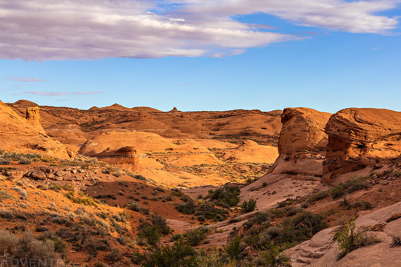
Canyons of the Escalante: Fiftymile Point to Davis Gulch
After a good night of sleep we were up before sunrise on Thursday morning so we could hike into Davis Gulch. Some nice clouds had moved in overnight, so before we drove over to the trailhead we stuck around to watch and photograph the sunrise for a little while, which turned out to be a good decision!
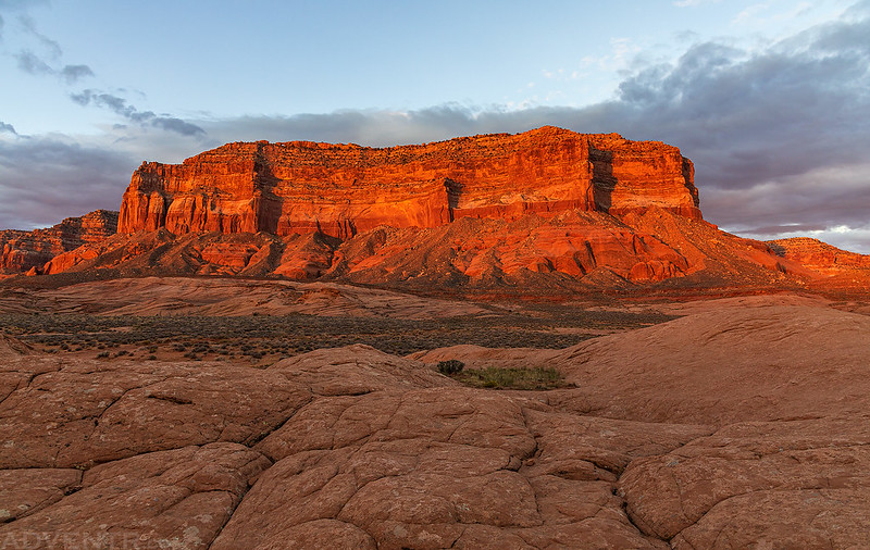
Fiftymile Point Morning
If you look closely at this photo, you can see the Hole-in-the-Rock Arch at the top of the cliffs.

Light Up the Cliffs

Morning View from Camp

Across the Hills

Jeep & Fiftymile Point

Navajo Point Sunrise
Just another photo of Fiftymile Point since it was the most prominent feature near us.

When the sunrise light subsided we drove the short distance over to the trailhead, left Fiftymile Point behind us and started the overland hike to Davis Gulch.

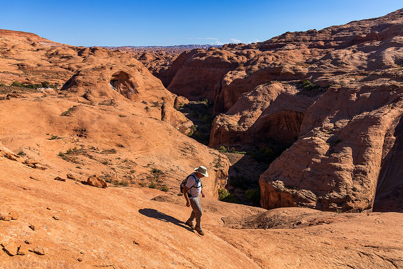
Jared hiking through Slickrock Country.

Land of Sand & Stone

There were a lot of ups and downs along the way…

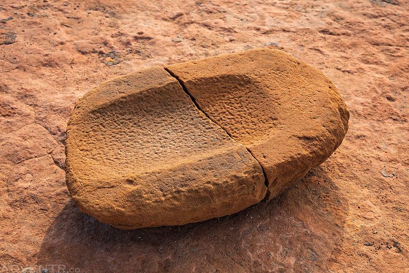
We came across this cracked metate.
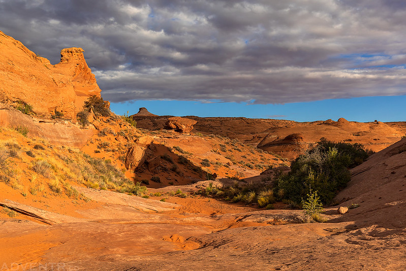
After a few miles we reached the rim of Davis Gulch and followed a steep old trail into the canyon.
When we reached the bottom of the canyon we found a good trail and thought it would be easy hiking up the canyon to Bement Arch. Boy, were we wrong!

The trail we were following quickly ended and from that point on it was a serious bushwhack to try and get further up the canyon. We probably made it less than 3/4 of a mile up the canyon before giving up and turning around. It was some of the worst bushwhacking I have done.
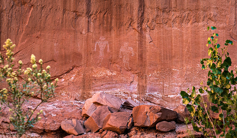
Large White Pictographs
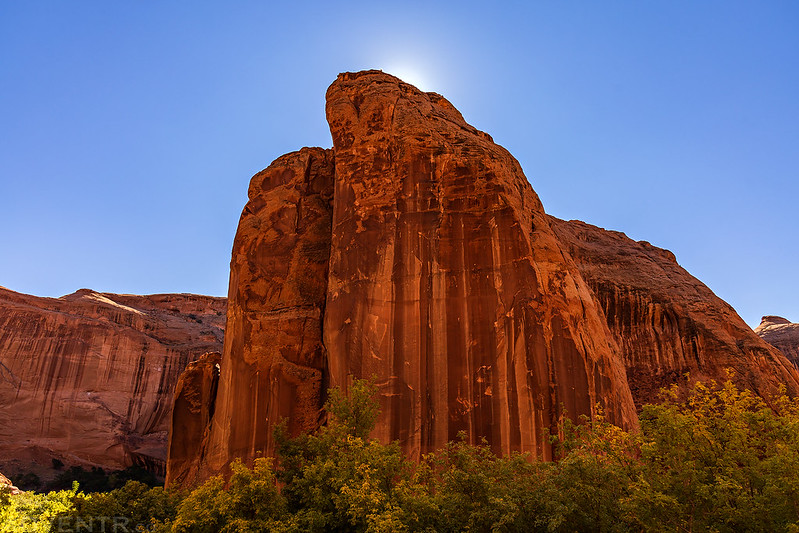
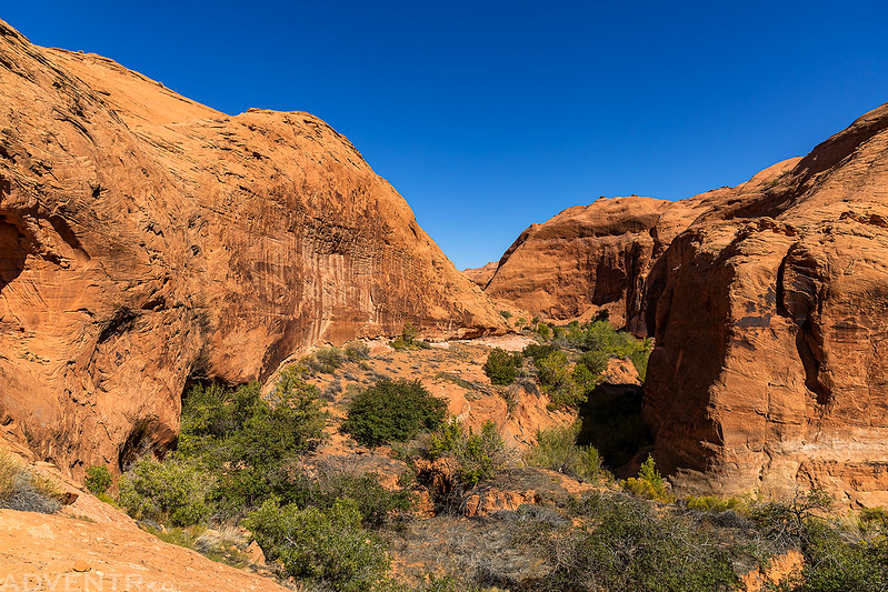
The small section of Davis Gulch that we did see was nice…


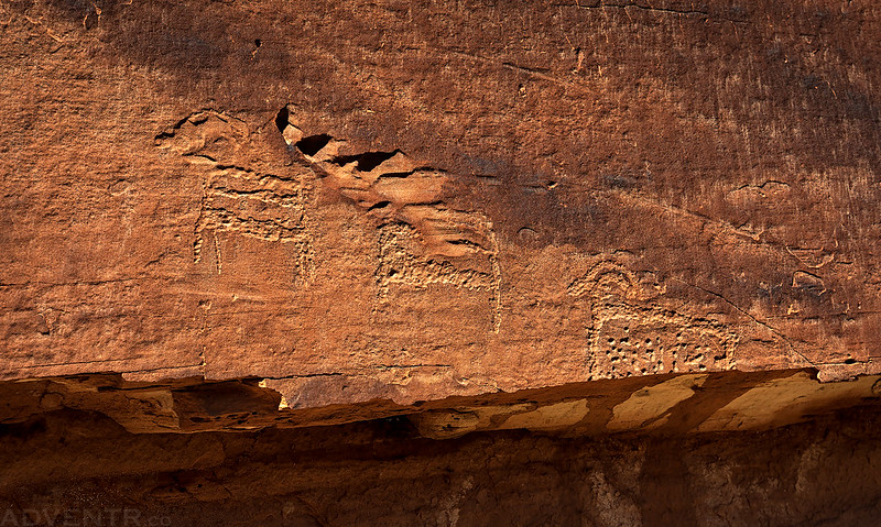
We stopped to check out some faded petroglyph panels before hiking back out.

Big Wheel Panel

Little Sheep Petroglyphs
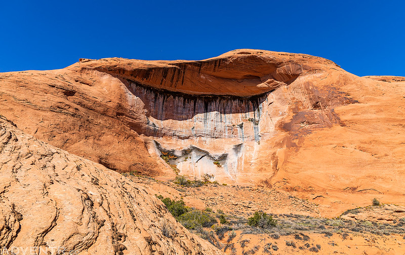
High Seeps
Looking down lower Davis Gulch as we headed back up the steep trail out of the canyon.

A small arch we passed on our hike back.

I’m not sure what was going on with me, but I was feeling pretty terrible throughout our entire hike back to the trailhead and it was a pretty miserable time for me. After slowly making it back to my Jeep, with a lot of stops in the limited shade along the way, we headed back down the road a bit and stopped at a campsite near Sooner Rocks for the night. I ate dinner and drank a lot of fluids, but was still not feeling all that well, so I went to bed early hoping I would feel better in the morning.
Early morning light on the top of the Straight Cliffs.

Sooner Rocks Sunrise

Camp at Sooner Rocks

Although I was feeling slightly better on Friday morning when I got up to watch the sunrise, I still wasn’t feeling well enough to do any hiking, so I decided to head home a day early to get some rest. Jared and I parted ways when we reached the pavement near Escalante so he could spend the rest of the weekend exploring on his own.
Thanks for the hike !
Nice. Was in Davis gulch years ago after reading about Everett Ruess’ famed disappearance. Thanks for the post.
How was the bushwhacking back then?
Hard to beat that book. I’m re-reading it now. One day ill make it to this trail.