The North Fork of Trachyte Creek to the Witch’s Cauldron & Maidenwater Canyon
Friday – Sunday, March 11-13, 2022
All through this region there is nothing but a network of canyons passing through the most desolate country in America. Nothing but bare rock.
– David Jordan Rust, 1922
For the past two years I have spent a weekend in early March exploring the Canyons of Trachyte Creek and thought it would be fun to head back down there again this weekend to make it three years in a row. The last two years I went on overnight backpacking trips into the canyon, first with Diane and then with Jackson, but this year I was on my own an decided to just do some day-hikes from the road instead. I left after work on Friday afternoon, topped off my gas tank in Hanksville at $4.69 per gallon and then made it to my campsite long Trachyte Creek shortly before sunset. I’m loving that the daylight is sticking around longer into the evening now and will be sticking around another hour longer after the Daylight Savings Time change on Saturday night. I listened to a couple podcasts and then went to bed early.
I woke up with the sunrise on Saturday morning and it was a bit cold out at 23 degrees, but I knew it was supposed to warm up quickly as I started hiking down Trachyte Creek from camp.
I quickly passed by Trachyte Falls a short way down the canyon. There wasn’t much flow at this time.

There was ice on the creek this morning, which makes this my coldest visit to Trachyte Creek so far.
Watching the sun come up over the shallow canyon walls.
I believe this is a flat metal tire from and old wagon wheel. Trachyte Creek used to be a wagon route from Hanksville to Hite before it was abandoned for the route through North Wash.

Trachyte Creek Morning

I spotted a short side canyon that slotted up and went in for a closer look.
This canyon wall spoke to me along the way. Shortly before reaching this point I had passed the canyon Diane and I came down on our first visit to Trachyte Creek, so now I have hiked the entire length of the canyon from the highway bridge to Lake Powell.
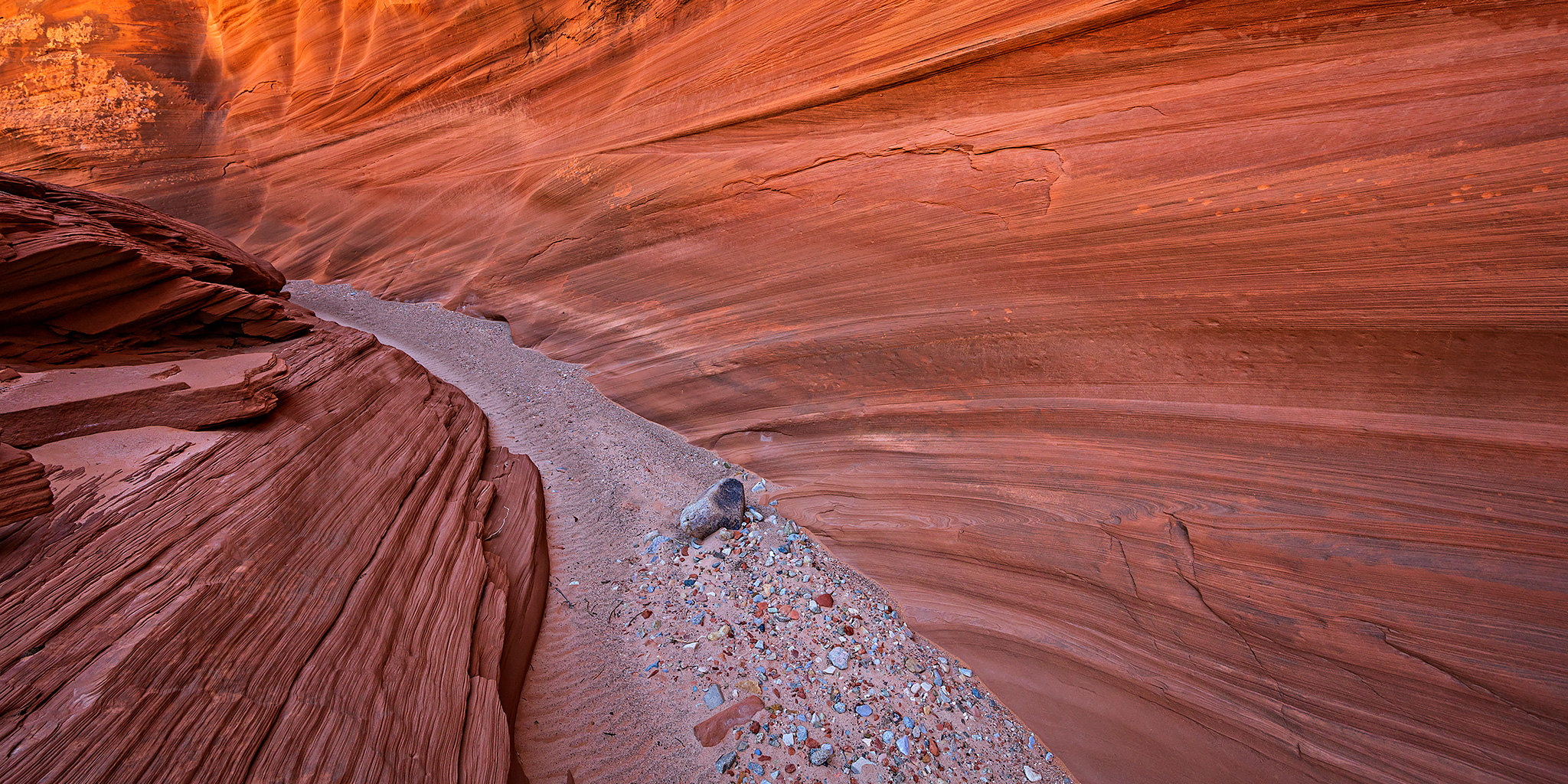
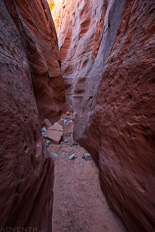
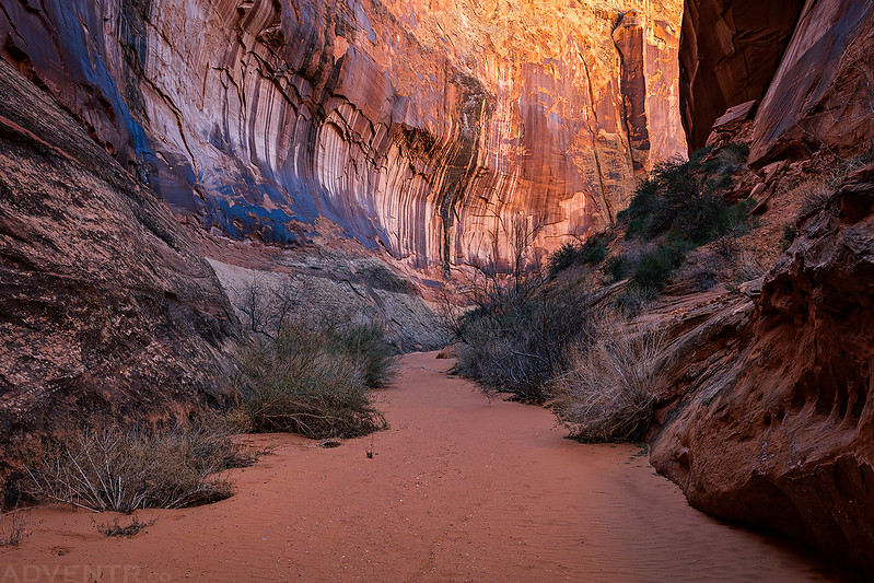
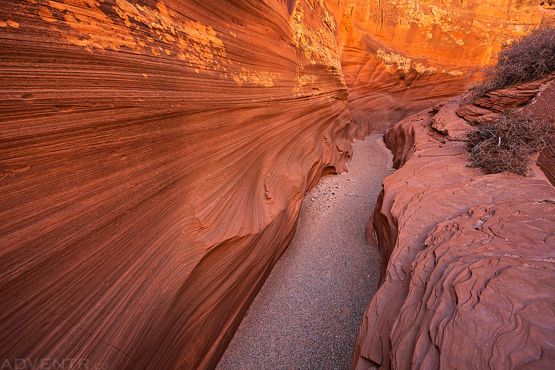
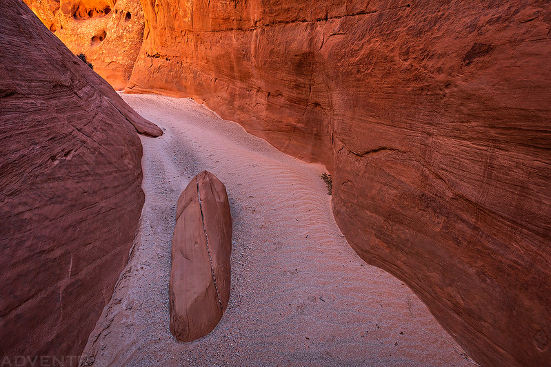
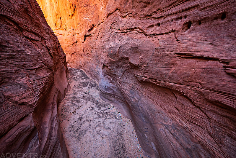
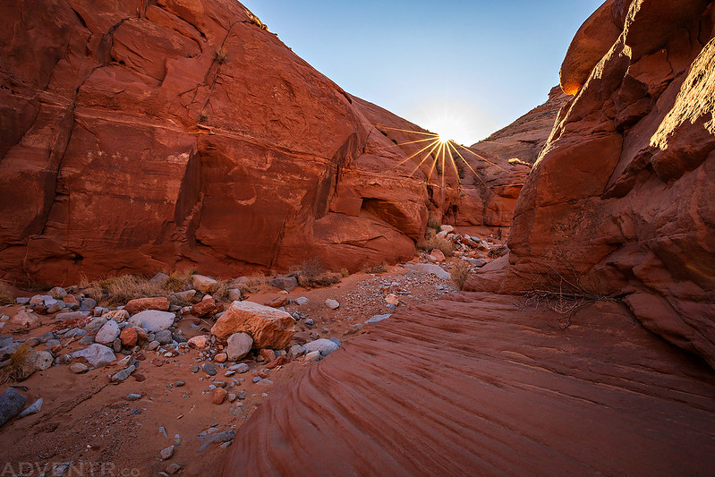
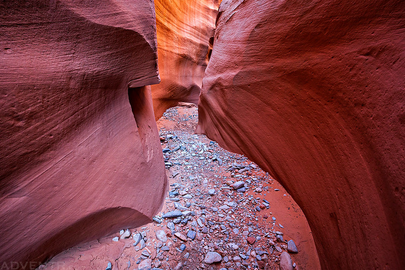
I hiked down Trachyte Creek until I reached the mouth of Witch’s Cauldron Canyon (Trachyotomy Canyon), a popular canyoneering route, and then I started hiking up the canyon to see how far I would be able to get.
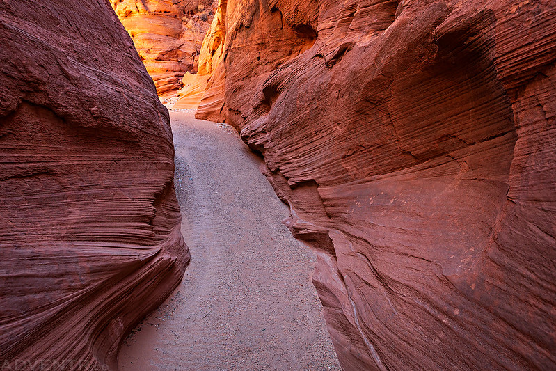
The lower part of the canyon was a bit of a bushwhack on cow trails, but it was worth getting through once I reached the tall walls of the narrows in the upper canyon!

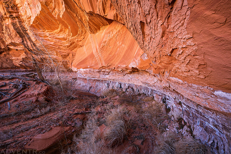
The light was pretty nice in this part of the canyon.
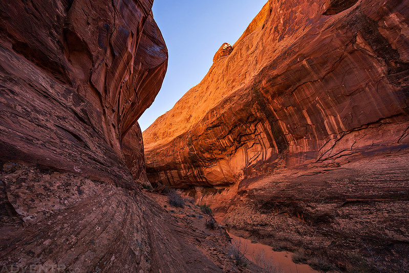
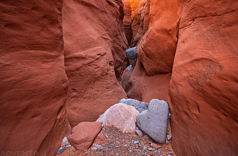
Once I hiked around this final bend I reached the end of the non-technical part of the canyon and turned around.

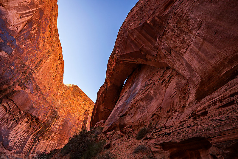
Although not separated from the canyon wall by much, this was a pretty large arch in the canyon.
Witch’s Cauldron Canyon View
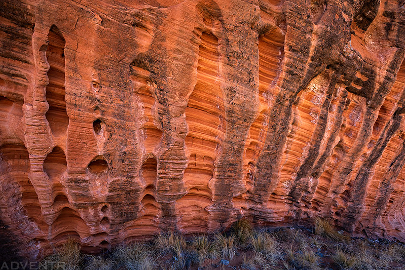
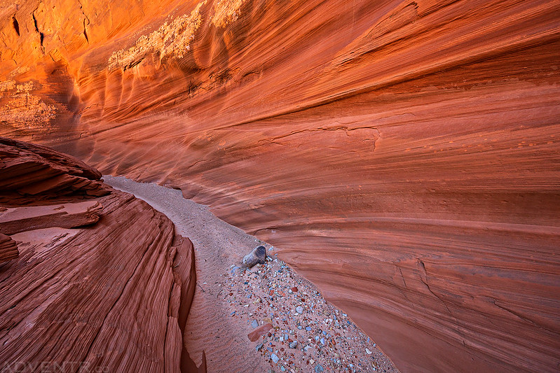
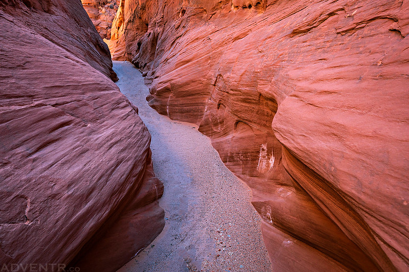
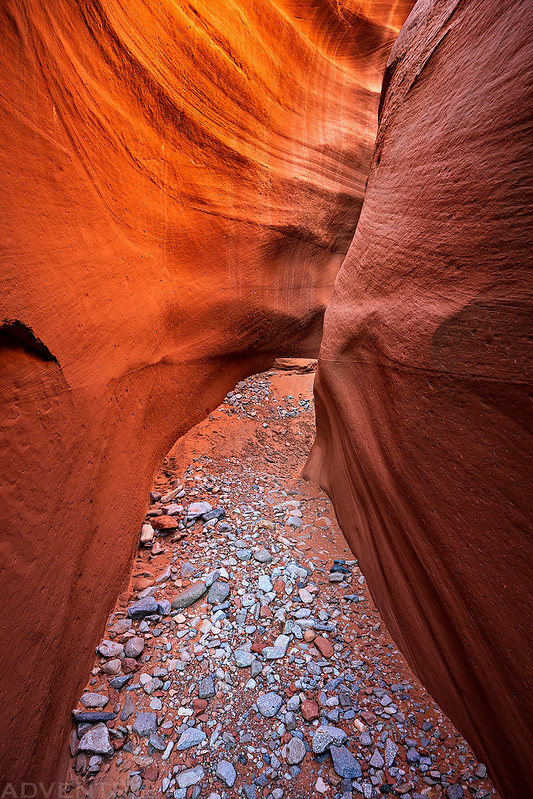
I loved the massive stripes on the walls in this part of the canyon.
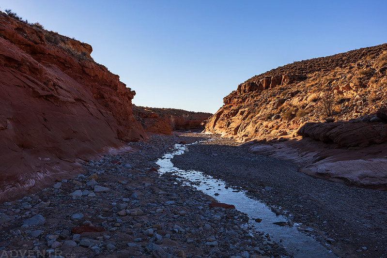
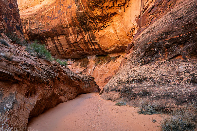
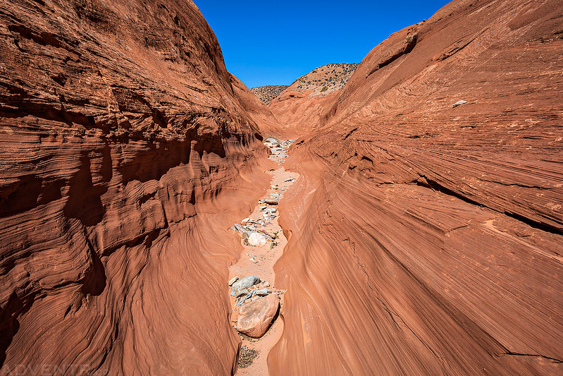
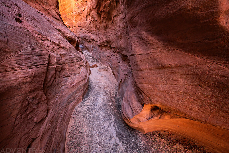
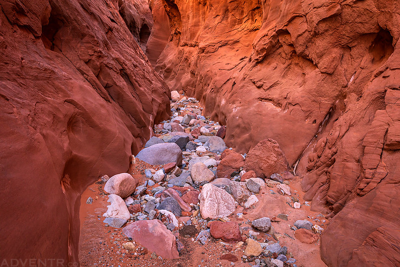
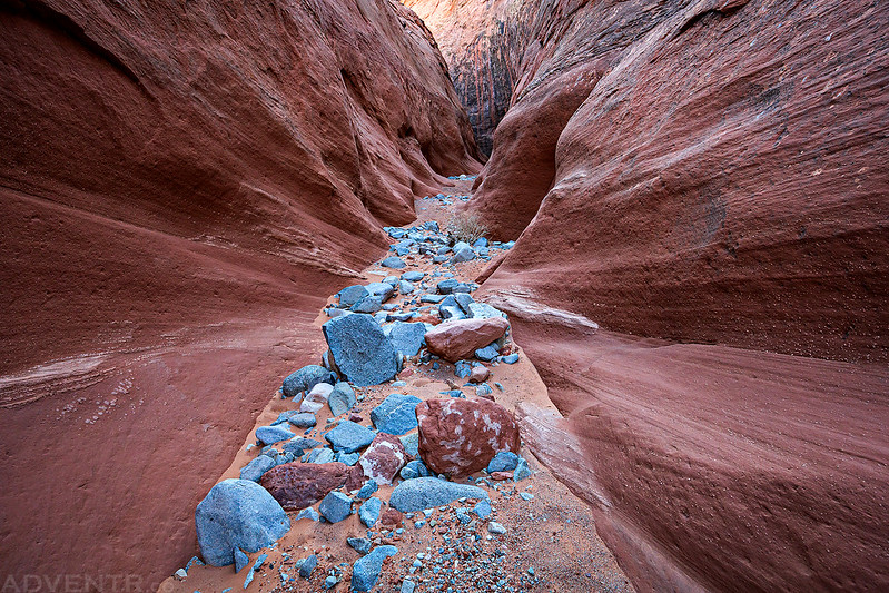
After returning to Trachyte Creek I stopped for a lunch break and then started hiking back up the canyon. Instead of following the same route I had come down on, I took the North Fork of Trachyte Creek on the way back.
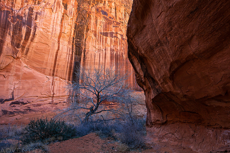
Although much of the canyon was in direct sunlight at this time of the day, there were still a few nice narrows and slots to photograph.
North Fork Curves
The North Fork of Trachyte Creek
I followed these recent bobcat tracks through the narrow canyon for a while.
Nice light in the North Fork.

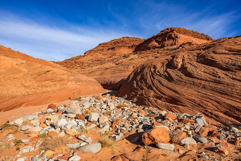
After leaving the slots and narrows behind, I climbed out of the canyon when I reached an impassible dryfall and then climbed over the ridge to my campsite following deer or cow trails.

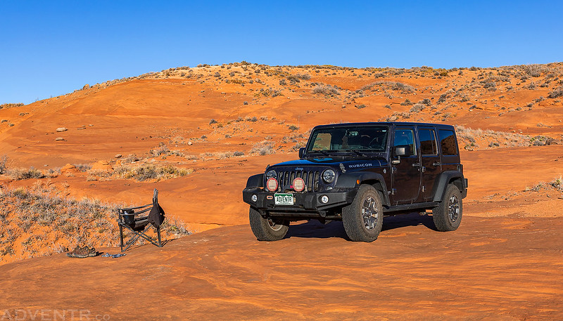
I still had a couple hours until sunset by the time I reached camp, so I thought it would be a good idea to drive up onto Trachyte Point and hike to the highpoint. Little did I know, the road ended up going all the way to the highest point and I wouldn’t need to do any additional hiking this afternoon to reach it. The views along the way into Hog Canyon and North Wash were very nice.
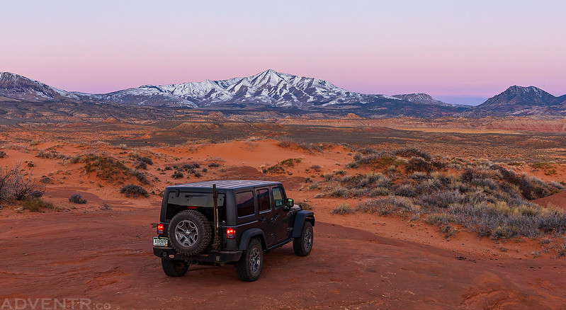
On my way back down from Trachyte Point I found a nice campsite and spent the rest of the evening relaxing on the sandstone with a good view of the Henry Mountains.
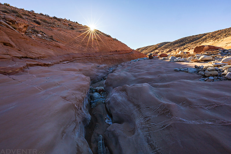
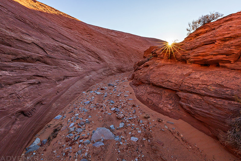
On Sunday morning I was up before sunrise again and then drove down the highway a couple of miles to the trailhead for Maidenwater Canyon. It was much warmer this morning although a bit windier. Two years ago Diane had hiked about halfway up Maidenwater from our campsite near it’s mouth and I was hoping to finish the other half from the highway this morning.
Even with the time change overnight, I was up and ready to go before sunrise since I had gone to bed early. That’s the great thing about camping during the daylight savings time change!
Maidenwater Morning
This is the only big drop in this part of the canyon, and there is an easy bypass around it to the left.
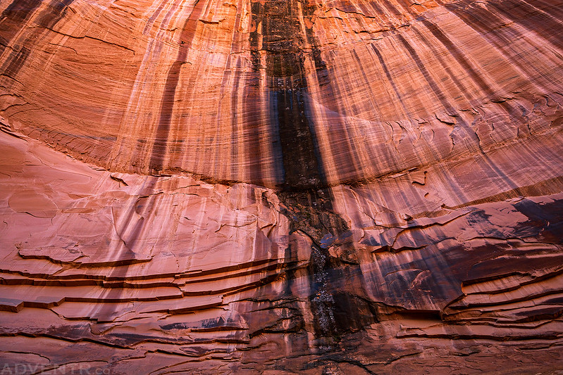
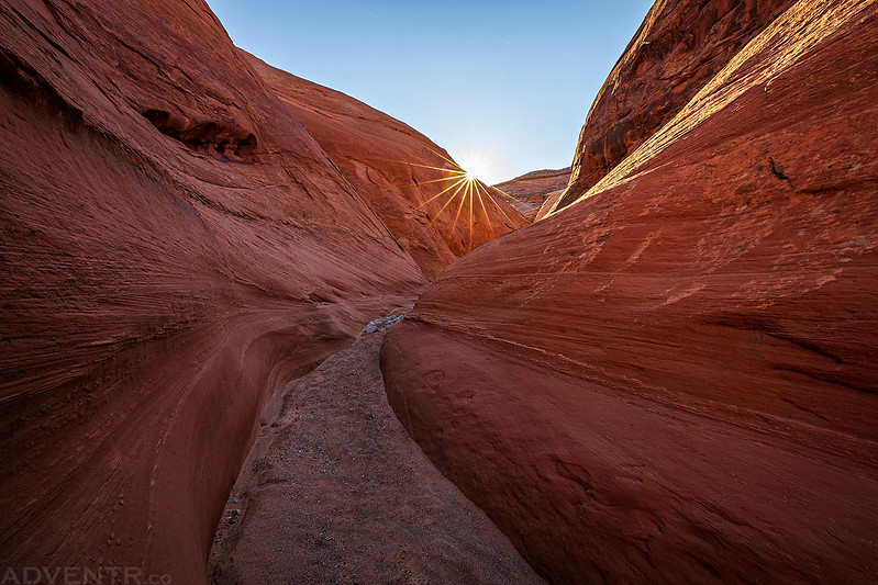
There’s nothing better than a sunstar over a narrow canyon in the morning!
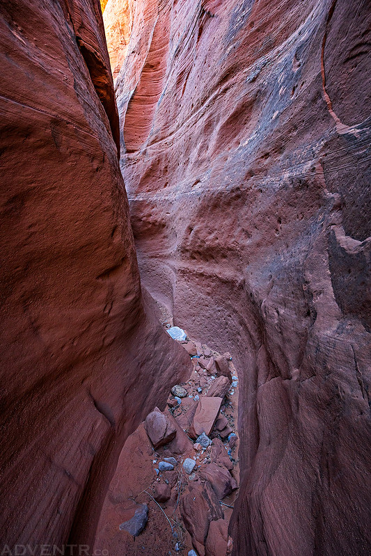
The canyon started to narrow up pretty quickly.
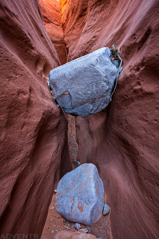
This easy chockstone was one of the only minor obstacles in the canyon.
Maidenwater Slot Canyon

This light was looking good at this bend.

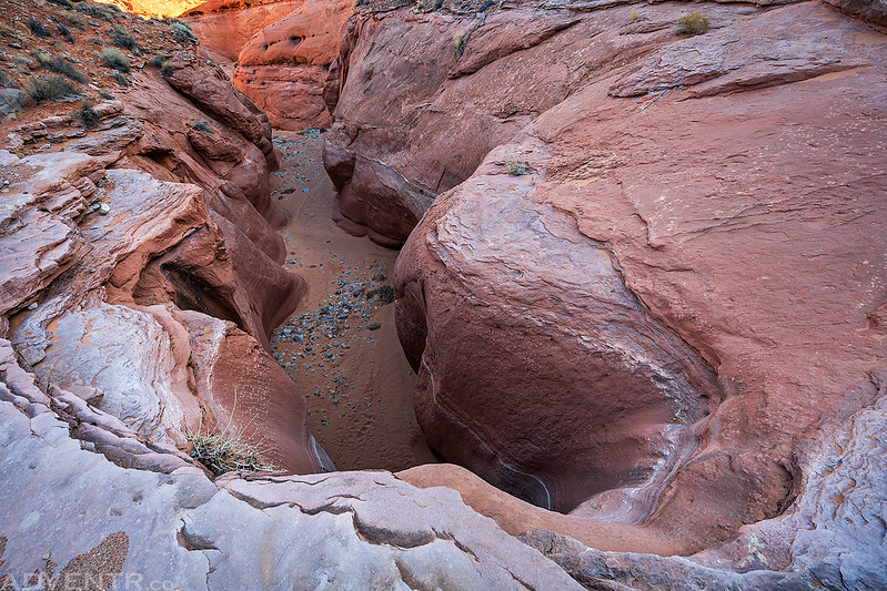
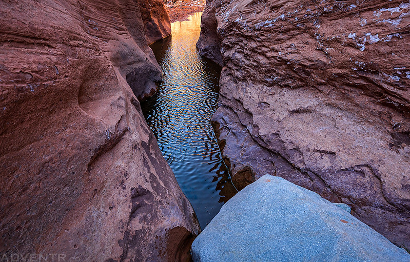
This pool is where Diane and I turned around when it was getting late two years ago, so now I’ve hiked the entire length of Lower Maidenwater Canyon, and I didn’t even have to get my feet wet today!
I think the light was even better on the way back up the canyon…

The view after leaving the slots and narrows behind.
Before climbing back up to the highway I walked through the tunnel that was bored through the sandstone under the road.
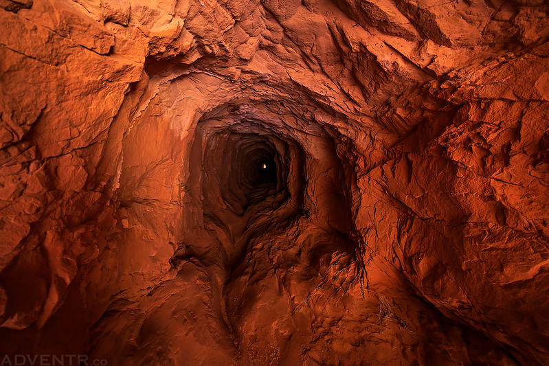
Tunnel View

On my way home I had hoped to stop at Stan’s Burger Shak for lunch, but they weren’t open when I arrived, so I continued on to Green River and got a burger from Ray’s Tavern instead. I have not stopped at Ray’s since before COVID started, so it was great to finally return!