Southern Utah Wanderings | Northern Bears Ears
Friday – Sunday, September 29 – October 1, 2017
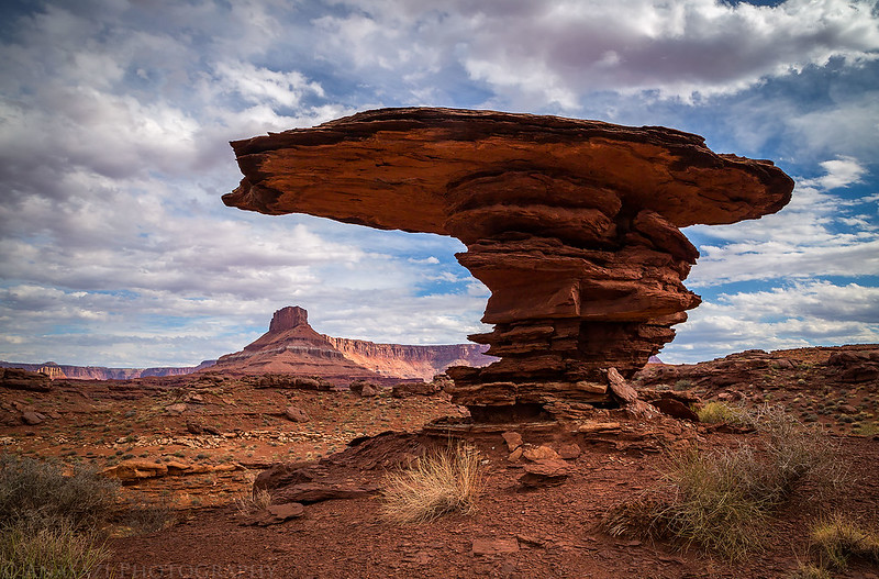
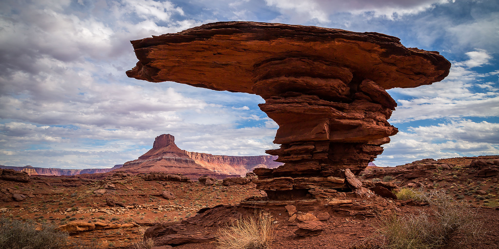
A large hoodoo we visited while exploring the northern portion of Bears Ears National Monument.
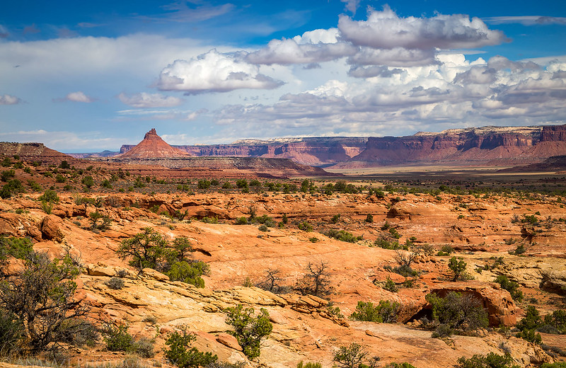
This year for my annual weeklong trip into southern Utah during the first week of October I met up with Jared and we spent most of the week exploring, hiking, four-wheeling, camping, backpacking, peak-bagging and photographing within Bears Ears National Monument. The first few days of our trip were spent in the northern part of the Bears Ears between Canyonlands National Park and Lockhart Basin. (We did a little hiking into Canyonlands, too.) We were hoping to visit a few new pictograph panels and maybe find some ruins, but we ran into some issue that prevented us from reaching the rock art sites we were looking for this time, so we will definitely have to come back and try again another time. Here are some photos from the first three days of the trip.
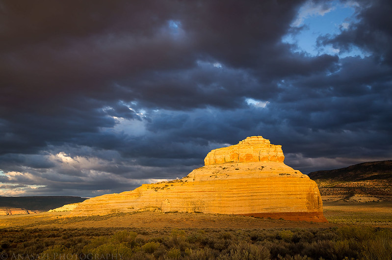
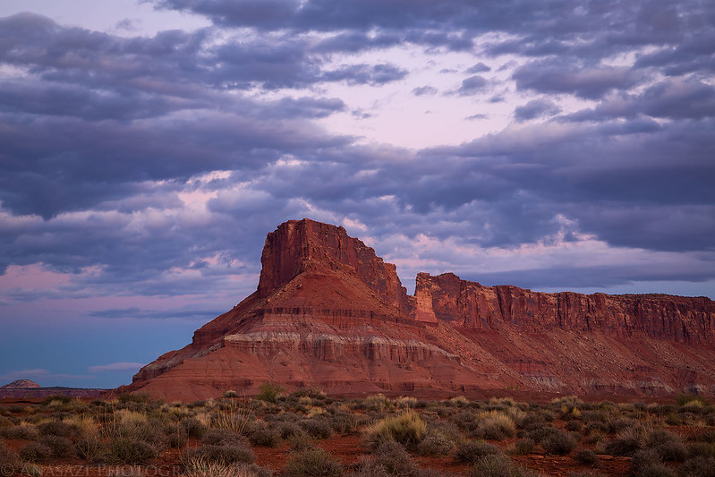
After meeting up with Jared in Moab we continued on to Davis Canyon where we planned to spend the night. As we turned off onto Highway 211 I had to stop for a quick photo of Church Rock since it was looking pretty nice. To me there’s nothing much better than dark clouds above sandstone that is lit up with warm light. Such a beautiful sight!
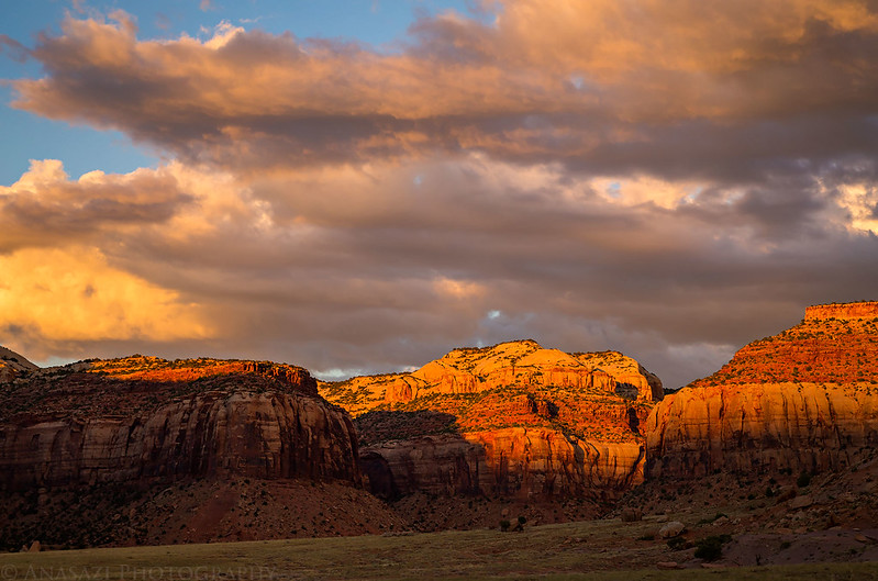
The sunset only got better as we drove through Indian Creek Canyon, so we had to stop a few more times for photos.

Sunset on the cliffs of Harts Point.
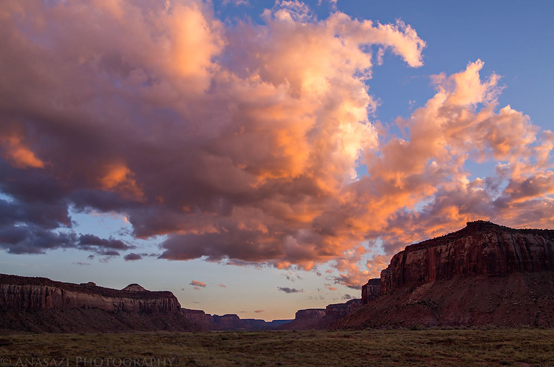
North Cottonwood Canyon with colorful clouds above.
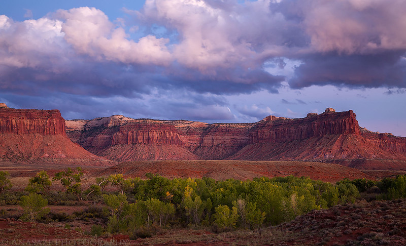
Vibrant green cottonwoods along Indian Creek with nice clouds above Harts Point.
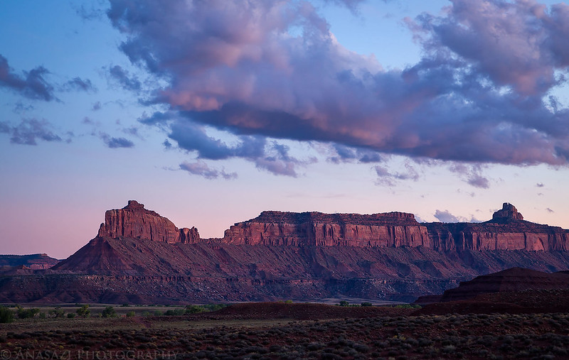
Bridger Jack Mesa after the sun went down.
The drive through the wide wash into Davis Canyon in the dark was a little nerve-wracking since it appeared to have flash-flooded very recently and was pretty wet and muddy in places. I’ve driven this canyon a number of times and never seen it this wet. We ended up making it to our planned campsite without any issues.
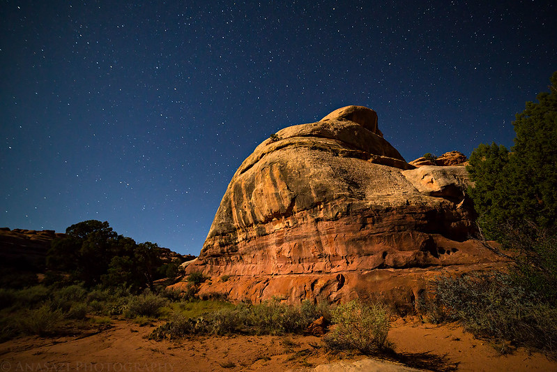
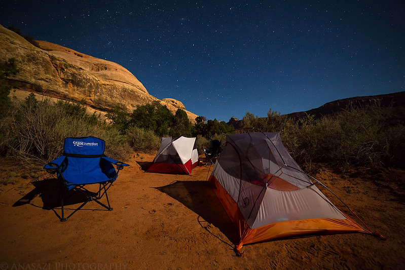
Stars and sandstone in Davis Canyon. It’s been a while since I took any night photos, so I thought I would try a few on this trip.
Our campsite in Davis Canyon under the stars.
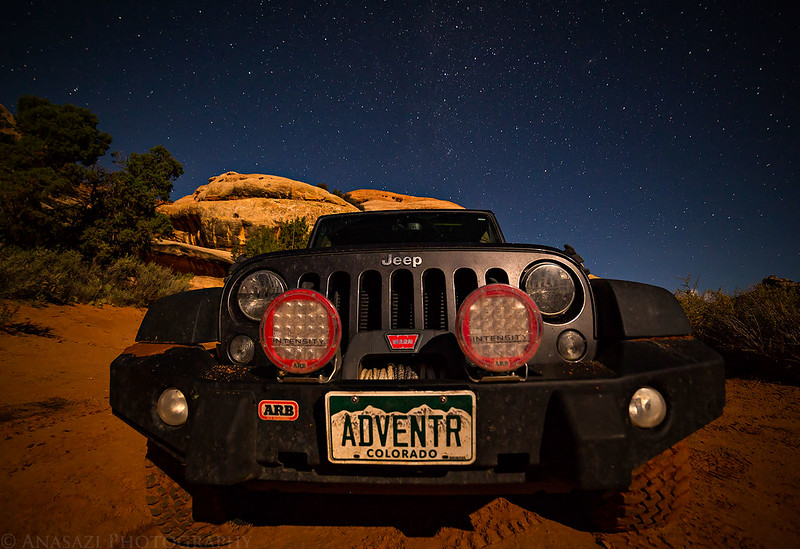
The ADVENTR Jeep under the stars and lit up by the almost full moon.
There was a pretty nice sunrise the following morning at our campsite.
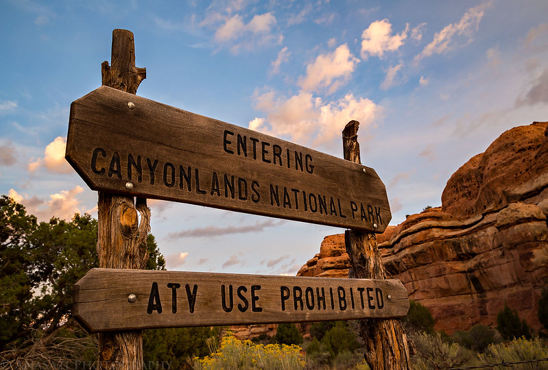
Entering Canyonlands National Park shortly after the sunrise.
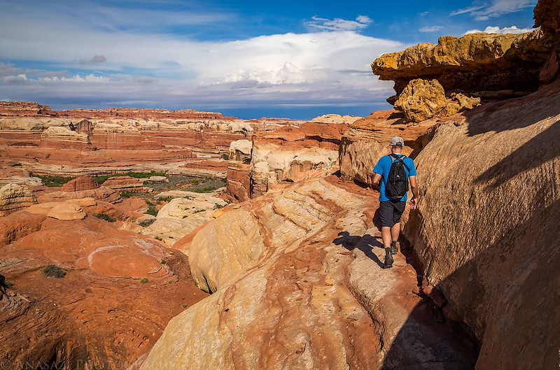
Hiking through an unnamed wash in the backcountry of Canyonlands.

View down the Trail Fork of Horse Canyon near its head. We had hoped to hike down into Horse Canyon, but the move to get into the canyon from the head was too difficult and exposed for both Jared and I, so I guess I will have to return from the bottom again.

It’s such a beautiful canyon from above…
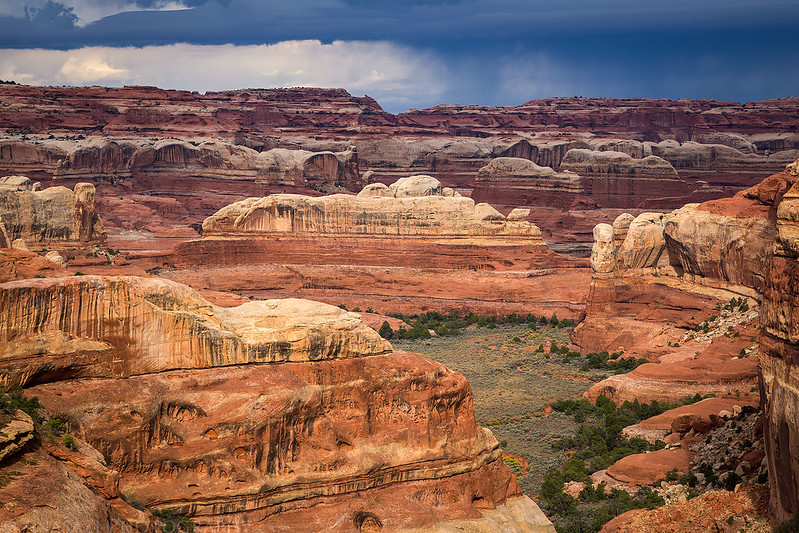

Since we couldn’t get down into the canyon as we had planned, we decided to follow the rim for a while instead.
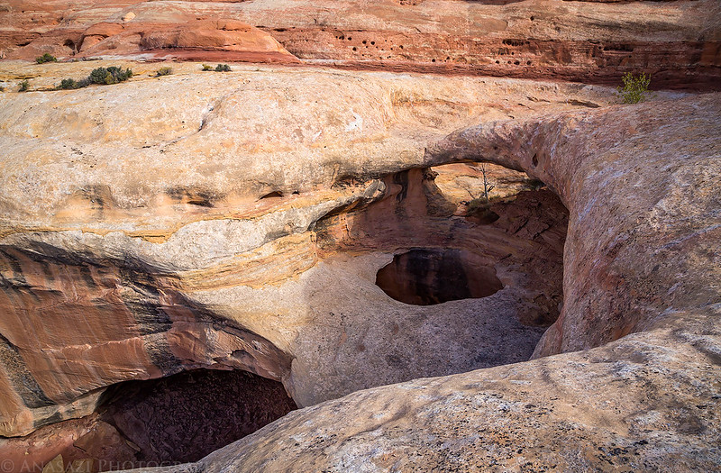
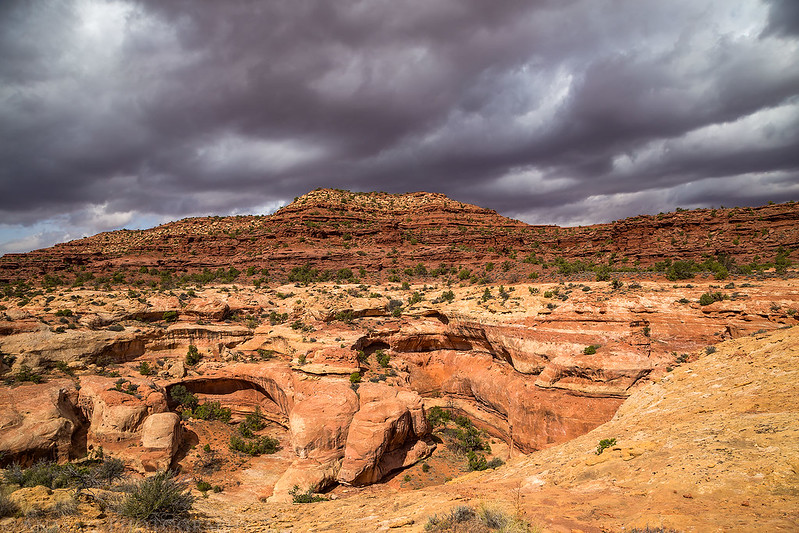
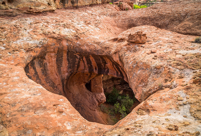
After rounding a corner we came across a nice double arch. The alcove below the bottom arch was massive!
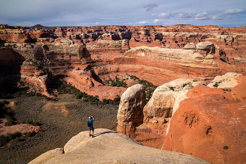
Jared stands on the top arch.

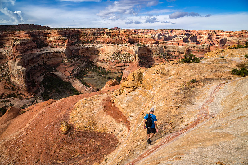
Jared takes a photo of the colorful canyon below as we continued along the rim.
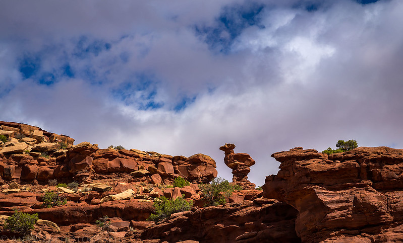
On our way back to my Jeep I spotted this hoodoo above that looks like a sitting bird.
These dark clouds to the north dumped a lot of rain on the Moab area, but we were far enough south that it missed us.
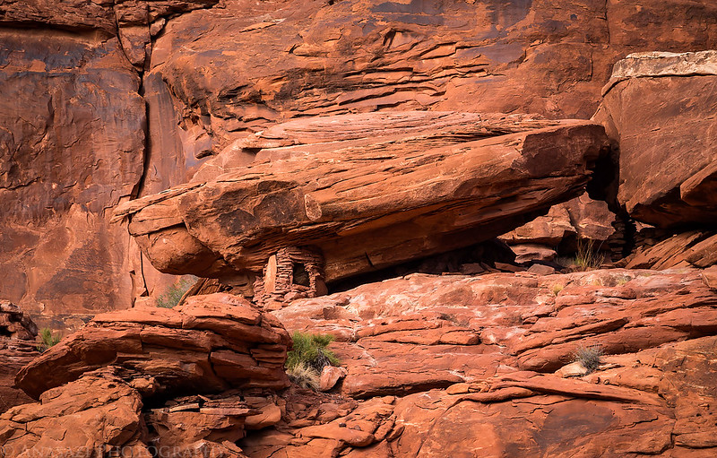
Before returning to my Jeep I took Jared over to see Ruin Arch, which has an inaccessible tower hidden underneath it.
Here’s a different view of the two-story tower on a ledge under the arch.

North Six-Shooter in the distance.
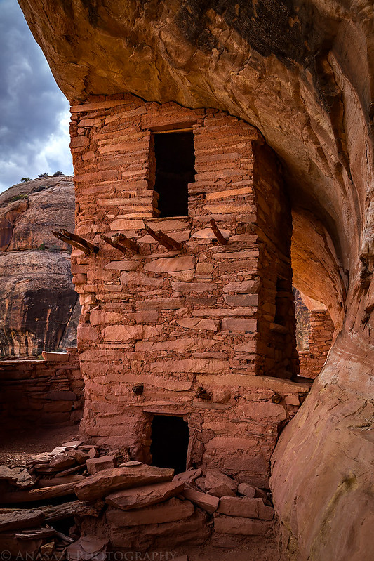
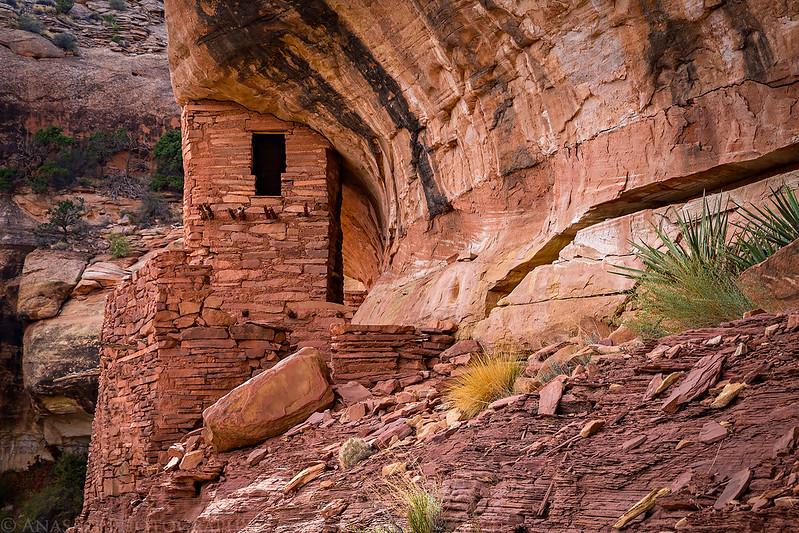
Here’s a very cool three-story tower we visited next.
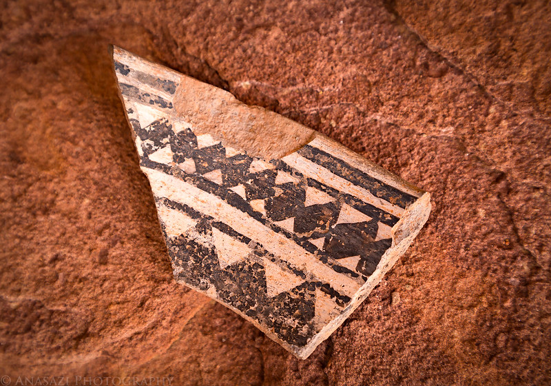
A nicely painted potsherd found nearby.
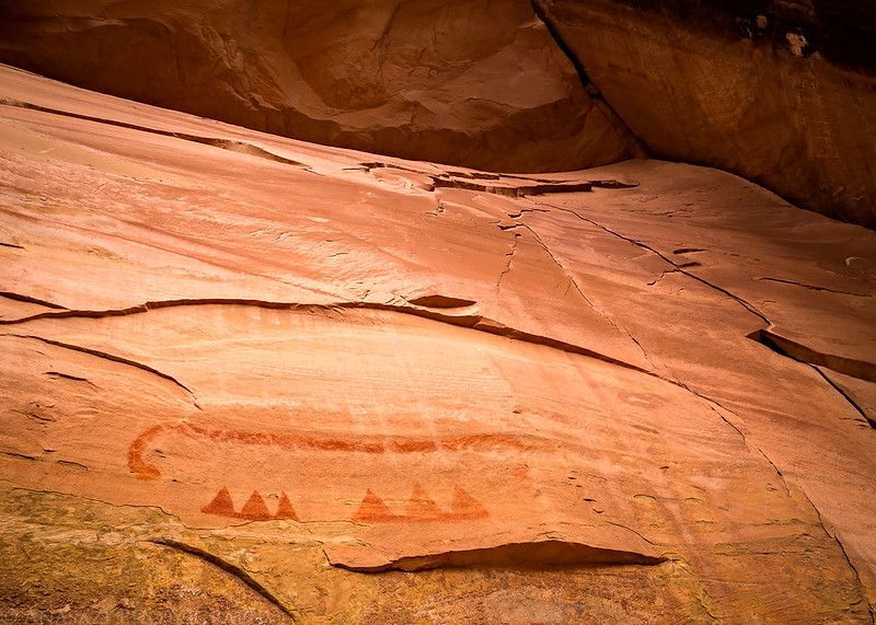
There were some faded pictographs in a shallow alcove adjacent to the tower, too.
This photo shows the built-up wall that protects the well-preserved tower.
Just a little granary that Jared spotted.
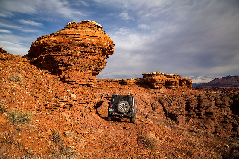
Driving towards Lockhart Basin in search of a campsite for the night.

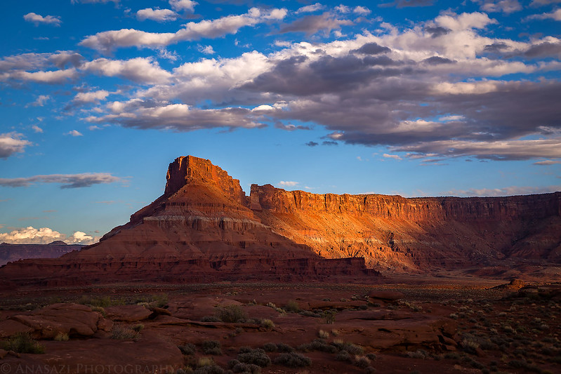
Warm evening light on sandstone formations along the Lockhart Basin Road.

Spotlight on part of Hatch Point.
A distant view of the United Nations Tablet from our campsite. I spent a nice night up above at the Canyonlands Overlook a few years back.

The La Sal Mountains are visible over the cliffs of Hatch Point towering above Lockhart Basin viewed from our campsite shortly before sunset.

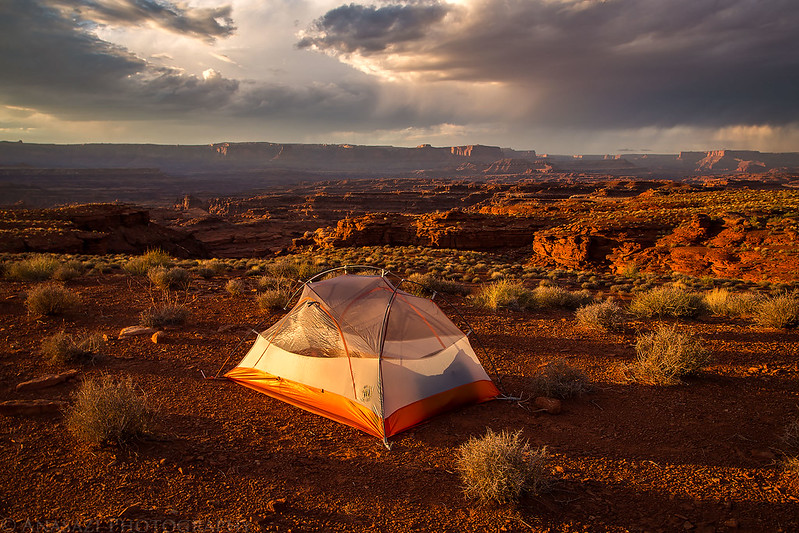
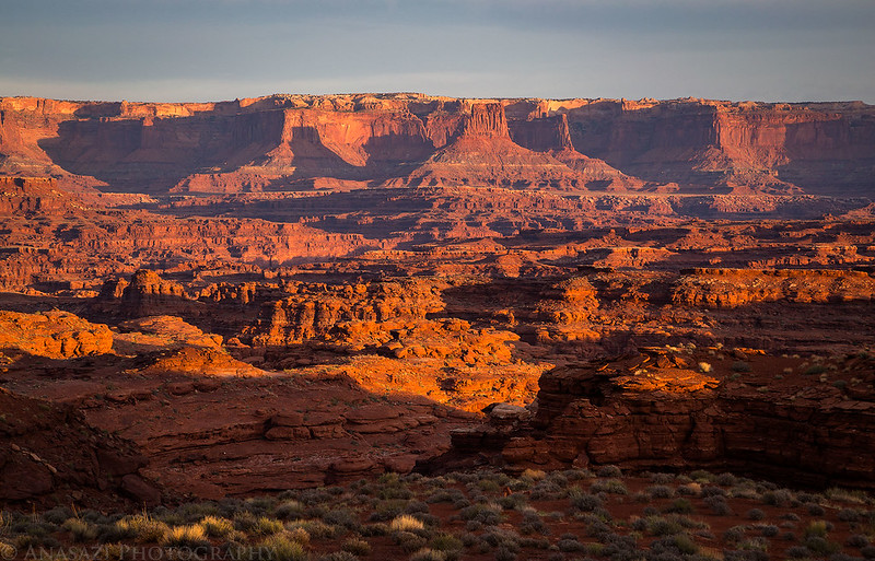
A great sunset with a beautiful view of Canyonlands National Park.
Hatch Point at dusk.
One last view after the sun went down. I liked the sparse clouds and colors in the sky in this scene.

Junction Butte and Grand View Point at sunrise in Canyonlands National Park the following morning.
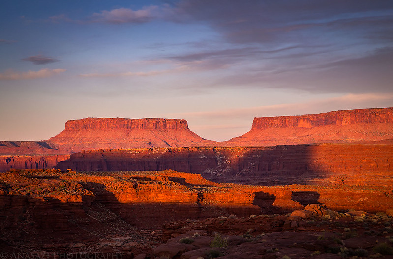
Another sunrise photo of the Island In the Sky with Airport Tower casting its shadow on the cliffs behind it.
After sunrise we packed up camp and hoped to hike down to Big Bottom along the Colorado River today. Unfortunately, this hike would not go in our favor either…
A benchmark from 1926 that we passed by.
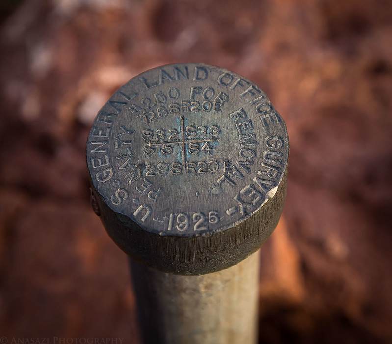
It was pretty easy to spot when we got near it. The view from here wasn’t bad either…

A very tight turn on an old mining track that doesn’t seem to have been used for quite a while. I actually was able to get around the corner with a three-point turn in this direction, but had a little more trouble on the way back.
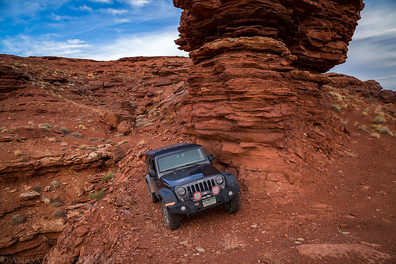
Here’ my Jeep in the same spot as above, but from a different angle. It was a pretty narrow and off-camber old mining track in places. We had to stop and fill in a few holes with rocks along the way.
While it doesn’t seem to have been used in a very long time, there once was an old mining road here…
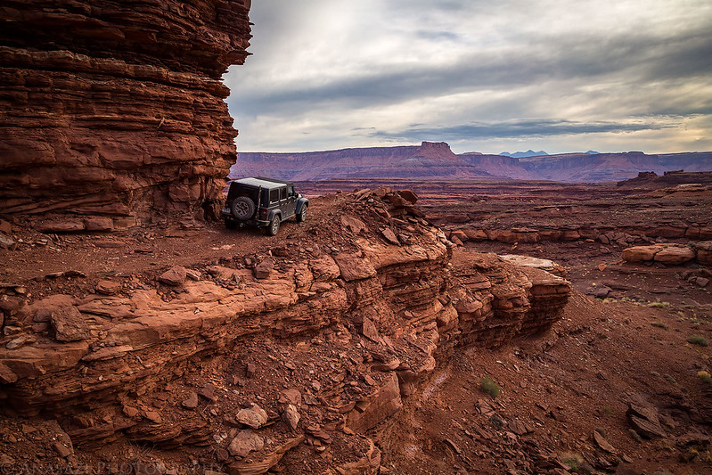
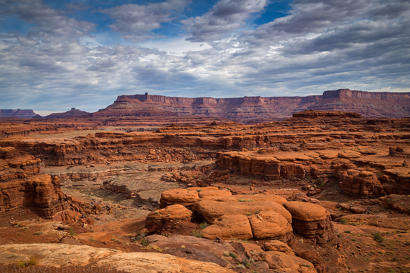
A large hoodoo and other sandstone formations from our hike along the top of a high ridge above Horsethief Canyon.

Hiking along the top of a ridge through the rugged country within The Bears Ears.
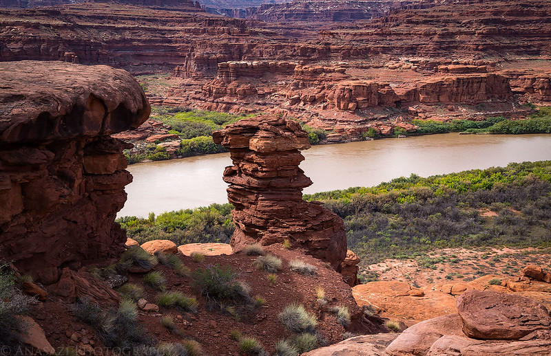
We tried to hike down to Big Bottom from the end of the ridge, but were unable to find a route down. We tried a few different ways and kept getting cliffed out.

So close, but not quite there. That’s the mouth of Gooseberry Canyon on the opposite side of the river behind the large hoodoo.
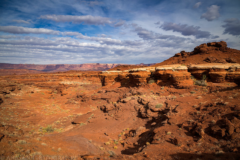
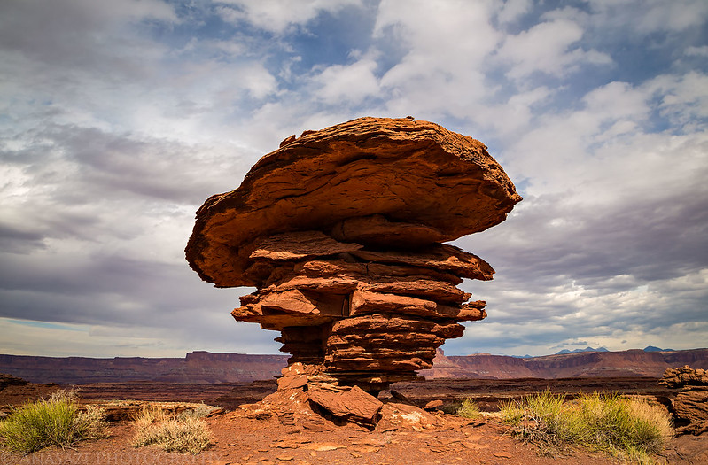
It was a pretty cloudy day, but the sun did break through a few times.

A very cool hoodoo we found on our way to try to get down to Big Bottom.
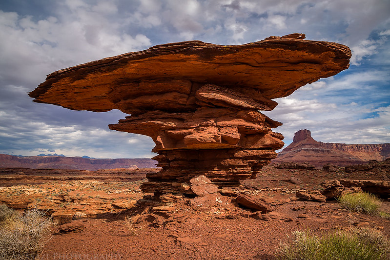
The thin cap on top was much wider and more impressive from the other side.
After returning to my Jeep from our hike we drove back to Monticello for dinner and then found a campsite at the base of the Abajo Mountains to continue our adventure!
No matter where you go you always seem to take such amazing photos. I always enjoy them.
Thank you
Thank you Robert!
Another gorgeous set of photos!
Thanks again John! Glad you enjoy them! I’ll keep posting them 🙂