Press "Enter" to skip to content

Tag: clouds

Ouray Solstice Hiking

Upper Cascade Falls & Baldy Peak
Saturday & Sunday, June 21-22, 2014

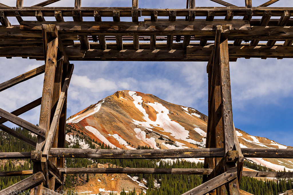
This weekend for the summer solstice, Diane and I headed down to Ouray to get in a little hiking in the San Juan Mountains. Since there’s still a lot of snow up high and it would be our first time really hiking in the mountains this year, we decided to start with some lower elevation hikes close to town between 8,000 and 10,000 feet. When we arrived, we setup camp just above town in the Amphitheater Campground and then got started on our first hike up to the Upper Cascade Creek Falls and Chief Ouray Mine. The hike started out easy, but soon it quickly climbed over 1,000 feet up a series of switchbacks. First we reached the Upper Cascade Falls and took a few photos and then we crossed the creek and continued on to the remains of the Chief Ouray Mine located high above town.

Leave a Comment

Silverton & Ouray

Saturday, June 14, 2014

The desert has been heating up recently and I’ve been looking to start getting up into the mountains soon. The first reports of roads opening up in the San Juan Mountains have been coming in, so I decided to head up towards Silverton and Ouray to see just how fast the snow was melting this year so I could start planning some mountain hiking trips. Much of Colorado’s high country got a lot of snow this year, so trails and roads are opening up later than they typically would. There is still a lot of snow up in the mountains, but it appears to be melting fast.

4 Comments

Red Rock to Black Canyon

Backpacking Red Rock Canyon
Saturday & Sunday, June 7-8, 2014

Deep, Steep and Narrow. That’s how the National Park Service describes the Black Canyon of the Gunnison, and it’s pretty accurate. The Black Canyon is comprised of some of the steepest cliffs, oldest rock, and craggiest spires in North America. I’ve wanted to hike down into the Black Canyon of the Gunnison for quite a while now and thought I would try Red Rock Canyon, the easiest route, for my first time. This trail is about 3.5 miles in length and only drops 1330 feet to the river. Compared to the other routes down to the Gunnison, this one is definitely the least steep.

4 Comments

Monument East Entrance

Friday, May 30, 2014

On Friday evening the sky looked like it could be nice for a great sunset, so I made a quick drive up through the east entrance of the Colorado National Monument and stopped for a few photos along the way. I did a little exploring of a new area that gave me a nice view of the Rim Rock Drive switchbacks climbing up to the tunnel and a nice overview of the Serpent’s Trail from above. Here’s a few photos from the short evening drive.

Leave a Comment

Maze Memorial Weekend

Memorial Day Weekend | Friday – Monday, May 23-26, 2014

It’s been over three years since I have been to the Maze District of Canyonlands National Park and I have been wanting to get back. Earlier this year I decided to try out Canyonlands’ new online permit system and got a permit for a few campsites in The Maze over Memorial Day weekend. The last time I was in The Maze we camped in the Land of Standing Rocks, but this time I wanted to make sure we spent a night at the Maze Overlook. I also wanted to check out the Millard Campsite along the Green River since it seems like a pretty remote area of the park and I haven’t heard about too many people driving out to it.

6 Comments