Uncompahgre Wilderness: Between Uncompahgre and Wetterhorn Peaks
Friday & Saturday, August 14-15, 2020
This Sunday Diane and I have a camping permit secured for an overnight backpacking trip to the popular Conundrum Hot Springs near Aspen, but I didn’t want to skip out on hiking at least one new peak this weekend, so I thought I’d try to find something quick and easy to hike on Saturday morning before I returned home to pack for the overnighter. Since I haven’t made it back to the Uncompahgre Wilderness yet this year, and it’s probably my favorite wilderness area close to home, I figured doing something in that area would be a good choice. After looking over my maps I settled on hiking Matterhorn Peak (13,590) which has been on my to-do list for far too long. What better way to spend the morning than hiking in between two of my favorite 14ers!
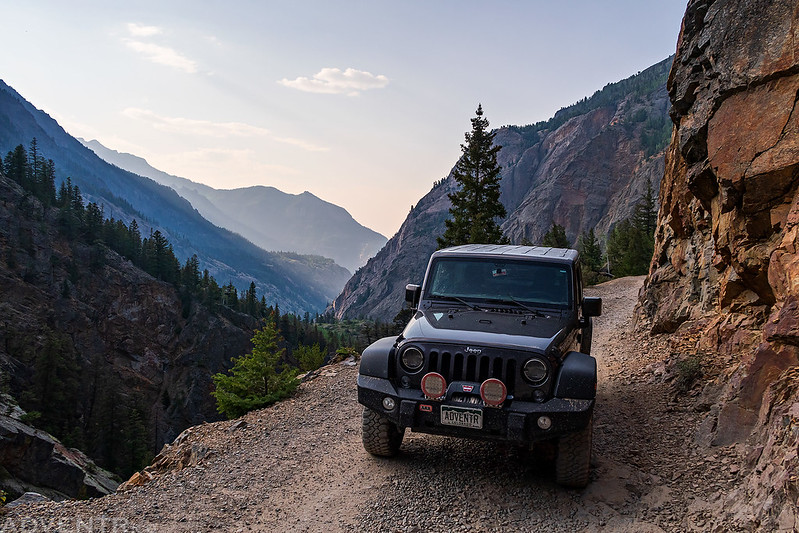
I left right after work on Friday and started heading south to the San Juan Mountains. When I first left town I was unsure which way I was going to drive to get to the Matterhorn Creek Trailhead. On one hand, I could take US 50 to Lake City, but with I-70 currently closed because of the Grizzly Creek Fire I was concerned that there would be a lot of traffic on that detour. On the other hand, I could head down to Ouray and then come over Engineer Pass via the 4×4 road along Mineral Creek. This used to be my standard route when heading this direction, but over the past couple of years the road from the Million Dollar Highway to Mineral Point has gotten torn up pretty badly and it’s not as fun and slow driving these days. In the end I decided to give the route over Engineer Pass another try this evening and thought that maybe I’d be able to catch a smoky sunset from near the pass.
Smoke from the Pine Gulch Fire near Grand Junction was thick all the way until I reached Ouray as the winds had changed direction and were blowing it south today. Once I passed through Ouray and started to climb up into the mountains the smoke thinned out a little, but it would be in the air for the remainder of this day trip.
Starting my drive up to Engineer Pass along the Alpine Loop.
It’s been a while since I stopped at the Mickey Breene Mine, so I took a little time and visited again. It looks a lot different now than it did on my first visit here.

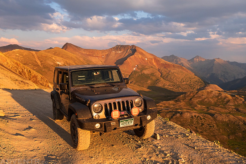
Model 3

Continuing my drive up the road to Mineral Point. Although this part of the road looks good, there were a couple of sections before this point that were really torn up and slow-going. I think my days of driving this road are finally over with, in the future I’ll just drive through Silverton and Animas Forks to reach Engineer Pass.
A smoky evening view of the Sneffels Range on the horizon.

As I drove up to Engineer Pass the light on the landscape below was pretty spectacular!

Looking down on Denver Hill with golden light washing across the landscape.
Driving up the last part of the Engineer Pass Road just before sunset.
There was a large flock of sheep below Engineer Pass along Bear Creek with smoke in the air.

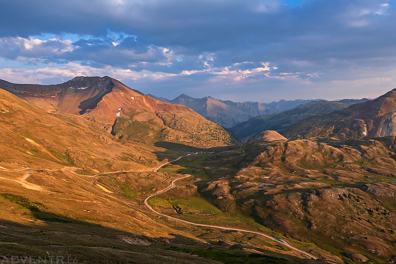
I finally made it to Engineer Pass at 12,800 feet just before sunset. I thought I was going to make it here sooner, but the condition of the Mineral Creek Road really slowed me down.

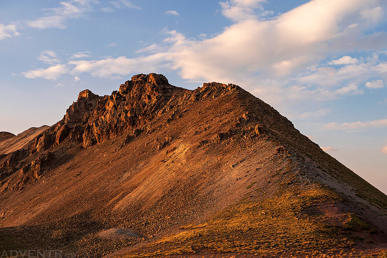
The south ridge of Darley Mountain was looking nice from the pass.
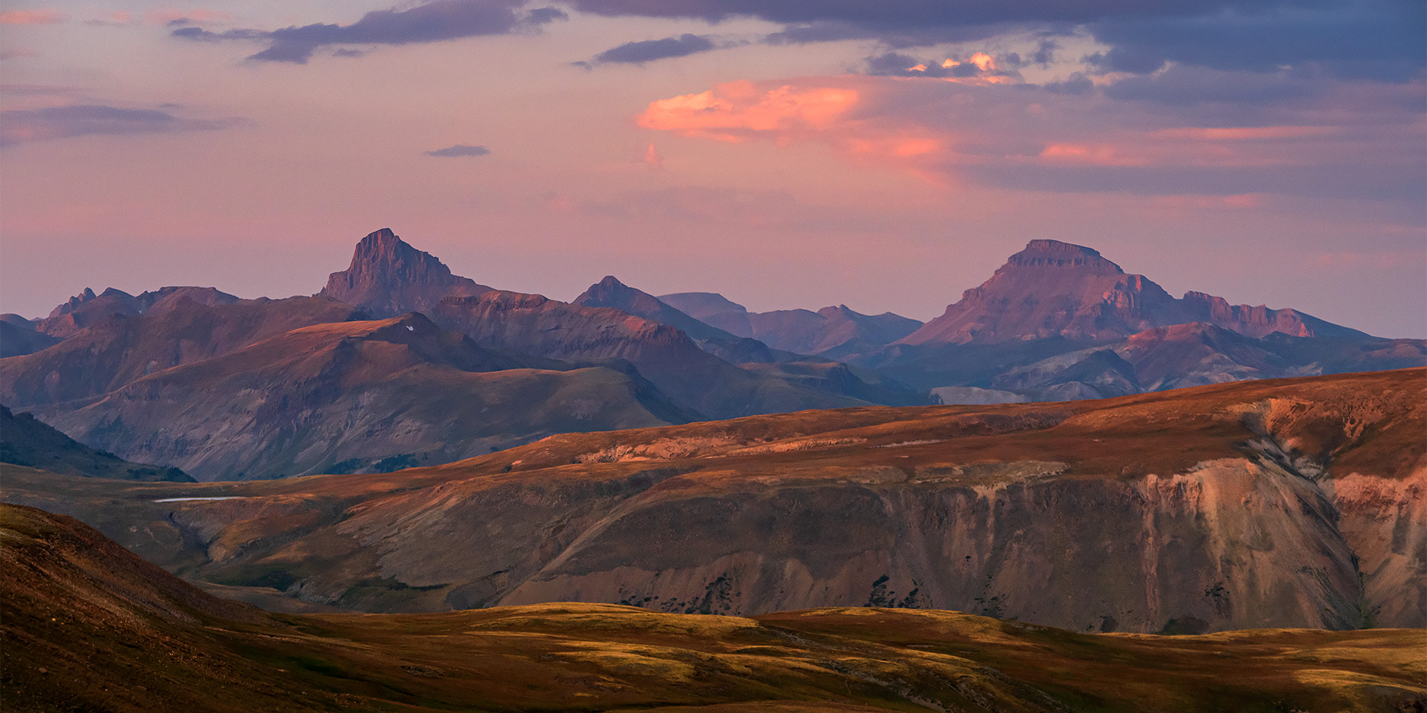
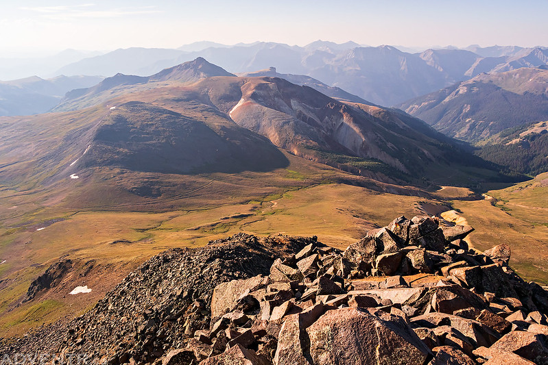
From Engineer Pass I had an excellent view of the ‘Giants of the Uncompahgre Wilderness’ which include Wetterhorn Peak on the left, Uncompahgre Peak on the right, and Matterhorn Peak between them.

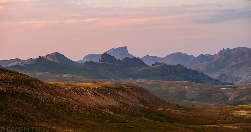
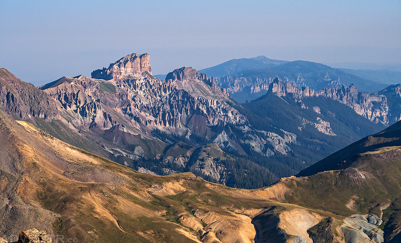
Here’s a view over American Flats to The Dragon’s Back and Coxcomb Peak (13,656).
Looking the other direction to the peaks surrounding Hurricane Basin.

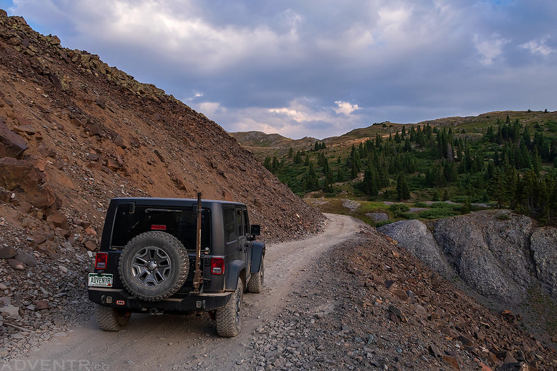
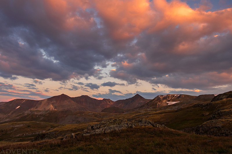
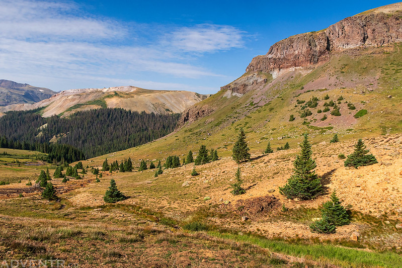
The sky was looking nice as I continued my drive down from Engineer Pass towards Henson Creek.
I was planning to camp close to the Matterhorn Creek Trailhead this evening so I could get an early start in the morning with minimal driving, but by the time I made it down to Henson Creek it was getting pretty dark out already and I spotted a nice empty campsite, so I decided to stop there and camp near the Rose Cabin instead of trying to find a campsite in the dark where there would be a lot more people around. This would just mean a little longer drive to the trailhead in the morning.
I woke up to my alarm at 4:00am on Saturday morning and then finished driving to the trailhead in the dark. I made it all the way to the upper trailhead and only found one other vehicle that was camped there. After getting ready I was on the trail shortly before 5:00am so I could be on the ridge in time for sunrise. The sky was still dark when I started hiking so I was able to see the bright stars above me surrounded by the dark outline of the mountain tops, plus a thin crescent moon and the planet Venus was shining brightly!
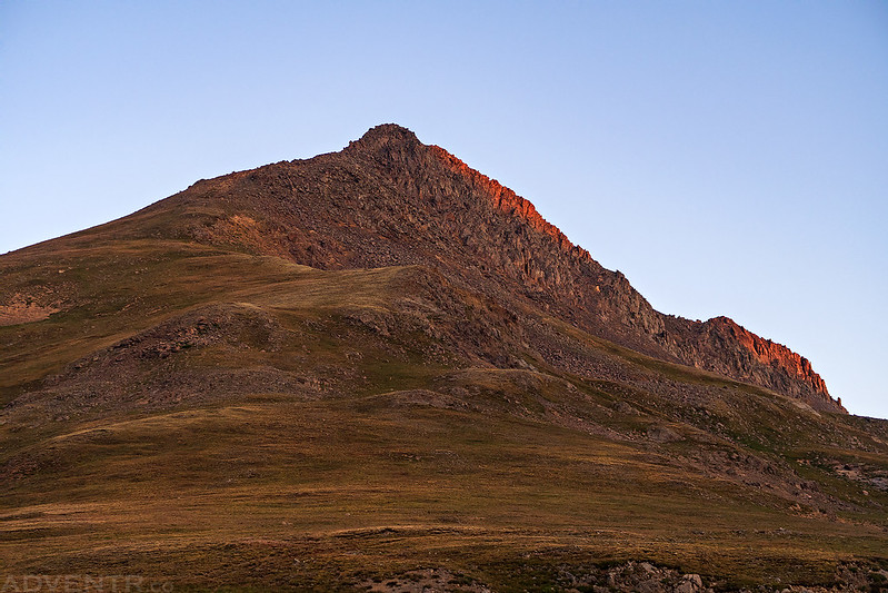
The first light on Wetterhorn Peak (14,015).

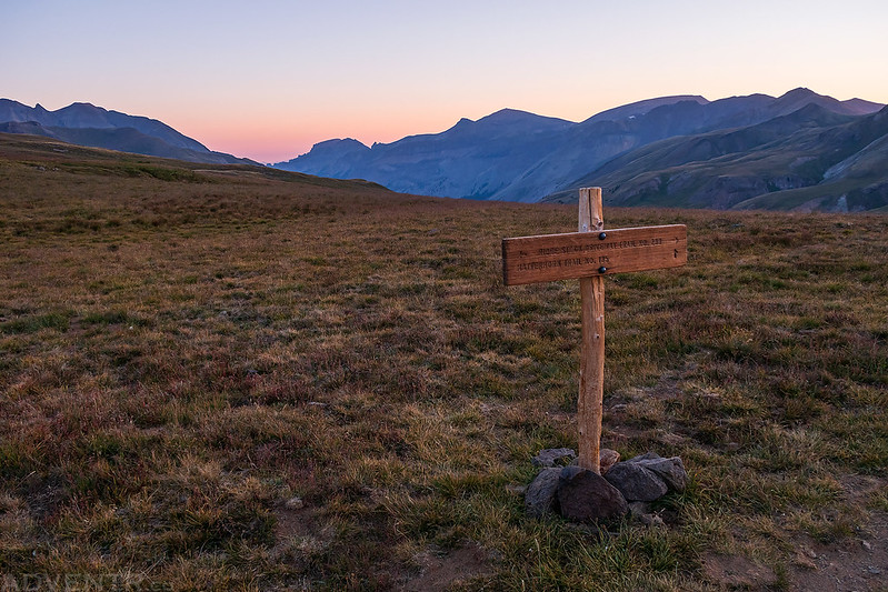
I hiked up to the junction with the Matterhorn Trail and then followed the ridge up Matterhorn Peak from there.
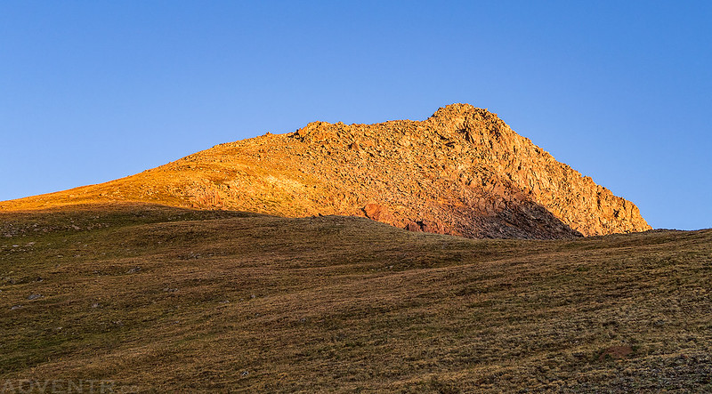
The morning light strikes Matterhorn Peak as I begin to climb the grassy slopes toward the rocky summit.
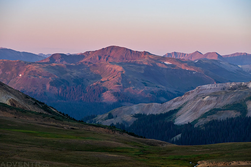
Looking back down Matterhorn Creek to Sunshine Mountain (13,321).
Light streams over the ridge above the East Fork of the Cimarron River with Silver Mountain (13,714) in the background.

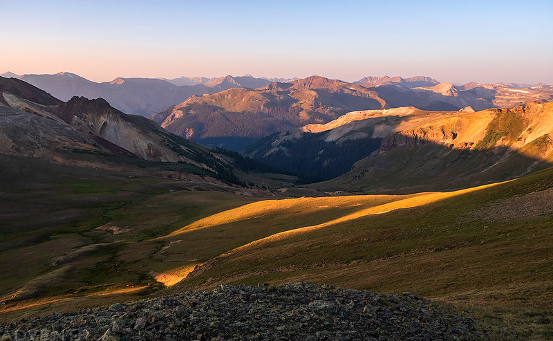
Light stripes across the landscape below in the Matterhorn Creek drainage.
Getting closer to the rocky summit of Matterhorn Peak.
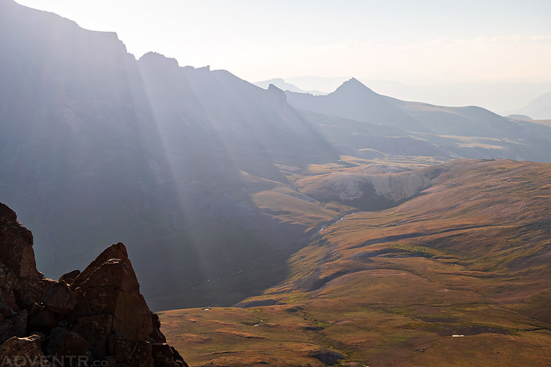
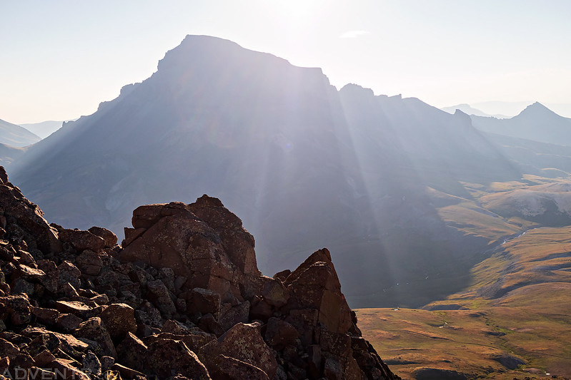
For most of the climb I was in the shadow cast by Uncompahgre Peak, until the sun finally crested over the top.

As you can see, there was still plenty of smoke in the air this morning.
Broken Hill (13,256) and the Iron Beds
The smoke in the air can make for some interesting photos, though…
I liked the way the light rays filtered through the smoke over the ridge here.
Light rays over Uncompahgre Peak
When I reached the final climb to the summit I was a little worried this short Class 3 section might be too much for me, but it turned out to be easy scrambling on talus that was mostly pretty solid. Honestly, I thought it was much easier than the loose climb to the summit of Groundhog Mountain which I did a couple of weeks ago and is rated as a Class 2 hike.

East Fork of the Cimarron River

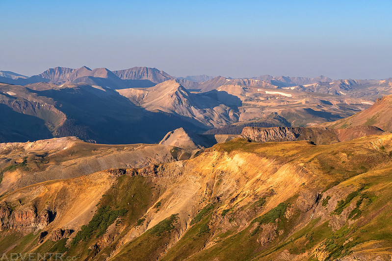
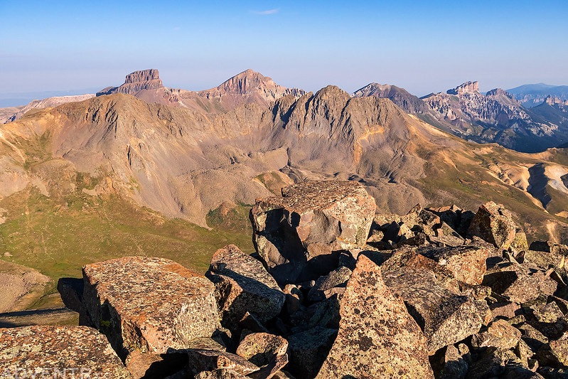
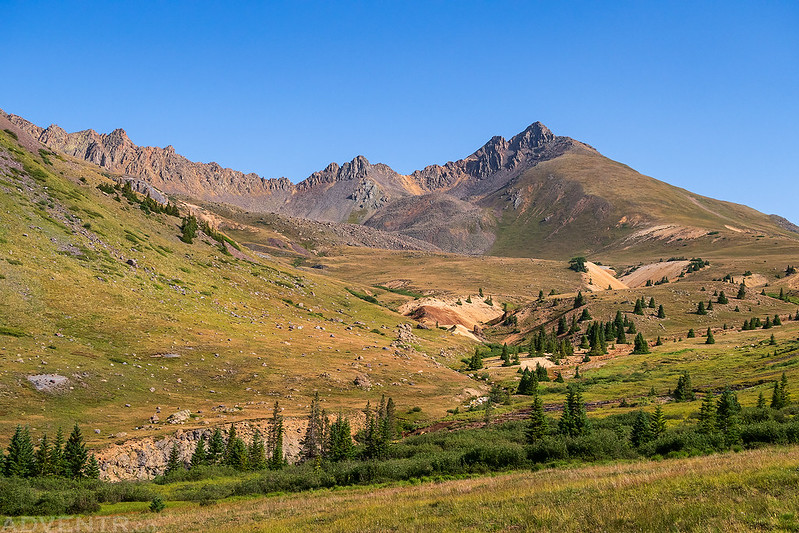
On the summit of Matterhorn Peak looking across to Coxcomb Peak (13,656) and Redcliff (13,642).
There was a nice view over to Wetterhorn Peak from the summit.

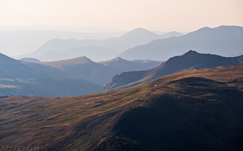
The view to Precipice Peak (13,144) and Dunsinane Mountain (12,742) was pretty awesome from up here and probably would have looked really nice at sunrise.
Looking over the summit back to Broken Hill with Redcloud & Sunshine on the horizon.
The rugged Uncompahgre Wilderness.

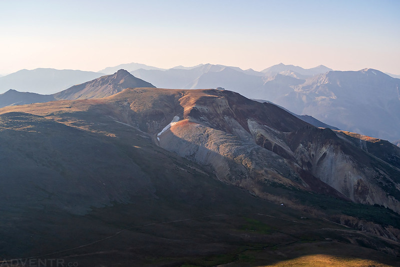
The ridge connecting Wetterhorn and Matterhorn is pretty cool.

Looking up to the summit of Matterhorn Peak as I started making my way back down.

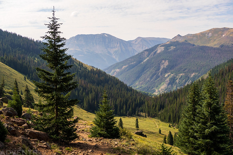
The smoke seemed to clear out a little bit as I hiked down along Matterhorn Creek.
One last look back to Matterhorn Peak before it went out of view.
Leaving the Uncompahgre Wilderness

Following the Wetterhorn Trail back down to the trailhead.

Randy, maybe you haven’t read ThE FOUR-CORNERED FALCON by Reg Saner? I didn’t see it in your library. Can you send me your mailing address in e-mail?
No, I’ve never heard of that book before. I’ll send you an email.
Hi, I’m planing on doing the alpine loop next month & was wondering which road you took off of the 550. I know the one closest to Ouray 878is rougher…if I recall it starts pretty steep. The next road is Corkscrew 880 & I think that is a lot easier. Is that the one you took that you didn’t like that much?
Jim
I took the first one that’s closest to Ouray and follows Mineral Creek beyond the turnoff into Poughkeepsie Gulch.. Corkscrew Pass is usually pretty easy, but it’s longer to get to Engineer Pass from there since you also need to get over Hurricane and California Pass next.
Thanks for the reply!
Jim
Some of those views are unreal (In particular this one https://www.flickr.com/photos/rlngstrt/50229601808 almost looks like something out of a video game, like Zelda: Breath of the Wild or something). Pretty crazy when you can get real life photos that fall into the uncanny valley. What an adventure, as usual.