Continental Divide Trail: Hunchback Pass to West Ute Lake
Labor Day Weekend | Friday – Sunday, August 30 – September 1, 2019
Since we just spent last weekend along the Continental Divide in Wyoming, I figured it would be nice to spend some time along the Continental Divide Trail in Colorado this weekend. Since Labor Day is a popular holiday in the mountains of Colorado I planned a backpacking loop into an area of the Weminuche Wilderness that I hoped would not be very busy so we could try to avoid the crowds. The plan worked out great as we only saw a couple of other people all weekend and had plenty of solitude! As for the trails we hiked, they required more bushwhacking and route-finding than I expected, so that might be another reason why we didn’t run into too many people.
We left after work on Friday afternoon and drove down through Ouray and Silverton on our way to Stony Pass. After crossing over the Continental Divide at Stony Pass we forded the Rio Grande and found a campsite near Beartown just after 9:00pm. This is the second week in a row that we found ourselves setting up camp in the dark, but at least it wasn’t after midnight this time! Once our tent was set up we went right to bed since we were tired from a long day.
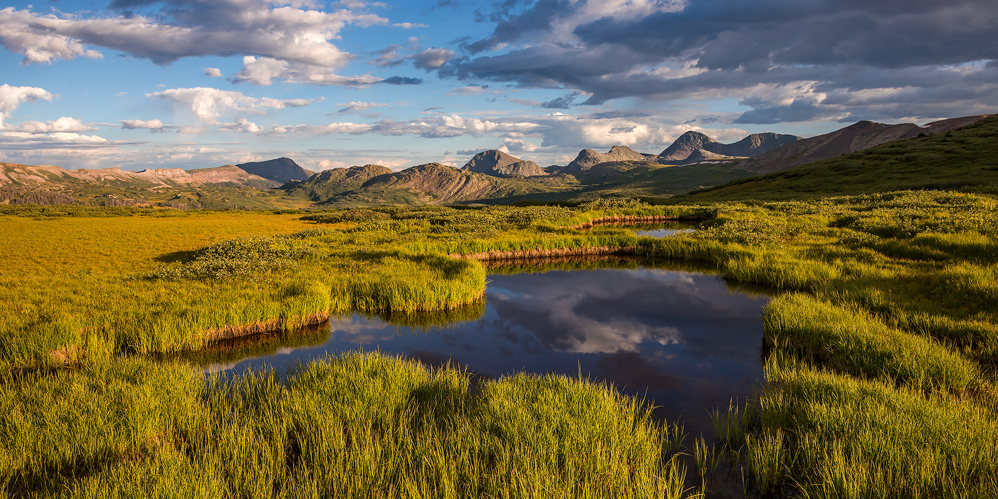
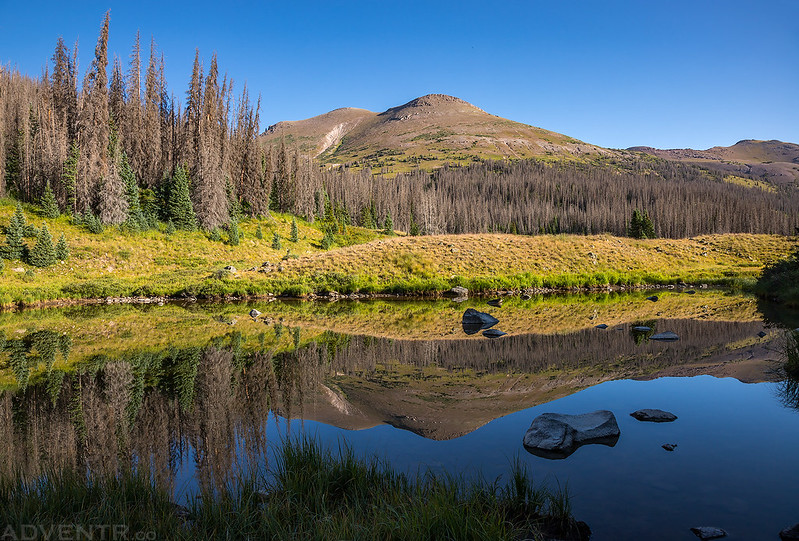
Good morning! This was my first view of our campsite near Beartown in the light.

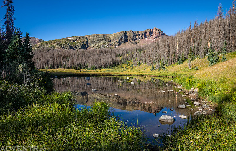
On Saturday morning we woke up after sunrise and I was pretty well-rested. Diane spotted a moose on the other side of the valley which was the first of three different moose that we would see this weekend. We took our time breaking down camp since we were not in a hurry for a change and then finished the drive through Beartown to the Hunchback Trailhead near Kite Lake. Although we needed to hike over two different passes today, the weather forecast was predicting that there would be no thunderstorms, so we didn’t need to rush to try and beat any afternoon storms. After making sure we had everything that we needed in our packs we started the hike along the Continental Divide Trail towards Hunchback Pass.
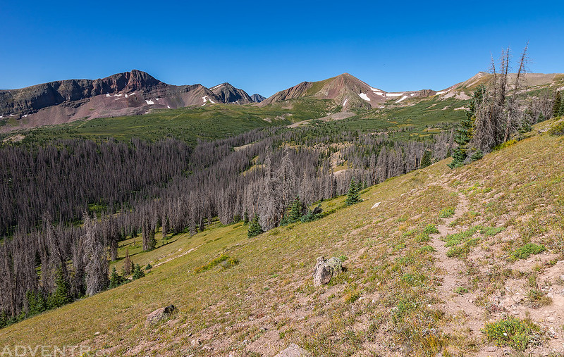
Starting our hike on the Continental Divide Trail from the Hunchback Trailhead.

Our view back over Bear Creek as we hiked up to Hunchback Pass.

Diane follows the trail to Hunchback Pass.

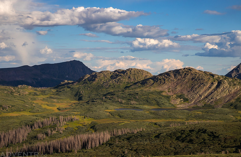
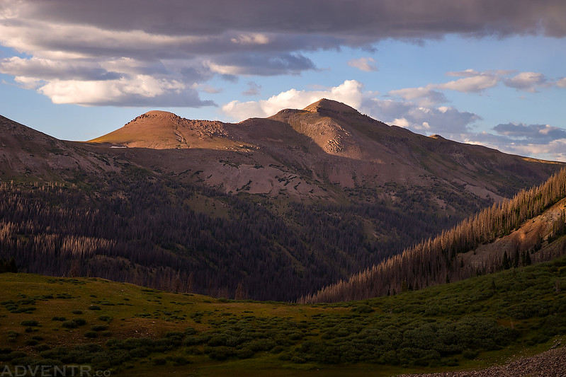
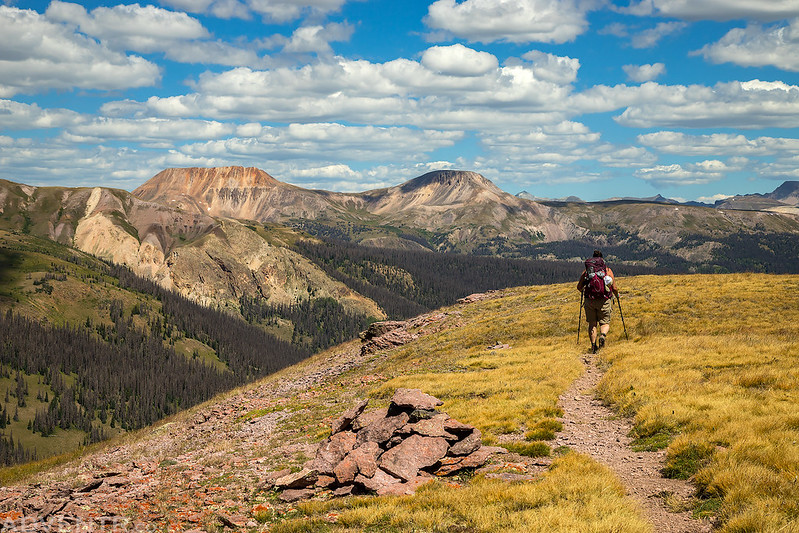
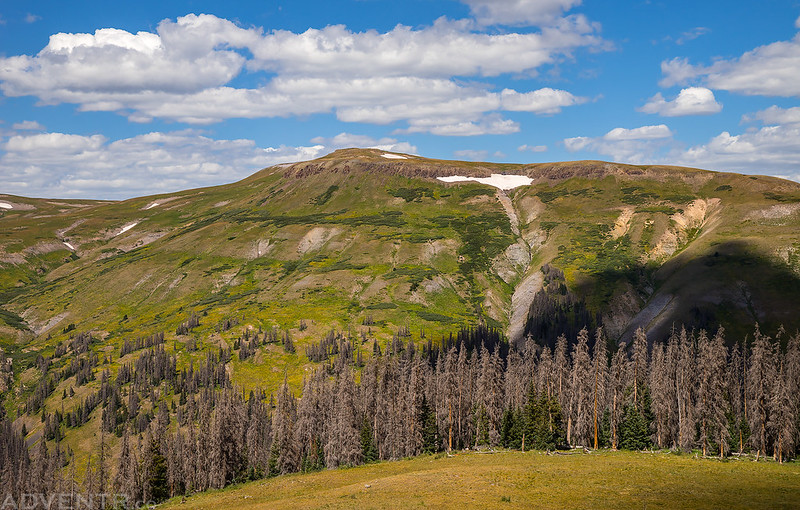
Hunchback Mountain (13,136) in the light above us.

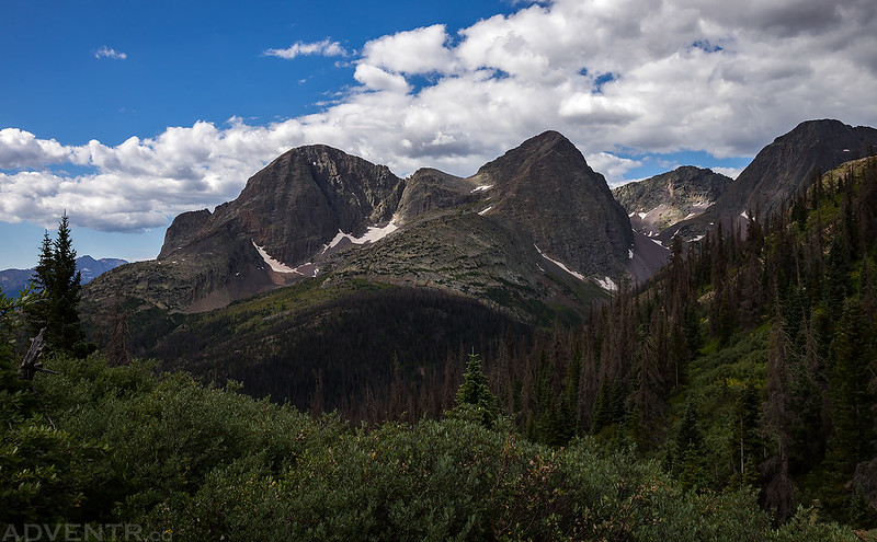
As we started descending the pass on the other side we had a good view of The Guardian (13,617) and Mount Silex (13,628). This was also where the trail began to pass through a bunch of overgrown willows, which we would encounter a lot of throughout this loop. It’s definitely a good idea to wear pants instead of shorts while hiking in this area.
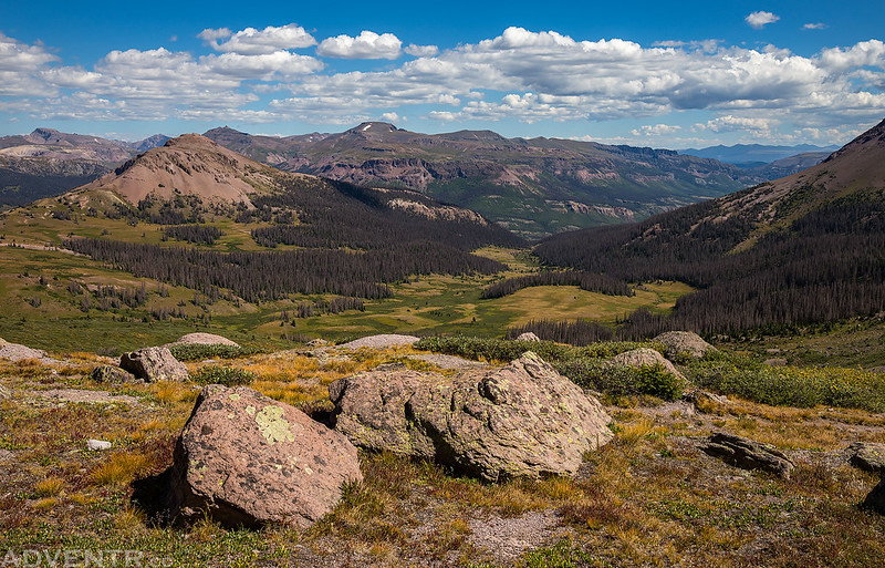
When we reached the next trail junction we turned left and followed Nebo Creek up to an unnamed pass.

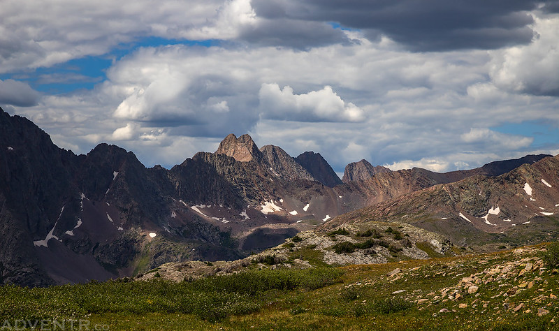
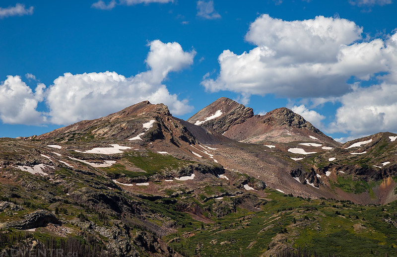
From this drainage we had a great view of Storm King Peak (13,752).

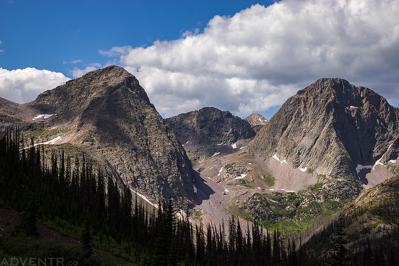
Mount Silex on the left, then Peak Nine (13,402), Peak Seven (13,682) and Storm King Peak on the right.
Looking down over the Nebo Creek drainage as we climbed higher to the pass.
A small tarn we passed by.
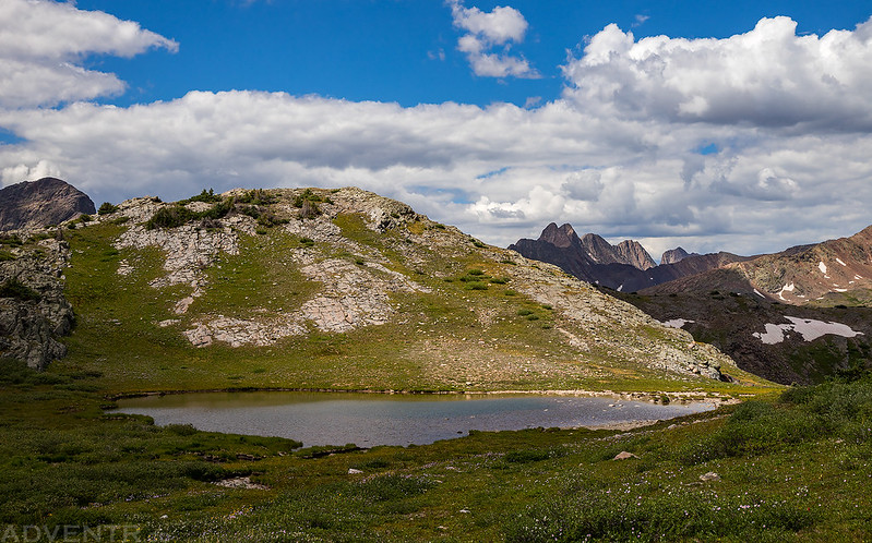
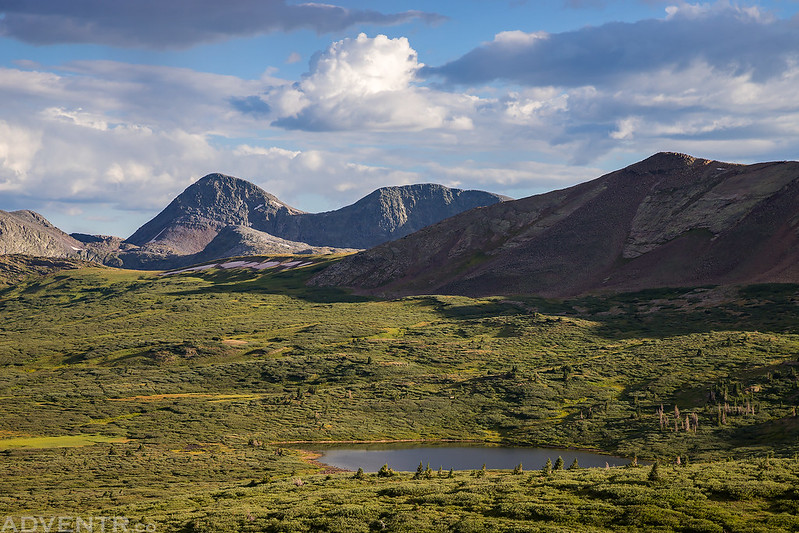
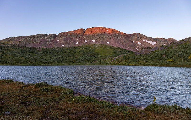
Just before reaching the highpoint we passed this nice blue lake with a small rocky island at the base of Mount Nebo (13,205).

There was also a view over to the rugged Grenadier Range.
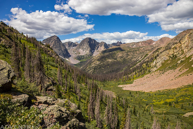
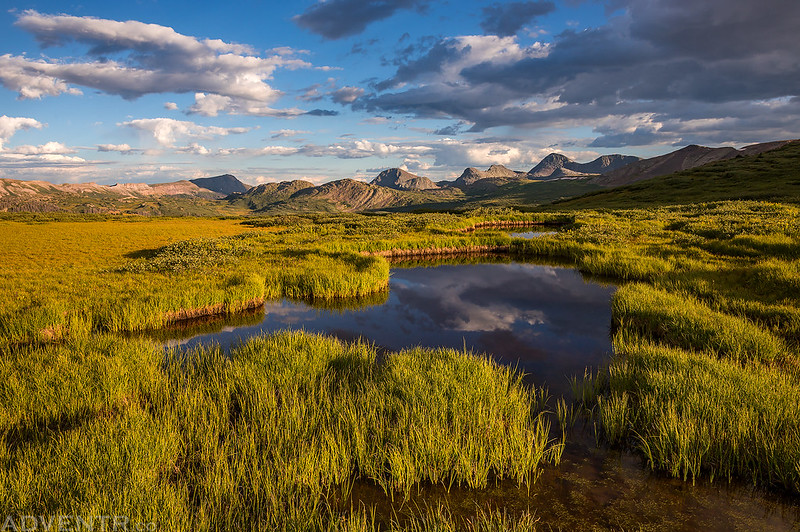
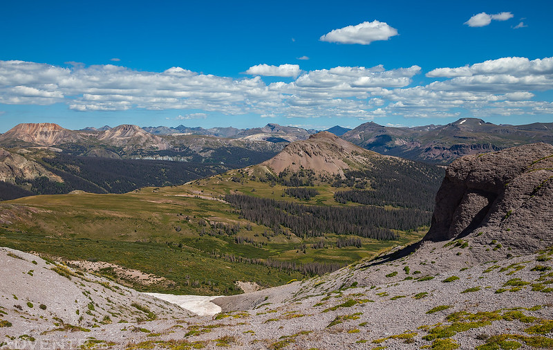
After crossing over the unnamed pass we had our first view over West Ute Creek with the Rio Grande Pyramid (13,821) dominating the skyline.
This was actually the only Continental Divide Trail marker that we saw all weekend, which is strange since I’ve been on segments of this trail that have tons of them.

When we reached the junction with the West Ute Creek Trail it was only a short walk over to West Ute Lake, which was our destination for the night. As you can see, there were plenty of willows to hike through around here. This is what the typical trail conditions were like.
After reaching the lake we found a nice scenic campsite hidden the the willows, but when the sun was out and not hidden behind a cloud, it was very warm up here this weekend. Plus there were a lot of mosquitoes, biting flies and other annoying bugs around. These certainly weren’t our favorite kind of camping conditions, and somehow I had also managed to forget the bug spray!

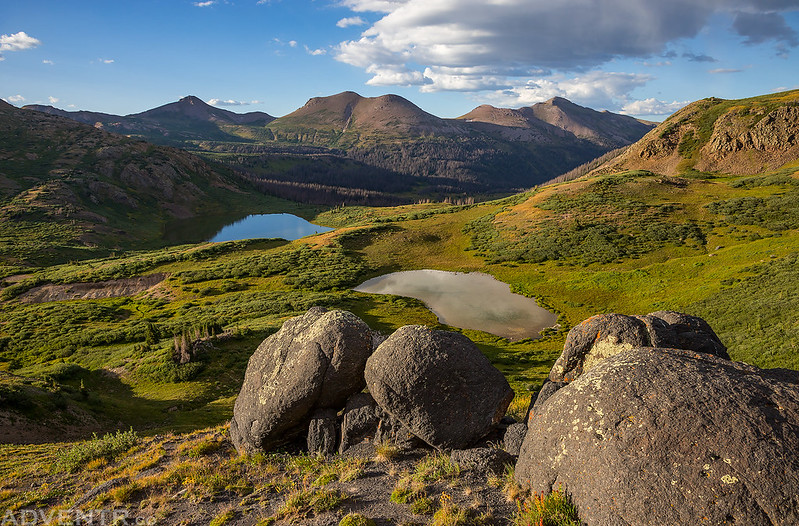
After dinner I hiked up above West Ute Lake to the divide between West Ute Creek and Middle Ute Creek to check out the views from above.

There was another good view of the Rio Grande Pyramid and The Window from up there. This is definitely a 13er that I would like to climb someday!

I could see the Twin Lakes in the distance with Mesa Lato in the shadows.
I also had a good view of Middle Ute Lake below.
Wildflowers wilting away along the trail.

The light was starting to get nice as I hiked back to West Ute Lake.
View from a small tarn on the top of the divide. A beautiful Weminuche evening!
Following the Continental Divide Trail back to camp.

Ute Ridge (13,455) just before sunset.
I took a walk along the shore of West Ute Lake on my way back.


The sky exploded with color when I returned!

One last shot of our campsite below the magenta-colored clouds after sunset.

When the color was gone we both got in the tent and went to bed. It had been another long day and we were tired. Diane told me that I fell asleep rather quickly.
I woke up for sunrise on Sunday morning but there were no clouds in the sky.
Ute Ridge looked nice in the morning light, though.
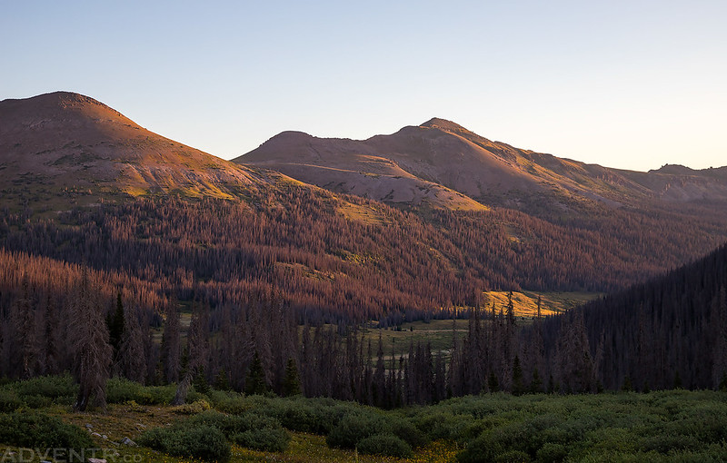
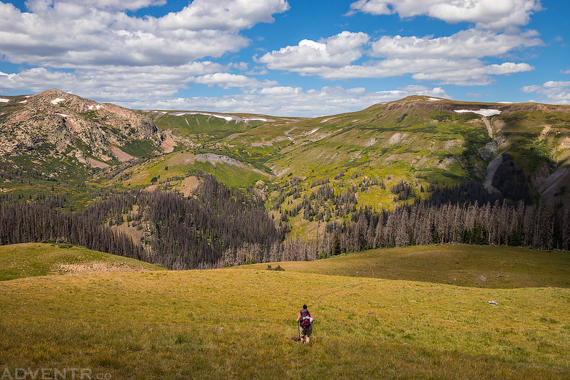
After taking a few photos we packed up camp and set out to complete the loop by hiking down along West Ute Creek to the Beartown Trail. While the Beartown Trail is shown on maps of the area, it appears that this trail does not get much use and its location on the maps is not correct, which isn’t very helpful. There was a lot of deadfall to get around and it was overgrown pretty badly in places which made it hard to follow. We ended up missing the trail a couple of times and just had to climb uphill until we crossed paths with the trail again. Oh yeah, there were also a ton of switchbacks on this trail!
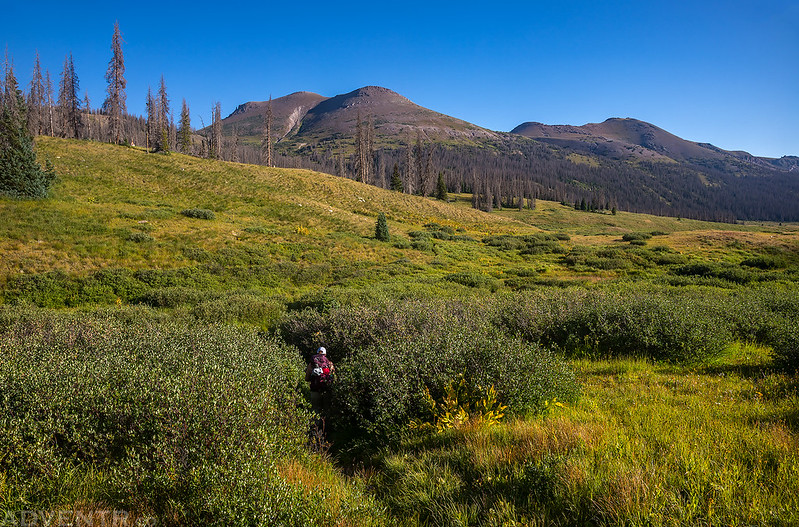
Diane disappears into the tall willows along the West Ute Creek Trail. A common occurrence this weekend…
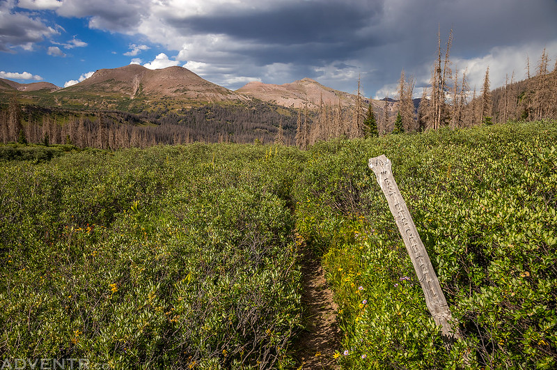
After descending into the valley we found the beginning of the little-used trail to Starvation Pass, also known as the Beartown Trail.

The trail passed alongside this small tarn.
Although we had trouble following the trail in the trees below, once we got above treeline it was a little easier to follow.
The summit of PT 13342 above Starvation Pass, which is just off to the right of this photo.
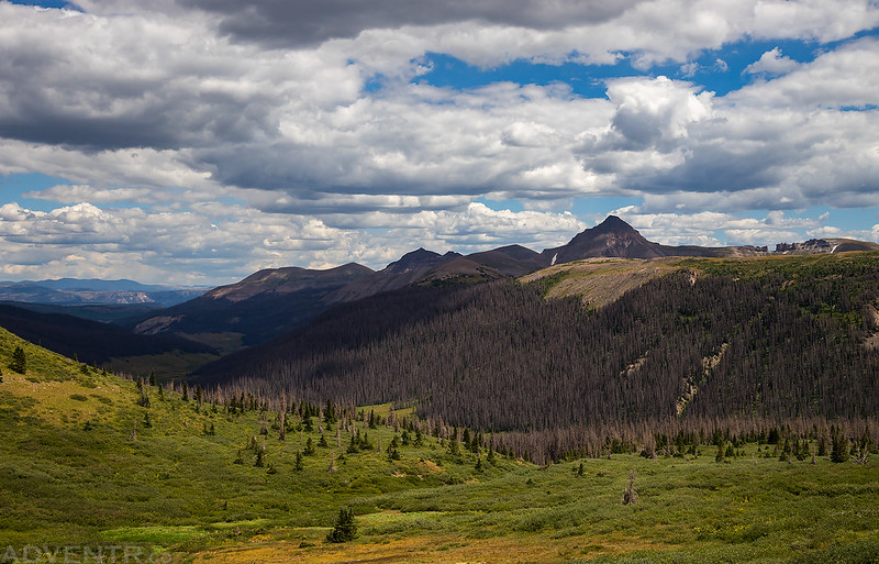
A view to the north from Starvation Pass including Sheep Mountain (13,292), Half Peak (13,841) and Pole Creek Mountain (13,716).
Following the Beartown Trail down to Indian Ridge on the other side of the pass with Canby Mountain (13,478) on the horizon.

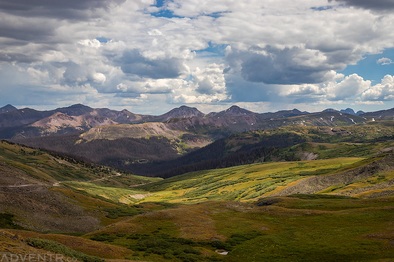
The trail traversed across the head of Starvation Gulch and offered distant views of the peaks in the La Garita Wilderness including Baldy Cinco, Stewart Peak and San Luis Peak.
This was a spot on the other side of the pass where we lost the main trail and ended up on one of the many elk trails in the area. At least it had a great view!

Diane follows the trail across Indian Ridge ahead of me.
Descending from Indian Ridge to Bear Creek below on a faint trail through the grass.
Looking across the valley.
Hunchback Mountain & White Dome (13,627)
We lost the trail one more time when we got back down into the trees and that’s when we stumbled upon our second moose of the weekend. This time the encounter was a little too close for comfort but we were able to back away and find another route around. When we reached the Beartown Trailhead Diane waited there with our packs while I hiked up the road to get the Jeep. Then I picked her up and we started our drive back over Stony Pass on our way home. There was a lot of traffic on the Silverton side of the pass which slowed us down, but wasn’t surprising since it was a holiday weekend. We saw our third moose of the weekend cooling off in Mineral Creek along the Million Dollar Highway before we drove back over Red Mountain Pass.
One last view back toward Starvation Pass, Indian Ridge and Ute Ridge from the top of Stony pass before finishing the drive back home. It was a nice weekend in the Weminuche Wilderness!
>> West Ute Lake Loop Photo Gallery
I think I stayed in that exact same campsite in 2012. Beautiful area! I can’t help noticing, though, I’ve got a 2012 photo that’s a near match for your shot of Rio Grande Pyramid and the Window, and all the trees were green and alive. Seven years – damn.
Yep, the beetle-kill is really bad in this area. Pretty much all the trees are dead.
Did you need high clearance vehicle to get to the trailhead? Thanks!
Yes, most definitely. The road to Beartown is pretty rough.
Spent a week here in the early 90’s, came in from Cathedral lakes, went in as far as Ute lake. The second to last day we camped at west Ute lake, and then went straight along the divide from Nebo pass all the way to Eldorado lake. Saved a lot of hours and got to spend the whole day on the divide. Also saved some time, which was good, since it started raining as soon as we had the tent set up, and didn’t let up for 18 hours! Probably the best backpacking trip ever… stunning country.