East Fork & Middle Fork of The Cimarron River
Labor Day Weekend | Saturday – Monday, September 2-4, 2017
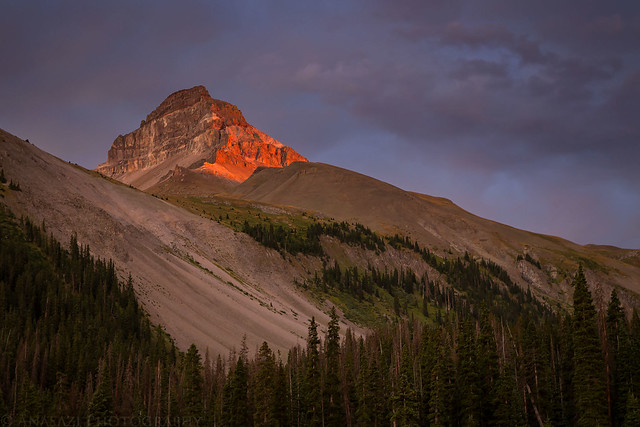
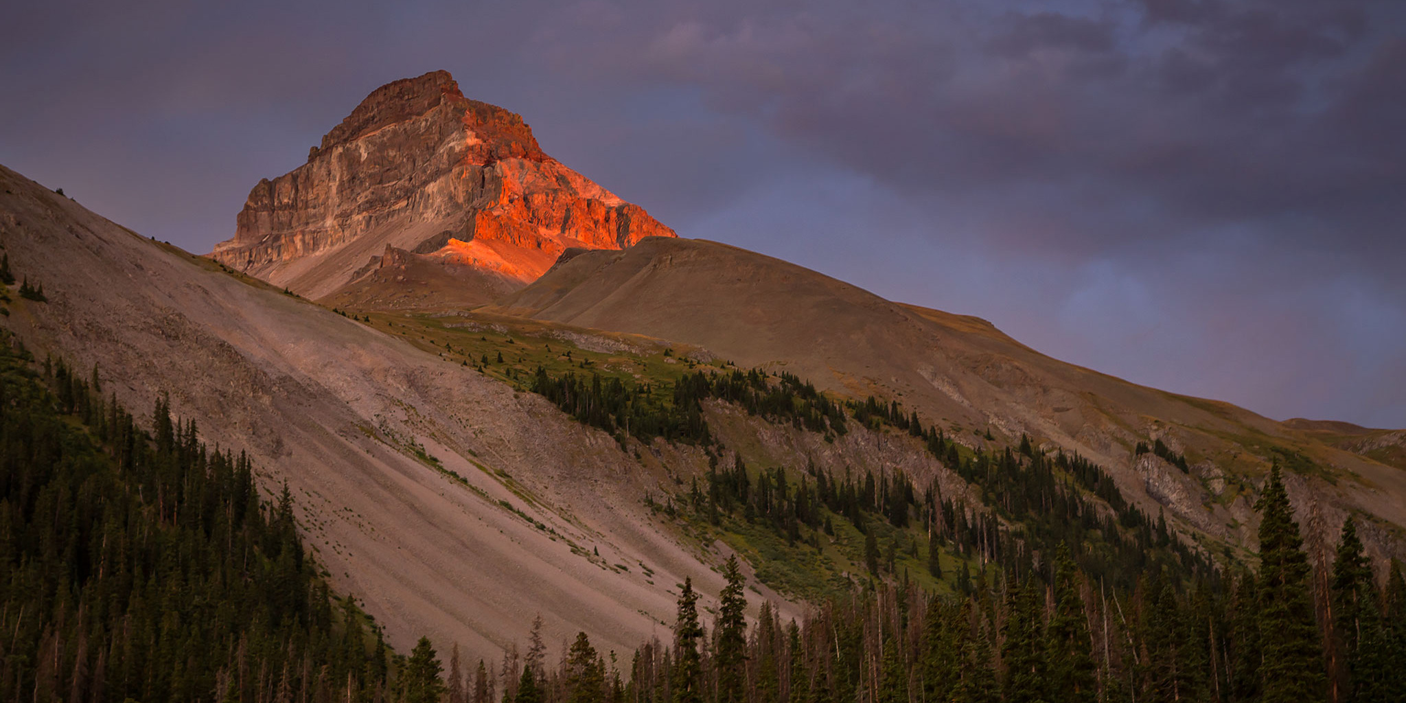
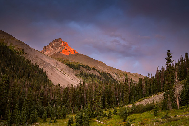
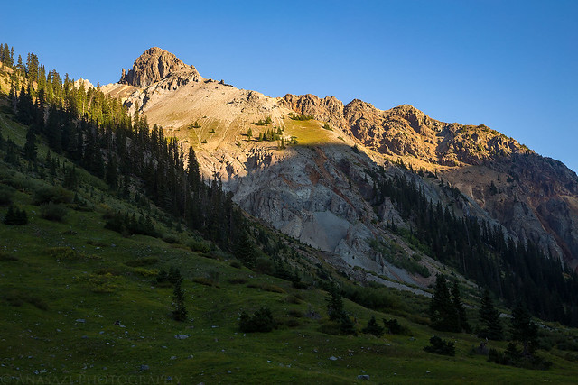
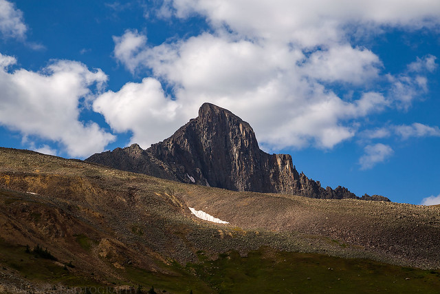
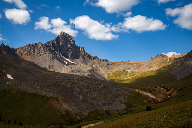
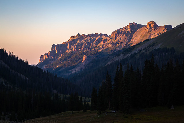
Sunset on Uncompahgre Peak from the East Fork of the Cimarron River.
Labor Day weekend was upon us again, which meant it was time for another backpacking trip into the Uncompahgre Wilderness! This would be our fourth year in a row backpacking into the northern valleys of the wilderness area, starting with our Wetterhorn Basin (West Fork) trip back in 2014, then continuing with trips into Big Blue Creek and Fall Creek. Earlier this summer we were also able to go on a quick overnighter along the Little Cimarron River to make up for our failed loop last year. With only two remaining major valleys left, we planned to combine the East Fork and the Middle Fork of the Cimarron River into a two night trip that I’ve called The Cimarron Loop.
We slept in a little later than usual on Saturday morning since we were up late for a concert on Friday evening. Once we were up we had some breakfast, finished loading the Jeep and then starting driving to the East Fork Trailhead. During the drive we noticed there was a lot of smoke in the air that was obstructing our views of the Grand Mesa. We hoped this wouldn’t be an issue all weekend and were relieved to find that the smoke wasn’t as bad when we reached the trailhead. I dropped Diane and our packs off at the trailhead and then drove over to the Middle Fork Trailhead where I would leave the Jeep so it would be waiting for us at the end of our hike. I had brought my mountain bike along to complete the shuttle back to the East Fork. Much of the ride back was downhill (about 1,000 feet descent in 5 miles) and easy, but the last mile and a half was mostly uphill, which slowed me down a bit. After returning to the trailhead I found a place to lock my bike up and then we shouldered our packs and started up the trail.
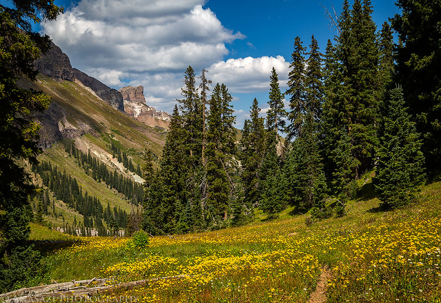
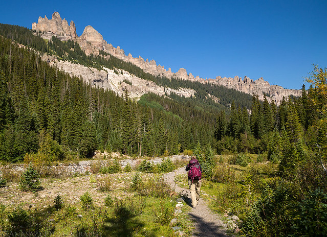
Beautiful views as we hiked along the East Fork of the Cimarron River.
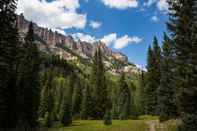
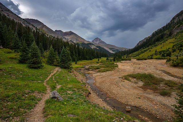
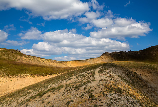
Pretty much the entire trail up the East Fork follows an old mining road, so it was easy hiking for the most part. We would end up hiking almost nine miles with around 1,700 feet of elevation gain on the first day so we could try to camp near treeline. Unfortunately, when we reached the area I had hoped to set up camp we found a huge hunters camp already there. We hiked back down the trail a little ways to find another spot to pitch our tent.
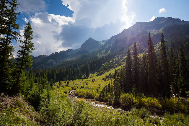
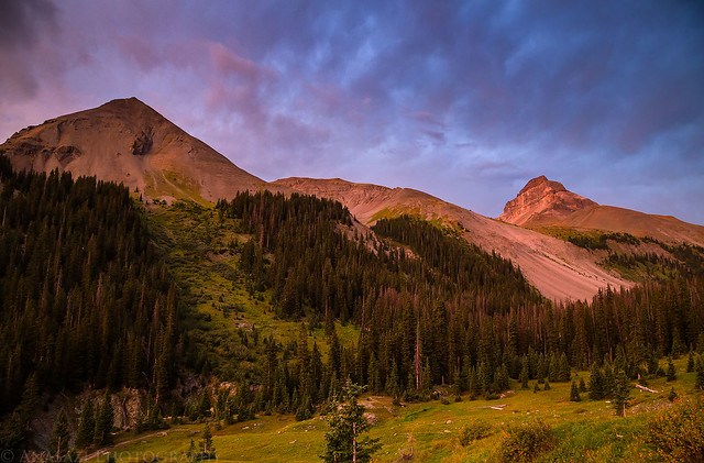
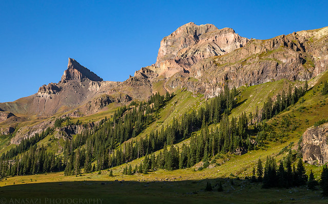
As we hiked further up the valley we were treated to nice views of Uncompahgre Peak (14,309) to our left. It’s been nice seeing this massive peak from all different angles over the years.
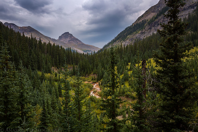
The partly-cloudy skies we had started hiking under had turned to mostly overcast. As we neared treeline we could start to hear rumbles of thunder, but we never saw any lightning and only had a few sprinkles of rain.
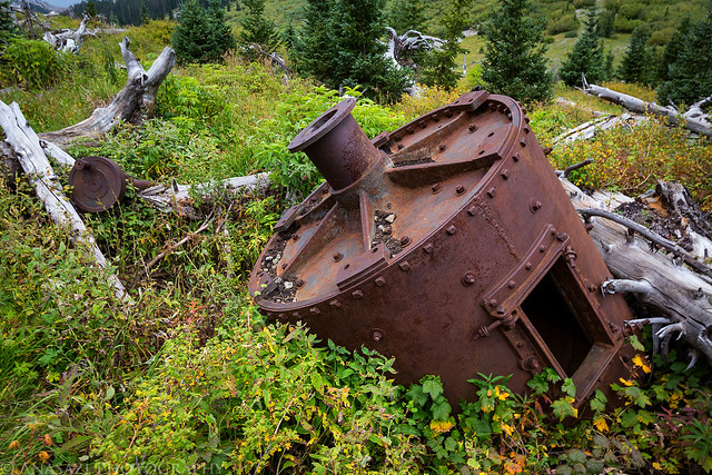
Remains of the Silver Jack Mine.
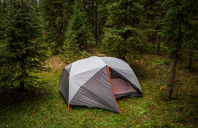
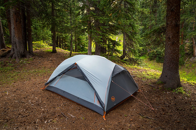
Our home for the night.
After our tent was set up we had a few snacks for dinner and then I hiked down the trail a short distance to a clearing in hopes of a decent sunset. To be honest, I looked at the sky and figured it was too cloudy for sunset and almost got in the tent to go to bed early. I’m glad I didn’t because the sun did manage to sneak thorough a small gap on the horizon that I couldn’t see.
Vibrant red light stikes the western face of Uncompahgre Peak.
Looking down the East Fork toward some colorful clouds. The smoke below the clouds was also turning pink.
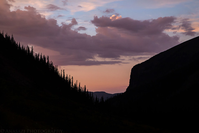
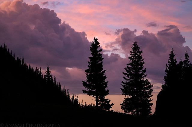
Sunset Silhouette
When the color was gone I hiked back to the tent and went right to bed. It had been a long day and I was pretty tired. Unfortunately, I found out pretty quickly that my sleeping pad had a leak and within the hour it was completely flat. It was dark out and I was tired, plus the ground wasn’t terribly uncomfortable, so I decided to make due and just sleep on the ground the rest of the night. It wasn’t my best night of sleep on a camping trip, but I got through it. The main issue I had was that I definitely slept much colder than usual without my insulated sleeping pad.
I poked my head out of the tent about thirty minutes before sunrise on Sunday morning and saw that there were no clouds in the sky, so I decided to skip getting up for sunrise and went back to sleep for a little while longer. After finally getting up we had a little breakfast, packed up our gear and continued hiking up the trail. We needed an early start today so we could try and get over the pass into the Middle Fork before any storms moved into the area since we didn’t want a repeat of last year.
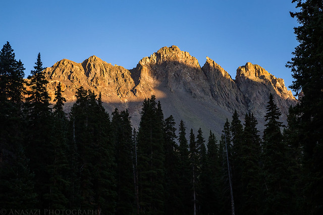
Sunrise in the East Fork.
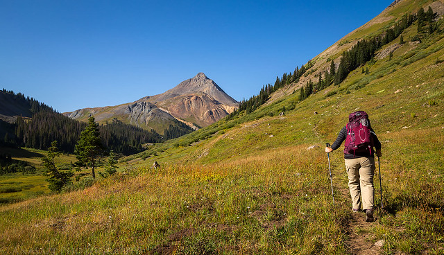
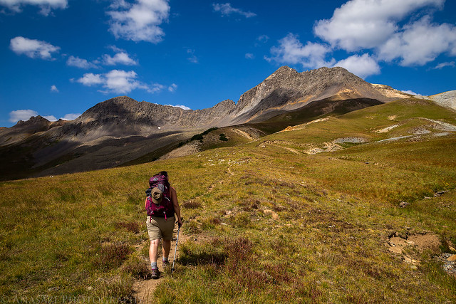
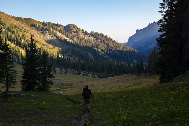
Diane starts hiking up the Middle Fork Trail towards Matterhorn Peak (13,590) in the distance.
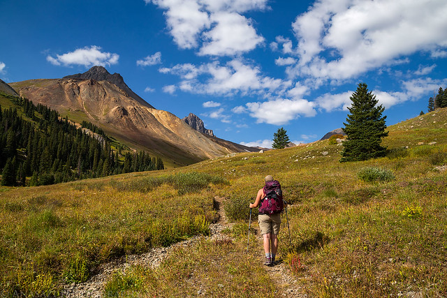
Climbing out of the East Fork on our way to Middle Fork Pass.
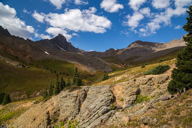
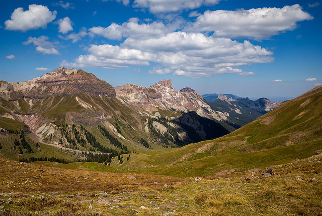
As we climbed up to Middle Fork Pass, which is just over 12,500 feet in elevation, we had great views of the upper basin including Matterhorn Peak, Wetterhorn Peak, Heisshorn and El Punto, though it was slow going with our heavy packs on.
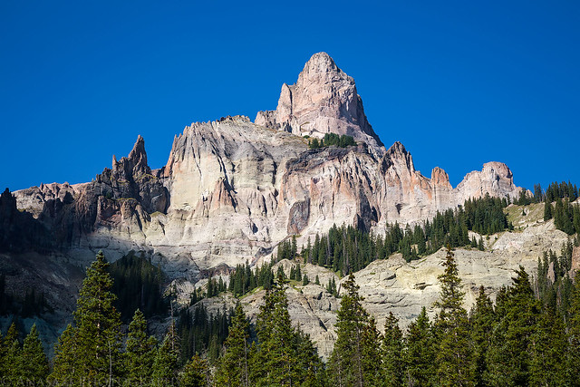
Wetterhorn Peak just barely coming into view to the right of Matterhorn.
Wetterhorn Peak (14,015)
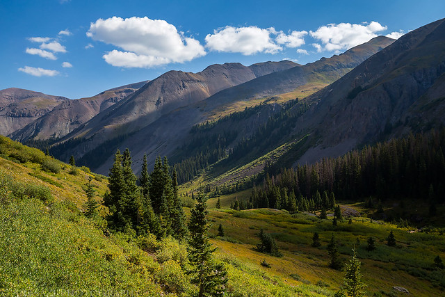
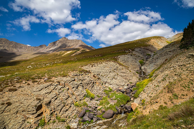
The upper basin of the East Fork.
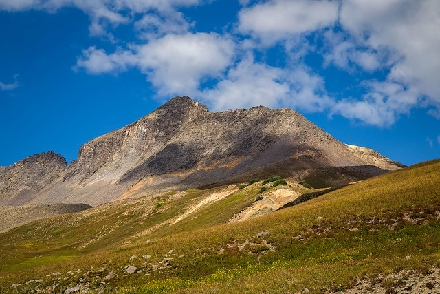
Heisshorn (13,411)
Climbing up the right side of this creek towards the pass.
Getting closer…
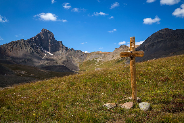
There were a few signs along the way so you knew you were on the right track.
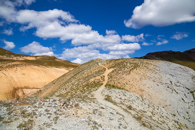
The trail to Middle Fork Pass.
Finally! That low spot left of center is the pass into the Middle Fork.
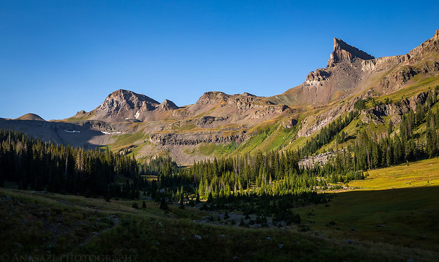
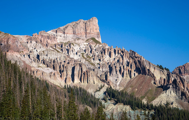
Once we reached the pass we had a great view down the Middle Fork including Coxcomb Peak, Redcliff and Precipice Peak.
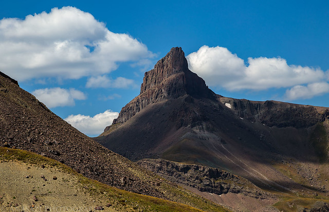
That’s Precipice Peak (13,144) right in the middle. I almost made it to the summit of that one a few years ago…
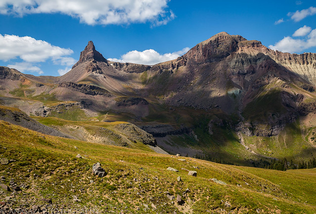
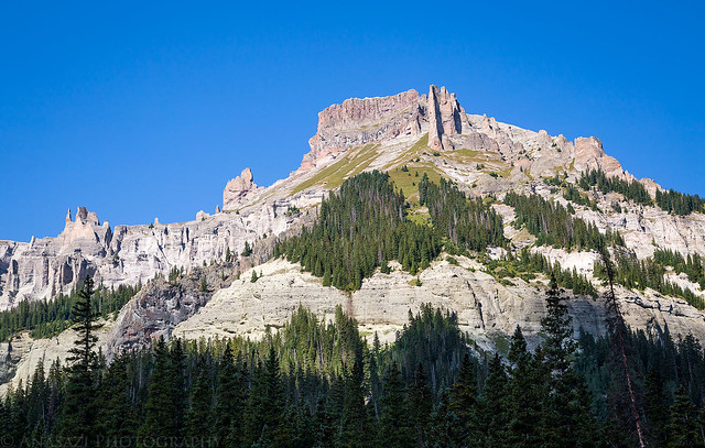
Coxcomb Peak (13,656)
Coxcomb and Redcliff (13,642) from the trail as we descended into the valley.
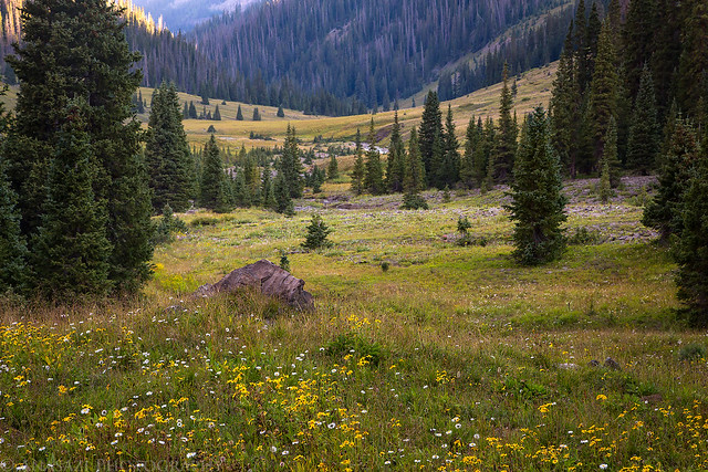
There were even some wildflowers still lingering around.
After hiking down from the pass for about a mile we found a great campsite just below Coxcomb Peak and Redcliff above the intersection with The Coxcomb Trail. After setting up camp Diane took a look at my sleeping pad and managed to find the hole and I was able to patch it so I wouldn’t have to sleep on the ground for a second night.
Our campsite in the Middle Fork.
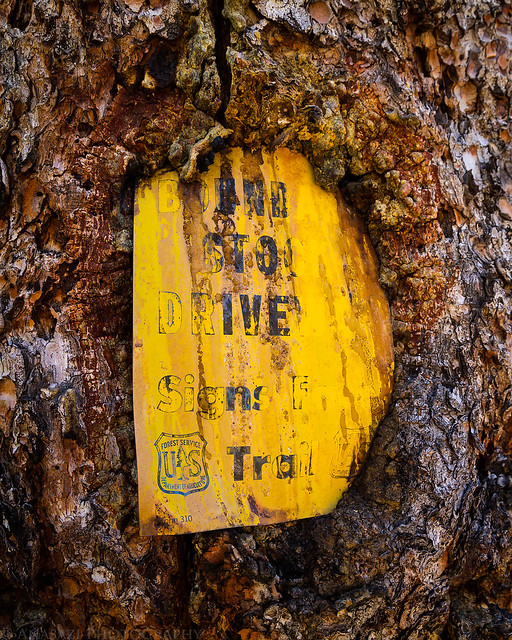
While we were filtering water from the nearby stream I noticed this old sign embedded in a tree. It looks like it says “Boundary Stock Driveway, Signs Face Trail”
Shortly before sunset I went on a short hike up The Coxcomb Trail and then returned to an overlook near camp to watch the sunset. All the nice clouds we had around during the late morning and early afternoon had disappeared, so it was a clear sky for sunset.
Sunset light on Heisshorn above camp.
An evening view down the Middle Fork from an overlook near camp.
After sunset we headed back to camp and went to bed. I slept much better this night with my sleeping pad, although it still must have another small leak because I did have to blow it up once in the middle of the night.
I guess it was a lazy weekend for me since I didn’t feel like getting up for sunrise again. We woke up shortly after, packed up camp and started hiking down the trail. Today would be the shortest and easiest hiking day since it was mostly downhill to the trailhead. However, we were surprised to find quite a bit of big deadfall over the trail between treeline and the Porphyry Basin Trail intersection that we had to climb over or find ways around. This part of the trail slowed us down. After the intersection the trail was maintained much better. Much of the trail was in the forest with limited views, but there were a few clearings where we got nice views of Precipice Peak and Dunsinane Mountain (12,742) above.
Leaving camp in the morning to hike down the Middle Fork.
Coxcomb Peak and PT13206 above the head of the basin. I caught a beautiful sunset from the summit of PT13206 during our trip into Wetterhorn Basin.
As we hiked further down the valley we were finally able to see the profile of Coxcomb Peak that gives it it’s name.
Hiking along the Middle Fork of the Cimarron River.

The unusual hoodoos below Precipice Peak kind of remind me of the Wheeler Geologic Area near Creede.
Right below Precipice Peak.
Dunsinane Mountain
Almost back to the Middle Fork Trailhead…
After returning to my Jeep at the trailhead we swung by and picked up my bike before heading back home. It was another great weekend in the Uncompahgre Wilderness!
We’re thinking about doing this hike in September or October this year when we get time. You mentioned having hunters in there with you, we’re there that many?
My wife is asking as she’s worried if there are too many in the valley that it might be unsafe to hike.
Thanks!
There was definitely a large hunters camp setup, but we never actually ran into any hunters. It may have been an outfitter staking their campsite for a group who was not there yet or something.
Randy
Do you have a preference on this loop as whether to star at the West Fork or East Fork Trailhead?
Alm considering doing a base camp for a couple of days for day hikes near the head of either the East Fork Valley or West Fork Valley. I plan to do a few day hikes for views. Probably won’t do any significant summits, just ridges for views. Which valley would you think has the better options for day hikes? Great pictures and thanks for your photo journals
Jim
We started at the East Fork and that seemed like a good direction to do the loop, but it probably doesn’t matter. I think I chose to do it that way to make the bike shuttle easier.
This particular trip combined the East Fork and the Middle Fork, and if I were to choose a basecamp I would go with the East Fork since there are more options for day hikes from there including Matterhorn, Wetterhorn, Uncompahgre, El Paso Creek, etc… Although, you could also day hike from the Middle Fork into Wetterhorn Basin which would be nice, too. Really can’t go wrong with either.
Silly question, but I’m trying to plan a trip with some friends who haven’t really backpacked before and am curious about total mileage? Might just do one fork as an out and back and do some day hikes, but curious about total mileage just in case they’re feeling frisky lol.
Great report and wonderful pics, thank you for posting!
According to the track from my GPS, it looks like this route is around 16-17 miles in length.