Friday – Saturday, July 28-29, 2017
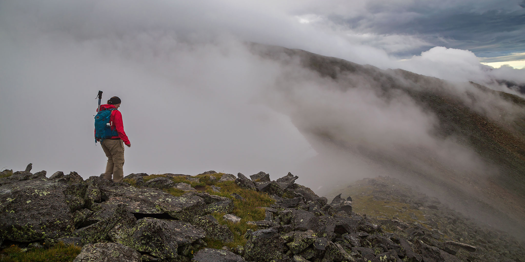
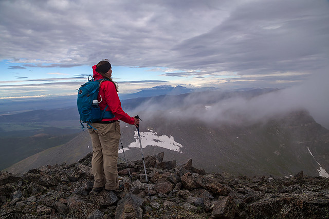
Diane hikes along the cloudy ridge on our way to the summit of Culebra Peak.
Last year after hiking my first 14er in the Sangre de Cristo Mountains I thought it would be nice to come back again this year for another one. After looking at my options earlier in the year I decided to try and get two permits to hike Culebra Peak (14,047) at the southern end of the range within Colorado. Culebra, which translates to serpent or snake in Spanish, is most likely named for the long snake-like ridge that leads up to its summit which is visible from the west. For those not familiar, Culebra Peak is the southernmost 14er in Colorado (only about 9 miles from the New Mexico border), the highest point in the Culebra Range, and is completely on private property which was originally part of a large Mexican Land Grant that dates back to 1844. This area of Colorado has a very unique and controversial history and I highly recommend that you check out this page on Summit Post to learn more about the timeline of this property. What pushed me over the edge to try for Culebra this year was the fact that the ranch it is located on has been for sale for a while and there is no guarantee the future owner of the property will continue to allow access. I figured that I’d like the opportunity to try and climb this peak now with it’s uncertain future.
Since Culebra is located on the Cielo Vista Ranch, the only way to climb it is to reserve spot on one of the few days during the summer that they allow climbers, and to pay the $150 fee per person. This year they only opened the peak up on seven weekends in June and July (Friday and Saturday only) for 20 people each day. I kept an eye on the calendar on their website in May until they finally opened up reservations and was the first one to grab two spots for the final day of the year on July 29th. They would be completely booked up in less than three days. It is my understating that the ranch currently has a contract signed and may be changing hands sooner rather than later. If the future owner does not allow access, we may be the last group who were allowed to climb this peak for a while.
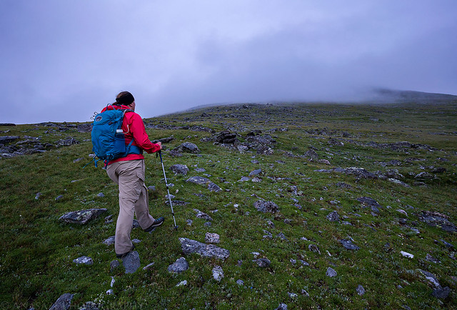
Diane near the top of the initial 1,300 foot climb to reach the ridge above our campsite, shortly before sunrise.
I worked a half day on Friday and when Diane got out of work a little while later we left for the Cielo Vista Ranch. After a late lunch in Gunnison we were driving along Cochetopa Creek on Highway 114 when I got a call from Ron at the ranch (I was actually surprised I had signal here). He told us that if we got to the ranch by 6:00pm, he would let us in so we could camp at the upper trailhead and get an early start to try and beat the weather on Saturday. Unfortunately, we were at least two and a half hours out and it was 4:00pm when he called. We tried to make it in time, but still only managed to get there by 6:30pm and assumed we missed our opportunity. We started to set up our tent near the front gate of the property (they have a small camping area there), but shortly before 7:00pm Ron came down to the gate and still let us go up to the upper trailhead. Luckily we hadn’t finished setting up the tent, so it was easy enough to quickly break back down and throw in the Jeep. After giving Ron our waivers and getting a little information on how things would work, we drove a little over six miles to the upper trailhead and found a flat enough spot to set up our tent. We visited with the three other people who had come up for the night including Mason, who was just starting a long trip where he plans to bike to and hike all of the 14ers in Colorado, and then went to bed early so we could get up for an alpine start on Saturday. Right after getting in the tent it started to rain, and would continue to rain steadily for the rest of the night. It finally stopped around 4:00am, which was when we were originally planning to start our hike. With all the rain we ended up pushing the start time back to about 4:45am.
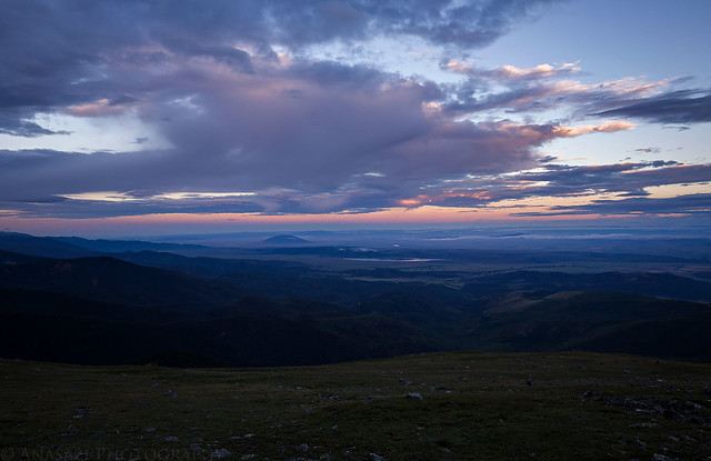
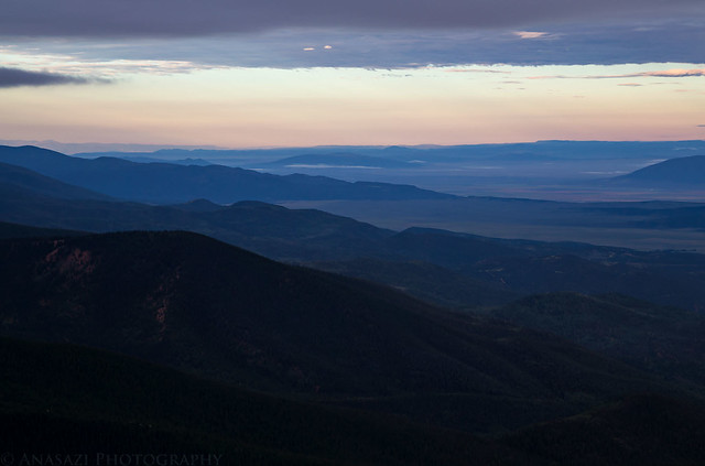
There was a little color in the clouds over the San Luis Valley at sunrise.
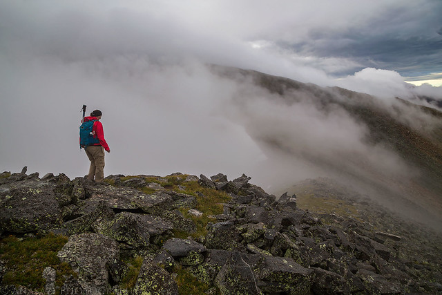
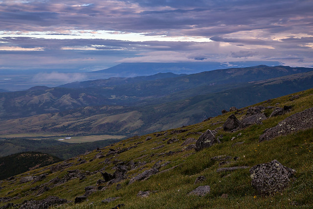
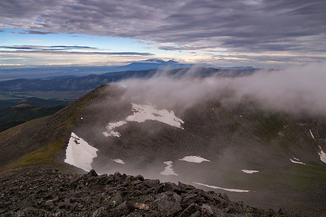
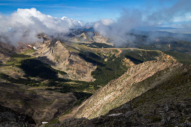
Leaving from the upper trailhead, it was a steady climb of around 1,300 feet to reach the main ridge which we would then follow the rest of the way to the summit. We arrived on top of the ridge shortly after the official sunrise, although the clouds clinging to the ridge and mountaintops blocked most of the light. From this point on we were in the clouds with limited views, but thankfully we were moving slowly because by the time we reached the summit most of the clouds had dissipated enough that we were able to get a nice view from the top.
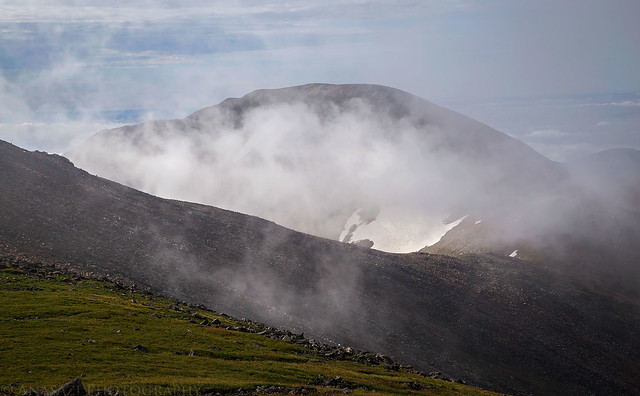
Looking north to the Blanca Massif hidden in the low clouds as we neared the top of the ridge.
The edge of the Culebra Range into New Mexico.
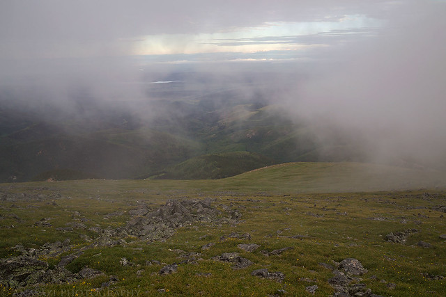
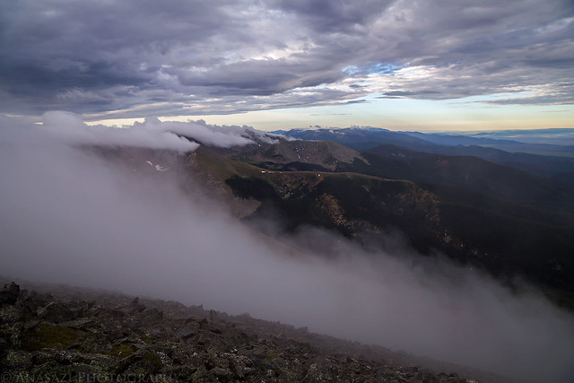
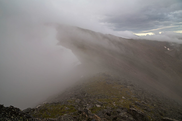
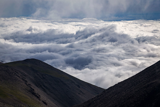
After sunrise the clouds were constantly moving and changing. Sometimes we would be socked in completely and then a few minutes later we would have great views of the surrounding area.
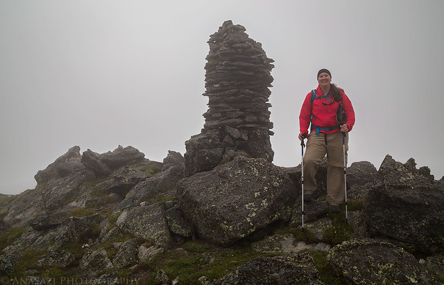
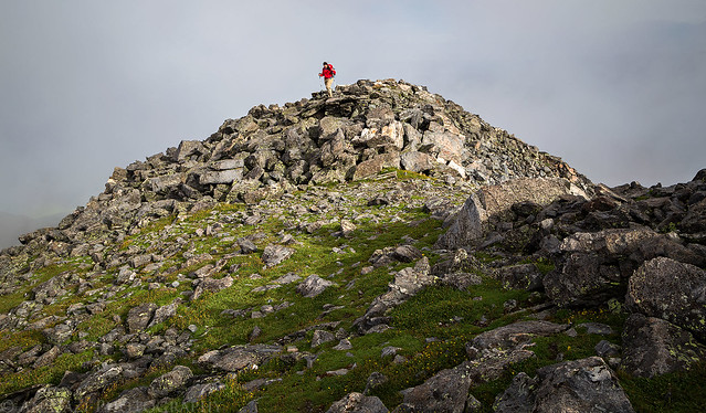
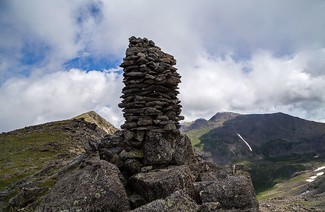
Diane stops to rest at the largest cairn I have ever seen when we finally reached the ridge.
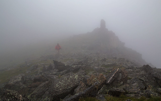
Leaving the cairn behind as we hike through the clouds along the ridge.
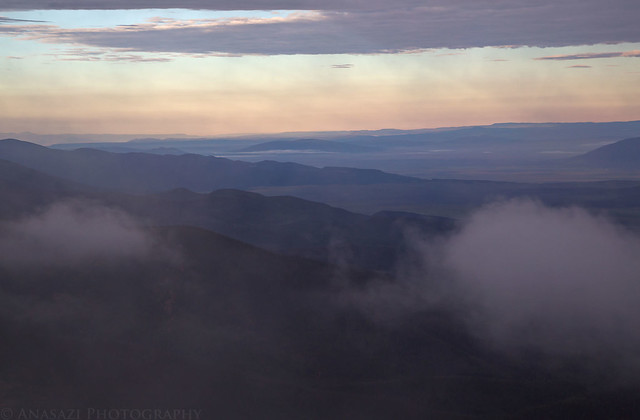
The constantly changing clouds certainly made for a surreal experience…
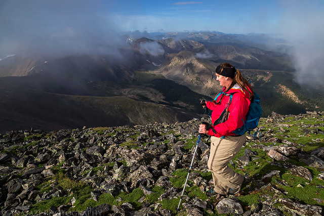
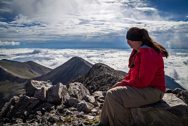
Diane enjoys the view along the ridge during one of the few times that Blanca Peak (14,345) and Mount Lindsey (14,042) are visible on the horizon in the distance.
Eventually a little sunlight would break through the clouds.
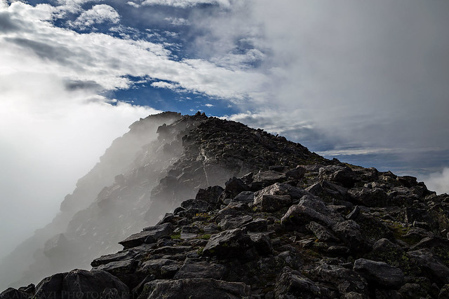
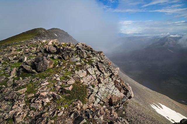
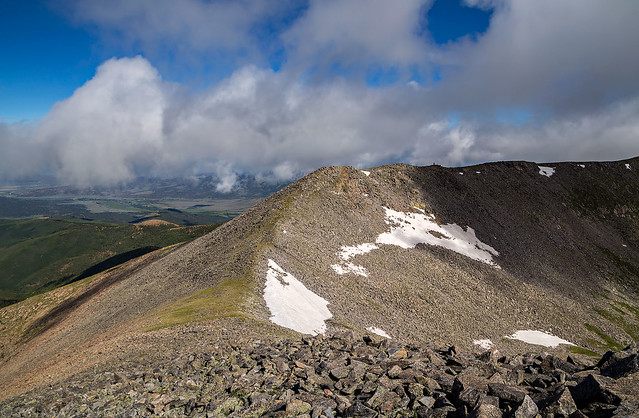
Following the rocky ridge to a false summit with our first glimpse of blue sky above.
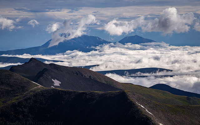
Our first view of Red Mountain (13,908) as the clouds around it cleared a little bit.
We finally reached the summit!
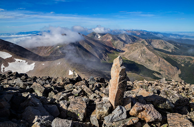
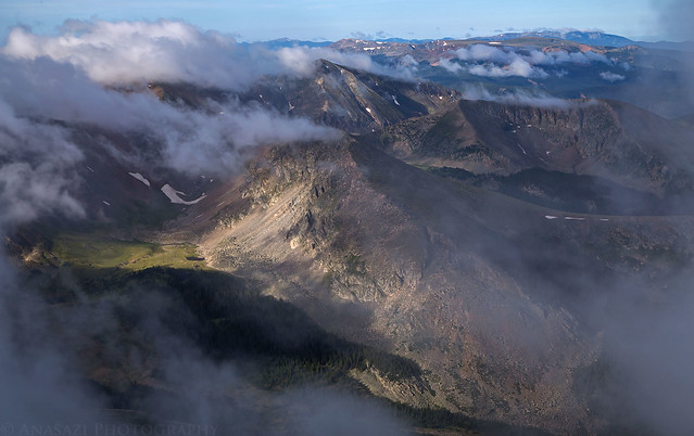
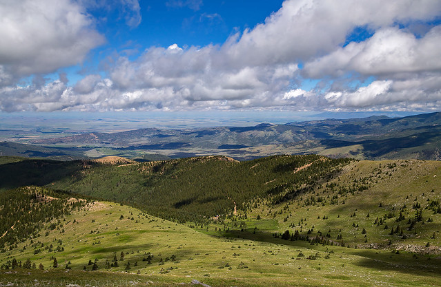
From the summit we were able to see that the valley on the other side of the range was filled with a sea of clouds.
A view toward the Spanish Peaks.
Resting on the summit and enjoying the view.
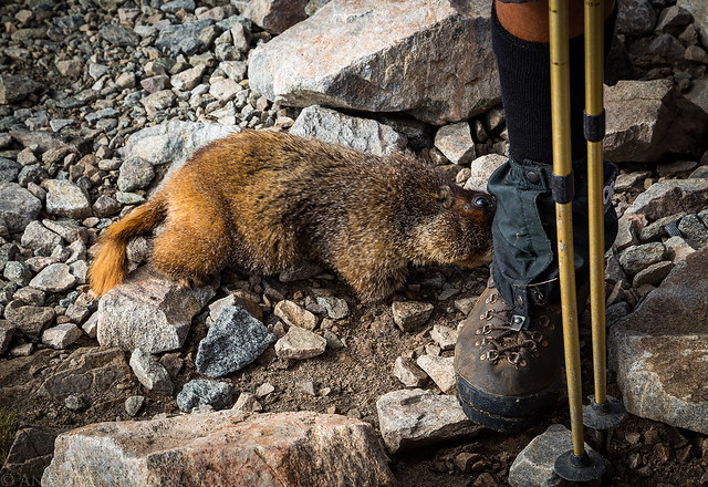
There was even a friendly marmot that joined us on the summit.
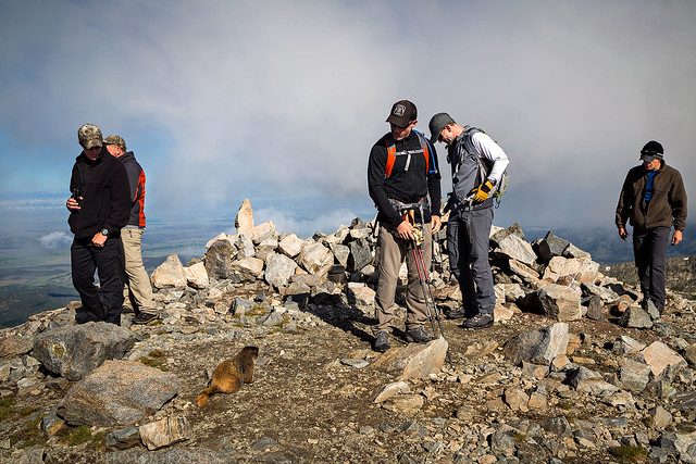
Maybe a little too friendly? He chewed on a fellow hikers boots while we were up there…
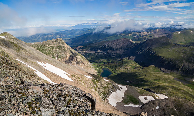
View from the summit over Carneros Lake.
Following the ridge back down from the summit.

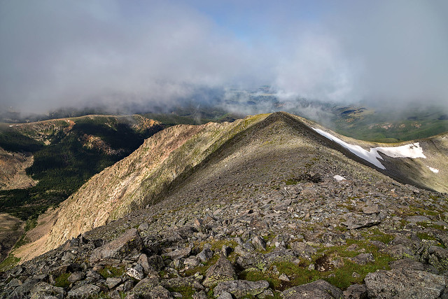
A nice cloudy view of the Culebra Range to the south.

Look closely on the distant ridge and you can barely see the large cairn we needed to return to. Yep, we had to drop down to that saddle and ascend another 150 feet on the way back.
Back at the cairn, but not in the clouds this time.
Hiking back down to the upper trailhead. If you look closely you can see the road and parking area where we spent the previous night and started the hike from.
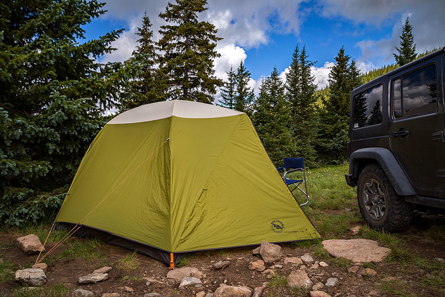
Just a photo of our campsite at the upper trailhead before taking down our tent since it was dark the evening before when we got it set up. At least the tent was completely dry now.
After returning to the trailhead and breaking down our tent it was time to start the drive back home. Of course, we wouldn’t be going straight home today since I planned to visit the Wheeler Geologic Area on our way back and spend the night there.
Have you thought about leaving a map of your hikes? In reading all of the places you go, I wish I could see the route you took etc. The photos are all so amazing and the information you write is very helpful and interesting!
Hi Michelle, thanks for the comment. I do sometimes include a map with GPS track at the bottom of some of my trip reports, but I don’t always do that depending on the hike. For example, I didn’t bother with this one since it’s on private property and there is already a map of this hike on the popular 14ers.com website. Also, I obviously don’t post maps and GPS info for hikes where I visit sensitive sites like ruins and rock art.