Press "Enter" to skip to content

Tag: google map

The Cimarron Loop

East Fork & Middle Fork of The Cimarron River
Labor Day Weekend | Saturday – Monday, September 2-4, 2017

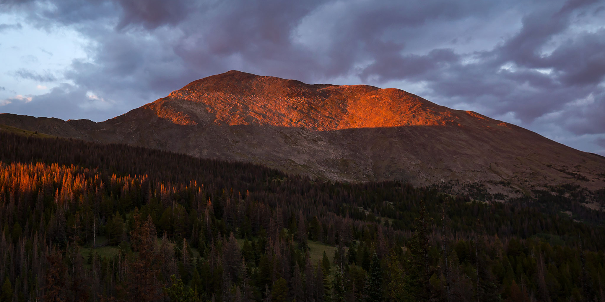
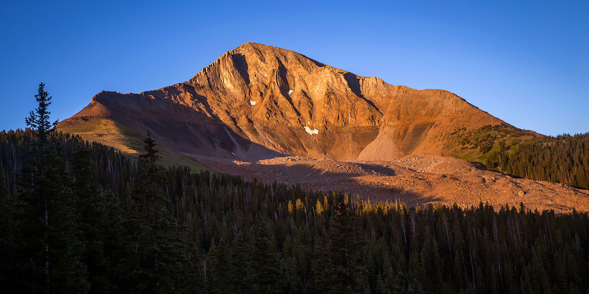
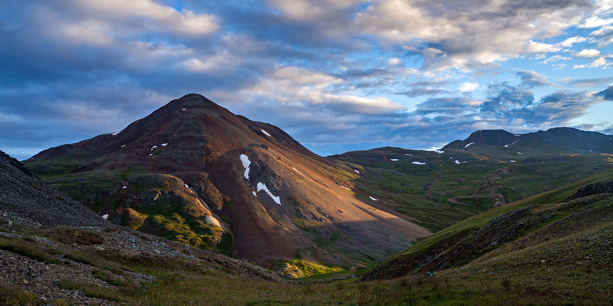
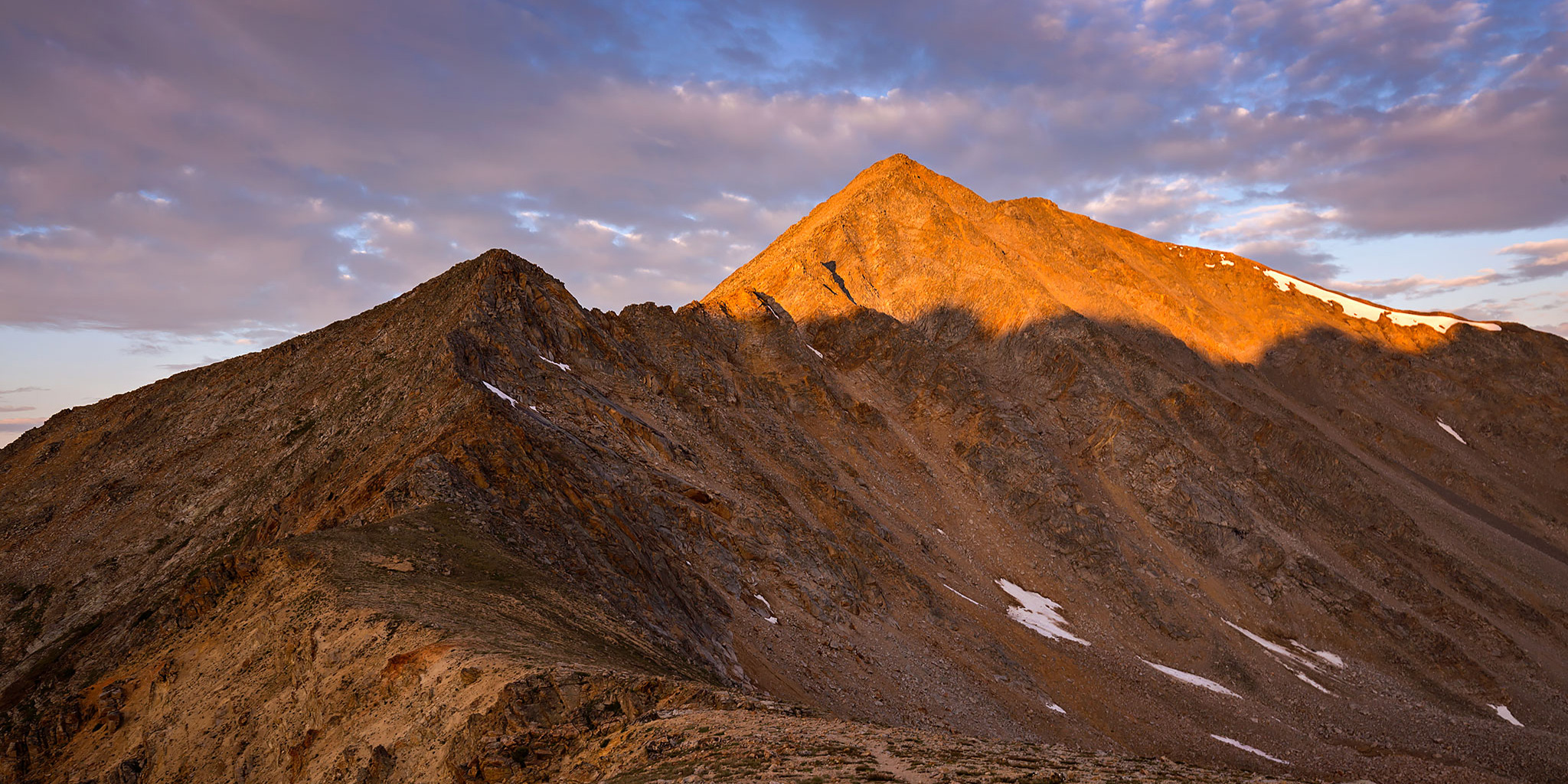
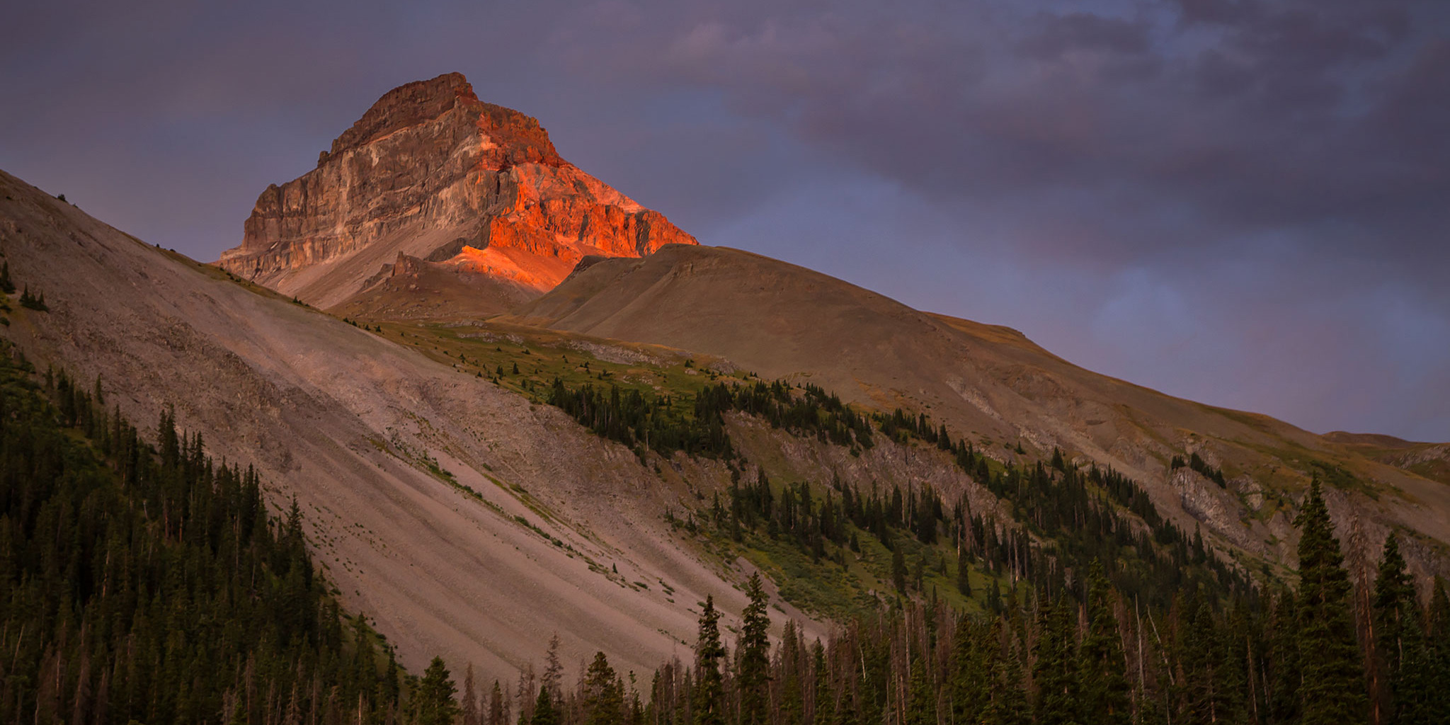
Labor Day weekend was upon us again, which meant it was time for another backpacking trip into the Uncompahgre Wilderness! This would be our fourth year in a row backpacking into the northern valleys of the wilderness area, starting with our Wetterhorn Basin (West Fork) trip back in 2014, then continuing with trips into Big Blue Creek and Fall Creek. Earlier this summer we were also able to go on a quick overnighter along the Little Cimarron River to make up for our failed loop last year. With only two remaining major valleys left, we planned to combine the East Fork and the Middle Fork of the Cimarron River into a two night trip that I’ve called The Cimarron Loop.

6 Comments

Mount Ouray & Old Chipeta Mountain

Friday & Saturday, August 25-26, 2017

After climbing my first two 13ers of the year last month and realizing that I really haven’t climbed any high Colorado 13ers yet, I thought it would be a good idea to get one in this summer. Since Mount Ouray (13,971) has been high on my list of peaks to hike for a while, I thought it would be a good one to go for this weekend. Mount Ouray is located at the very southern end of the Sawatch Range just off the Continental Divide and is the 5th highest 13er in the state, being just 29 feet short of 14,000 feet. I had actually wanted to climb this peak last year during my fall trip, but I didn’t end up making it there.

2 Comments

Lone Cone: Westernmost Peak of the San Juans

Saturday & Sunday, August 12-13, 2017

For years I’ve explored southwestern Colorado and southeastern Utah and during that time I’ve seen Lone Cone (12,613) on the horizon from all different angles. It’s the westernmost peak in the San Juan Mountains and is easily identified from a hundred miles away. During that time I’ve always thought to myself that I really should make time to climb that peak one day. Well, that day has finally come…

Leave a Comment

Mineral Point Peaks

Friday & Saturday, August 11-12, 2017

This weekend I headed down to the San Juan Mountains by myself to hike to the summit of a few mountains above the ghost town of Animas Forks near Mineral Point. I left after work on Friday afternoon and after a quick dinner in Montrose I drove over Red Mountain Pass to Silverton. From there I followed the Animas River to the base of Denver Hill (12,300) so I could go on a late evening hike to its summit. It was a short hike to the top, but it offered me some nice views of the surrounding mountains including Houghton Mountain (13,052), Seigal Mountain (13,274), Tuttle Mountain (13,203), Animas Forks Mountain (13,722), and Engineer Mountain (13,218). After hiking across the rolling tundra I reached PT 12340 which gave me a good overview of Mineral Point below and I caught a nice sunset on my way back to the Jeep.

Leave a Comment

La Plata Peak via the Southwest Ridge

Southwest Ridge | Saturday & Sunday, August 5-6, 2017

Last fall during my drive to the trailhead for Mount Elbert (14,433), I got a nice view of La Plata Peak as I was descending Independence Pass shortly before sunset and thought to myself that I should make time to climb that peak soon. That thought has stuck around in the back of my mind for the last year and I finally decided to make it happen this weekend since I had good luck with Culebra Peak (14,047) last weekend.

2 Comments