Canyons of the Black Ridge Wilderness
Tuesday, April 28, 2020
The ledge varies in width, 10 to 20 feet at the wider places, less than 30 inches at the narrowest. Yet this precarious shelf is a well-traveled road… Over the High Trail, great bands of sheep, herds of white-faced cattle, packers and camp movers, with their strings of loaded pack horses, pass on their migrations between the Black Ridge country and the lowlands along the Colorado River.
-Will C. Minor
This evening after work I headed back into the Black Ridge Canyons Wilderness in search of a historic route known as the High Trail which is located in upper Flume Creek Canyon. After visiting Will Minor Arch on a bench above Mee Canyon last weekend I was interested to find out more about who Will Minor was, so I did a little searching to see what I could dig up. I didn’t find much information online, but I did come across this article from the Daily Sentinel written by Bob Silbernagel in 2013. My interest was very piqued as I read about the High Trail and I knew instantly that I had to go looking for this route! Using the two photos from the article as reference and Google Earth, I was quickly able to figure out what I thought was the location of the trail in upper Flume Creek Canyon, and I wanted to get out there as quickly as I could to find out if I was correct!
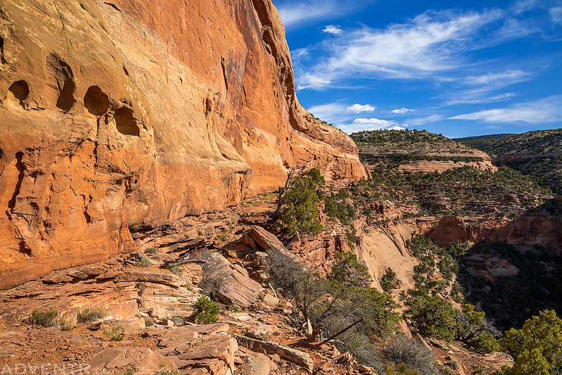
Entering the Black Ridge Canyons Wilderness in Flume Creek Canyon.
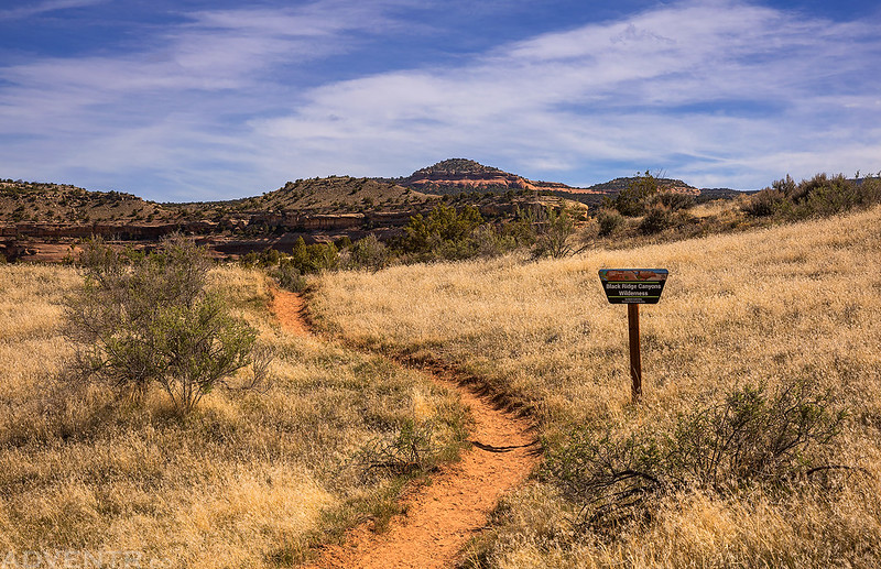
Although I typically don’t try to go on a hike this long in the evening after work, I was really interested in finding the High Trail and figured I’d be able to squeeze it in before dark if I kept my pace up. I left right after work and drove over to the Pollock Bench Trailhead to start the hike. Since the trails around the Grand Valley have been pretty busy lately, I was expecting to find a lot of vehicles at the trailhead, but I was pleasantly surprised to find only a couple parked at the trailhead. I quickly started hiking up the Flume Creek Trail and pushed myself a bit to make sure I would have enough time before sunset, even if it was pretty warm out this afternoon.
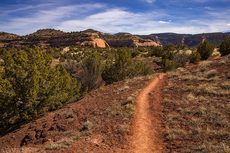
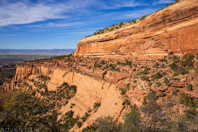
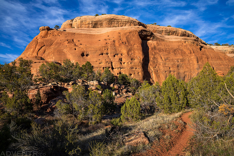
Following the Flume Creek Trail into the upper canyon.
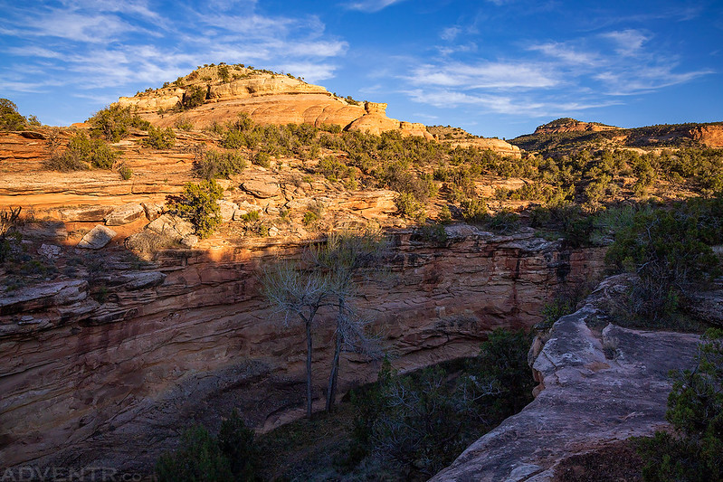
I followed the trail along the rim of the inner slot canyon and had some nice views over the narrow canyon below.

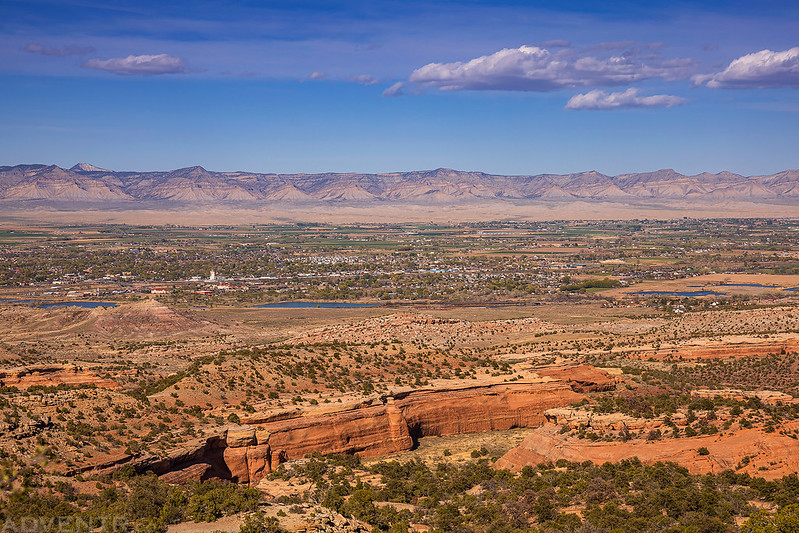
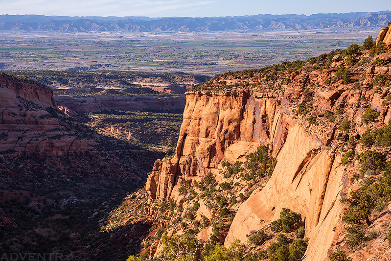
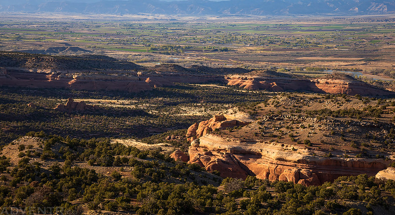
A look back over the Grand Valley as I climbed higher in search of the High Trail.
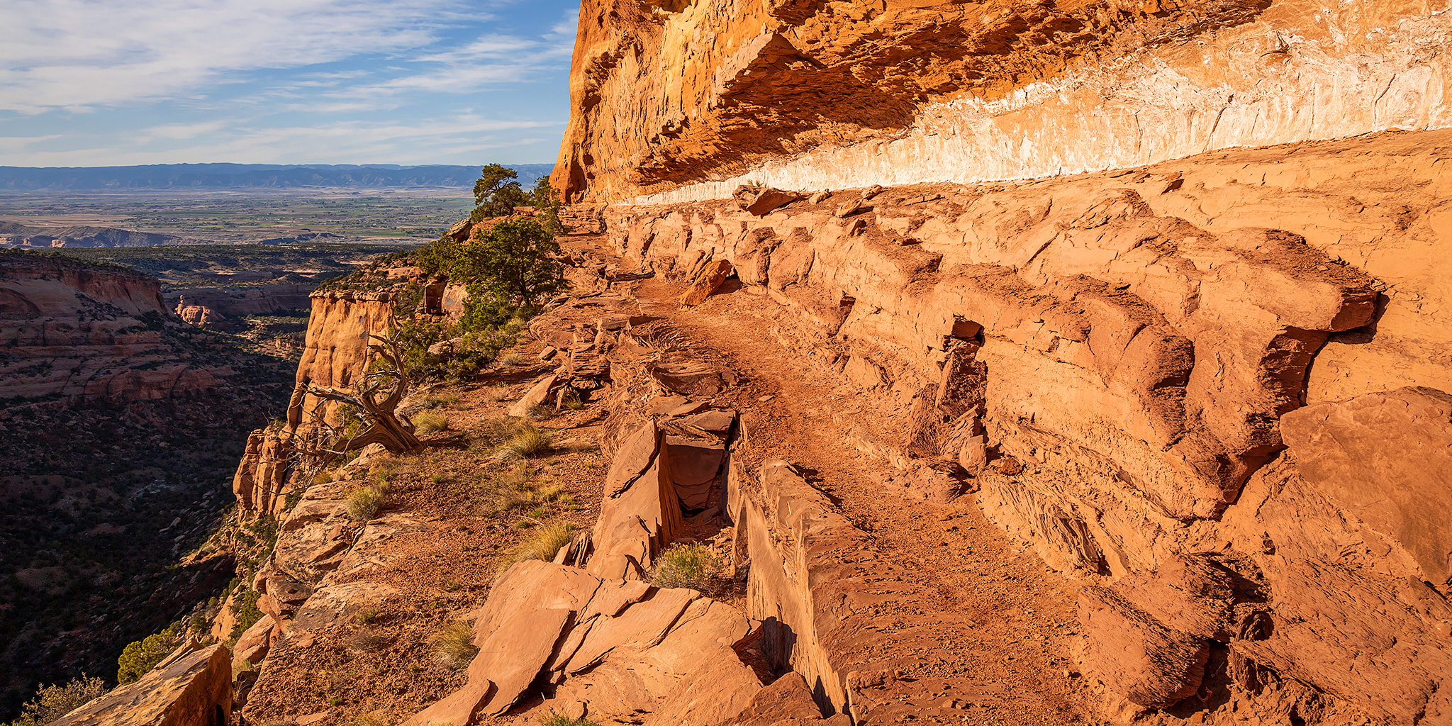
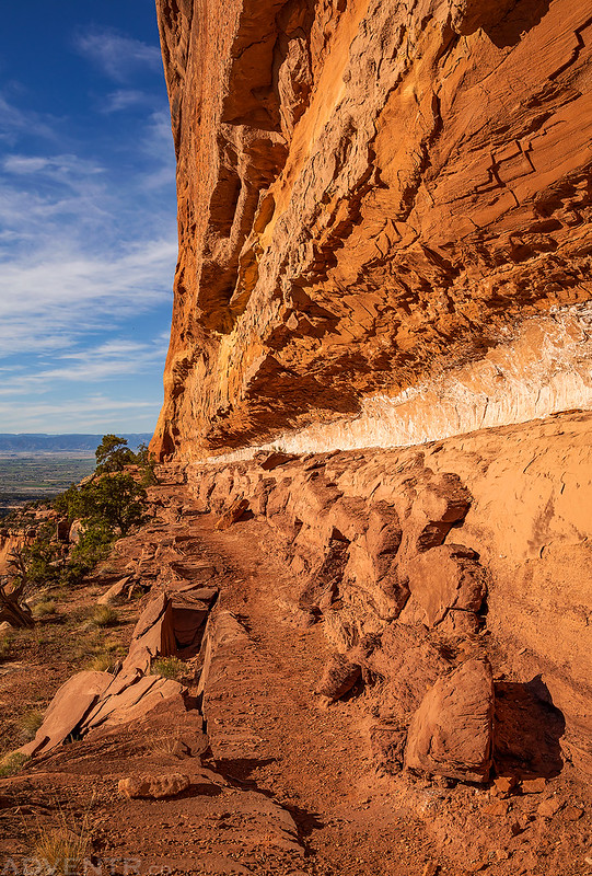
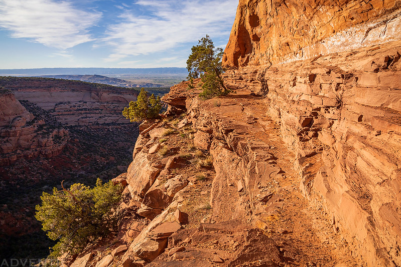
I was pretty excited when I reached the beginning of the ledge that makes up the best part of the High Trail. My research had paid off!
Looking back as I crossed one of the narrowest sections of the High Trail.

The view below into Flume Creek Canyon wasn’t bad, either.

Walking The Ledge

After I finished crossing the ledge, I continued along the trail and came to a nice overlook of the ledge I had just crossed.
Right before crossing another little pass, I found an old campsite and this hammer was among the historic relics scattered about.

Shortly beyond the old campsite the trail seemed to disappear and I decided this would be a good place to stop and turn around this evening. From my stopping point it looked like it would be easy enough to finish climbing to the top of the mesa below Black Ridge if you desired to continue on a longer route.

Since it took me less than two hours to get up to the top, I took my time hiking back down.

Over The Edge
On my way back across the ledge the late evening light was pretty intense and vibrant on the sandstone.
I really enjoyed hiking across the high ledge. This was a fun and scenic part of the trail.

One last look at the narrowest part of the trail on the ledge.
After leaving the ledge behind, I started heading back down into Flume Creek Canyon.

Overlooking lower Flume Creek Canyon as I made my descent.
I soon found myself on one of the main trails down in the canyon.
The sandstone benches were looking nice in the golden light before sunset.

Flume Creek Canyon in the shadows.
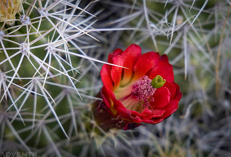
Hey! I finally found my first Claret Cup of the season on the way back down, too!
I returned to my Jeep at the trailhead shortly before sunset and ended up hiking just under 10 miles with about 1,000 feet of elevation gain. It was definitely not a bad way to get in some exercise after work on a scenic and historic trail of the Grand Valley!
Thanks for posting about this! I have an old book that mentions the “high trail” that ranchers would take their sheep herds across…this has got to the same one!
Thanks for this post. This is a trail I’ve wondered about for awhile. Also, thanks for not posting too many details.