Saturday, June 13, 2015
This morning I drove down to Ouray so I could try and climb my first mountain summit of the year. After this weekend I’m going to be pretty busy for the rest of June and I didn’t want to wait until July to get into the mountains for the first time this year. Since I’m not in the best shape right now and the weather forecast was predicting that storms would move into the area late in the morning, I decided to hike to the top of Twin Peaks (10,798 feet), a famous Ouray landmark. There are currently two trails that will get you to the summit- a new trail and an old trail. The reason for this is because in the early 1980’s the Old Twin Peaks Trail was washed out by a major storm. To replace the old trail, a new connector from the Oak Creek Trail was built to bypass the washed out section. This trail is now known as the New Twin Peaks Trail. In 2004 the Ouray Trails Group reconstructed the old trail which now consists of over 300 steps and 1,300 feet of elevation gain within 1.2 miles. Apparently, the Forest Service won’t officially sanction the reconstructed trail because they consider it too steep, but it is back on the maps.
I left home bright and early in the morning and started hiking up the Old Twin Peaks Trail just before 7:00am. Since this trail is shorter and steeper, I decided to take it up to the top and then return via the New Trail. This is a lower elevation hike, so much of it was spent in the trees with limited views until I reached the final ridge to the top. It took me about 2.5 hours to climb about 3,000 feet to the top. As soon as I stepped on the summit of Twin Peaks I heard the first rumble of thunder for the day in the distance. I took a few photos from the top and didn’t stick around on the summit too long. The hike back down the New Trail was a little bit longer and uneventful, aside from the crossing of Oak Creek. There were more clearings and better views on this trail and it took me another 2.5 hours to reach my Jeep. I never saw anyone else on the trail until I was almost back to the trailhead, where I ran into two people who were out walking their dogs.
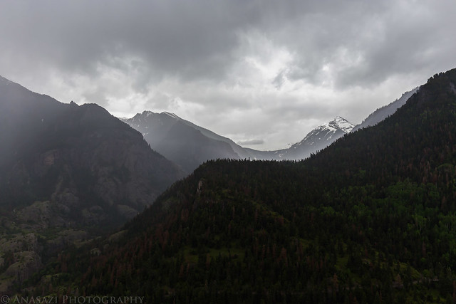
A view of Corbett Peak and Whitehouse Mountain coming out of the clouds as I drove into Ridgway.
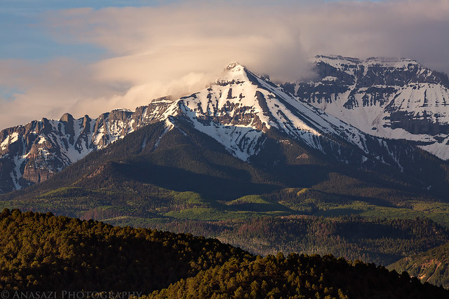
Corbett Peak by Randy Langstraat, on Flickr
There were warning signs at the bottom and top of the Old Trail, but I didn’t find this section any more difficult than the rest of the trail to the top of Twin Peaks. Maybe I’m just used to steep and loose climbs?
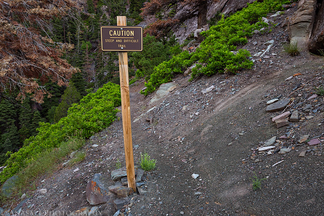
Caution by Randy Langstraat, on Flickr
There were a few sections of these stairs which were built when the trail was reconstructed.
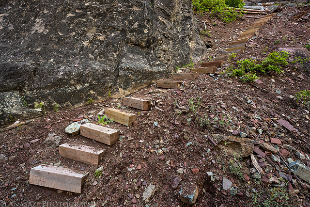
Stairs by Randy Langstraat, on Flickr
A view of Hayden Mountain and Mount Abrams from the trail.
Hayden Mountain by Randy Langstraat, on Flickr
Shortly after passing the intersection with the New Trail there was a clearing with a view of the next ridge I would be climbing.
Clearing by Randy Langstraat, on Flickr
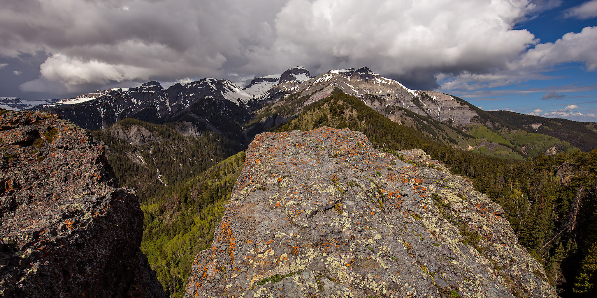
Following the last ridge to the summit after passing Sister Peak.
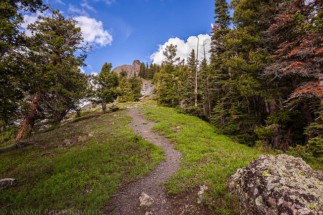
Final Climb by Randy Langstraat, on Flickr
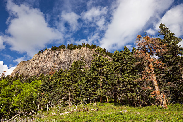
Almost to the top. I would be climbing to the rocky summit in the upper left of this photo.
Rocky Top by Randy Langstraat, on Flickr
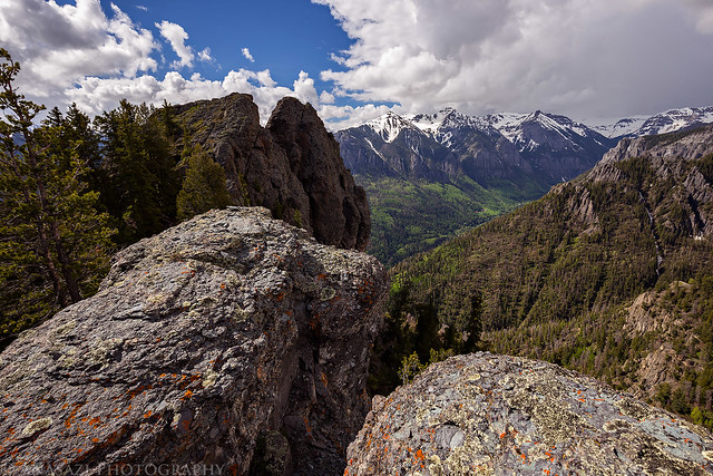
View from the summit towards Whitehouse Mountain and Potosi Peak. It’s funny, as soon as I stepped on the summit I heard my first rumble of thunder for the day, so I didn’t stick around too long.
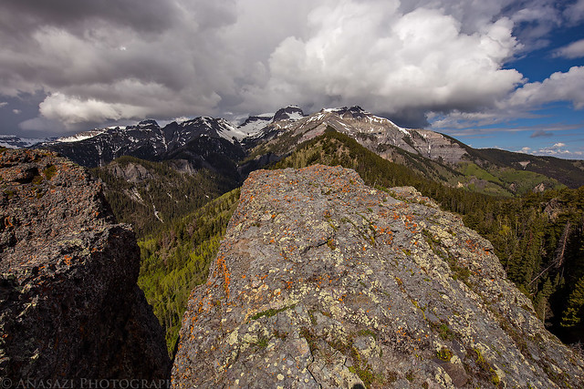
Twin Peaks Summit by Randy Langstraat, on Flickr
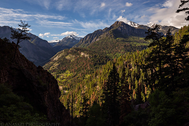
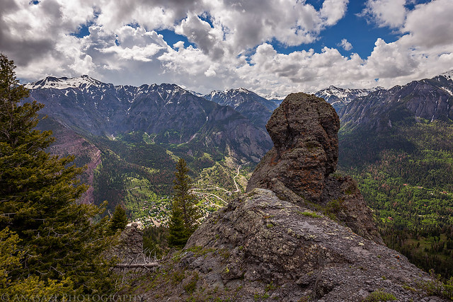
Looking down the Uncompahgre Valley from the summit. If you look closely, you can see the faint outline of the Grand Mesa in the distance.
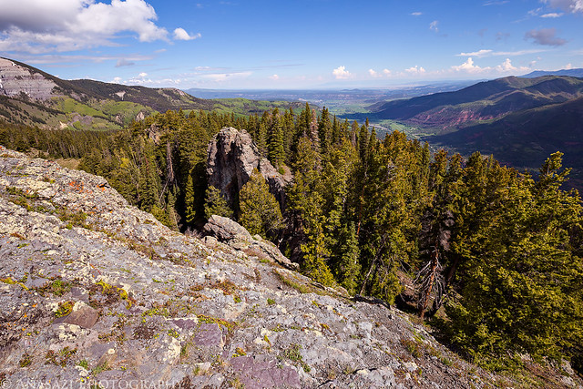
Uncompahgre Valley by Randy Langstraat, on Flickr
Storm clouds moving in as I started the descent.
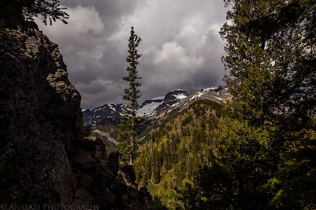
Storm Clouds by Randy Langstraat, on Flickr
Looking down on Ouray as I hiked back.
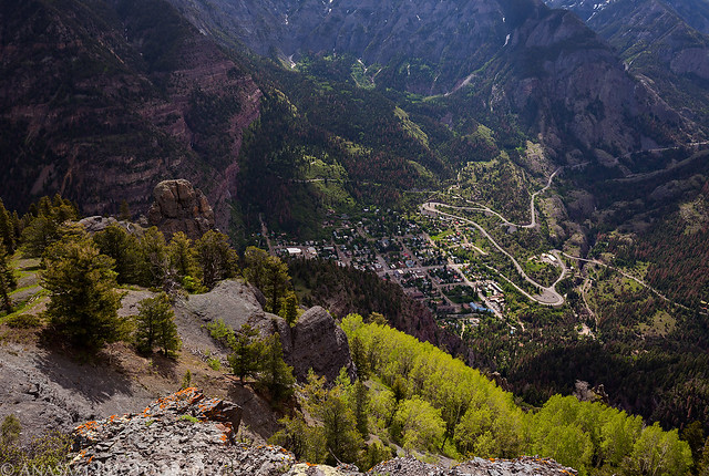
Ouray by Randy Langstraat, on Flickr
I stopped for a quick photo of Sister Peak (10,282 feet) on the way down.
Sister Peak by Randy Langstraat, on Flickr
There were a few fallen trees across the trail that I had to bypass.
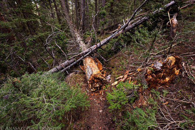
Fallen Tree by Randy Langstraat, on Flickr
I passed these old cabin ruins near the old Speedwell Mine shaft.
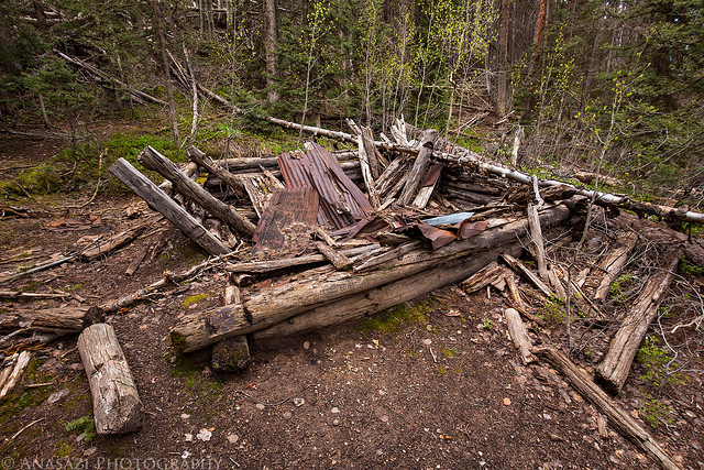
Cabin Ruins by Randy Langstraat, on Flickr
Lush green trail.
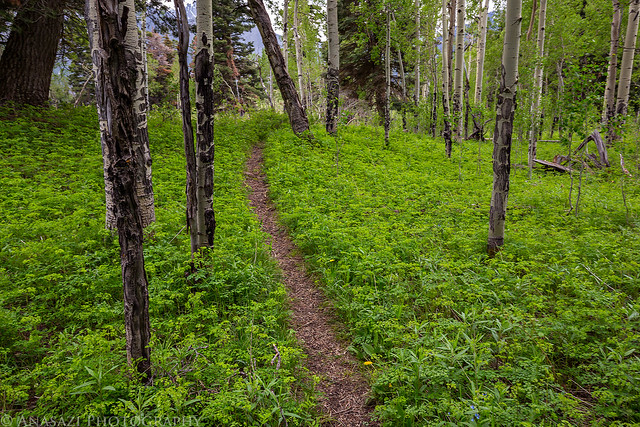
Green Trail by Randy Langstraat, on Flickr
Since I decided to take the New Twin Peaks Trail back, I had to cross Oak Creek. I figured that since this is a popular trail closer to town that it would be an easy crossing, even this early in the season. I was wrong. The water was high and moving pretty fast and I could find no way to cross without getting wet, so I took off my shoes and socks and rolled up my pants to cross. The water was pretty cold!
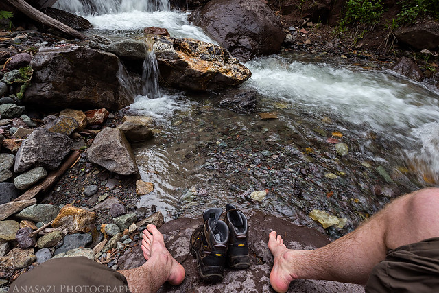
Creek Crossing by Randy Langstraat, on Flickr
A small waterfall in Oak Creek near the crossing. Right after I took this photo lightning, thunder and rain finally started.
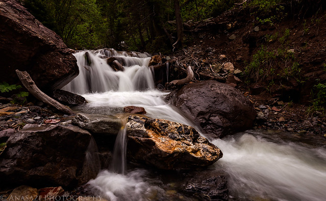
Oak Creek by Randy Langstraat, on Flickr
Rain in the distance as I hiked down the Oak Creek Trail.
Rain by Randy Langstraat, on Flickr
Since I wasn’t able to find much information about this hike online when I was researching it, I’ve added the Google Map below with my GPS track.
Looks like a lot of fun. I enjoyed reading this.