Saturday & Sunday, June 23-24, 2012
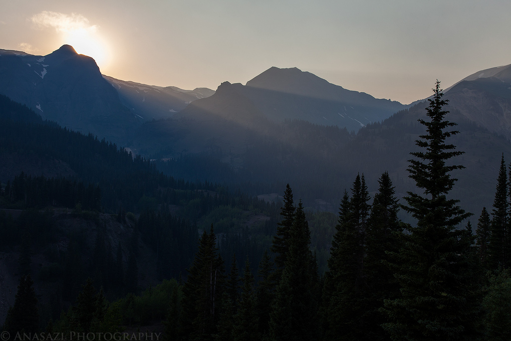
After spending a few hours in the morning at the Shavano Valley Petroglyph Park near Montrose, we continued driving into the San Juan Mountains to get out of the heat for the weekend. Shortly after crossing over Red Mountain Pass we turned down the road along the South Fork of Mineral Creek and found a campsite for the weekend. After setting up our camp we drove through Silverton and made our way up Cunningham Gulch to the trailhead for the Highland Mary Lakes. As soon as we passed through Silverton the valley started filling up with smoke, and by the time we reached the Cunningham Trailhead the smoke had become pretty thick and there was even a little ash falling from the sky. We would later learn this smoke was from a wildfire that had started near Mancos.
A view of the smoke in Cunningham Gulch from the trailhead.
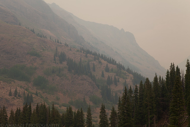
Smoke in the Gulch by IntrepidXJ, on Flickr
Entering the Weminuche Wilderness.
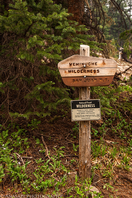
Weminuche Wilderness by IntrepidXJ, on Flickr
Smoke fills the sky with a view of the trail below through some pine trees.
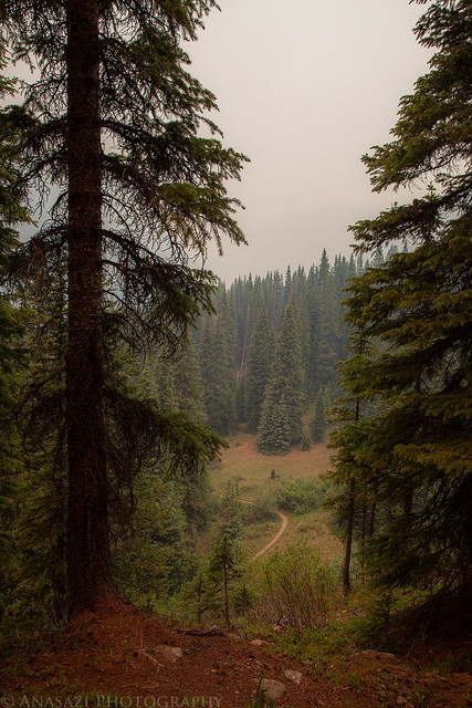
Trail Below, Smoke Above by IntrepidXJ, on Flickr
Unfortunately the smoke in the air was making it a bit difficult to breath and bothering Amanda pretty bad, so she had to stop and head back down to the trail. I continued up just a little further before turning around and joining her again. The Highland Mary Lakes will have to wait for another day…with all the smoke in the air I wouldn’t have been able to take any good photos anyway.
I came across this cool waterfall along the trail before turning around.
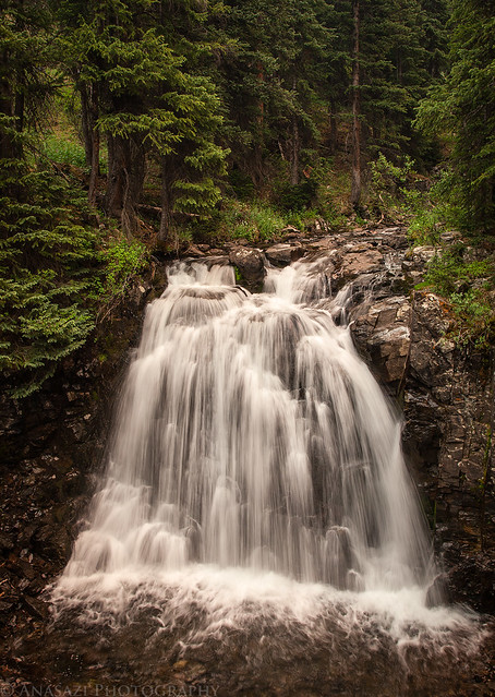
Cunningham Creek Waterfall by IntrepidXJ, on Flickr
Another small cascade of the creek.
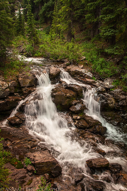
Small Twin Falls by IntrepidXJ, on Flickr
Since our planned hike for the day was now cancelled, we decided to drive up to Stony Pass to see if we could get up above the smoke.
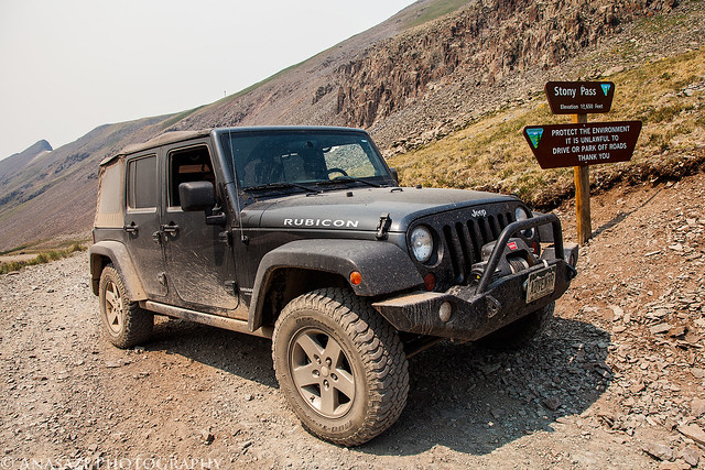
Stony Pass by IntrepidXJ, on Flickr
Getting up this high did manage to get us above most of the smoke, so I ended up hiking part of the Continental Divide Trail while I was up there.
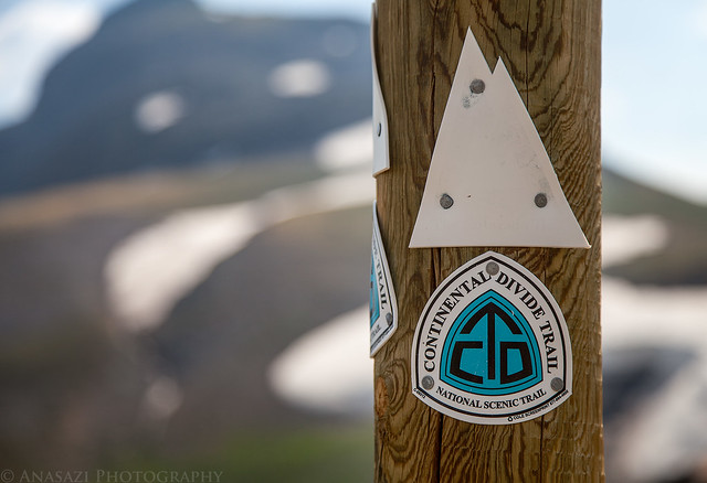
Continental Divide Trail by IntrepidXJ, on Flickr
Dappled light on the nearby Sheep Mountain.
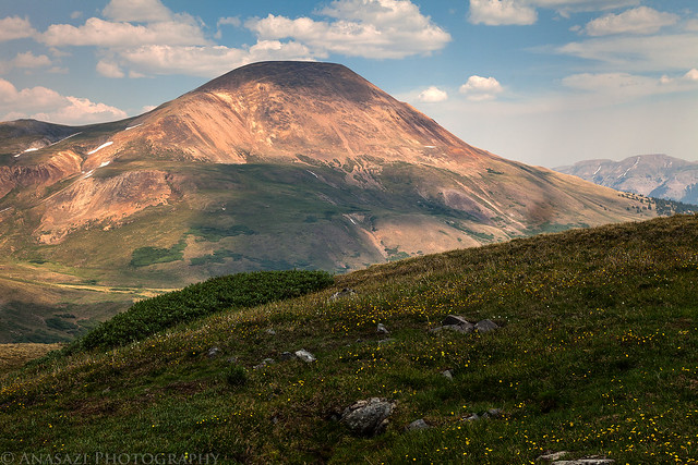
Sheep Mountain by IntrepidXJ, on Flickr
There were a few wildflowers growing along the trail where there was running water including Marsh Marigolds and Rose Paintbrush.
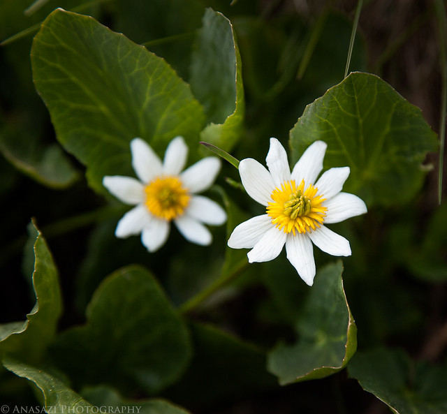
Marsh Marigold by IntrepidXJ, on Flickr
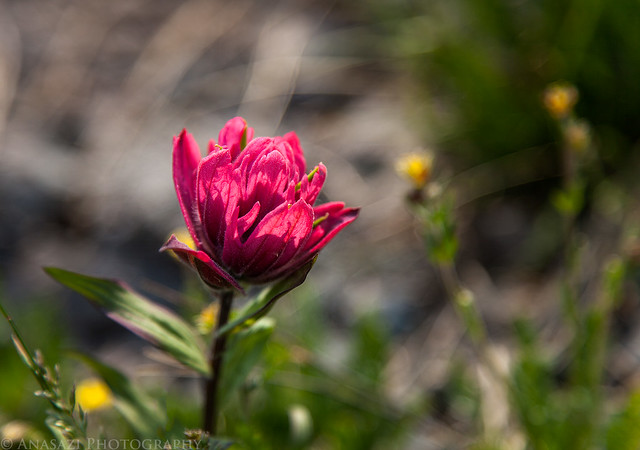
Rose Paintbrush by IntrepidXJ, on Flickr
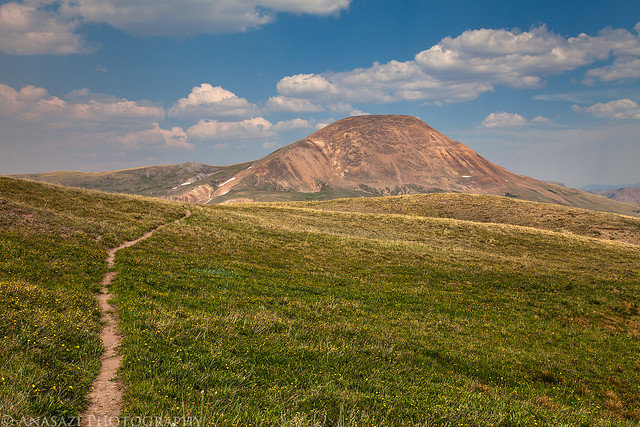
A view from the turnaround point of my hike over the headwaters of the Rio Grande.
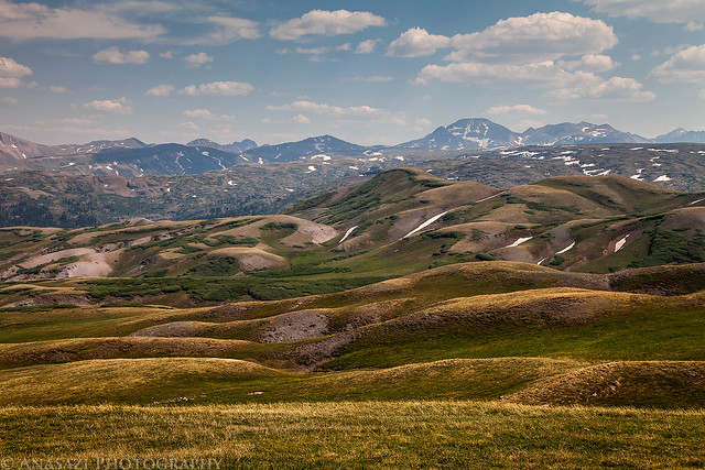
Rolling Hills by IntrepidXJ, on Flickr
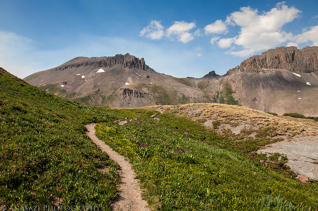
Hiking back towards Sheep Mountain through the apline tundra.
CDT to Stony Pass by IntrepidXJ, on Flickr
The trail back towards Canby Mountain and Stony Pass.
Canby Mountain by IntrepidXJ, on Flickr
Before reaching the road again I stopped to check out an old mine and cabin. These tracks were nearby.
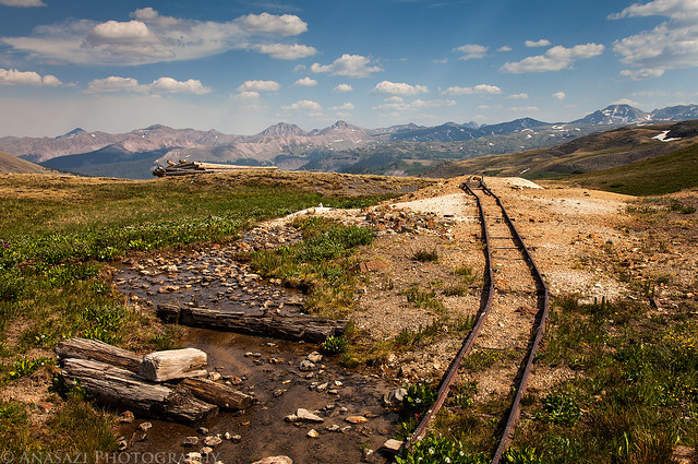
Tracks to Nowhere by IntrepidXJ, on Flickr
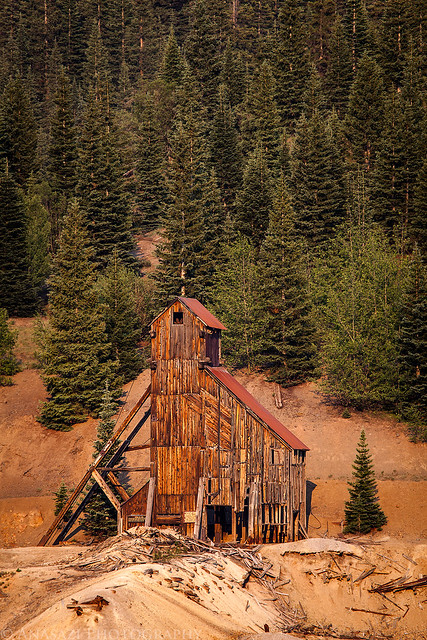
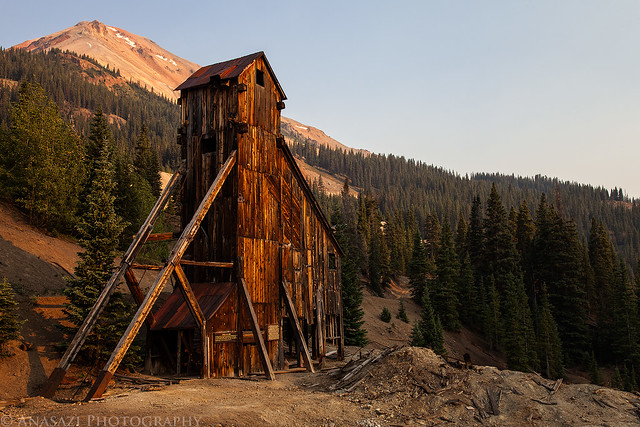
When I reached the Jeep it was time to drive back down to Silverton and grab some dinner. It was nice to see that much of the thick smoke had finally started to clear out and the sky could be seen again. After eating we still had some time before sunset, so we drove over to the Red Mountain Mining District to take a few more photos. With the smoke in the air, the light getting through was a much warmer tone than usual, so I thought I might try to get some nice photos of the Yankee Girl Mine.
After driving back over Red Mountain Pass, I stopped along the highway to take this photo of the Yankee Girl in the distance.
Yankee Girl Mine by IntrepidXJ, on Flickr
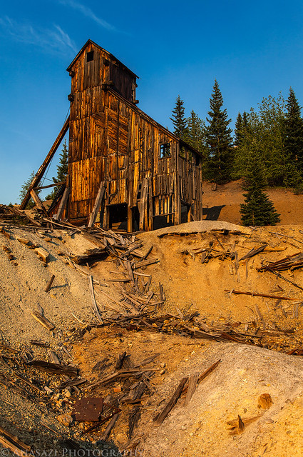
Then we continued to the mine for a closer look.
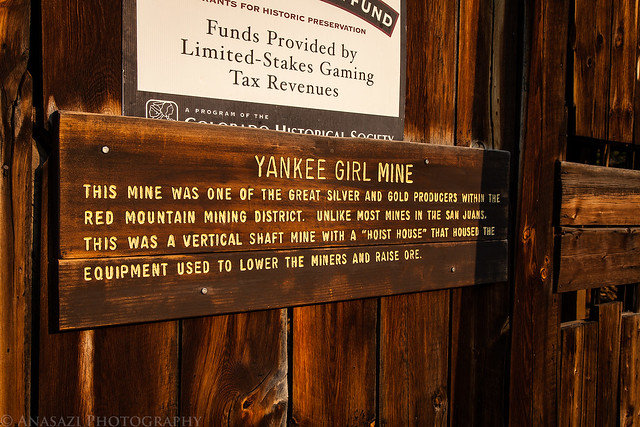
Yankee Girl Info by IntrepidXJ, on Flickr
Yankee Girl Sunset by IntrepidXJ, on Flickr
Yankee Girl by IntrepidXJ, on Flickr
The sun finally dips below the mountains on the other side of the valley.

Sun Behind the Mountain by IntrepidXJ, on Flickr
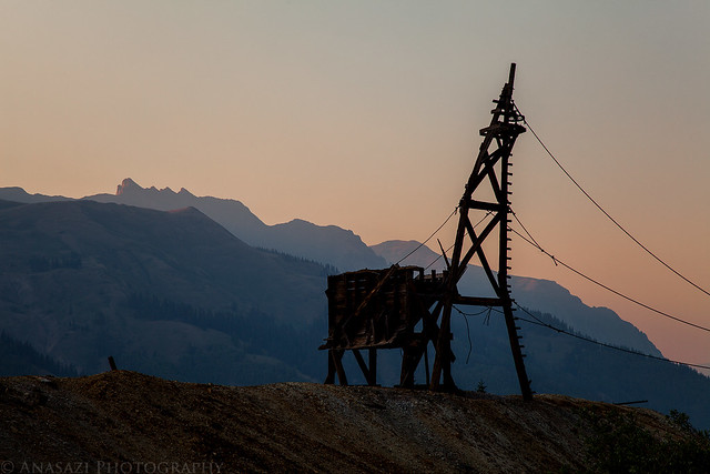
Tram Sunset by IntrepidXJ, on Flickr
When the sun was finally down we headed back to camp and went to bed early. It was a long day and we were both very tired. The following morning we both slept in and I didn’t even bother trying to get up to photograph the sunrise. It was nice 🙂 After packing up camp we stopped back in Silverton for breakfast at the Black Bear Cafe and then headed over Ophir Pass to Telluride.
Just over the pass and headed down to the little town of Ophir.
Ophir Pass Road by IntrepidXJ, on Flickr
Great scenery along the way.
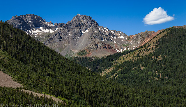
Ulysses S. Grant Peak by IntrepidXJ, on Flickr
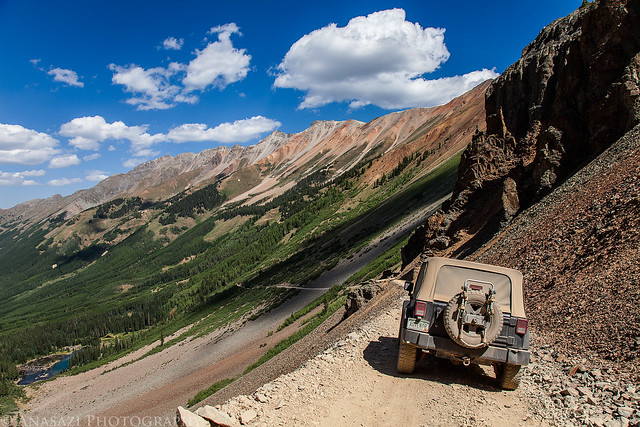
When we reached Telluride we were stopped by a road block since they were having a bluegrass festival in town this weekend. I explained that we were just passing through to get to Imogene Pass and they let us in.
As we climbed the road up to Tomboy in the Savage Basin we passed through the Social Tunnel.
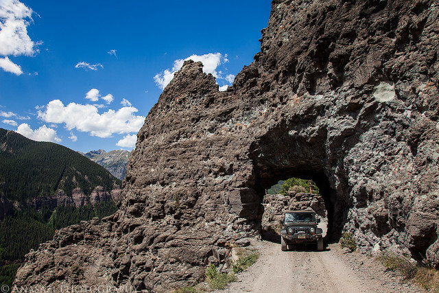
In the Social Tunnel by IntrepidXJ, on Flickr
The view down from Savage Basin back towards Telluride.
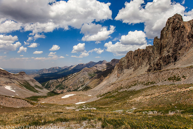
Savage Basin by IntrepidXJ, on Flickr
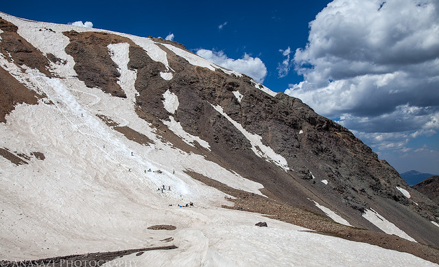
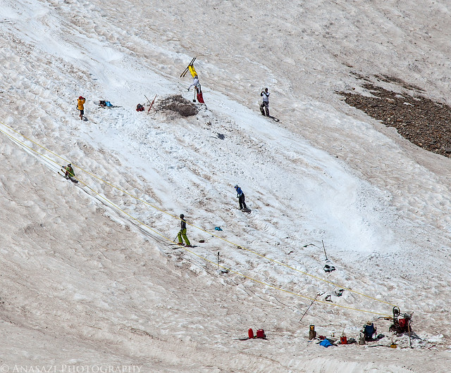
As we neared Imogene Pass we spotted a group of people skiing on what little snow was left up here. It appears that they had setup a motorized pulley system to drag them up to the top.
Summer Skiing by IntrepidXJ, on Flickr
They even had a jump setup at the bottom and were doing some flips. I caught someone upside down in this photo. You can even see someone being pulled up on the left.
Upside Down by IntrepidXJ, on Flickr
We finally reached Imogene Pass and were lucky enough to have nice weather up here for a change. The sign was missing, though…
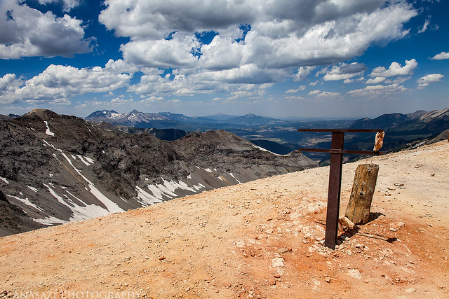
Missing Sign by IntrepidXJ, on Flickr
We didn’t stick around the pass long, but instead we drove just a little further and stopped at the Red Mountain Overlook.
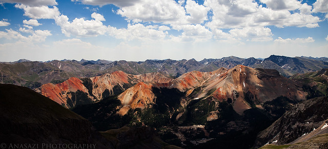
The Red Mountains by IntrepidXJ, on Flickr
While we were at the overlook, I climbed up to an unnamed 13,365′ peak to visit this shack on top. I tried to open the door to look inside, but it was still filled with ice and snow.
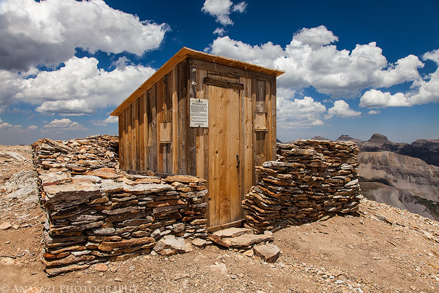
Mountain Shack by IntrepidXJ, on Flickr
Looking down on the 13,114′ Imogene Pass below. A group of vehicles had stopped there while I was above.
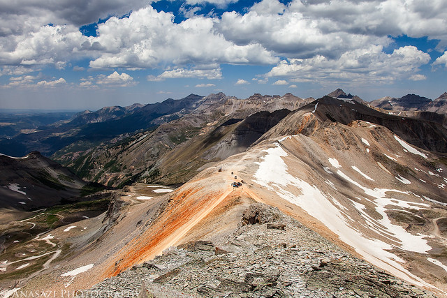
Above Imogene Pass by IntrepidXJ, on Flickr
Driving under a large snow drift along the road. It still looks large in this photo, but it’s certainly not as big as it usually is at this time of the year.
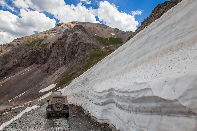
Snow Drift by IntrepidXJ, on Flickr
When we reached Ouray we just kept on driving back into the heat of the Grand Valley. It was another nice weekend camping in the San Juan Mountains with Amanda.
I really enjoy all of your posts but this one was especially nice. I really like the Rolling Hills picture. Thanks for getting us all out to the San Juans for a minute!
Thanks Monica!