After Work Adventures | Friday, June 14, 2024
This weekend I was going to be staying close to home so I could spend a little time on the Colorado River, but since a cold font had come through the area and dropped temperatures significantly for the day, I thought it would be a good idea to head over to the Gunnison Gorge National Conservation Area after work so I could go for a scenic drive on the Smith Mountain Jeep Road and hike to a couple of highpoints along the way. After leaving work on Friday afternoon I drove over to Delta, grabbed dinner in town and then headed over to the Smith Mountain Saddle Trailhead where I started driving up to the top of the ridge above the Black Canyon of the Gunnison. As I was making my way up the mountain a fast-moving storm storm moved across the valley from the Uncompahgre Plateau and quickly dropped the temperature another 15 degrees as the wind picked up.
Starting my afternoon drive up the Smith Mountain Jeep Road with dark clouds all around.

The incoming storm was getting closer as I drove up the mountain.

It was raining in the distance ahead of me and I saw a couple lightning bolts in that direction.

When the storm was right on top of me the wind picked up significantly and was blowing a lot of dust around, but there were only a couple sprinkles of rain. The wind was so strong I was actually having a hard time holding my camera steady to take this shot.

I needed to wait for the lighting to stop before I started going on my short hikes, so first I drove down to the Gunnison Forks area and then returned to the top of the mountain.

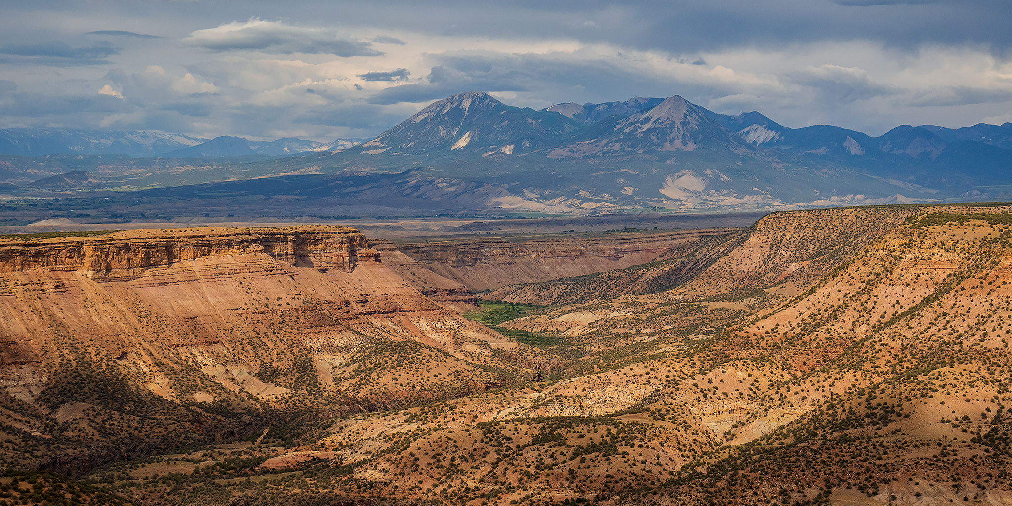
Mount Lamborn and Landsend Peak were obscured by the rain as the storm continued heading east.

It wasn’t long until the sun started to come out again and I continued exploring the Smith Mountain Jeep Road.

The Gunnison River

Looking across the Gunnison Gorge to Scenic Mesa.

From the edge of the ridge there was a great view across to Fruitland Mesa and the canyon that contains the East Gorge Trail, which is an area I just spent a nice weekend in.

There was also a nice view right up the Smith Fork to Mount Lamborn and Landsend Peak.

Near the highest point on the ridge I parked and went for a short walk over to PT 6991. The view near the top was spectacular!

PT 6991 Summit

Just below the highpoint was an outcropping of rocks that offered a lovely view both up and down the canyon.


I returned to my Jeep and continued driving south along the ridge, where I had a good view back to PT 6991.

My next stop was an even shorter walk to the View Benchmark.

View, 1951

From the View Benchmark there was a good look across to Red Canyon, which looks like a deep crack in the Earth.

Looking back to the View Benchmark highpoint as I followed the road toward the Ute Trailhead.

When I reached the Ute Trailhead I parked my Jeep and followed part of the Rim Trail to PT 6869.

Another look north to the View Benchmark highpoint from the trail.

From the summit of PT 6869 there was an interesting view across the tilted landscape of the Black Canyon.

When I returned to my Jeep at the trailhead I drove down off the mountain on the Ute Road and then headed back home. It turned out to be a very nice evening in the Gunnison Gorge!