Saturday, March 14, 2015
I stayed home this weekend so I could work on a large photo project that I need to get done soon, but when Saturday afternoon rolled around I was tired of staring at a computer screen and had to get out hiking somewhere. It’s a good thing that I live close to a lot of trails and amazing scenery here in the Grand Valley! I had no plans, so I decided to explore the East Fork of Pollock Canyon since I had looked down into it from the Pollock Bench a few weekends ago and thought it would be a nice area to explore.
I started my hike from the trailhead near Flume Creek Canyon and followed the Rattlesnake Canyon trail to where it enters Pollock Canyon. Here I left the trail and followed the wash up the canyon to to confluence of the two forks, where I took a left in order to follow the East Fork.
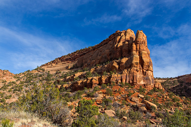
A sandstone hoodoo above the trail.
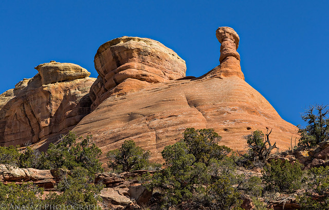
Pollock Hoodoo by IntrepidXJ, on Flickr
A huge cairn marks the descent into Pollock Canyon.
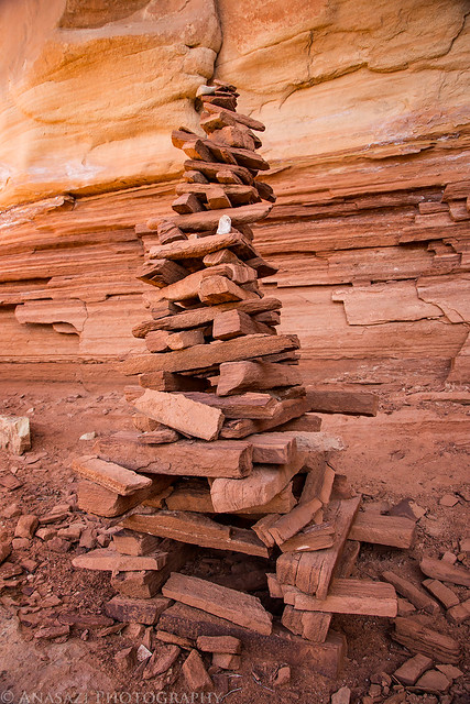
Big Cairn by IntrepidXJ, on Flickr
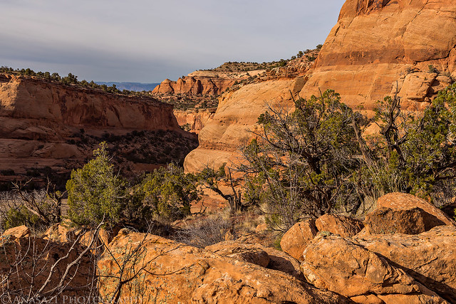
Following the wash up Pollock Canyon after leaving the Rattlesnake Arches trail.
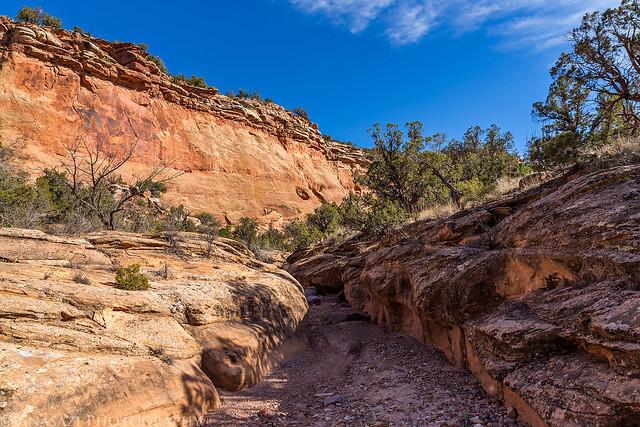
Pollock Canyon Hiking by IntrepidXJ, on Flickr
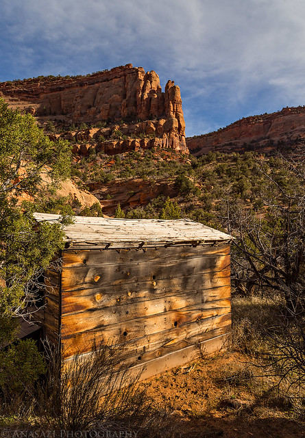
A big open field in the East Fork of the canyon near an old shepherd’s cabin.

Field by IntrepidXJ, on Flickr
A nice view from the front door of the cabin. Not a bad place to live!
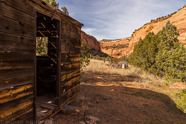
Front Door View by IntrepidXJ, on Flickr
An old bottle on a shelf inside.
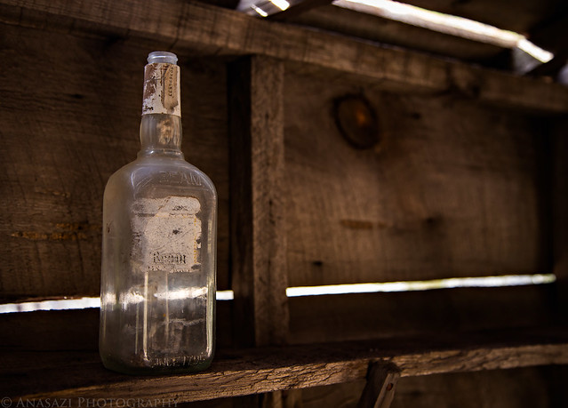
Beam by IntrepidXJ, on Flickr
Inside the cupboard.
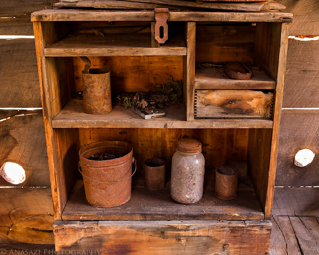
Cupboard by IntrepidXJ, on Flickr
An old ladder in the corner.
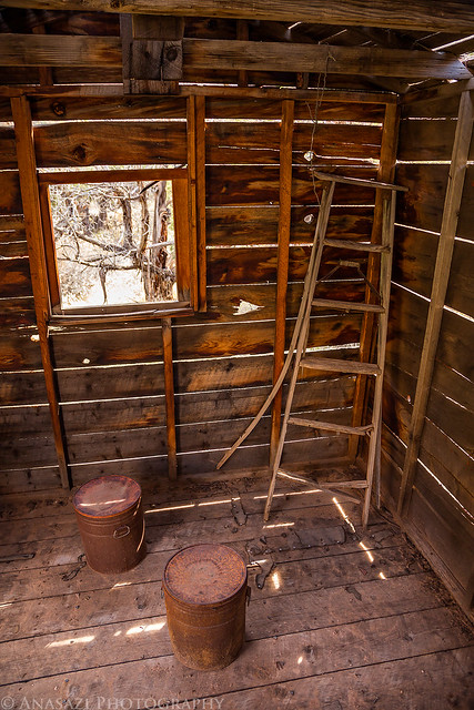
Ladder by IntrepidXJ, on Flickr
An old stove in the opposite corner.
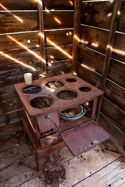
Dinner Time by IntrepidXJ, on Flickr
Back of the cabin.
Shepherd’s Cabin by IntrepidXJ, on Flickr
After checking out the cabin for a bit, I continued up the wash until it entered a short slot canyon in the Precambrian rock. It ended at a high waterfall that had a trickle of water running down it into a muddy pool.
The muddy pool and end of the short slot canyon on the left, with the entrance to the slot on the right.
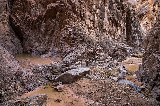
The End by IntrepidXJ, on Flickr
Looking out the slot down the canyon.
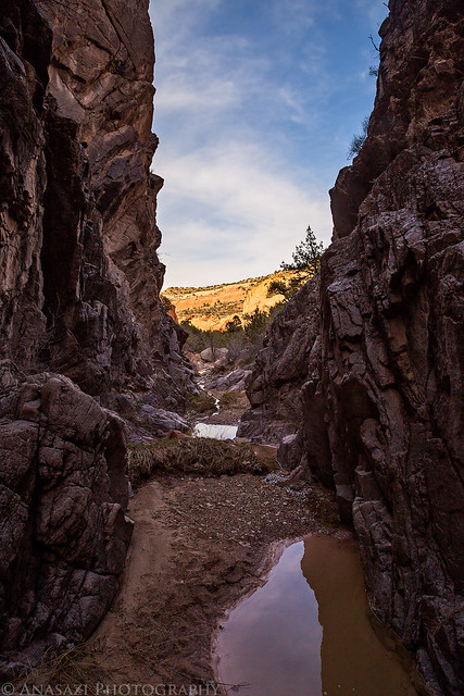
Precambrian Slot by IntrepidXJ, on Flickr
Since I couldn’t go any further up the canyon this way, I exited the slot and found a steep and loose climb up to the top of the Precambrian rock where I got a nice view of the sandstone scenery surrounding me.
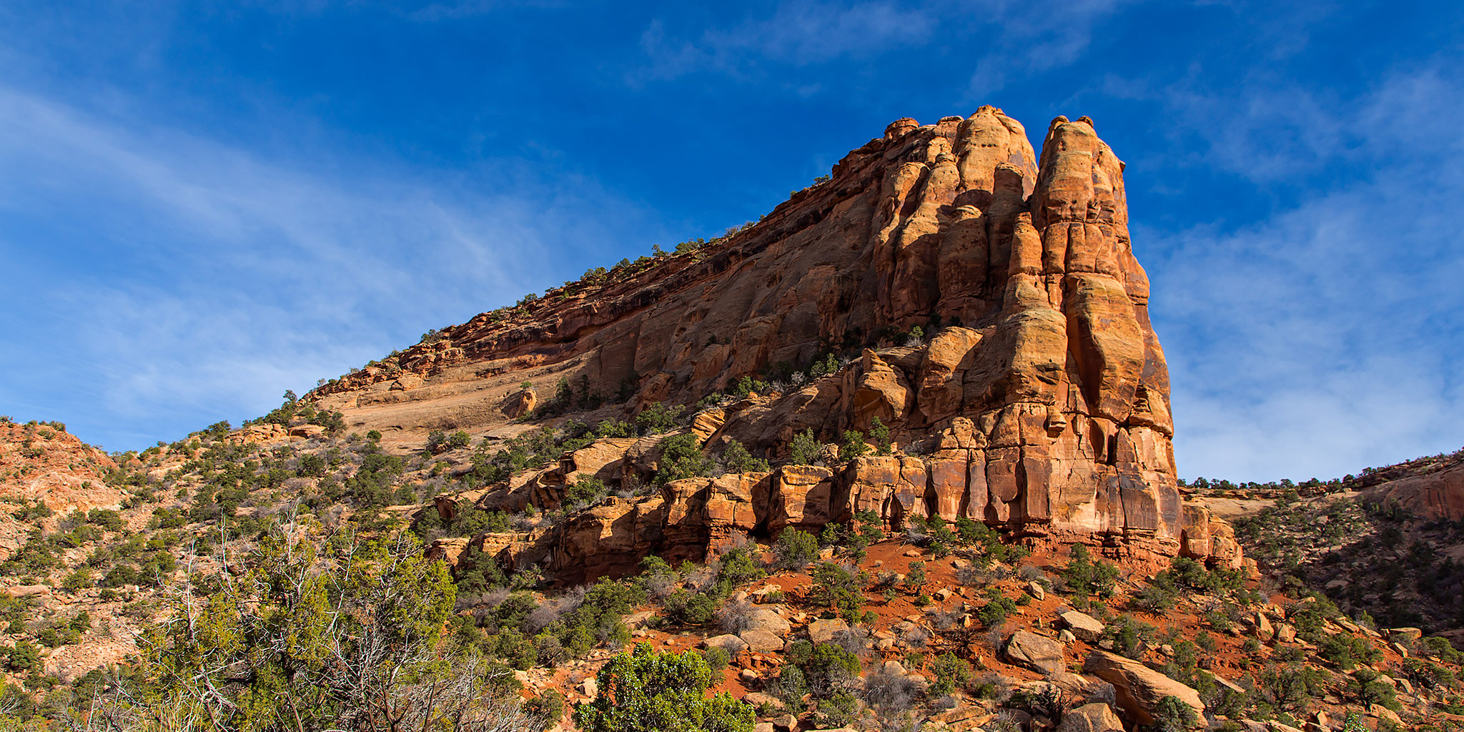
When I left the trailhead earlier in the afternoon I had run into Steve Obser, another local hiker that I have talked to before. While we were talking about my plans for the evening he mentioned that there was a way down from the Pollock Bench Trail into the canyon. Instead returning the way I had come, I decided to try to find a different and shorter way back by climbing up to the bench. Looking at the landscape above from the top of the Precambrian rock, the only way that looked possible was the rocky slope to the left of the formation pictured below, and I started climbing that direction. I soon realized that I had chosen the right direction when I came across a few cairns and a faint trail and knew I was probably on the route that Steve had mentioned. I followed the faint trail all the way back to the top where I was able to connect with the Pollock Bench Trail. It was a good climb to the top, but it saved me some distance on the hike back.
The way back up is to the left of this formation.
Pollock Exit by IntrepidXJ, on Flickr
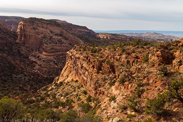
View down the East Fork from the trail I followed back to the top.
Down-Canyon by IntrepidXJ, on Flickr
Almost to the top of the Pollock Bench, the East Fork of Pollock Canyon is far below.
Back to the Top by IntrepidXJ, on Flickr
One last photo from the top of the Pollock Bench towards the Grand Mesa before the sky filled with clouds and stayed overcast for the remainder of my hike back to the trailhead.
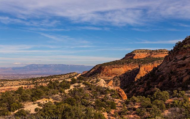
Bench View by IntrepidXJ, on Flickr
Below is my GPS track from the hike in Google Maps. The entire hike was about 8.5 miles in length and a nice way to spend a Saturday evening.
Hey Randy, so glad you found the cabin! Nice to see the Jim Beam bottle is still there but I don’t see the animal trap hanging up or rusty pan with utensils in your photos. Hope they still remain!
I’ve contacted you in a separate email with more info about some of the other destinations in that area that we talked about the other day.
Great photos of one of my favorite places! I’ve done a lot of geology work in the Pollock Canyon area. On your next trip out there head west from the sheepherder cabin, up and over that saddle. On the west side of the saddle look for seeps and springs. I found columbines growing there in late spring/early summer. Then head upstream in the west fork of the canyon, it’s wonderful in there.
Thanks for the info Shelly. Do you know if the seeps/springs in the west fork have water year round? Just curious since it might make for a nice overnight destination in the future 🙂 Thanks!
We just did the grueling 13-mile hike from Pollock Bench trailhead to the Pollock Windows yesterday and the 90 ounces of water that I pulled from that seep on the way back pretty much saved us!