Dolores Canyon: Bradfield Bridge to Mountain Sheep Point
Friday & Saturday, May 26-27, 2023 | Average CFS: 2,400
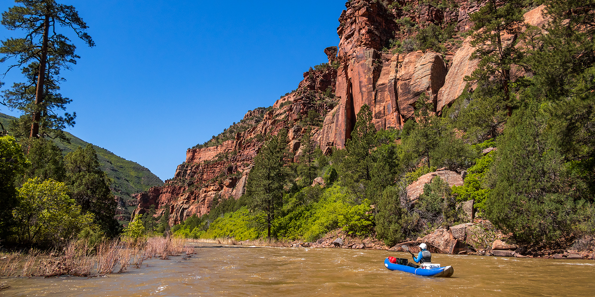
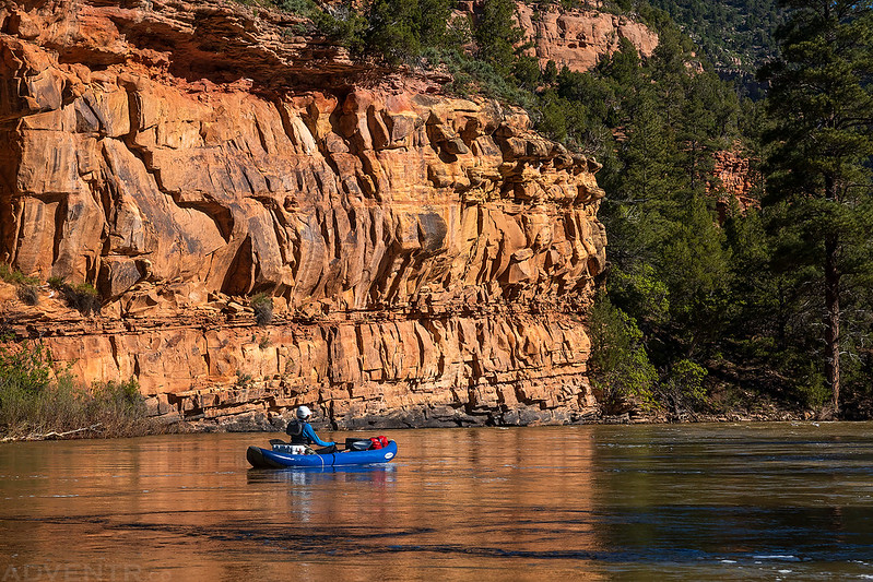
After spending the last couple of weekends on the river, Jackson and I wanted to keep the streak going with three different day trips planned over this extended Memorial Day weekend. For our first destination on Saturday we were going to float a section of the Dolores River below the McPhee Reservoir from Bradfield Bridge to Mountain Sheep Point that is known as the Ponderosa Gorge. This nineteen-mile section of the Dolores River is known for it’s quick pace, spectacular campsites, soaring cliffs of red sandstone and of course the tall stands of ponderosa pines. Diane and I had visited the Dolores Canyon Overlook on our way to Mesa Verde last year which looks down into this portion of the Dolores Canyon, so I was really looking forward to seeing the canyon from the river this time!
We left right after work on Friday afternoon and headed straight to the Mountain Sheep Point Recreation Site where we dropped off Jackson’s car at the takeout. We were pretty surprised find that were were only a few vehicles parked here so far for this busy holiday weekend. Then we finished the drive over to the Bradfield Recreation Site where again we were surprised to find a couple of open campsites in the campground this evening. We originally thought that we were going to have to head up into the nearby San Juan National Forest to find a dispersed campsite in the dark this evening, so we were happy to just grab a campsite near the boat ramp instead.
Jackson finishes setting up his tent at our campsite at dusk on Friday evening. It is believed that this is the area where the Dominguez – Escalante Expedition spent a night on August 14, 1776 as they tried to find an overland route from Santa Fe to Monterey.

On the 14th we set out from the meadow and Río de Dolores toward the north, and after a quarter league of travel we continued northwest for one league and to the northwest by west for five leagues over a rather troublesome stretch of sagebrush. We entered a tall and craggy canyon and, after going through it two leagues to the north, we arrived a second time at El Río de Dolores, which already here runs northwest. We crossed it twice within a brief space and halted by its western edge, calling the stopping-point, which is a brief meadow of good pasturage, La Asunción de Nuestra Señora (The Ascension of Our Lady).
Silvestre Vélez de Escalante,
August 14, 1776
After getting camp set up we sat around for a little bit until we got tired and then went to bed. Unfortunately, I did not sleep very well this night, mostly because the temperature dropped and I started to get cold. The weather forecast had predicted a low temperature of only 46 degrees overnight, but it got much colder than that. When we got up with the sunrise on Saturday morning our tents were covered with ice and my sleeping bag was pretty wet. It’s no wonder I had been cold for much of the night! We ate breakfast, packed up camp and then headed over to the boat ramp to get our inflatable kayaks ready for the river.
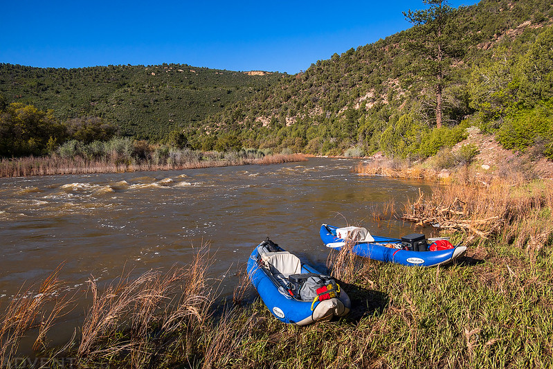
Although we were the first ones at the ramp this morning, it wasn’t long before others started showing up, so we were glad to have been rigging our boats just upstream from the main ramp. Although the ground looks muddy here, it was pretty frozen from the cold temperatures overnight.
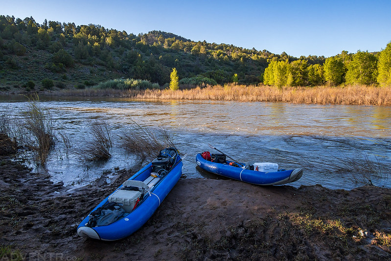
We were the first ones on the river this morning at about 7:15am and glad to be leaving since the boat ramp was getting pretty busy by then.
Off we went downstream into the Dolores Canyon!

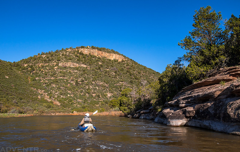
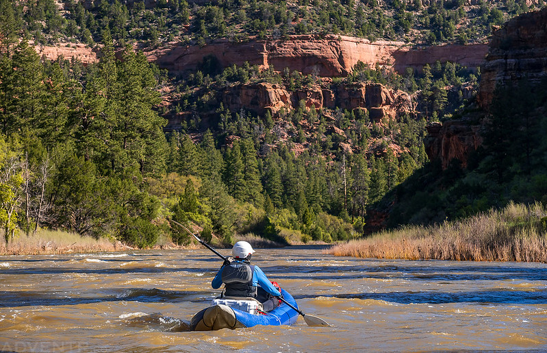
It was still cold this morning, especially as we floated through the canyon’s shadows.

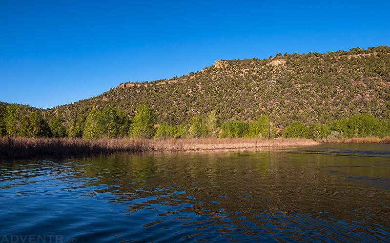
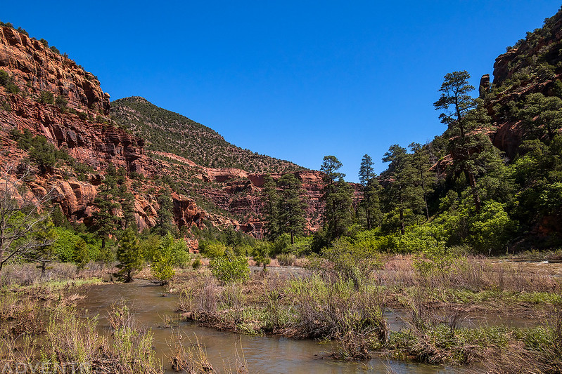
It was a calm morning in a beautiful canyon with a clear blue sky above. This is the reason I love getting out onto the river first thing in the morning!

After a couple of miles I had to stop so I could warm up my feet a bit by walking around. They had gotten pretty cold while we were rigging our boats and had not had time to warm up.
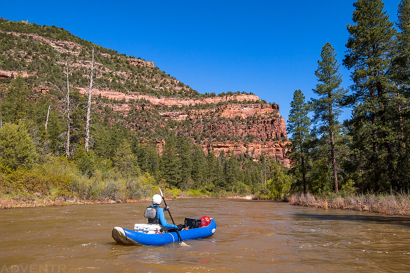
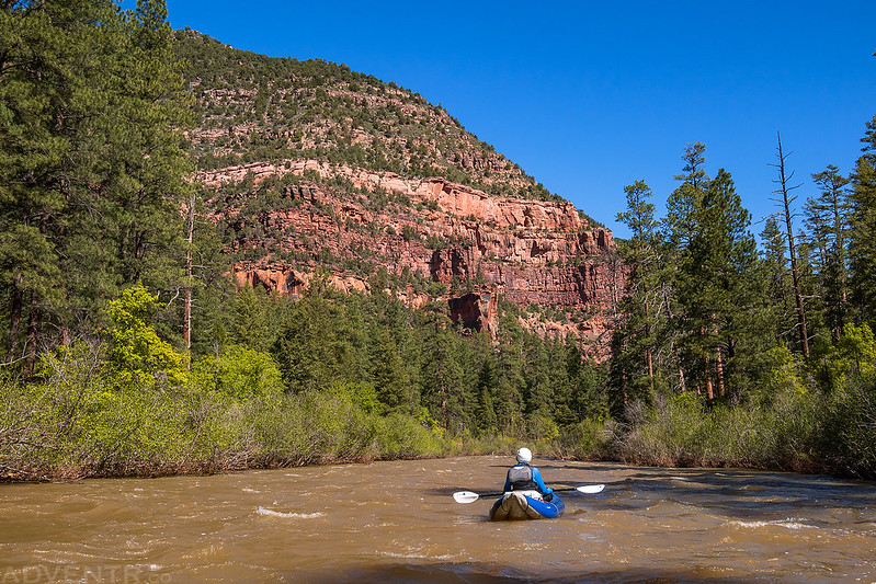
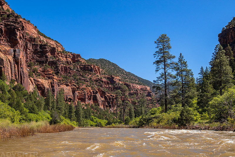
Once my feet were warmed up we were back on the river as the canyon gorge grew deeper.
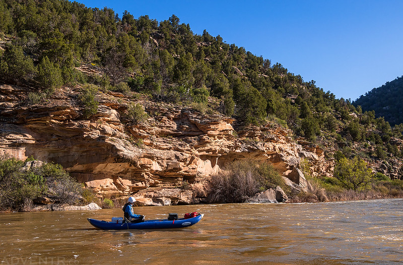

It wasn’t long until we started seeing the large ponderosa pine trees that this canyon is known for.
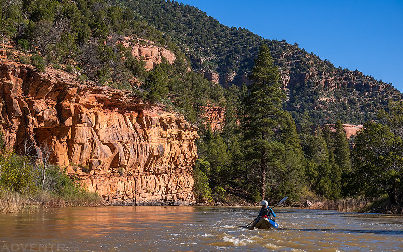
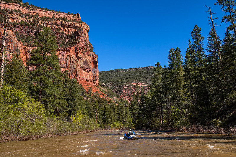
Much of the float was fast and splashy with a few larger rapids along the way to keep us on our toes.
Floating through the Ponderosa Gorge was a scenic endeavor.


We wouldn’t see anyone else on the river this morning until the final mile or so before the takeout. Then we saw a couple of other groups including one large commercial outfit that was stopped where we had wanted to hike. We ended up skipping the hike since there were just too many people around.
When we reached the takeout at Mountain Sheep Point it was a much different scene compared to the night before and the boat ramp was packed full of people and boats. We ended up landing just downstream from the ramp and took out in this swampy muddy area.
After getting our gear packed up into Jackson’s car we drove back to Bradfield to pick up my Jeep and eat lunch. We finalized our plans for Sunday to float a section of the Colorado River through the Grand Valley and then followed the Dolores River most of the way back home through Colorado’s West End.
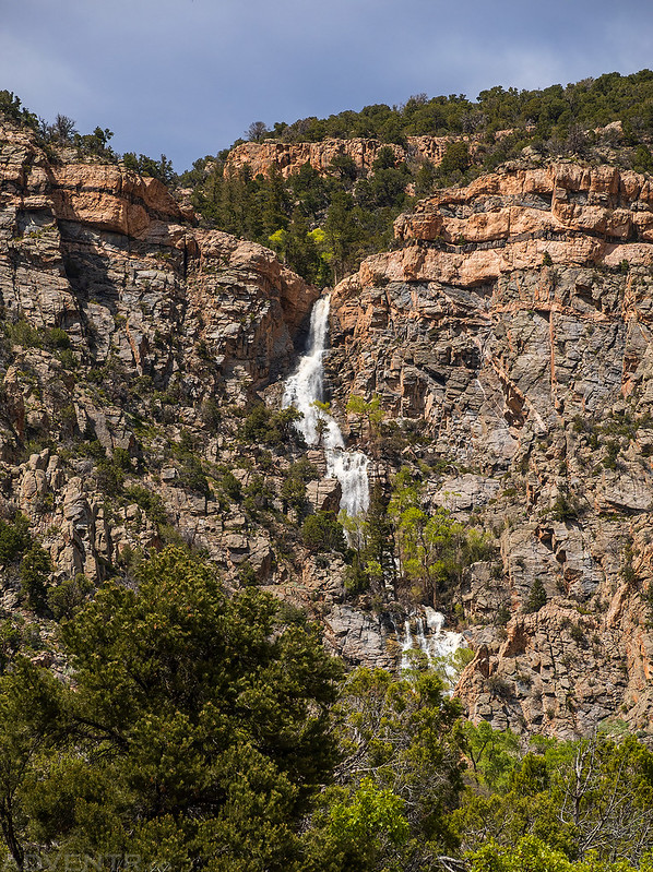
I did briefly stop for a photo of this large waterfall in Unaweep Canyon on the way home.