The Chinese Trail, Mille Crag Bend and West Fork of Rock Canyon
Friday – Sunday, January 22-24, 2021
Late Friday evening a winter storm was forecast to move across the Colorado Plateau and into the mountains of Colorado that was supposed to stick around until Tuesday and bring much-needed moisture to the area. Leading up to the weekend I kept a close eye on the weather forecast and it seemed like the area around Hite would be the best location to get in some hiking during the days while avoiding precipitation. Heading that direction this weekend sounded like a great idea to me since there are plenty of places around the Dirty Devil Country that I’ve wanted to explore and camping in the Glen Canyon National Recreation Area near Hite would allow me to visit a few of those places surrounding The Block.
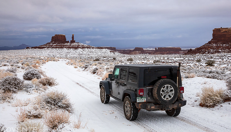
I left straight from work on Friday afternoon, grabbed a quick dinner and then headed back into Utah. I stopped to top off my fuel tank in Hanksville and then finished the drive through North Wash to the Dirty Devil River. After crossing the bridge over the river I took the dirt road on the left, that eventually makes it’s way into The Maze, and found a spot to spend the night along the rim of Rock Canyon. It was 50 degrees when I arrived and was actually very nice out. There were a few sprinkles of rain but then it seemed like the sky cleared up a bit and the moon lit up the cliffs around me. It felt as if I was at the edge of the storm. Throughout the night there was rain on and off with some pretty strong wind gusts, but the rain seemed to stop about an hour before sunrise, just as the forecast had predicted! The temperature had only dropped down to 37 degrees when I got up and there was a dusting of snow on the high cliffs around me, but it was still pretty cloudy out.
I was hoping that the clouds would clear out enough for a sunrise as I started hiking, but it wasn’t looking very promising.

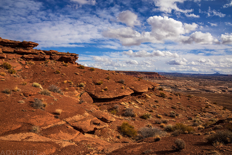
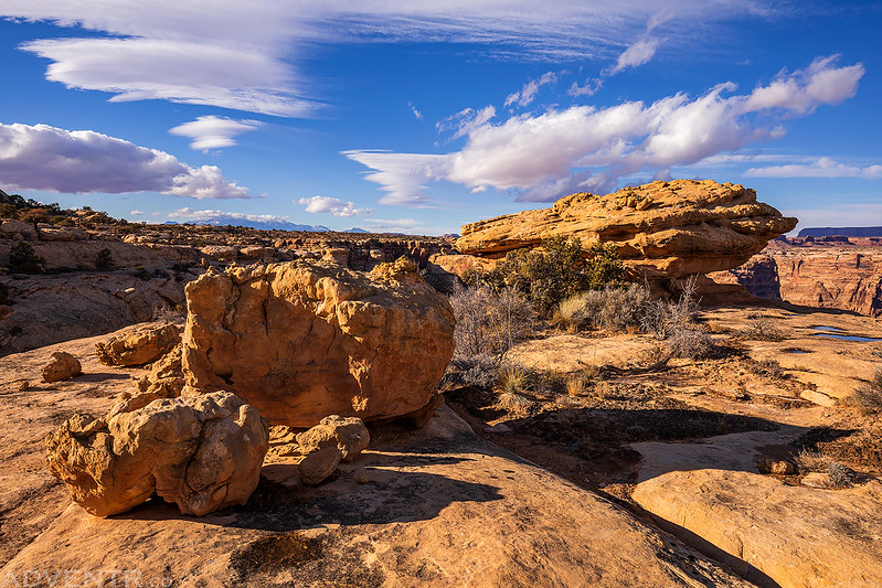
I followed an old mining track to the top of the cliffs above Rock Canyon. The views from the top were outstanding as the road followed along the curves of the rim.

The clouds did eventually clear out a bit and the sun came out.

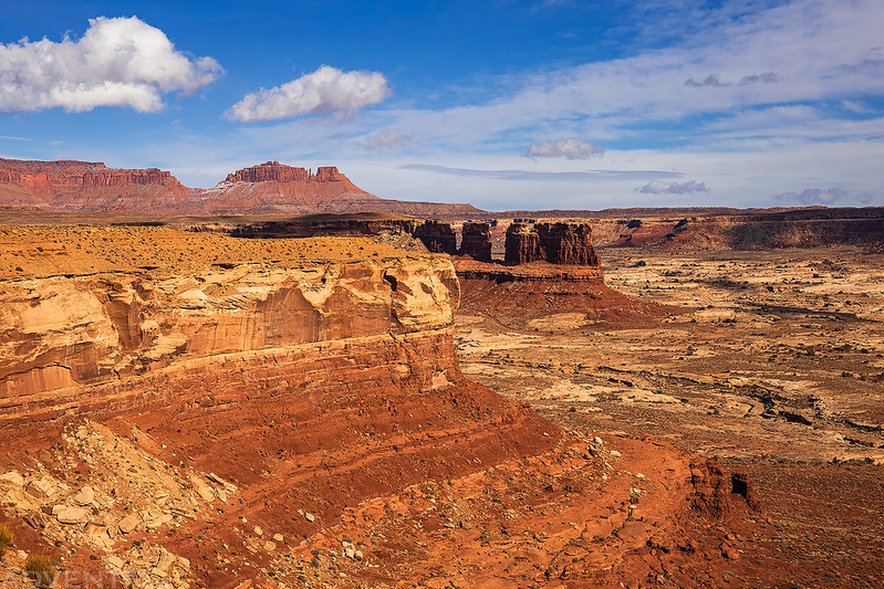
Hiking across the mesa as I made my way toward the Red Benches.
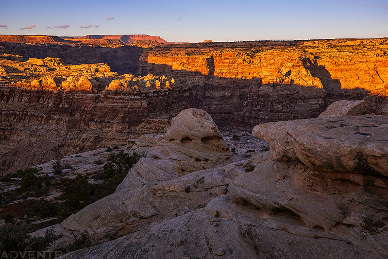
The cliffs of The Block lit up nicely as the sun came out.

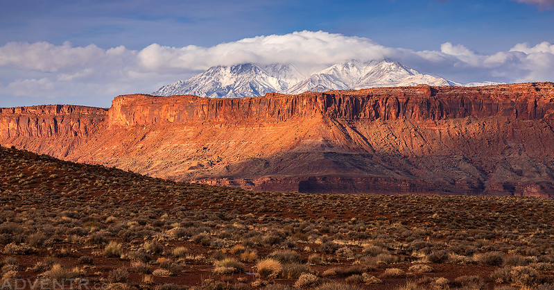
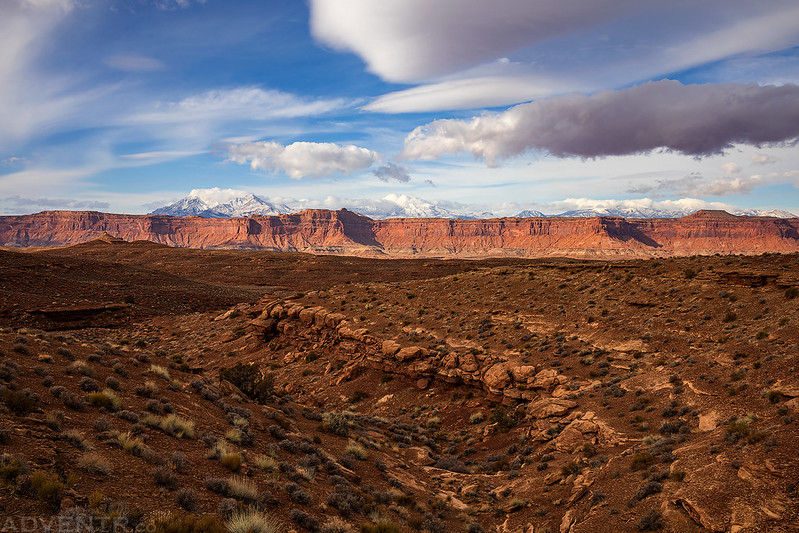
Soon I could see the tops of the Henry Mountains emerging from the clouds above the orange cliffs on the other side of the Dirty Devil River.

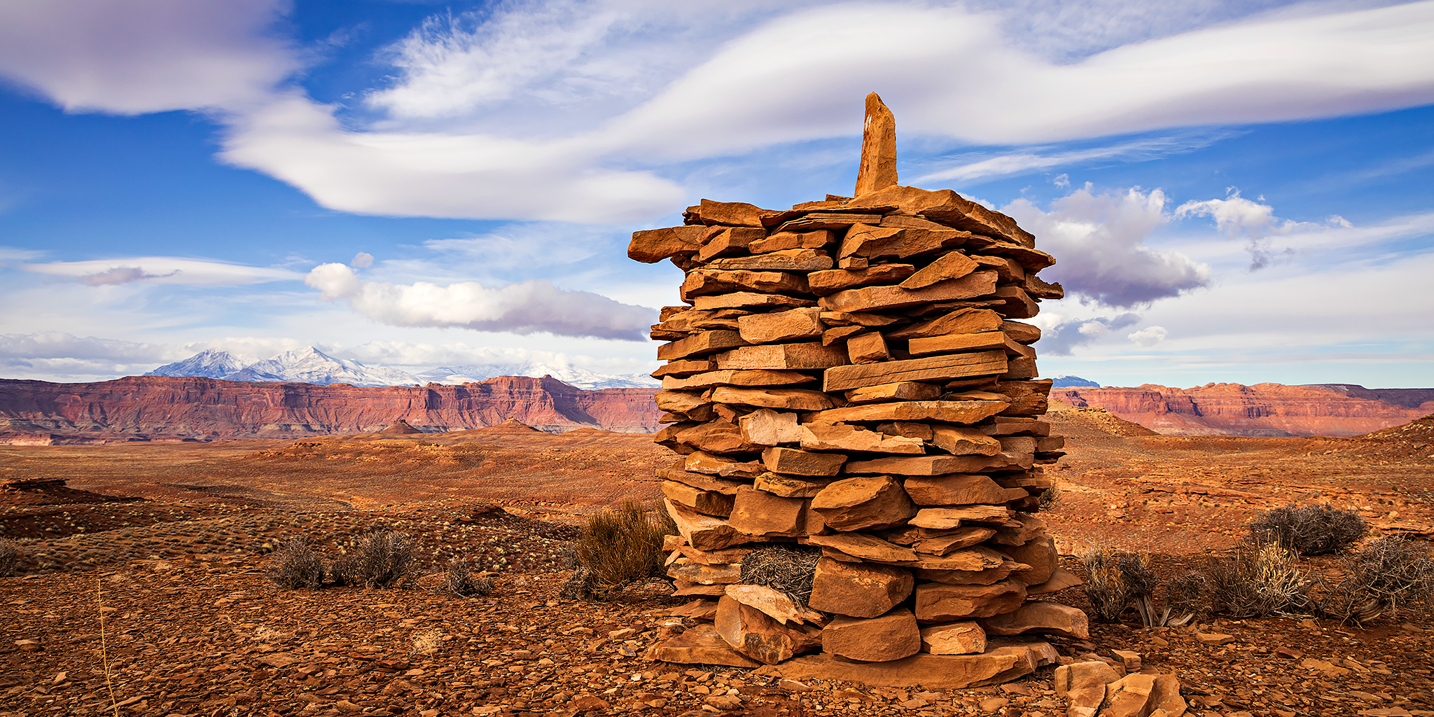
I followed the old road until I couldn’t see it anymore and then started following the Chinese Trail into the Red Benches, which also happens to be part of the Hayduke Trail. The Chinese Trail is an old stock trail that goes from Hatch Canyon to Rock Canyon and was named by backpackers who thought the large stone cairns marking the route looked like Chinese pagodas.
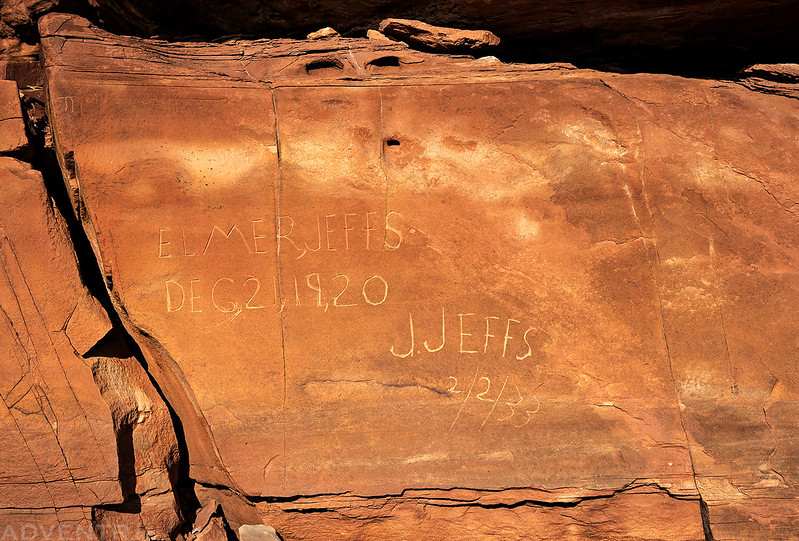
There were a number of inscriptions along the route dated from the 1920’s to 1930’s.
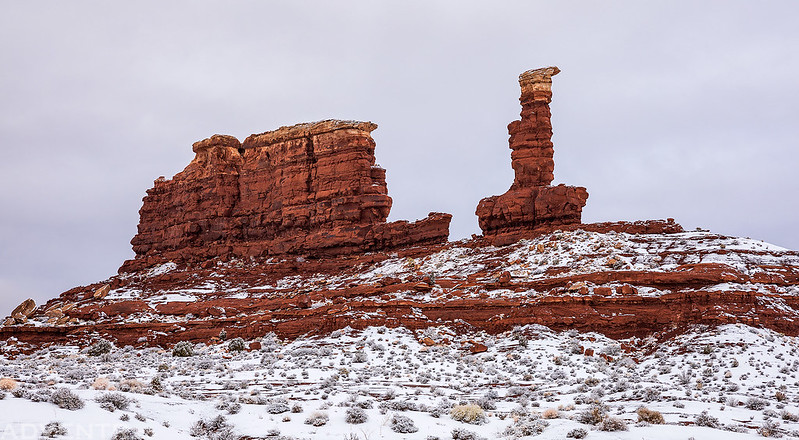
This was the largest cairn along the route that I would pass by today, although I know there are taller ones further along the trail. This one was probably about six feet high and on top of a ridge.

I followed the bench below the South Block to a low pass that would take me into the Red Benches.

Looking up to a point of South Block as I crossed a shallow drainage.

This is one of the smaller cairns along the route, but it was probably still about 3 feet tall.

A view from the low pass as I entered the Red Benches.

I passed by this old stove that was made out of a steel drum.

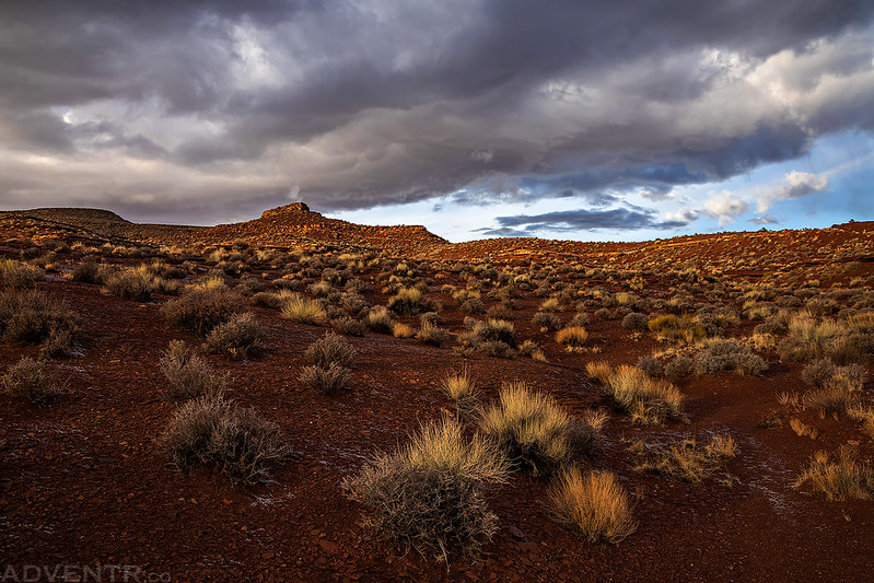
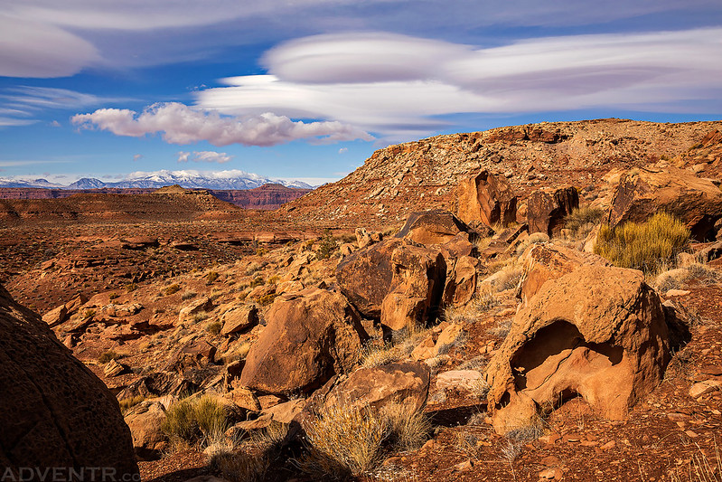
A view across the Red Benches to the Henry Mountains. Although the sky had cleared up by now, it had also gotten pretty windy out.
I only ended up hiking about a mile and half beyond the pass into the Red Benches since by then I had hiked around eight and a half miles and still had to return back to my Jeep the same way. I’ll have to come back on a backpacking trip in the future so I can go further.

The windy conditions over the Henry Mountains made for some nice Lenticular clouds in the sky.
I went back a slightly different way and found a few more inscriptions.


I was actually hoping to follow the Hayduke Trail through the West Fork of Rock Canyon on my way back, but I was not comfortable climbing down the class 4 chimney into the canyon by myself, so I returned to the old road to hike back instead.

The upper end of the West Fork of Rock Canyon.

The clouds were nice this afternoon and I hoped they would stick around for sunset.
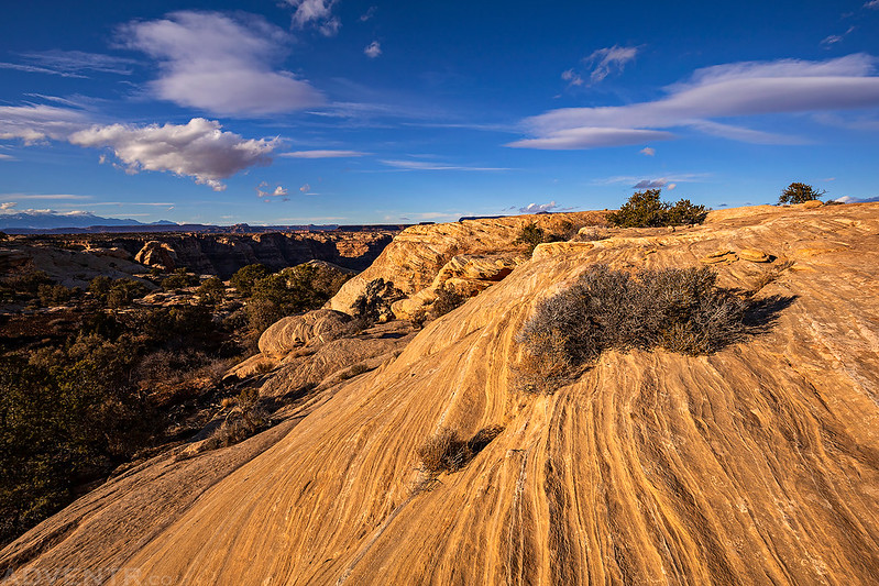
There were great views over the upper reaches of Rock Canyon as I followed the rim back.
When I arrived back to my Jeep I still had a few hours until sunset, and even though my legs were tired from the long hike I knew I wanted to try to photograph the Mille Crag Bend of the Colorado River this evening. I thought it would be a short and easy hike to the edge…
At three o’clock we arrive at the foot of Cataract Canyon. Here a long canyon valley comes down from the east, and the river turns sharply to the west in a continuation of the line of the lateral valley. In the bend on the right vast numbers of crags and pinnacles and tower-shaped rocks are seen. We call it Mille Crag Bend.”
– John Wesley Powell
* Mille is Latin for a ‘thousand.’
I crossed the bridge over the Colorado River and followed Browns Rim Road until I was near Mille Crag Bend. Then I hiked cross-country to the rim of Narrow Canyon to find a viewpoint of the bend.

Soon I was near the edge of Narrow Canyon with a view of the Colorado River far below.

The terrain near the edge was very convoluted and it was not easy to get around, but the area offered some excellent sandstone wandering!


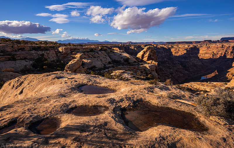
All the potholes were full from the rain overnight.
When I had almost given up on finding a viewpoint that I could see the whole bend from, I finally found this spot shortly before sunet!

Looking straight down to the Colorado River.

Getting down to the viewpoint was a little tricky and I didn’t want to return in the dark, so I hiked back just before sunset. The views were great on my way back!

The ‘short’ walk out to Mille Crag Bend turned into a four mile round-trip hike with a lot of ups and downs along the way. I had hiked over 21 miles today and my legs were shot! I haven’t hiked this much in a while, but I definitely needed to start getting back into better hiking shape…
Then sun had just set by the time I returned to my Jeep, so I drove back over the Colorado River and camped in the same spot I had the previous night. There were more on and off rain showers overnight, but they had stopped for a while before sunrise so I thought Sunday was going to be a repeat of Saturday. I was wrong, because once I started driving towards Andy Miller Flats for the hike I had planned today it started to snow pretty good.
This was my view towards The Cove shortly before sunrise.

Driving through Cove Canyon on a winter’s morning.

I was hoping to hike up on top of The Block this morning, but it was not a route I wanted to try in the snow, so I decided to cancel those plans and turn around.

Driving back across Andy Miller Flats.
I’ve always liked this formation.
The Sewing Machine hidden in the clouds.

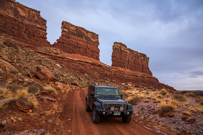
When I reached the West Fork of Rock Canyon I was back below the snow line so I decided to hike up the West Fork from the road since I was unable to hike down it the previous day.
The top of The Block was visible through the clouds as I hiked up the canyon.

I passed this nice hoodoo along the way just as some blue sky started peeking out from behind the clouds.

The last curve of the canyon before I reached the end.

The pourover at the end of the canyon and my turnaround point.


The blue in the sky did not stick around for very long and as I was returning to my Jeep it looked like another storm system was moving in and it started lightly snowing again. I figured this was a good time to start driving home.
Before heading back up North Wash to Hanksville, I stopped at the Hite Overlook for a rainy / snowy overview of the area I had been exploring all weekend.
