Silveys Pocket to the Dolores River, Petroglyphs in Paradox & La Sal Creek
Friday – Sunday, April 3-5, 2020
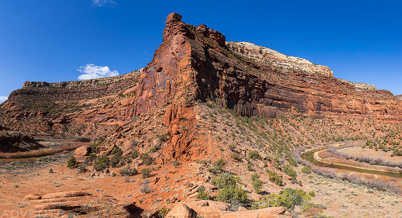
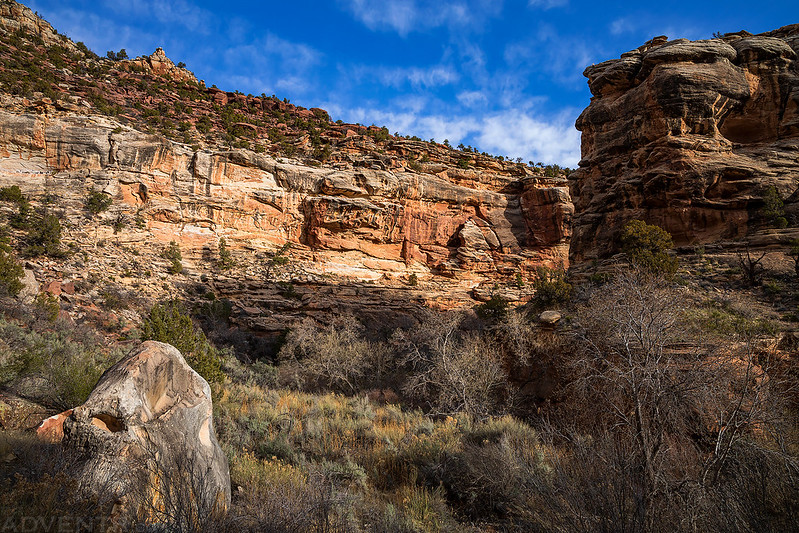
With all of southern Utah essentially shut down to non-locals right now, this weekend I tried to pick one of the more remote areas in western Colorado that wasn’t too far from home to go explore. Ever since I floated through Slick Rock Canyon on the Dolores River last year I have wanted to get back to hike some of the side canyons that we were unable to visit on that trip, so I thought the Dolores River Canyon Wilderness Study Area would be the perfect place to go. I left right from work on Friday and was completely self-contained in my Jeep with food and fuel for the entire weekend so I wouldn’t have to make any stops along the way. I followed the Unaweep-Tabeguache Scenic Byway to Naturita and then headed over to Big Gypsum Valley where I crossed the bridge over the Dolores River beyond the boat ramp and found a place to camp along the rim of Silveys Pocket.
Evening light on the cliffs above the Dolores River after I crossed the bridge into Little Gypsum Valley.

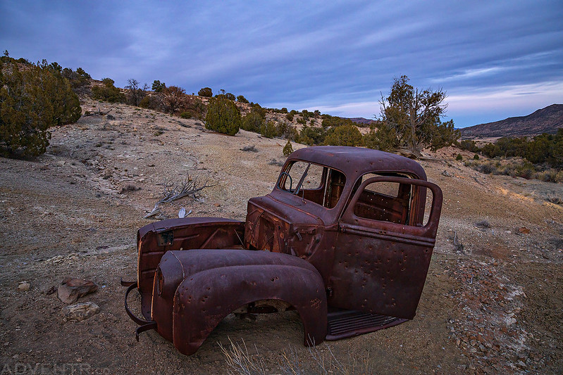
While searching for a place to spend the night, I came across this old truck cab near the American Eagle Mine after sunset.
Silveys Pocket to the Dolores River via Coyote Wash
I was a little worried when I started to hear raindrops falling at around 5:00am on Saturday morning since there was not supposed to any chance of rain this weekend when I checked the forecast, and I was camped in an area with roads that could get very slick if they got wet. Thankfully there were only a few on and off light drizzles of rain until sunrise and the ground never even got wet. When it was starting to get light out I finished driving to the end of the rough Jeep road in Silveys Pocket and then started hiking down a short side canyon into Coyote Wash which I then followed to its confluence with the Dolores River.
A beautiful morning view over Silveys Pocket.

While driving through Silveys Pocket, I stopped to check out this old crushed-up car. There seems to be a lot of these old vehicles scattered among the mines in this area.

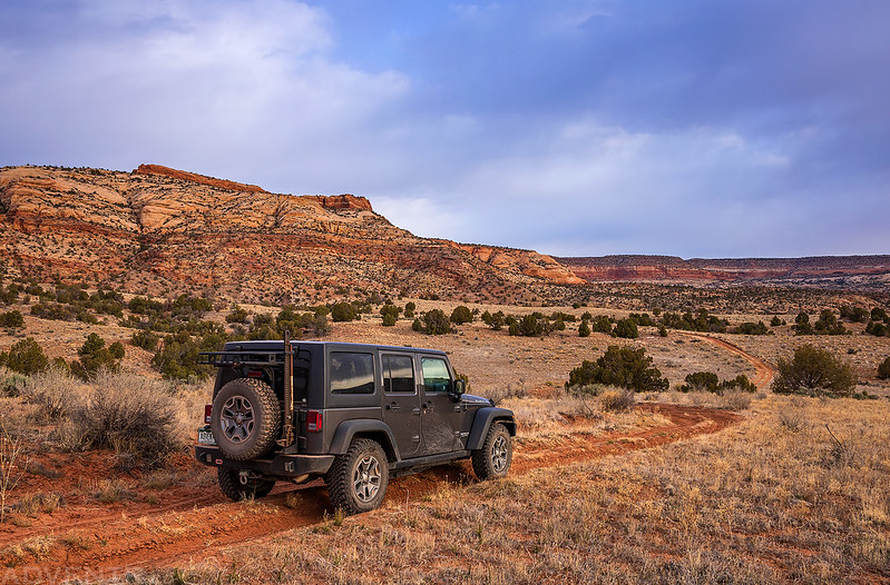
Driving through Silveys Pocket
The short side canyon that drains Silveys Pocket and Coyote Wash were both pretty cowed up as I hiked through, but at least the cows had left a good trail to follow all the way to the river. The Dolores River certainly looked a lot different from when Diane and I had stopped in this area last year. I searched the wide open area near the confluence for rock art and found a couple small petroglyphs and one possible faint pictograph, but nothing that was great. I sat along the edge of the river for a while to rest and eat a snack since the hike to the river took me a lot less time than I was expecting.
Hiking down the short canyon that drains Silveys Pocket into Coyote Wash.

There was a little bit of water flowing through Coyote Wash, but it was shallow enough to walk right through without getting my feet wet in most places.


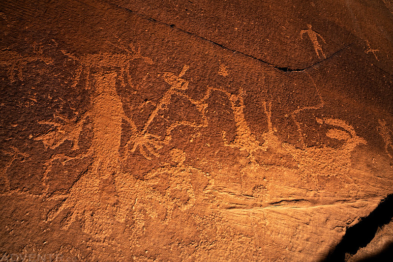
These were the small petroglyphs I found along the Dolores River. Three bird tracks and a vertical zoomorph in the water streak above them.

A reflection on the Dolores River from my resting spot.

While I was resting at the edge of the river I realized that the Muleshoe Bend wasn’t that far downstream from where I was. Since I also had not able to stop there last year, I wondered if it would be possible to hike there from where I was to check it out. There was only one way to find out, so I decided to give it a try! As it turns out, there was a faint trail for much of the of the way which made it a lot easier than my last hike along the Dolores River.
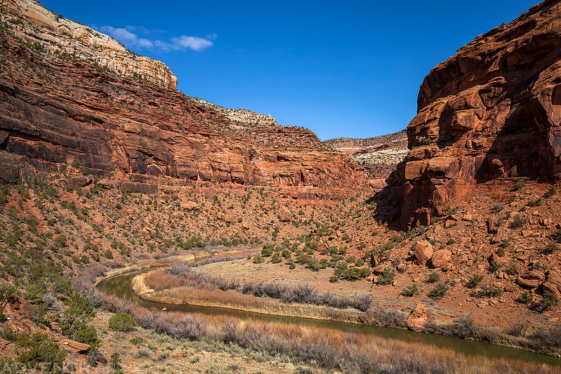
Following the Dolores River to the Muleshoe Bend Notch ahead.
Here’s a panoramic shot from the saddle of the Muleshoe Bend Notch. The river on each side of the notch is only about a tenth of a mile apart, but the river flows about two miles around the Muleshoe Bend to cover that distance. Although it’s not nearly as spectacular as the Bowknot Bend in Labyrinth Canyon, it was still pretty cool.
A view downstream from the saddle of the notch.
I hiked through the notch to the other side of the Muleshoe Bend and then returned to the mouth of Coyote Wash so I could hike back up to my Jeep. On the way back I ran into three ranchers on horseback who were looking for cows that have been missing for about three months. They asked if I had seen any, and although I saw a lot of traces of cows in the canyons, I never actually saw any cows all morning.
Here’s a good look at the Muleshoe Bend Notch.

Back at the mouth of Coyote Wash.
Following the wash back up into Silveys Pocket.

Leaving Silveys Pocket on the sandy two-track road.

Petroglyphs in Paradox
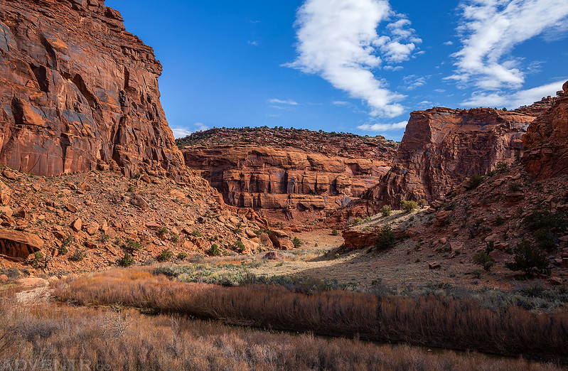
After returning to my Jeep I drove back out of Silveys Pocket and Big Gypsum Valley and then made my way over to Paradox Valley. A few years back Diane and I had spent a day searching for petroglyphs here. We found quite a few that day, but we had missed some that I was looking for, so I spent the rest of the afternoon visiting a few of the panels we had missed. It started to get windy in the afternoon during my drive into Paradox Valley, and it would stay windy for the remainder of the evening.
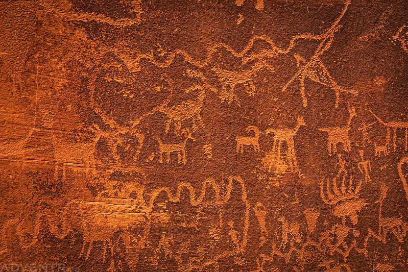
Hunting Magic Panel
Feet & Sheep

Big feet seem to be common in Paradox Valley petroglyphs.
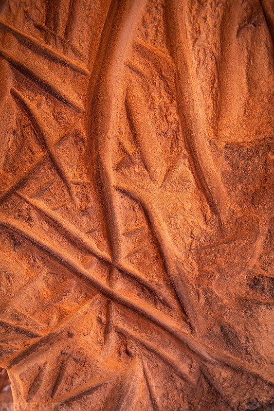
A closeup and more abstract shot of some sharpening grooves.
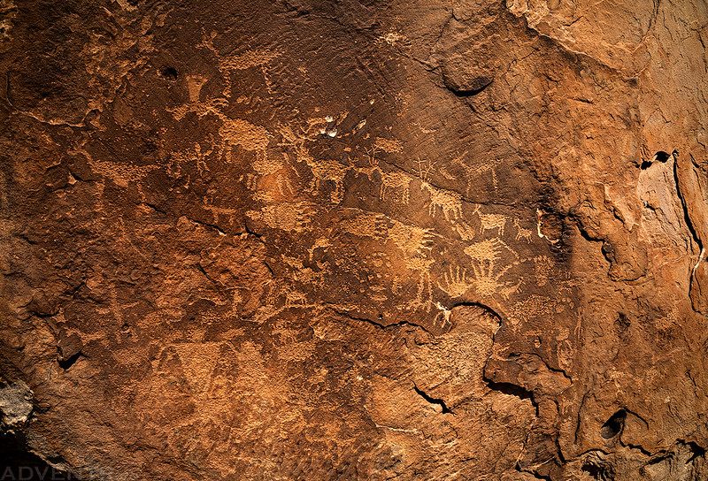
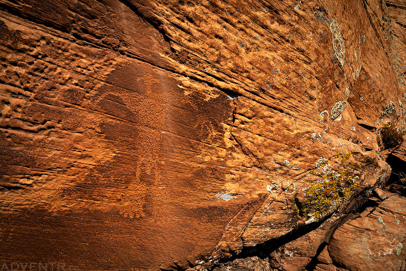
Slot Site Petroglyphs. This was the highlight of the afternoon and the main panel I had wanted to find on our previous visit.


This panel of petroglyphs are found just to the left of the Slot Site.

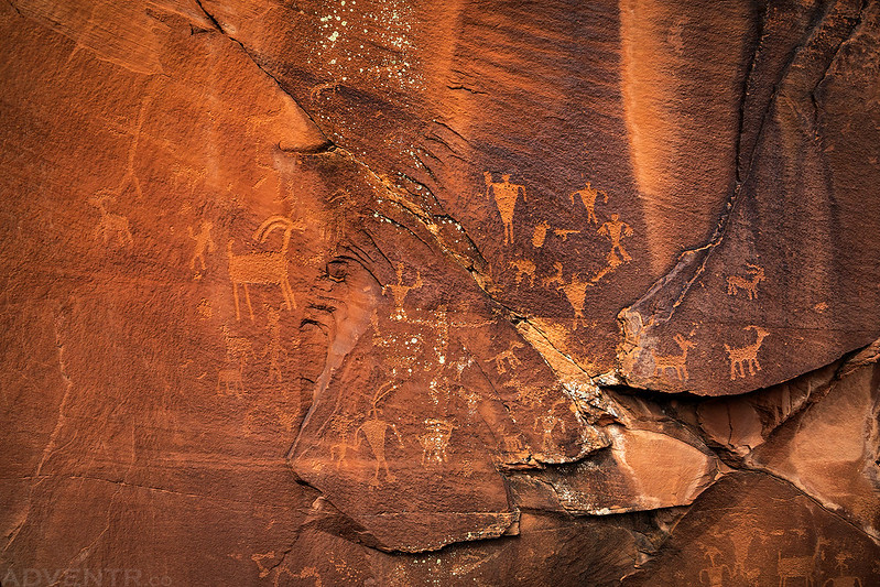
More big feet with what appears to be an atlatl stuck in its hand.
After visiting the petroglyph panels I headed off to the far western end of Paradox Valley and found a spot to camp for the night below Nyswonger Mesa, which would be pretty close to my planned hike for Sunday morning. Surprisingly, I could see the snow-covered Sneffels Range from my campsite along with the top of the Uncompahgre Plateau. I also noticed that the mosquitoes were starting to come out here in the evening.
A nice view in Paradox Valley as I drove to the west end to find a campsite for the night.

La Sal Creek to the Dolores River from the Cashin Mine
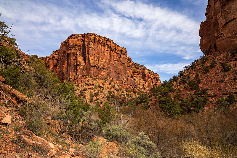
On Sunday morning I woke up with the sunrise and then headed a little further west, almost to the Utah state line, and then drove down La Sal Creek to the Cashin Mine. From here I planned to hike the rest of the way down La Sal Creek to its confluence with the Dolores River. I had hiked up the Dolores River from Bedrock a while back and had stopped at the mouth of La Sal Creek, so I wanted to finally close the loop. The route through La Sal Creek actually follows an old state highway, so I expected the hiking to be relatively easy, but I was wrong about that!
I started the hike from the old Cashin Mine at the end of the road in the canyon.

There were a bunch of mine shafts around here, but I liked this one with the bent tracks coming out of it the most.

Shortly after leaving the mine behind, the trail disappeared and the bushwhacking got pretty intense. At first, there was almost no trace of the old state highway that I could find. The bushwhacking got so bad in a few places that I almost gave up and turned around a couple of times. Besides the standard Colorado Plateau desert bushwhacking, there were also a lot of sharp thorns that could not be avoided! If you want to try this hike, know that you are going to get your feet wet as there are a number of crossings of La Sal Creek along the way, too.
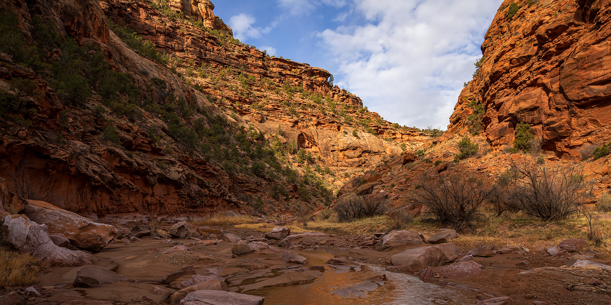
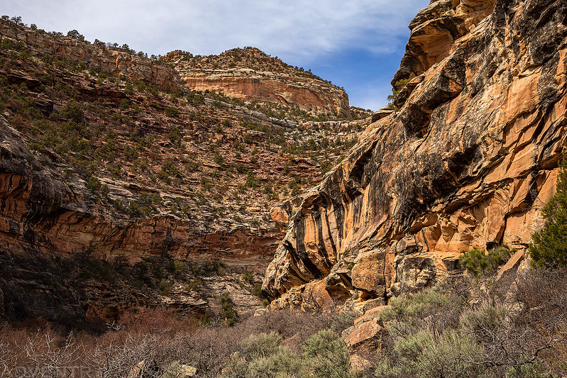
La Sal Creek Canyon Morning
I spotted this arch above me as I continued thrashing through the canyon.

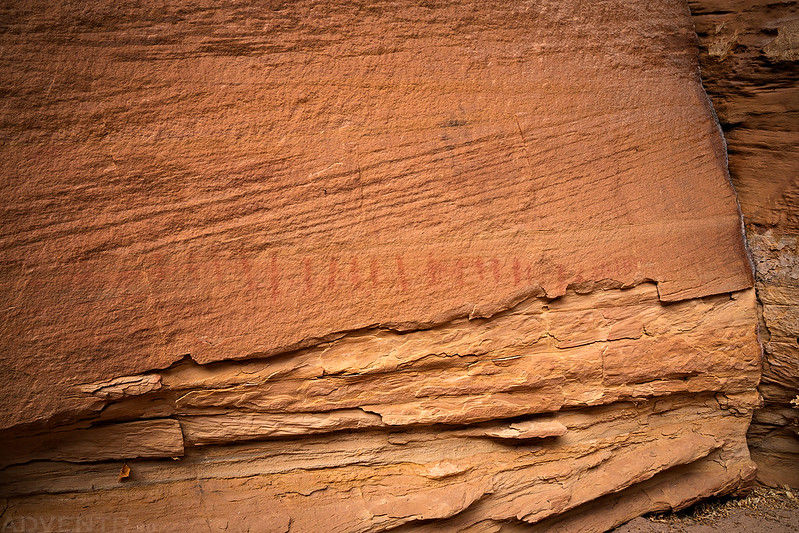
I didn’t find much rock art in the canyon, mostly because it was hard enough to just hike through all the vegetation, but I did come across these faint hash marks.

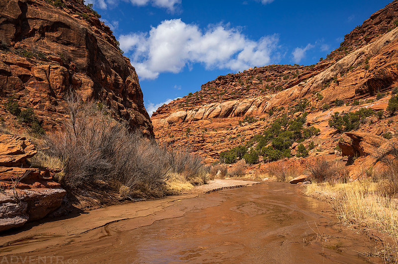
La Sal Creek

If you look closely, you might be able to tell that this photo was taken from the old roadbed that is now pretty overgrown in most places. The last mile and a half of the lower canyon became much easier than the first part of the hike, as long as you stayed on the old road.
After one last bushwhack at the mouth of the canyon I was soon overlooking the Dolores River again.

If I had an easy way to get back from Bedrock to the Cashin Mine (I don’t think many people would be interested in picking up a hitchhiker right now), I would have rather hiked out to Bedrock instead of going back the way I had come. But I really didn’t have that choice today…
The view up the mouth of La Sal Creek Canyon before I started hiking back up the canyon. I was not looking forward to the return hike…

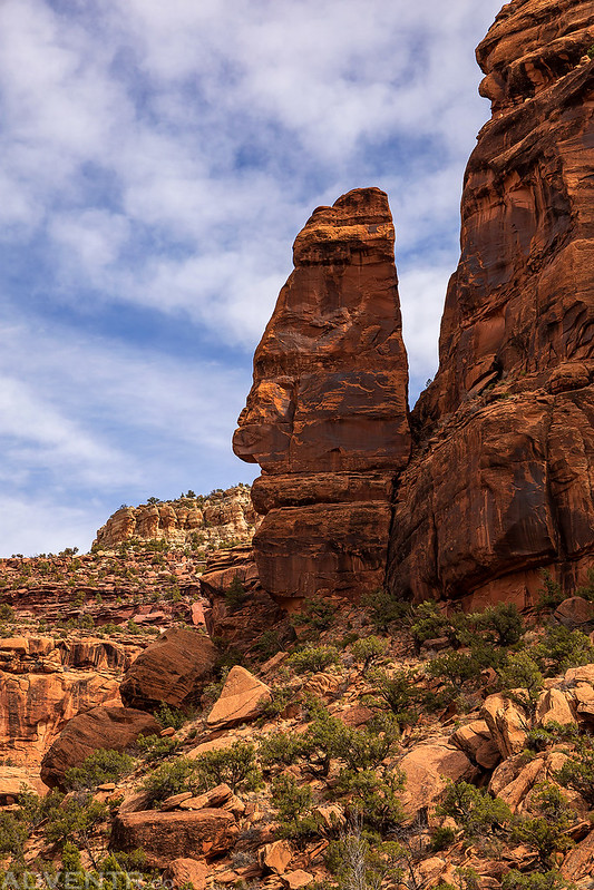
La Sal Creek Tower
Another overgrown bend in the canyon on my way back.

I’m not going to lie, I was pretty happy to see the Cashin Mine again!

Although I’m glad I didn’t give up on the hike, this is one I would probably not repeat or recommend, unless you really love bushwhacking! If you do plan to try it, I would highly recommend wearing long pants and long sleeves, as I scratched up my arms pretty good!
Interesting place. Glyphs were captured well. Lots going on in them. Thanks.