Press "Enter" to skip to content

Tag: wind

The Labyrinth Rims: Horsethief Point to Tenmile Point

Friday – Sunday, November 19-21, 2021

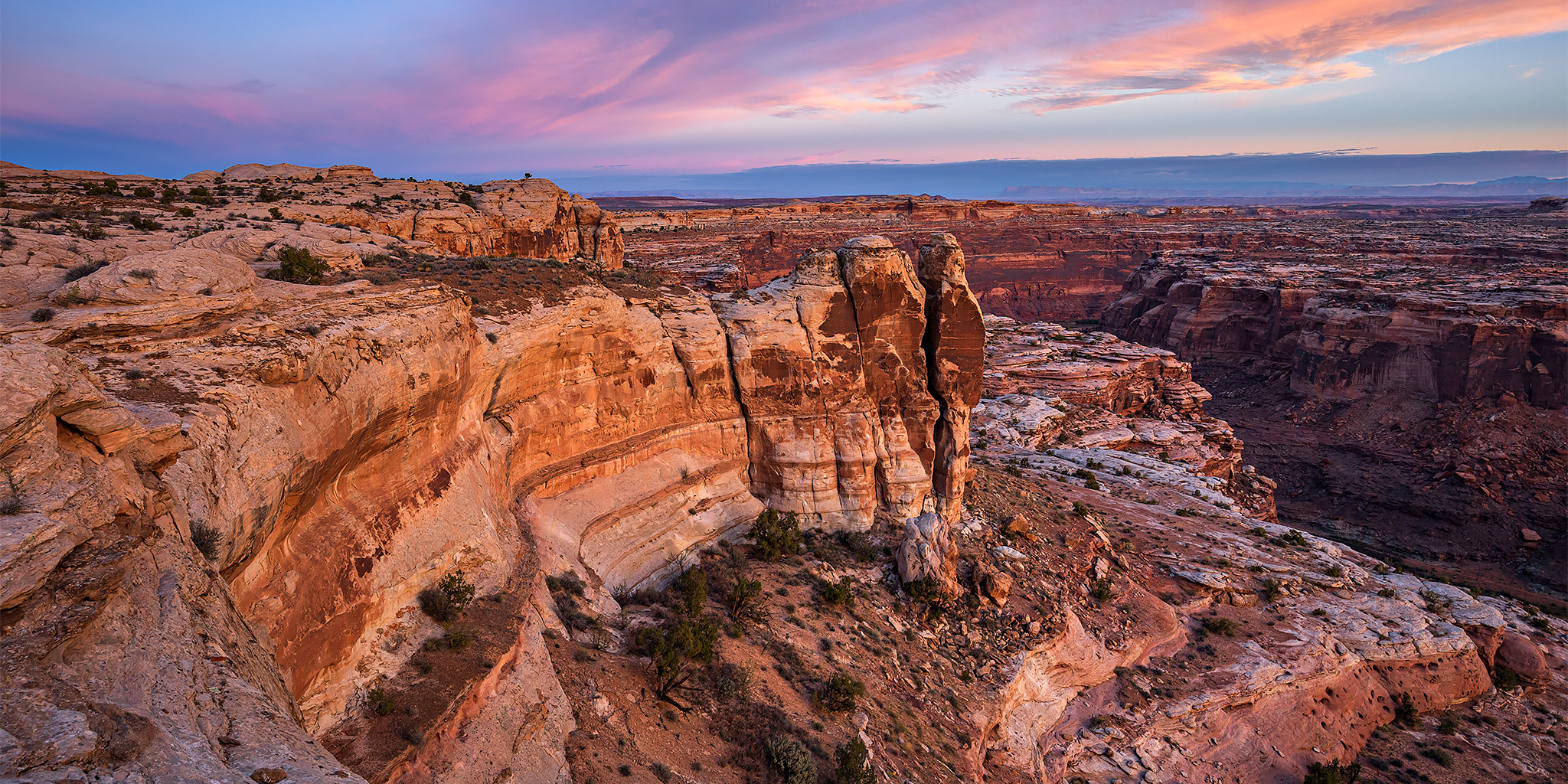
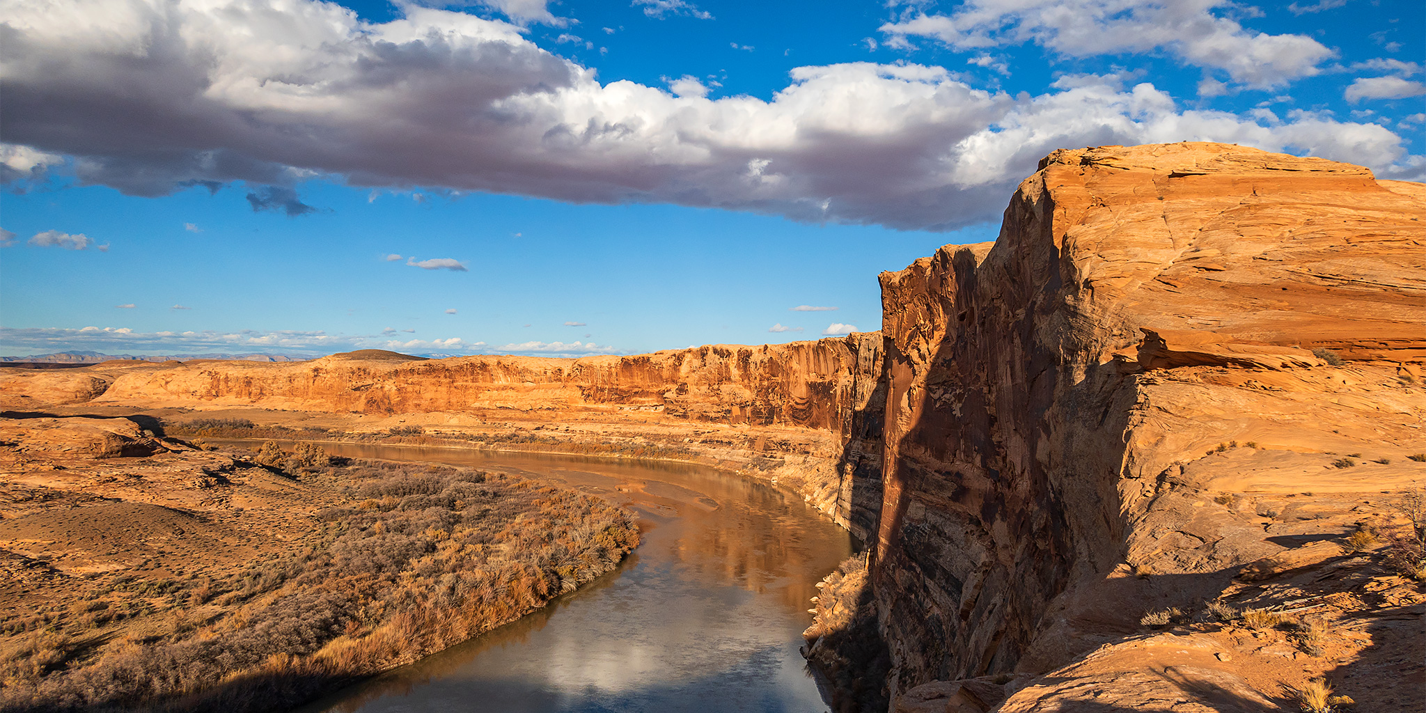
I was originally planning to spend this weekend on Cedar Mesa by myself, but after my issue while hiking last Friday I was a bit uncertain about hiking alone this weekend. I decided it would probably be a better idea to take it easy and stay a little closer to home. I didn’t want to do anything too strenuous alone yet, so I figured I could go back to my roots by doing some exploring and short walks from my Jeep. There are a bunch of Jeep roads north of Moab in the Labyrinth Rims area that I have never driven before, so I thought that would be a good place to go. Since I didn’t plan this trip out like I usually do, I basically just hopped in my Jeep with a map and an idea of a couple areas I wanted to explore along the way and went. I thought I would start the trip at the rim of Taylor Canyon on Horsethief Point and then make my way north along the eastern points of Labyrinth Canyon.

3 Comments

The Orange Cliffs: North Trail & Millard Canyon Rim

Friday – Sunday, November 5-7, 2021

This weekend I decided to spend a little time hiking and exploring along the Orange Cliffs in the Glen Canyon National Recreation Area, which are the tall Wingate Sandstone cliffs located to the east of Robbers Roost and to the west of The Maze. Since I have already hiked all of the official trails that descend from the Island in the Sky and the Canyon Rims Recreation Area, I thought it was finally time to check out the North Trail which descends from North Point to Elaterite Basin. Most people that hike this trail use it to access The Maze when they don’t have a vehicle that can be driven down the Flint Trail, but since I’ve never had that problem I never really had a reason to hike it before, so I was looking forward to finally checking it out.

1 Comment

The Good Gallery & Bowknot Bend Overlook

Friday – Sunday, October 22-24, 2021

This weekend I decided to stay just a little bit closer to home than I have the past couple of weekends, and headed over to the west side of the Green River so I could spend some time in the Horseshoe Canyon and Labyrinth Canyon Wilderness areas. I was hoping to check out a large Barrier Canyon Style pictograph panel that I had not been to yet and then hike to an overlook of the Bowknot Bend Saddle from Keg Point. I left right after work on Friday afternoon and headed west into Utah. I stopped for gas in Green River and then followed the Hans Flat Road until it was dark out and found a spot to spend the night. There was a pretty nice sunset during the drive, but I didn’t stop to take any photos this time. I was anticipating it to get a bit cold overnight, but surprisingly it never got down below 50 degrees and was very comfortable. On Saturday morning I was up shortly before sunrise and then made my way over to the starting point for my first hike.

Leave a Comment

ABC’s of the Green River: Red Canyon to Browns Park

Flaming Gorge Dam to the Swinging Bridge | High CFS: 1,870 – Low CFS: 1,240
Saturday – Tuesday, September 18-21, 2021

The middle and latter part of September is probably my favorite time of the year to go on a nice relaxing river trip. The heat of summer is starting to diminish, but it’s still usually warm enough to go for a swim. The rivers are lower and slower making a more enjoyable trip for those of us who aren’t really into the swift water and big rapids. The low water also means there are a lot of sandbars for camping on, which is my favorite kind of camping. The nights are beginning to to get longer and cooler and most of the bugs are usually gone! What more could you ask for? After spending a few days on the Colorado River in Canyonlands National Park last September, this year Jackson, Chris and I decided to follow in the footsteps of John Wesley Powell again and check out the Green River just below the Flaming Gorge Dam from Red Canyon to Browns Park. This segment of the Green River is known as the ‘ABC’ section because it is divided into three different sections; Section A from the Flaming Gorge Dam to Little Hole is about 7 miles, Section B from Little Hole to Indian Crossing is about 8 miles, and Section C from Indian Crossing to Swinging Bridge is about 15 miles- for a total of about 30 miles. We planned to do the whole stretch.

2 Comments

Southern Sawatch Saweekend

Friday – Sunday, September 10-12, 2021

This weekend was going to be the last opportunity for me to hike a 14er this summer, and since I have climbed at least one 14er each summer since 2010 I was originally planning to. However, as I started figuring out my weekend plans I just wasn’t feeling like hiking on a busy trail and was looking for a little more solitude, so I decided to skip the 14ers this year and headed to the southern Sawatch Range to hike a few peaks along the Continental Divide instead. I left from work on Friday afternoon and headed to Gunnison, taking the route through Hotchkiss and Crawford since Highway 50 is still closed until 5:30pm on weekdays and I wasn’t sure how quickly I would get to that point. I topped off my fuel tank in Gunnison and then made my way over to Pitkin and started up the road to Hancock Pass. Unfortunately, the road near the top of the pass was much rougher than I remember it being and I wasn’t comfortable driving a section of it in the dark, so I returned all the way back to Highway 50 and drove over Monarch Pass to the Middle Fork of the South Arkansas River and found a place to spend the night shortly before the end of that road. It was pretty late by the time I arrived, so I went right to bed.

Leave a Comment