Press "Enter" to skip to content

Tag: wildlife

Wetterhorn Peak

Saturday & Sunday, August 22-23, 2015

Over the years I have spent a lot of time in and around the Uncompahgre Wilderness of the San Juan Mountains, and every time I do I usually see the massive Uncompahgre Peak looming above all the other mountains along with it’s shorter but more rugged neighbor, Wetterhorn Peak. I have wanted to climb Wetterhorn Peak for a long time, but the class 3 route to it’s summit combined with exposure had stopped me from trying until I gained more experience. For years I have looked at photos and videos of the final climb to the summit and thought that there was no way I’d be able to do that, so I kept putting it off. After a few years of hiking easier fourteeners, it was finally time for me to attempt my first class 3 route and I knew it would have to be on Wetterhorn.

4 Comments

The Dragon’s Back

Saturday & Sunday, July 25-26, 2015

This weekend Diane and I went on an overnight backpacking trip into the Uncompahgre Wilderness of the San Juan Mountains to explore and photograph the area around Unnamed Peak 12968, which is unofficially known as the Dragon’s Back. I have wanted to visit this area for a few years and had planned to finally get there sometime this summer, so I’ve been waiting for the right weather forecast on a weekend when I was also free. With the wet and stormy weather we’ve been having around here lately, this proved to be a challenge. Finally, we had some drier air move into the area and this weekend looked like it would be mostly storm free and might still have good conditions for photography. It turned out to be a great weekend for this trip and I couldn’t have asked for a better sunset on Saturday evening!

3 Comments

Red Mountain Pass Peaks

Friday – Sunday, July 10-12, 2015

June was a busy month for me that prevented me from spending much time outside and then I got sick over the long Independence Day weekend, so it’s been quite a while since I’ve been out hiking and camping and I really needed to get back into the mountains this weekend! Since I’m a little out of shape, I thought it would be a good idea to start out the season hiking a few easier peaks near Red Mountain Pass this weekend that I’ve thought about climbing for years. Diane and I left after work on Friday and drove through Ouray to one of our go-to campsites in Mineral Basin. We quickly setup camp at 11,600 feet elevation and were soon sleeping. I know that some people have trouble sleeping at higher elevations, but I almost always sleep well over 10,000 feet and this night was no exception.

Leave a Comment

Foggy Morning at the Monument

Saturday, April 18, 2015

After a storm moved through western Colorado and left a lot of precipitation behind the past few days it looked like it was going to finally clear this morning, so I woke up early and drove up to the Colorado National Monument shortly before sunrise to take a few photos. I never did get the sunrise that I was hoping for, but the valley below was filled with low clouds and fog which is always fun to watch and photograph.

3 Comments

Toms Canyon to the Little Dolores River

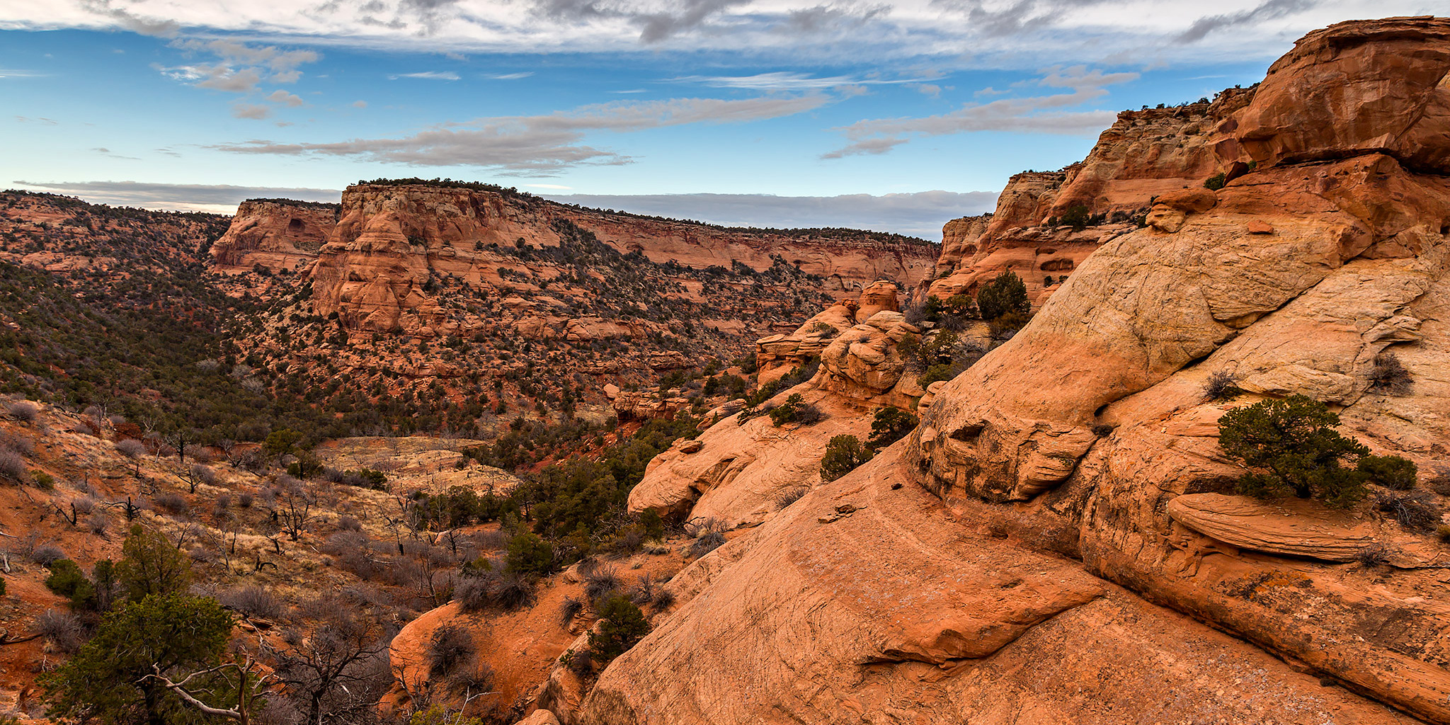
Saturday, December 6, 2014

In a recent conversation with a Facebook friend, he mentioned to me that there might be some rock art located along the Little Dolores River between two parcels of private property. After doing some research on the property boundaries and finding that access would probably be possible by hiking down Toms Canyon, I mapped a possible route on Google Earth that avoided all private property and stayed on BLM land to the area. The only concern I had left was finding an access point down into Toms Canyon from the rim. I had found a spot on Google Earth that looked good, but would not know for sure until I was there and checked it out for myself. On Saturday morning I decided to head up and give this hike a shot. After stopping at the Visitor Center in the Colorado National Monument to pick up a calendar that features one of my photos, I continued up through Glade Park to the Little Dolores Road and took it almost to it’s end at the private property. I turned off on a side road that lead to a campsite and started hiking from there. First, I had to climb to a short pass on a faint trail that gave me a nice view down into Toms Canyon. The faint trail I followed up to the pass pretty much ended there and I had to bushwhack through the steep and rocky wash on the way down into Toms Canyon. There was one rocky ledge that I thought was going to stop me and prevent me from going further, but after a little searching I managed to find a way down. It turns out that the route I had planned in Google Earth worked out perfectly. Once I was down in Toms Canyon the hiking was much easier and I followed some well-used cow trails.

Leave a Comment