Press "Enter" to skip to content

Tag: sneffels range

Blaine Basin

Saturday & Sunday, July 9-10, 2016

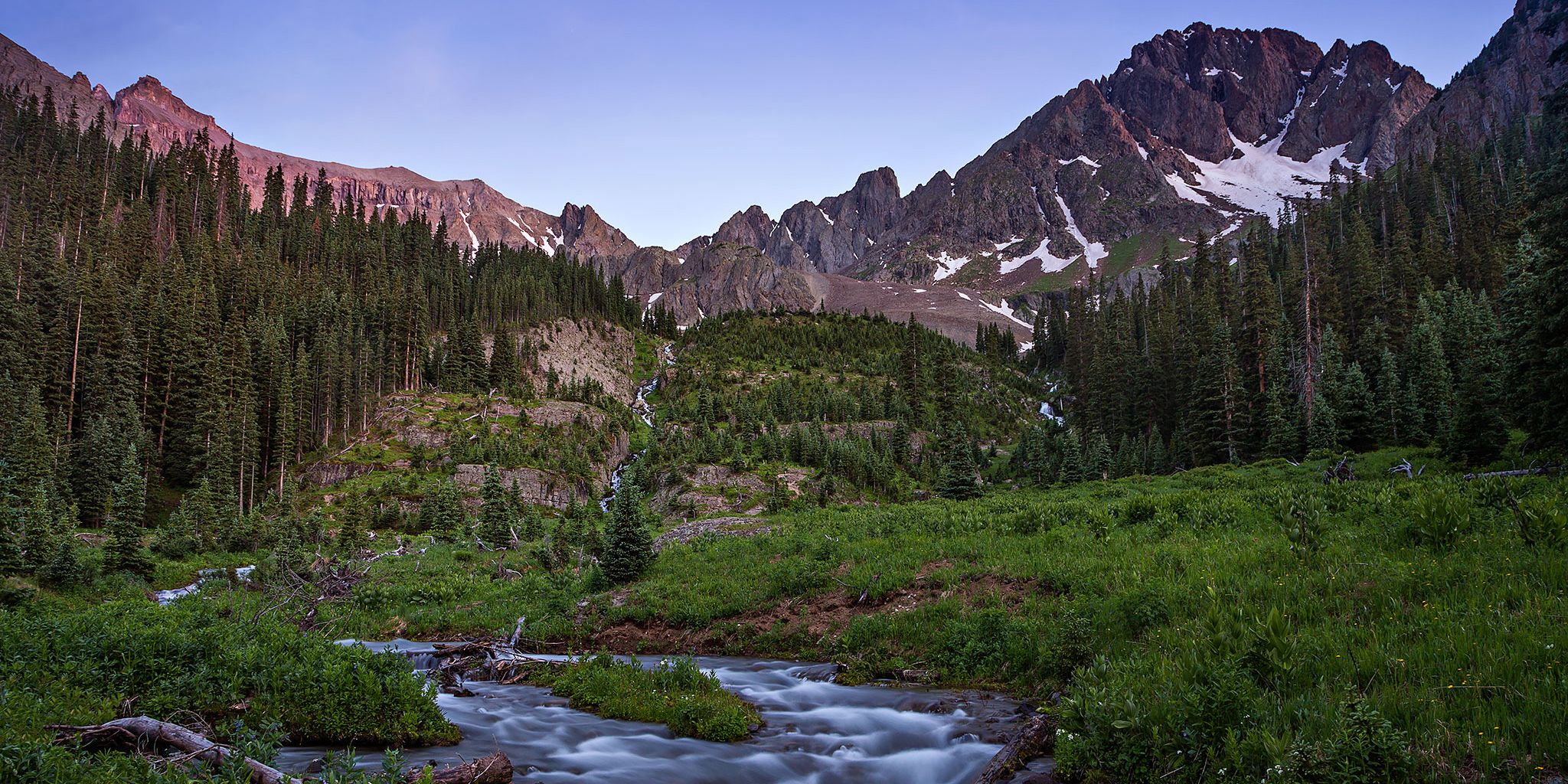
Since Diane and I won’t be able to get back into the outdoors for the rest of the month I wanted to do a quick and easy overnight backpacking trip in the mountains this weekend. I was looking for something close to home that wouldn’t be crowded and thought that Blaine Basin in the Sneffels Range of the San Juan Mountains would be a good option. We left home later than usual on Saturday morning and arrived at the Blue Lakes Trailhead around 11am. I was blown away by how many vehicles were at the trailhead! It was crazy! There were cars lined up and down the road pulled over any place they could find to park. At this point I was second guessing the trip because I wasn’t convinced that all of these people were headed to the Blue Lakes?

1 Comment

The Black Canyon of the Gunnison

Saturday, October 17, 2015

It’s been a few years since I had been to many of the main overlooks along the South Rim in the Black Canyon of the Gunnison National Park and I thought it was time to finally get back for another visit. Diane and I left home early enough on Saturday morning so that we were able to make it to the Cedar Point overlook about a half hour before the sun came up. I spent that time photographing The Painted Wall and the deep canyon below us until shortly after the sunrise. Once the sun was up we drove the rest of the way to the end of the road and hiked out to Warner Point since I had never been out there before. Clouds started rolling in from the west as we hiked back to the trailhead as a storm front moved into the area that was supposed to bring us some rain for the next couple of days. After our hike, we drove back out of the park and stopped at a couple of the other viewpoints along the way. Before leaving we drove down the East Portal Road to the Crystal Dam on the Gunnison River and were pleasantly surprised to find a couple nice patches of fall colors along the way. It’s always nice to spend a few hours along the rim of The Black Canyon.

2 Comments

Abrams Mountain & Cimarron Thirteeners

Saturday & Sunday, September 19-20, 2015

On my quest to hike and explore more of the Uncompahgre Wilderness I decided to climb a pair of thirteeners in The Cimarrons along the high ridge that towers between the West Fork and the Middle Fork of the Cimarron River. The peaks along this ridge are prominent landmarks on the horizon every time I drive south into the San Juan Mountains and it was time to finally get a closer look.

3 Comments

Twin Peaks

Saturday, June 13, 2015

This morning I drove down to Ouray so I could try and climb my first mountain summit of the year. After this weekend I’m going to be pretty busy for the rest of June and I didn’t want to wait until July to get into the mountains for the first time this year. Since I’m not in the best shape right now and the weather forecast was predicting that storms would move into the area late in the morning, I decided to hike to the top of Twin Peaks (10,798 feet), a famous Ouray landmark. There are currently two trails that will get you to the summit- a new trail and an old trail. The reason for this is because in the early 1980’s the Old Twin Peaks Trail was washed out by a major storm. To replace the old trail, a new connector from the Oak Creek Trail was built to bypass the washed out section. This trail is now known as the New Twin Peaks Trail. In 2004 the Ouray Trails Group reconstructed the old trail which now consists of over 300 steps and 1,300 feet of elevation gain within 1.2 miles. Apparently, the Forest Service won’t officially sanction the reconstructed trail because they consider it too steep, but it is back on the maps.

1 Comment

Courthouse Mountain

Fall Colors 2014
Saturday & Sunday, September 20-21, 2014

On Saturday, Diane and I headed back down to the San Juan Mountains again so we could climb to the top of Courthouse Mountain in the Cimarron’s . While this mountain is short compared to the surrounding peaks in the area at only 12,152 feet, it is uniquely shaped and has over 1,000 feet of vertical prominence. It’s also a very distinguishable peak near Owl Creek Pass that is often photographed, especially in the fall when the surrounding mountainsides are changing colors. I have seen this mountain in the skyline for many years when I would drive to Ouray and Silverton, and decided it was finally time to climb to the top a few weeks ago when I had a different view of it during our hike into Wetterhorn Basin. While there were afternoon storms predicted after 3:00pm today, we didn’t need to get too early of a start for this hike since it’s a relatively short trail, clocking in at just under 2 miles, but it climbs almost 2,000 feet of elevation in that short distance.

Leave a Comment