Press "Enter" to skip to content

Tag: gpx

The White River: Floating through the Uinta Basin

Bonanza Bridge to the Enron Ramp | Fantasy Canyon & Goblin City
Friday – Sunday, June 28-30, 2019

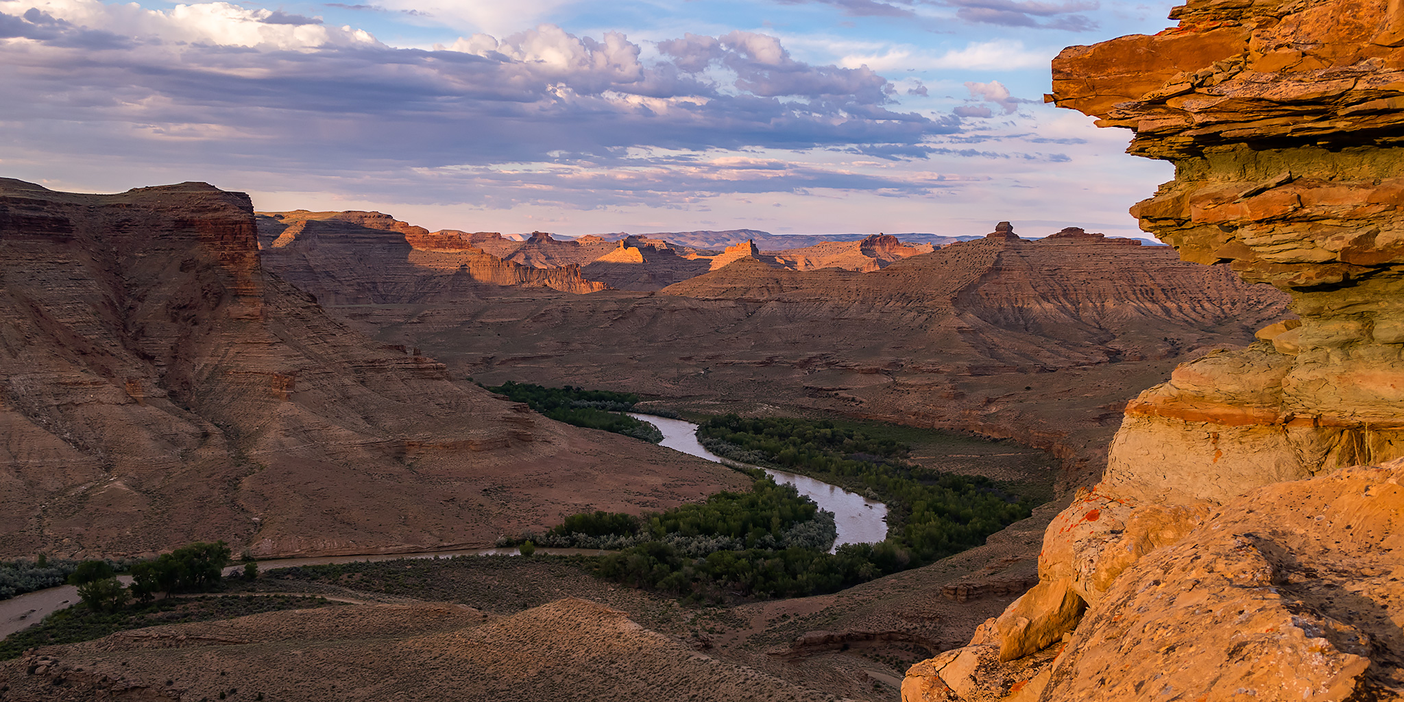
For the last weekend of National Rivers Month I definitely wanted to keep the streak going and get out on the river one last time before I started heading up into the mountains. I wanted to go somewhere new that wasn’t going to be crowded and that didn’t require a permit, so after looking at my options I decided to give the White River in Utah a try. There’s not too much information out there about this stretch of river, but from what I could find it looked like this would be a nice relaxing desert trip that doesn’t see too many people. The White River is born from snowmelt in mountain headwaters of the Flat Tops in western Colorado near where we hiked Sleepy Cat Peak early last summer, and then it flows west through Meeker and Rangely before entering Utah. From the state line it continues winding its way through the gas fields of the Uinta Basin along the northern edge of the East Tavaputs Plateau and joins the Green River in the Uintah and Ouray Indian Reservation. Our journey this weekend would begin at the Bonanza Bridge and end at the Enron Boat Ramp, which is about 35 miles of the river.

4 Comments

Triangle Canyon: Cactus Park to the Gunnison River

Dominguez Canyon Wilderness | Ten Year Anniversary
Saturday, March 30, 2019

I spent the last two weekends hiking in the Needles District of Canyonlands and will be going back again in another week and a half, plus we had a concert to go to on Sunday evening, so this weekend we planned to stay close to home and take a little bit of a break from driving. Saturday was also the ten year anniversary of the designation of the Dominguez-Escalante National Conservation Area through the passage of the Omnibus Public Land Management Act of 2009, so we decided to celebrate the occasion by hiking down an unnamed canyon within the Dominguez Canyon Wilderness to a petroglyph panel that I first visited on a river trip back in 2012. This canyon, located just north of the more popular Dominguez Canyon, has no official name on any map that I’ve seen, so I’m simply going to refer to it as Triangle Canyon since it sits just below Triangle Mesa.

1 Comment

Westwater Mesa Loop

Sunday, December 30, 2018

Well, here it is! Our 65th and final trip report of the year and our very last hike of 2018. When we woke up on Sunday morning I had no plans scheduled for the day but I did know that I wanted to get out hiking at least one last time this year, so I looked at some maps and settled on the Westwater Mesa Loop Trail in the Utah Rims area just west of Rabbit Valley. Since it was pretty cold out this morning Diane and I waited until the the afternoon when it warmed up into the low 30’s to start our short drive to Utah and start hiking. After getting off the interstate at the Westwater exit and then following the Kokopelli Trail for a short distance we parked at the edge of Westwater Mesa and started hiking. This trail is about 7.5 miles in length and pretty much follows the rim of the mesa most of the way with views over Bitter Creek, Westwater Creek and the Colorado River. It was a nice local hike to end the year with. Here’s to a great 2019!

1 Comment

Lower Salt Wash Canyon

Friday – Saturday, December 14-15, 2018

Salt Wash begins its journey near Thompson Springs at the southern end of the Book Cliffs just east of Sego Canyon. From there it meanders generally south across Yellow Cat Flat and joins up with Lost Spring Canyon inside the boundary of Arches National Park. This desert wash eventually passes by the Wolfe Ranch near the popular trailhead for Delicate Arch as it enters Cache Valley and then carves a deep canyon through Dry Mesa just east of The Windows before finally reaching the Colorado River. I have studied this particular canyon on maps over the years and thought about hiking it a number of times before, but I always seem to find somewhere else I’m more interested in going instead. I haven’t found much information about hiking this canyon and wasn’t sure what to expect, but I guess that is what intrigued me about this location in the first place.

1 Comment

Stone Desert: End of Trails in The Needles

Big Spring Canyon – Elephant Canyon Loop
Friday – Sunday, November 30 – December 2, 2018

After looking over the official map for the Needles District of Canyonlands National Park earlier this year, I noticed that I had hiked just about every single trail on it, so I figured it would be a good goal to try and finish hiking them all this year. After hiking a few of those remaining trails earlier in the year, I only had a few segments of trails in the Big Spring Canyon area left, so Diane and I headed down to The Needles this weekend so I could finish them up in one big loop on Saturday.

8 Comments