Press "Enter" to skip to content

Tag: google map

Twin Peaks

Saturday, June 13, 2015

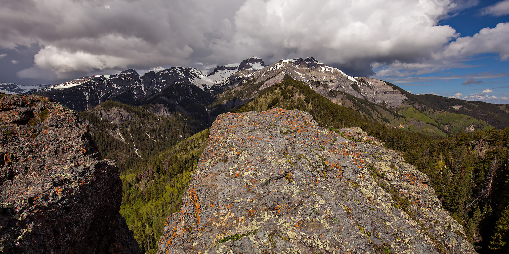
This morning I drove down to Ouray so I could try and climb my first mountain summit of the year. After this weekend I’m going to be pretty busy for the rest of June and I didn’t want to wait until July to get into the mountains for the first time this year. Since I’m not in the best shape right now and the weather forecast was predicting that storms would move into the area late in the morning, I decided to hike to the top of Twin Peaks (10,798 feet), a famous Ouray landmark. There are currently two trails that will get you to the summit- a new trail and an old trail. The reason for this is because in the early 1980’s the Old Twin Peaks Trail was washed out by a major storm. To replace the old trail, a new connector from the Oak Creek Trail was built to bypass the washed out section. This trail is now known as the New Twin Peaks Trail. In 2004 the Ouray Trails Group reconstructed the old trail which now consists of over 300 steps and 1,300 feet of elevation gain within 1.2 miles. Apparently, the Forest Service won’t officially sanction the reconstructed trail because they consider it too steep, but it is back on the maps.

1 Comment

Upper Pollock Canyon

Liberty Bell Arch
Sunday, May 10, 2015

After spending the last two weekends backpacking in Grand Gulch I needed to spend a more relaxing weekend at home so I could start preparing for an upcoming trip on the San Juan River later this week. It had rained on and off all day on Saturday, but it looked like things might start finally clearing up on Sunday morning and I wanted to get out for at least one local hike this weekend. A few weeks back when I had hiked into the East Fork of Pollock Canyon I had run into Steve Obser, another local hiker, who had mentioned a nice arch in the upper section of the canyon that is known as Liberty Bell Arch (I have recently seen this same arch called Pollock Arch and Picture Window Arch). I thought that this arch might make for a nice destination this morning, so I decided to hike into the upper Pollock Canyon for a little exploring. After looking at my maps, it looked like hiking up the trail through Flume Creek Canyon and then crossing over the saddle at the far end of the Pollock Bench would be the shortest route into the upper canyon, so that’s the way I went. It was a pretty straight-forward hike and got me where I wanted to go, though I’m not really sure if it saved me much distance or elevation gain. I ended up hiking about 9.3 miles round trip this morning.

4 Comments

Rabbit’s Ear Trail

Sunday, April 19, 2015

This morning I decided to sleep in a little later since I was up early on Saturday morning to photograph the sunrise at the Colorado National Monument. After breakfast, Diane and I drove over to Rabbit Valley near the state line for an afternoon hike on the Rabbit’s Ear Trail. This is a nice trail that climbs to the top of Rabbit’s Ear Mesa and then loops around the rim with expansive views over Ruby Canyon of the Colorado River and the rest of the McInnis Canyons National Conservation Area. Since we were out hiking under harsh mid-afternoon light I didn’t take many photos, but I will definitely be returning in the future to make some better images from this location. Here are a couple of snapshots from our hike…

Leave a Comment

Quick Rattlesnake Arches Hike

Sunday, April 12, 2015

Diane and I ended up having a rare lazy weekend at home, but we managed to get outside for a short hike on Sunday afternoon. Diane had never been to the Rattlesnake Canyon Arches before and since the upper Black Ridge Road had just opened for the season we decided to visit them. We started from the upper trailhead and followed it down to the main Rattlesnake Canyon Trail until we reached the arches. After reaching Cedar Tree Arch (the end of the trail), we climbed through the arch to the rim of the canyon to shorten the hike back to my Jeep. While I have hiked this trail a few times before, I had never felt comfortable climbing through the arch when I was alone. We were easily able to climb through the arch this time with each other’s help and didn’t have to retrace our steps back to the trailhead. With clear blue skies and harsh light I didn’t really take many photos this time, but I do have a couple snapshots that I will share.

Leave a Comment

Colorado National Monument Traverse II

The Monument from Top to Bottom | Black Ridge Loop
Saturday & Sunday, March 28-29, 2015

After completing a traverse across the face of the Colorado National Monument last year I decided that I wanted to put together a longer loop through the Monument to hike this year. The route I strung together begins at the Kodels Canyon trailhead outside of the Monument near Fruita and climbs up the historic Fruita Dugway trail where it connects with the Black Ridge Trail. The Black Ridge trail is the highest trail in the Colorado National Monument topping out at just over 6,700 feet. Since the trailhead is at about 4,700 feet, this route ascends over 2,000 feet of elevation gain while climbing from the lower part of the Monument to the higher part. After following the Black Ridge Trail to it’s end at the Upper Liberty Cap trailhead we would then follow the entire Liberty Cap trail back down to the Wildwood trailhead. Since this route is about 18 miles in length, I thought it would make a nice overnight backpacking trip so that we could take our time and spend a night in the Monument. I stopped by the Visitor’s Center on Friday and picked up a backcountry camping permit so that we could start the hike bright and early on Saturday morning.

Leave a Comment