Moab Winter Weekend | Moab Area Rock Art XXXIV
Saturday & Sunday, December 24-25, 2022
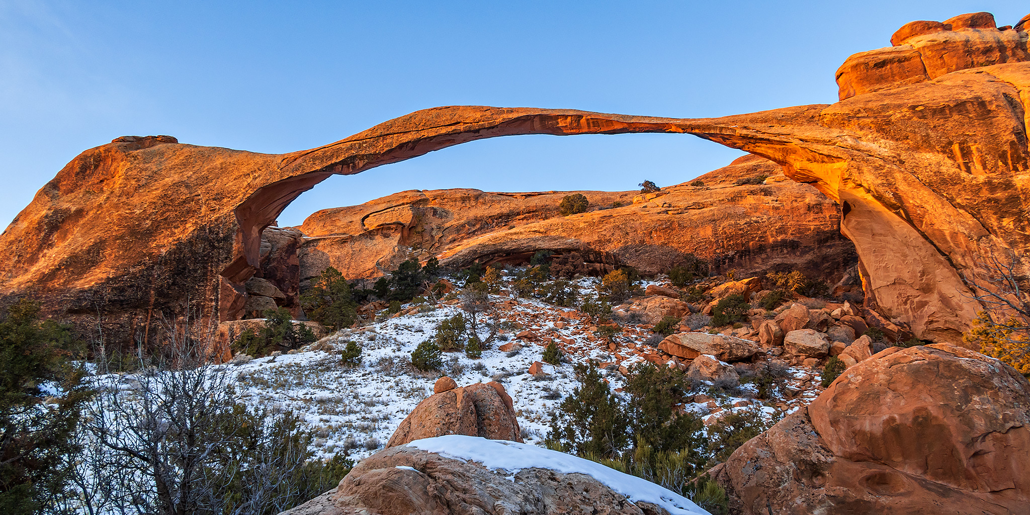
Christmas is here once again, which means that it was time for Diane and I to continue our annual tradition of spending Christmas Day in Arches National Park. This would be my fifteenth year visiting Arches around the yuletide holiday and Diane has been joining me for the past nine of those years on Christmas Day. Since Christmas fell on a Sunday this year, Diane and I headed down to Moab on Saturday morning and we did a little exploring around the area before spending the night in town. Then we got up early on Sunday morning and drove to the Devils Garden Trailhead so we could hike out to Landscape Arch at sunrise before we spent the rest of the day in other parts of the park.
2 Comments