Press "Enter" to skip to content

Tag: cisco

The Colorado River: Cisco Landing to Hittle Bottom

Average CFS Above the Dolores River: 26,278  //  Below the Dolores River: 32,500
Sunday, May 14, 2023

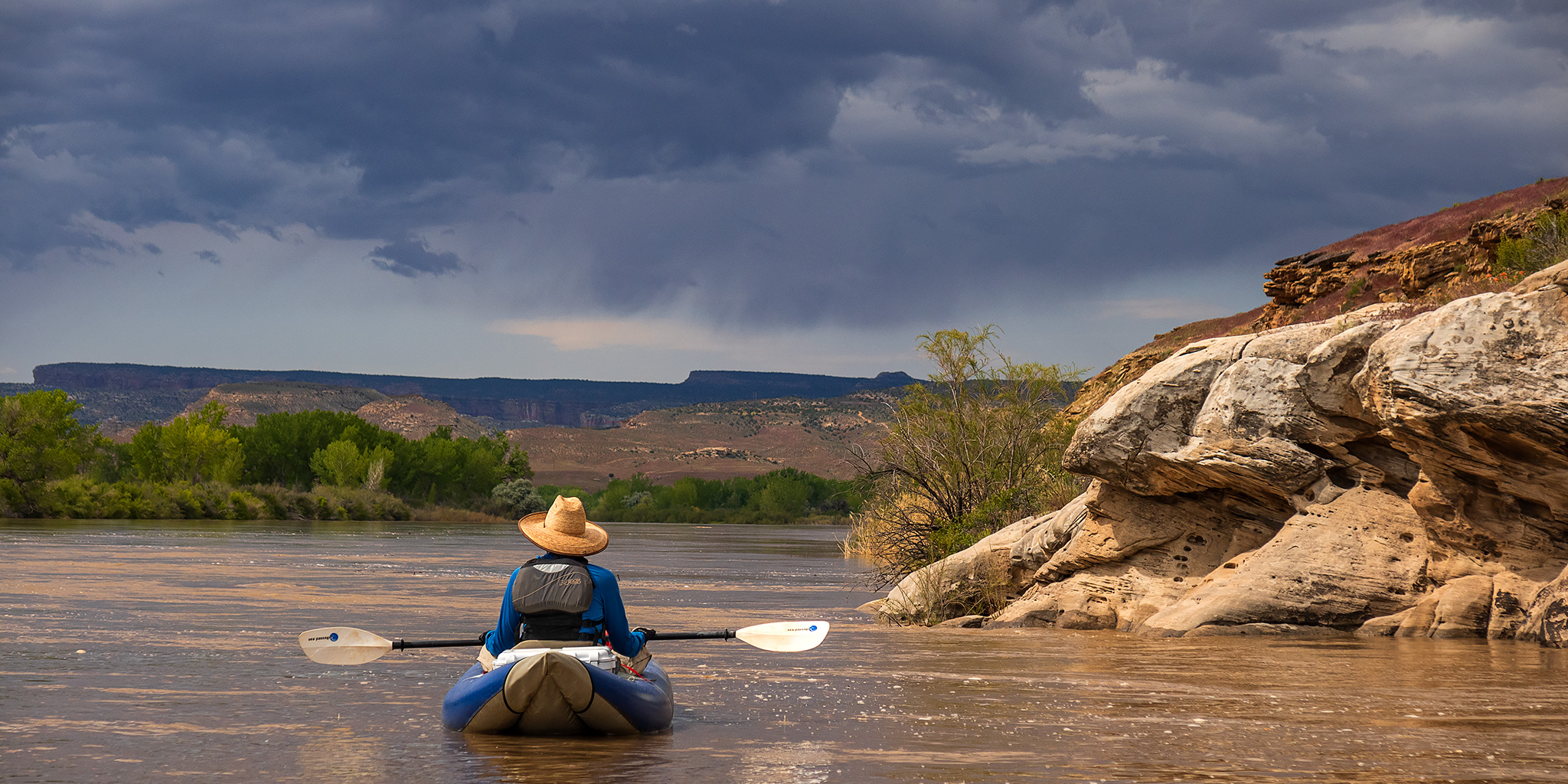
After spending five days on the Yampa River last week and then yesterday morning hiking in the Black Canyon of the Gunnison it was time for Jackson and I to get back out on the river again for a short day trip. Today we planned to float a section of the Colorado River that we had not been on before, starting from Cisco Landing and taking out at Hittle Bottom. With the water level around 30,000 CFS we knew the river was going to be high and fast, and figured that we would make it through this section of the river pretty quickly. We were right since we ended up floating all 23 miles in just about four hours and made it home by the early afternoon!

2 Comments

Salt Wash: Lost Spring Canyon to Cordova Canyon

Arches National Park | Saturday, April 23, 2022

Recently I realized that it’s been a while since I last explored the backcountry of Arches National Park and I was definitely overdue for a return. After a winter hike down Lower Salt Wash Canyon a couple years ago I’ve been interested in exploring the upper reaches of Salt Wash and a recent Trip Report from Dennis finally gave me the motivation I needed to get back out to that area. I was all set to leave after work on Friday afternoon like I usually do, but a storm system was moving through the area with very strong winds and rain, so I decided to stay home overnight and then leave early in the morning since I wasn’t travelling far from home this weekend. After a good night of sleep I woke up early on Saturday morning, grabbed a quick breakfast and headed west into Utah.

1 Comment

The Sandstone Bowl

Saturday, March 1, 2014

When Diane and I woke up Saturday morning we had no plans for the day. We wanted to do something outsite but the weather was calling for rain all day. In the end we decided to ignore the weather reports since it looked nice outside and took a last minute trip just over the stateline into Utah so I could check on a geocache that I had placed a few years back. It’s in a remote area that sees little traffic so very few people have actually found it. It had been a while since I had been out that way and I was looking forward to hiking around the area. After getting off the pavement onto the Yellow Cat Road we ran into some pretty muddy conditions that slowed down driving, but nothing too bad. After leaving the Yellow Cat Road we pretty much drove on sandy roads the rest of the day and didn’t have to deal with any more slippery mud. Although, a lot of the two-track roads we drove were filled with tumbleweeds, so we had to deal with those instead. It appears that we were the first vehicle on some of these roads this season. Even though there were storms all around us for most of the day we managed to miss most of the rain. It was a bit windy out all day, but the scattered clouds made for some excellent photography conditions with the changing light and shadows. My favorite kind of day!

2 Comments