Diane’s Birthday Ride on the White Rim Trail in Canyonlands National Park
Saturday – Monday, October 17-19, 2020
Earlier this year Diane told me that she wanted to mountain bike the White Rim Trail in Canyonlands National Park for her birthday in October. I told her I would try to make it happen, but that it would depend if I could get permits or not since they can be hard to get for that time of the year. Although I really have no desire to bike the White Rim Trail myself, I knew that I would be perfectly happy to carry all of the gear in my Jeep for the trip as it’s been a while since I drove around the entire White Rim. Earlier this year and late last year I had driven in part of the way from both ends of the White Rim Road, but the last time I drove the entire route was to celebrate Canyonlands 50th Birthday in 2014, so I was looking forward to getting back out and doing it again. This trip would also be a good opportunity for me to take it slow and make this a nice easy and relaxing trip where I could stop and go on a few obscure hikes along the way.
So back in June about four months before Diane’s birthday I set my alarm a couple of minutes before midnight for a couple of nights and managed to snag a permit for two nights over the weekend closest to her birthday. I rarely ever try to get Canyonlands permits during the busy seasons and it was tough! ** I had to be fast to get them! Not only did I manage to get two campsites for the weekend, but they were pretty evenly spaced out to divide the trip as equally as I could over the three days. Plus, they were all new campsites that I have not stayed at before, so that was an added bonus! Now all we had to do was wait until October for the fun to begin!
** As I finally sit down to write this Trip Report at the beginning of December, Canyonlands has recently moved their permit system to Recreation.gov, so I guess we’ll see how that changes things in the future? Maybe they’ll eventually have to move to a lottery system for White Rim camping permits?
The original plan for this trip was for Diane to invite a few of her friends to join her, some on bikes and maybe another vehicle or two. She also had me invite Jared along since he has biked the White Rim a couple of times before and thought it would be good to have someone experienced with us. Unfortunately, as the trip grew nearer many of her friends had to back out which left only Diane, Jared and myself still going. I tried to invite a couple of my friends with so we could at least have another vehicle with us, but it was too short of notice and none were able to go. I guess it would just be a small group of us after all, but luckily we are used to travelling in a small group, and to be honest, I prefer it. I guess I’d also be hanging out with Jared for another weekend after just spending the previous week exploring the Canyons of the Paria with him.
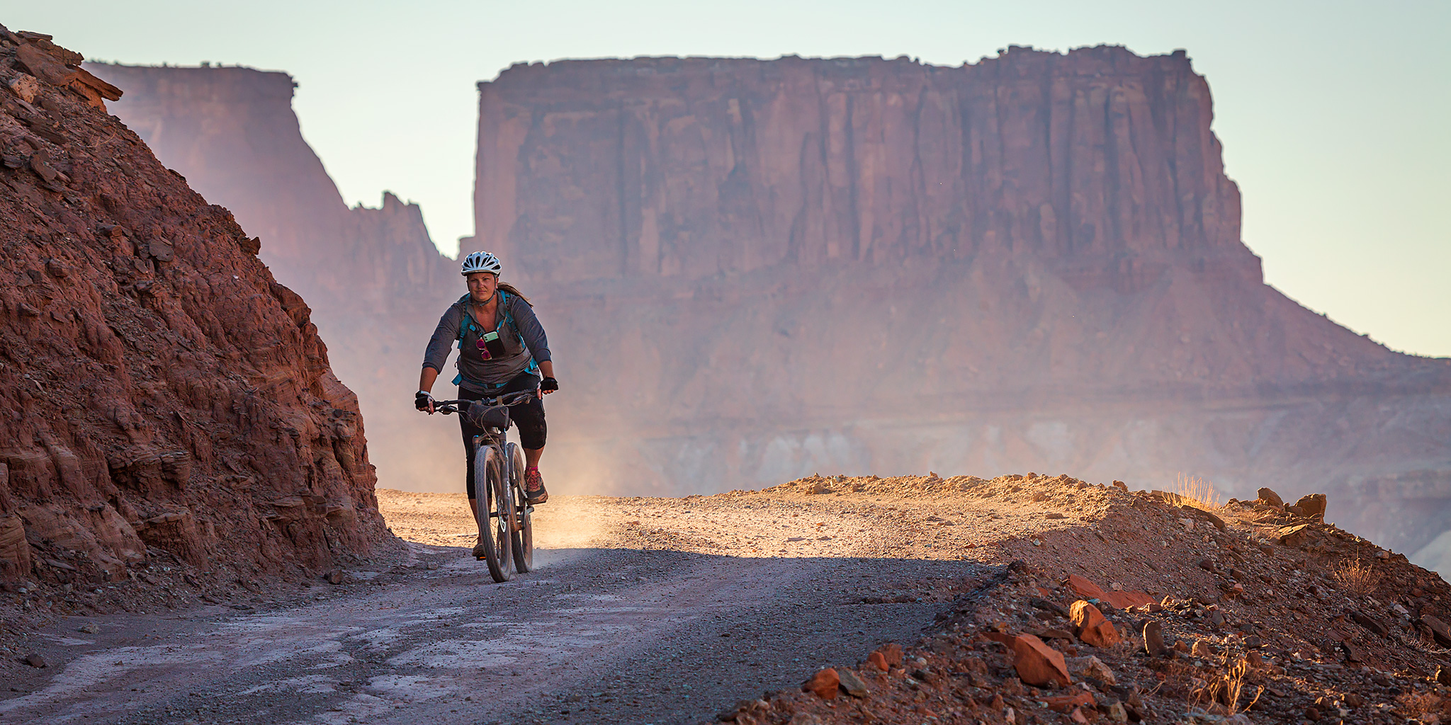
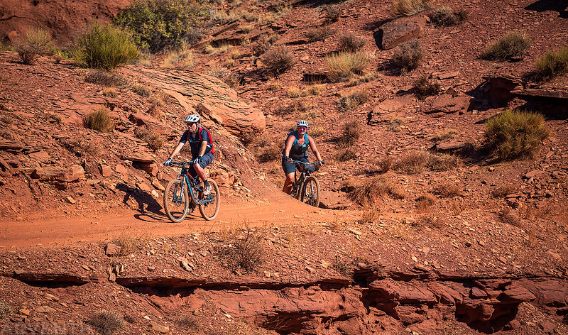
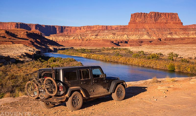
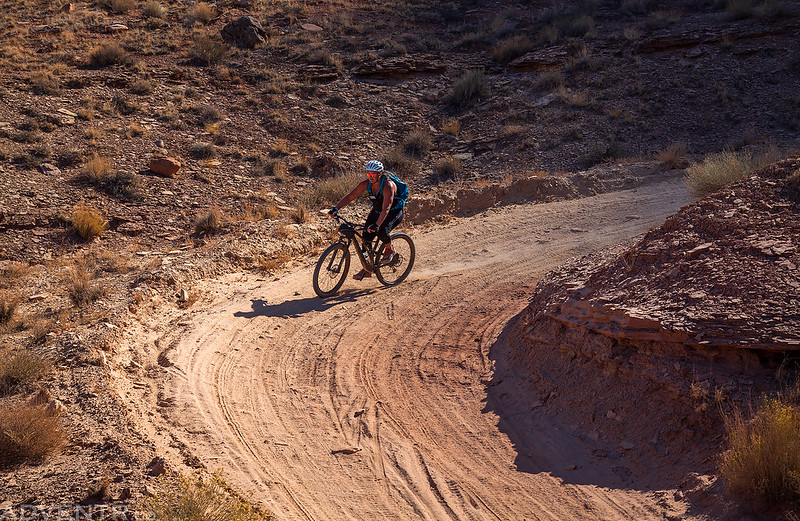
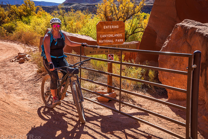
Diane at the top of the Shafer Trail ready to start her trip around the White Rim on Saturday morning.

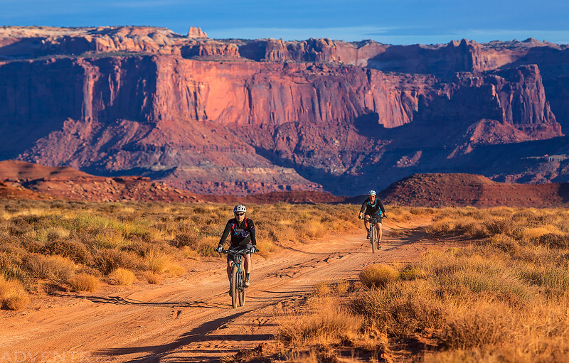
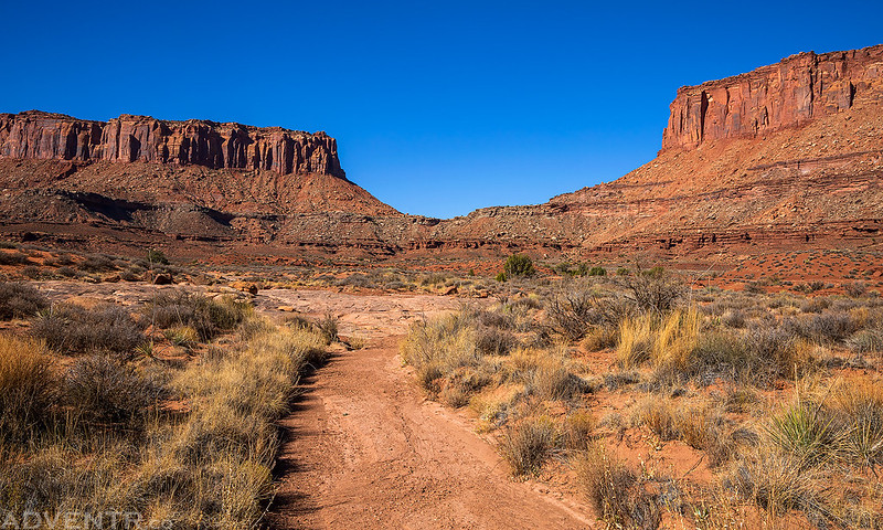
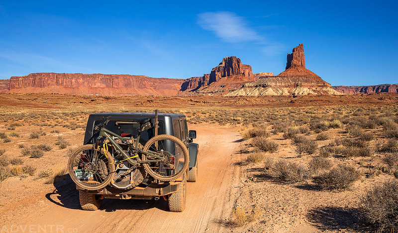
Early on Saturday morning Diane and I left home and drove towards the Island in the Sky where we met up with Jared at the turnoff for the Mineral Bottom Road at sunrise. I couldn’t believe how many people we saw camped everywhere along the way, many in places they shouldn’t have been! The area surrounding Moab was crazy busy this weekend, and to be honest, if we didn’t already have permits for this weekend I’m pretty sure we would have stayed completely clear of this area. When we reached the parking area at the Mineral Bottom Road it was already completely full and Jared had to park his Jeep up the road a little bit. Since I can really only carry one bike at a time on the back of my Jeep, we loaded Jared’s gear into my Jeep and he was going to start riding from here while Diane was going to start at the beginning of the Shafer Trail inside the park. We drove to Diane’s starting point and she got ready while we waited for Jared to catch up.
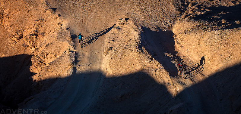
I hung back at the beginning and took a few photos of them riding around Shafer Trail switchbacks with my long lens from above.
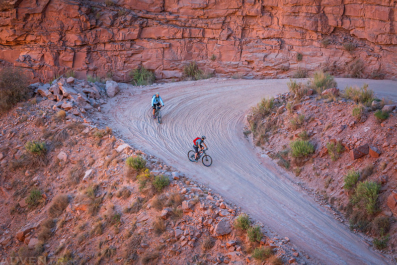


The first few miles of the trail are almost all downhill, so it was an easy start for them.


Thankfully, once we descended the switchbacks of the Shafer Trail things got a bit quieter and less crowded.

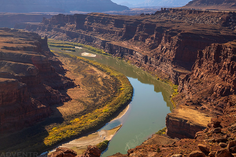
I passed them at the intersection with the Potash Road and then waited at the trailhead for the Gooseneck Overlook since Diane wanted to stop and hike that one.

Diane and Jared arriving at the trailhead.

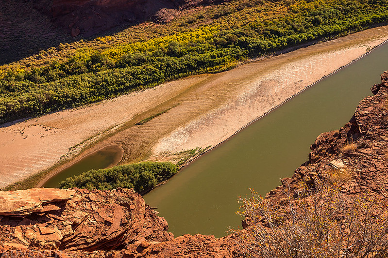
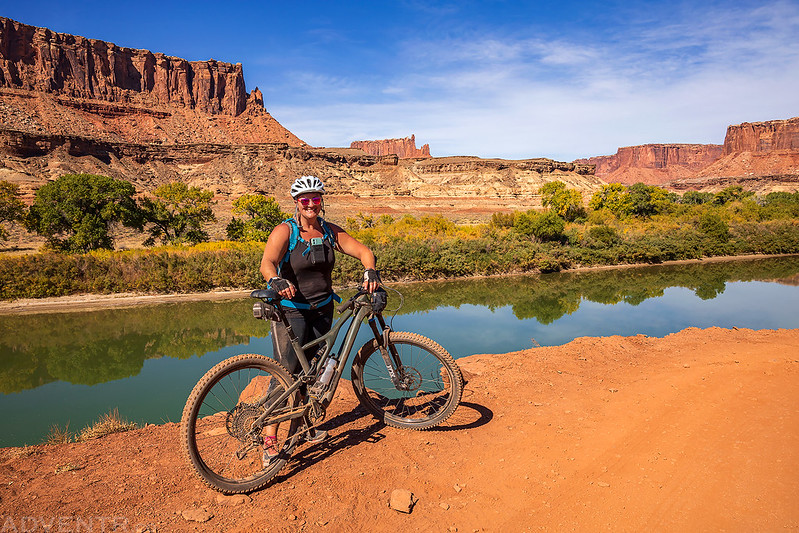
We followed the short trail out to the overlook of the Goose Neck of the Colorado River. It felt like just yesterday that we were floating down there.
After driving a little further down the road I stopped at the Colorado River Overlook and we parted ways for a little bit so I could hike along the edge of the cliff to the Walking Rocks.
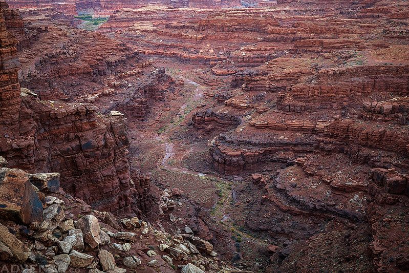
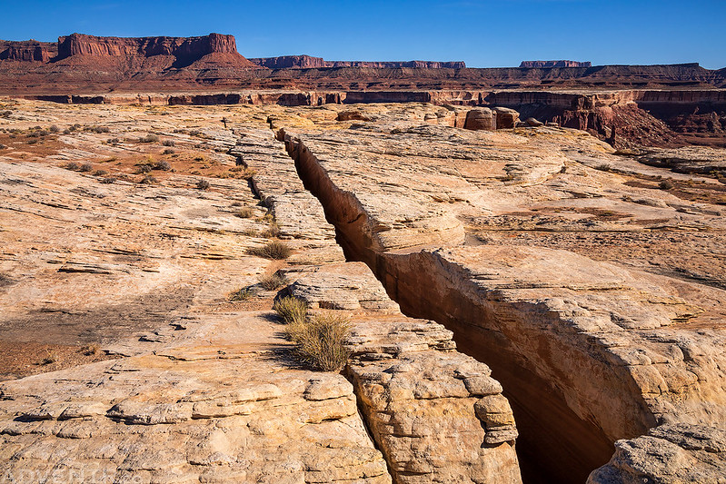
When I reached the Walking Rocks I found a break in the cliff and hiked down into the canyon so I could visit Musselman Arch from below.

As I hiked up Musselman Canyon it felt as if I was being watched from above…

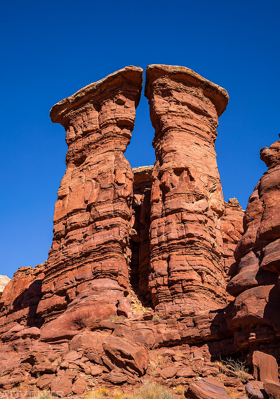
There were a lot of cool sandstone towers in Musselman Canyon that you don’t really notice from the rim above.

Twin Towers
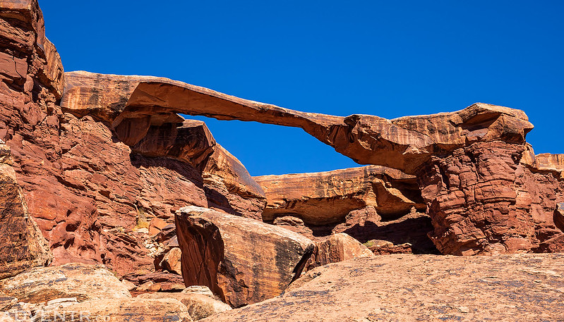
After a bit of route-finding and trying to figure out which ledge to stay on, I soon found myself looking up at Musselman Arch from below!

This is definitely a much better view of the arch than from the typical viewing area above the rim.
Hiking around the point of Musselman Canyon on my way back.

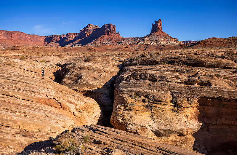
The hike took me a bit longer than I was expecting, so I continued on down the White Rim Road and caught up to Diane and Jared below Washer Woman and Monster Tower. They were making good time, especially since it was pretty warm out this afternoon.
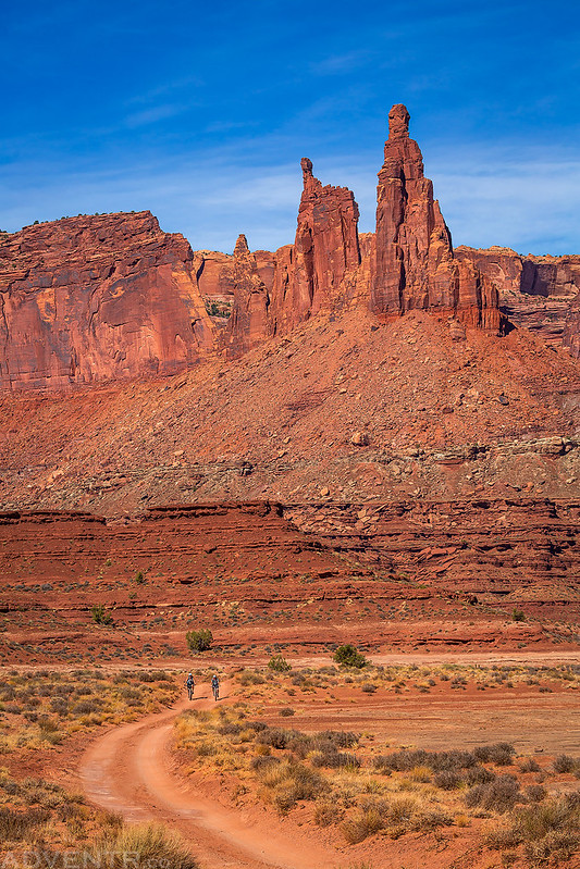
Here’s another view of Washer Woman and Monster Tower. I took out my binoculars and looked over to Mesa Arch on the rim just to the left of this photo and saw a ton of people up there. I’m so glad we weren’t up there!

I drove ahead to our first campsite, which was at Gooseberry B, and waited for them to arrive.

Diane resting in camp after riding almost 30 miles on the first day. Although the sun had finally dipped down behind the cliffs when I took this shot, we had been sitting in the shade created by my Jeep since there is no other shade to be found in this wide-open campsite. There was a good view of the La Sal Mountains over Hatch Point, though!

While Diane and Jared rested in camp I headed out for an evening hike to a point between Gooseberry Canyon and Dog Leg Canyon to watch the sunset.
My hike out to the point was pretty brisk since I was being chased by the shadow cast by the Island in the Sky the whole way, and I made it out to the end just in time to watch the sun disappear behind the cliffs.

A beautiful view from the end of the point!

Looking down into Dog Leg Canyon after the sun disappeared behind Grand View Point to the west.
I arrived back to camp just in time to catch a colorful sky over our tent.

By the time I returned to camp Diane was already in the tent asleep, so Jared and I sat around camp and watched the sky as the light faded into darkness. When it was finally dark out I noticed that there were a couple headlights in the La Sal Mountains that appeared to be driving down from Geyser Pass. We didn’t stay up very late since it had been a long day and we were both pretty tired.
The temperature overnight stayed very comfortable and it was almost perfect weather for camping with almost no wind. We woke up around sunrise at 7:00am to get ready for the second day of our adventure. After packing up camp back into my Jeep I left before them so I could stop along the way to take a few more photos of them riding. Not only did I carry almost all of their gear in my Jeep, I guess I was also their own personal photographer for the trip, too! Maybe I should offer my services to others?
Getting ready for day two on the trail…

The warm light on the surrounding hills was looking nice this morning.

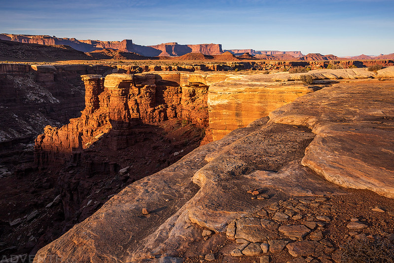
We were camped right below the White Rim Overlook, which happens to be one of my favorite overlooks from the Island in the Sky. The nearby Gooseberry Trail is also a great hike!

After I stopped at a high point along the road, I waited for them to catch up.

Here’s a short video I took as they rode around the point and continued on ahead of me.
Riding bikes below the Island in the Sky.
Soon I reached my first hike of the day. We parted ways with plans to meet up again at the top of Murphy Hogback.
I followed an old mining track past an old open-pit uranium mine to the edge of the Colorado River just above Sheep Bottom.

There were a few scattered remains from the old mining days.

When I reached the edge I had a great view over Meander Canyon.
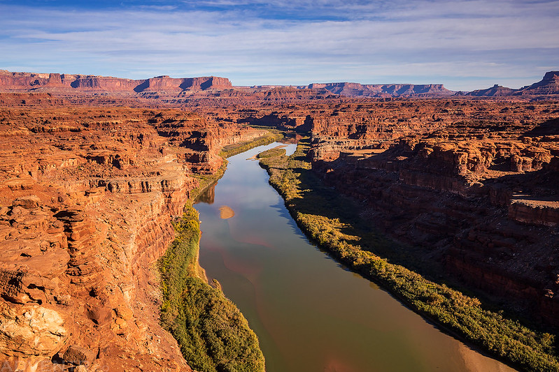
Looking over the edge I had a good view straight down to the sandbar we camped on during the second night of our float through Meander Canyon in September. It was kind of nice to see this spot from a different angle.
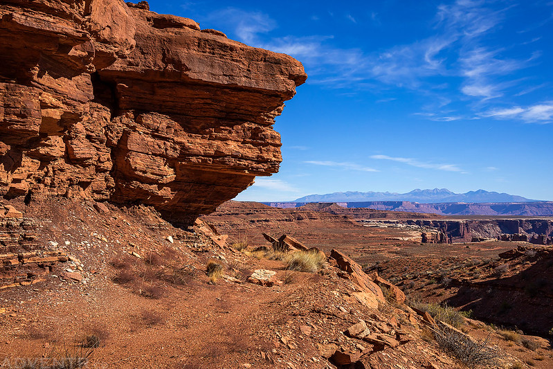
After taking in the views from the edge along the river and then returning to my Jeep, I continued the drive around Monument Basin and parked near the site of Lonesome City so I could hike along another old mining track to the saddle between Junction Butte and Grand View Point.
I started hiking up this wash and could see the saddle I was hiking to straight ahead.
Another look at Junction Butte as I left the wash and started following the old mining road.
For some reason this tower reminds me of King Tut.

Following the old road as it climbed up to the saddle.
Soon I reached the saddle and had a new and different view of Grand View Point above me. I could hear voices of the tourists echoing above me.

I walked to the other end of the saddle, which was further than I was expecting and then turned around and headed back down to my Jeep. These two hikes had taken me longer than I thought they would, so I had to rush over to Murphy Hogback so that Jared and Diane wouldn’t be waiting too long for me. After passing the junction with the road to White Crack I was stopped by a Park Ranger who was checking permits. Of course, as I pulled up the first thing she said to me was “Are you Randy?” Apparently she knew who I was because she ran my license plates when I was hiking earlier in the day since I was parked in an unusual location. I guess that’s what I get for hiking to more obscure locations. After chatting for a few minutes I was on my way again.
When I reached the top of Murphy Hogback I found that Diane and Jared had been waiting for me for about an hour, so they had arrived there about the time I was on top of the saddle. Jared told me that Diane had taken a little nap in the shade while they were waiting. They were out of water so I topped them off and they were ready to get on the road again. I waited for a little while so they could get a good head start on me before I left. I had no other plans to hike alone today, so I figured I’d just hang back and meet up with them occasionally.
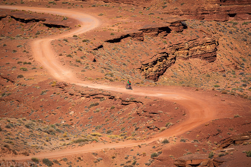
Back on the road again…
Looking up to Murphy Point.

The Lonely Road
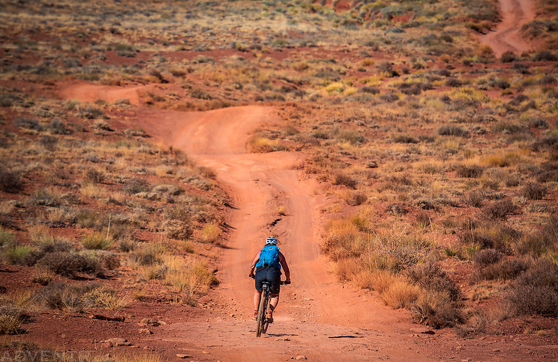
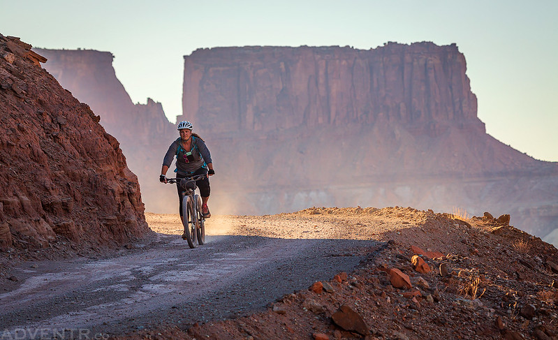
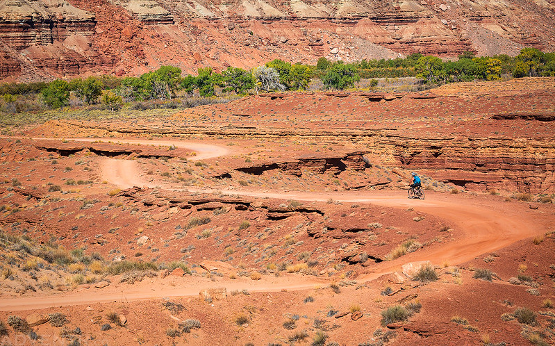
Here’s a shot of Diane riding along the edge of the White Rim that gives this place a bit of scale.
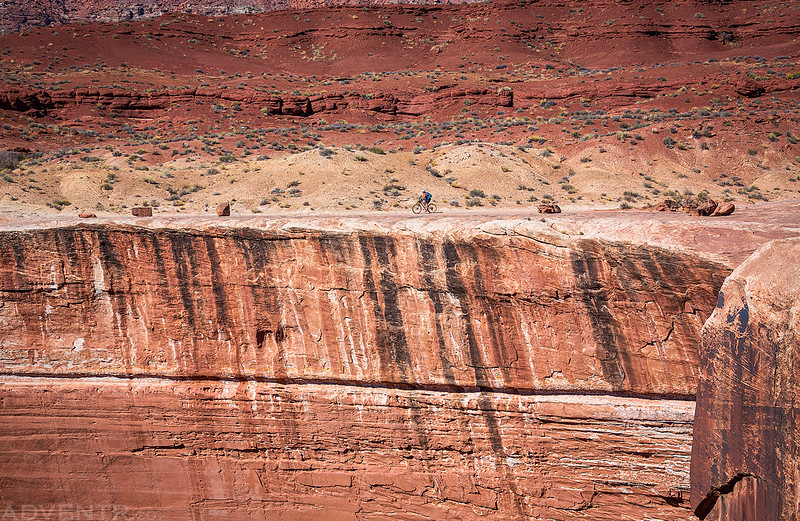
The edge of the White Rim and Candlestick Tower.
Our next stop was at the Black Crack. We met up again here and hiked over to this long massive crack in the sandstone near Turks Head.

Looking the other direction over the Black Crack.
While we were at the Black Crack a pickup truck with bikes on a hitch-mounted rack was flying down the road and I thought to myself that those bikes sure looked like they were going to fly off at any moment. Lo and behold, as soon as we left we came across a bike just laying in the middle of the road. It had come off the back of the pickup which was now long gone. We decided to put the bike on my rack and bring it with us, hoping that either they would be camping near us for the night or they would meet us on their way back to find the bike they were missing. A few miles down the road we did meet up with the pickup coming back to look for their bike, and were able to get it back to them.
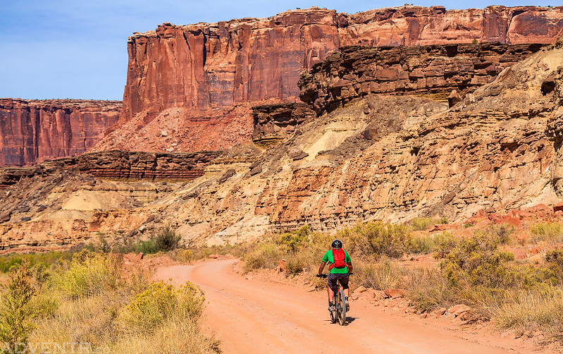
Jared riding through the dust.

By the time we reached the Candlestick Campsite Diane had had enough riding for the day. It really was hot out for the end of October, and I’m surprised she had made it this far. If it were cooler out I’m pretty sure she would have made it all the way to our second campsite at Potato Bottom, but we ended up loading her bike on the back of my Jeep and she rode with me the last 10 miles of the day while Jared planned to ride the rest. She ended up riding about 28 miles today.
Diane’s bike on the back of my Jeep as we left the Candlestick behind and continued on to our second campsite.
We all made one more stop to check out the Holeman Slot Canyon along the way.
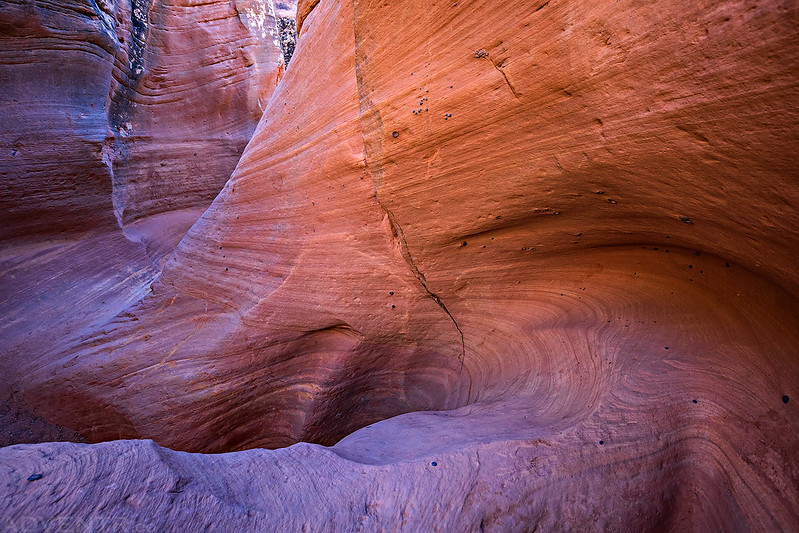
Jared checks out the Holeman Slot from above.
Soon we found ourselves riding along the Green River in Stillwater Canyon.
We would also be leaving the sandstone of the White Rim behind and following the sandier road along the Green River for the remainder of the trip.

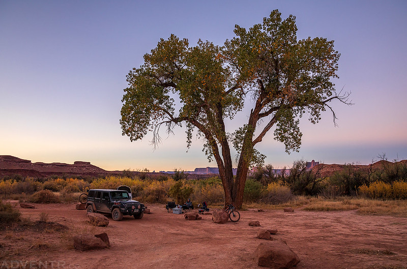
We arrived at the Potato Bottom A campsite about an hour before sunset. First we had some dinner, then we rested for a bit and finally we set up camp at sunset. It had been a long and warm day and we were all very tired, so none of us stayed up late this evening. The temperature overnight night was much cooler than the previous night, dropping down to 41 degrees when we woke up shortly before sunrise on Monday morning.
Monday morning at the Potato Bottom A campsite. There was one large cottonwood tree that provided some nice shade at this campsite and was easily visible for miles around.
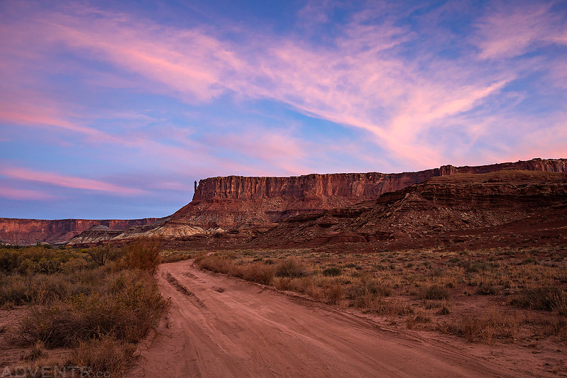
There was a little color in the sky over Potato Bottom and Bighorn Mesa this morning.
We also had a great view of the Buttes of the Cross from camp, which reminded me of our night spent along the Green River near the mouth of Millard Canyon.

I wandered through the tamarisk to the edge of the river for a little reflection.

After packing up camp we were all on the road again and headed right for Hardscrabble Hill.

I drove up Hardscrabble Hill first so I could take some photos looking down on them climbing it.
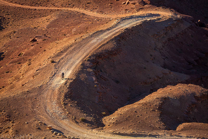
I liked their bike shadows in this shot as they rounded the switchback.
Hardscrabble Tower

Sag Wagon on Hardscrabble Hill

Coming around a corner on Hardscrabble Hill.

We stopped at the trailhead for Fort Bottom and started hiking out to the ruins at the point since this was one hike that Diane really wanted to do.

There are great views of the Green River from all along the trail.

According to John Wesley Powell, this is the spot where Labyrinth Canyon turns into Stillwater Canyon, about 42 miles up from The Confluence.

Diane taking a little break from biking to hike to the Fort Bottom Ruins.

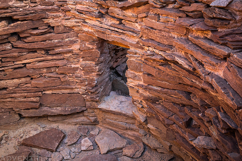
The Fort Bottom Ruins

This is the small doorway inside between the two towers.
Diane and Jared hike back across the narrow part of the Fort Bottom Trail.

Diane and Jared left ahead of me from the trailhead and I hung back to take photos as they started the descent to Hardscrabble Bottom.


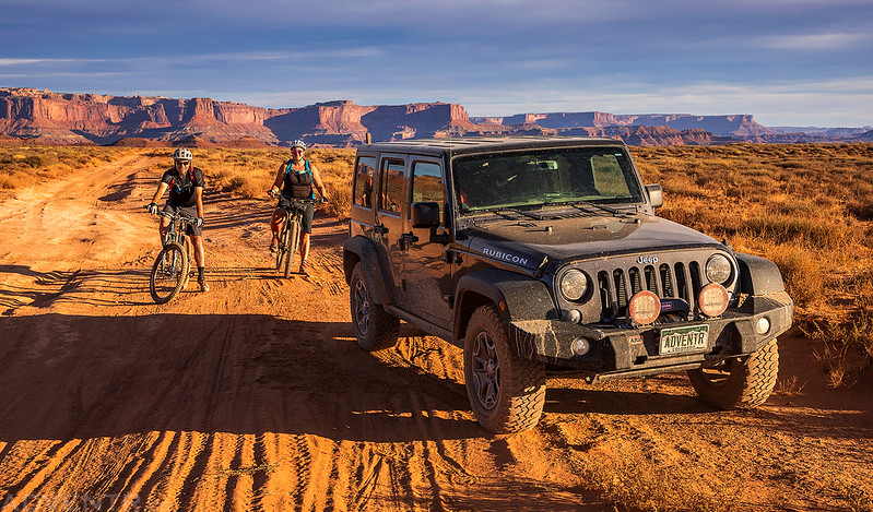
Diane and I stopped above the Green River just past Taylor Canyon as we waited for a Jeep to come up a narrow section of the road.
Leaving Canyonlands National Park and almost to the end of the ride.
After riding 16 miles on Monday, including the steep climb up Hardscrabble Hill, Diane decided it was time to stop for the day when we reached the Mineral Bottom Road. She had no desire to ride up those switchbacks today. After loading her bike onto the back of my Jeep I gave her a ride to the highway while Jared did want to ride up the switchbacks. But since he didn’t to ride all the way back to the highway I dropped Diane and her bike off and then went back to pick him up along the road. He had made it up the switchbacks and was a little further down the road when we met up again. We loaded his bike onto the back of my Jeep and then I gave him a ride the rest of the way back. After unloading his gear out of my Jeep we said our goodbyes and headed our separate ways. It was another great circumnavigation of the White Rim Trail and I think Diane really enjoyed this trip, even though it was pretty tough!
Wonderful photos as always… and spectacular scenery. Loved the view of Musselman Arch from below… I somehow didn’t imagine it would look so dramatic.
This was a nice tour as I drank my a.m. coffee. I feel like dusting off the red sand. Diane is a real gutsy lady. As a woman I appreciate her tenacity and desire to get OUT THERE. I loved the pic of her riding along White Rim. It just somehow showed the loneliness of the long distance ride. Wasn’t she fortunate that Jared went with her and that you backed them up! I also particularly liked the photo of Jared at Holeman surveying the canyon below. Such vastness that a suburban dweller really doesn’t comprehend. You are a good ad. for Jeep because you put those Jeeps out where they want to be. I drove a Grand Cherokee and poor thing never hit a patch of real dirt. Thanks for the share of this birthday trip. I am feeling the need of the great outdoors.
Thanks for the fine report and photos. I always enjoy them, but this brings back some great memories as well…