Friday & Saturday, September 11-12, 2020
After spending the end of last week on a road trip driving Across the Great Basin and Back, this weekend it was time to get back to hiking in the mountains of Colorado since the season will be ending for me very soon. After climbing Lone Cone a couple years back and Groundhog Mountain earlier this summer, I thought it was time to tackle Little Cone which is another isolated mountain that is located at the western edge of the western San Juan Mountains and sits just to the north of Middle and Dolores Peaks. Although this solitary 11er stands out when you are in the area, I don’t believe the summit sees too many visitors because access is tricky since this mountain is almost completely surrounded by private property. If it weren’t for just one narrow strip of public National Forest land, it would be impossible to climb this peak without permission from a landowner. Luckily that one little strip of land is all I needed to make it to the summit!
Here’s an overview map of Little Cone that shows the land status of the area. Everything that is brownish in color is private property, and as you can see, there is only one little strip of land southeast of the peak that is public land within the Uncompahgre National Forest.

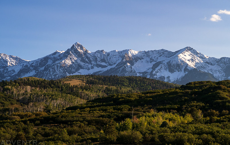
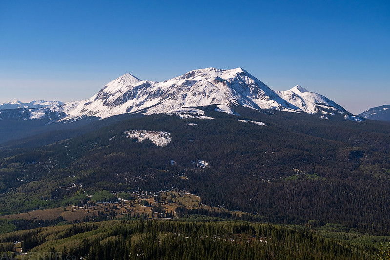
This Friday it was back to my normal routine as I left right after work and headed south into the San Juan Mountains. This time I drove over the Dallas Divide and stopped for a couple quick photos of the snow-capped peaks of the Sneffels Range. The strong winter storm that had moved through the area the past couple of days had left plenty of snow behind, but with the temperature warming up again it will all probably melt off pretty soon.
Snow on Mount Sneffels

The Sneffels Range from the Dallas Divide
As I was descending the road through Leopard Creek Canyon I had a brief view of the top of Little Cone, so I pulled over for a quick photo.

Next I followed the Fall Creek Road almost all the way to Woods Lake, but turned off onto the road that goes over to Beaver Park before reaching the end. This road was a little muddy and slick in places, especially the higher up I went while looking for a campsite for the night. There were quite a few hunters camped along the road and driving around, too. I guess it’s that time of the year…
Boskoff Peak (13,123)

There weren’t many views to be had from the road through the trees, but there was one clearing that I was able to see Little Cone (11,981) through at sunset. While there was definitely snow around the area in the trees, it didn’t look like there was much, if any, snow on Little Cone.

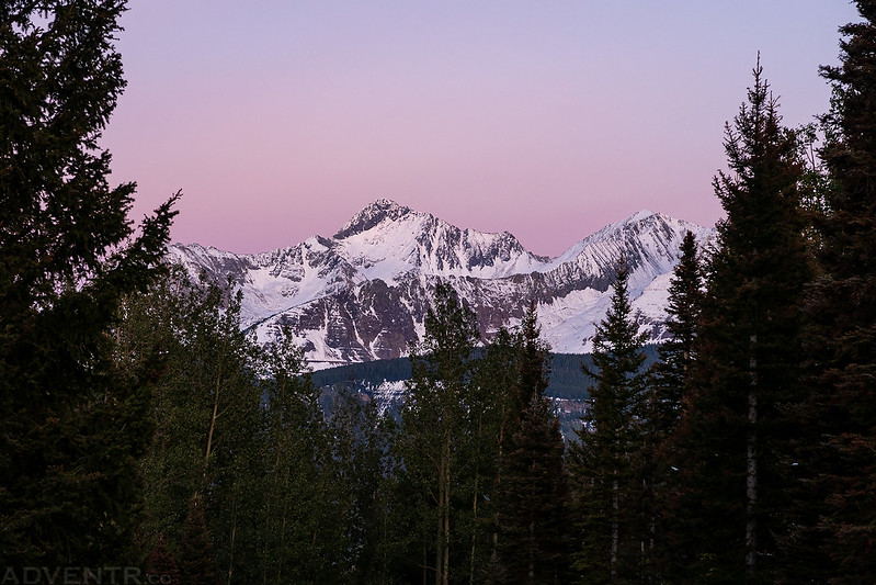
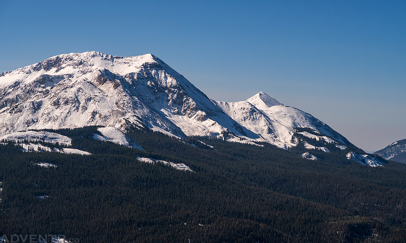
Wilson Peak (14,017) at dusk.
The days are obviously getting shorter since I’m barely making it into the mountains after work before the sunset. Surprisingly, I found a really nice campsite near Saltado Creek at the edge of the Lizard Head Wilderness that wasn’t already occupied by hunters shortly after sunset and got to bed right away. It was already in the upper 30’s at sunset, so I was expecting it to be a cold night and probably a muddy hike in the morning.
When I woke up on Saturday morning I was happy to see that the temperature only dropped a little bit down to 32 degrees and it wasn’t as cold out as I was expecting. I got ready and then drove back down to the trailhead and started hiking shortly before sunrise. The first two miles are easy hiking along an old road that is now closed, which was a bit muddy, like I thought it might be.
There weren’t many views from along the trail until I reached the final ridge, but I did find an opening in the trees for this shot of Little Cone just before sunrise.

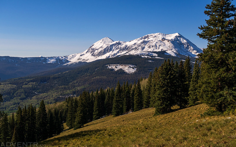
There was also a clearing where I left the old road that had a really nice view of the Wilson Group.

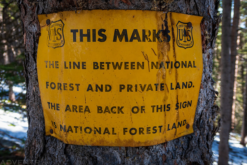
From my research into the route, there was supposed to be a trail that I could follow all the way to the South Ridge. However, that trail actually crosses a corner of private property, so I wasn’t too surprised to see that there were some new No Trespassing signs on both sides of the trail where it entered the property. Instead of giving up and turning around, I bushwhacked up a steep slope with a lot of deadfall, which was complicated with some slippery snow, and managed to get around the property to rejoin the trail above. It wasn’t the funnest hiking and slowed me down a lot, but it was better than calling off the hike!
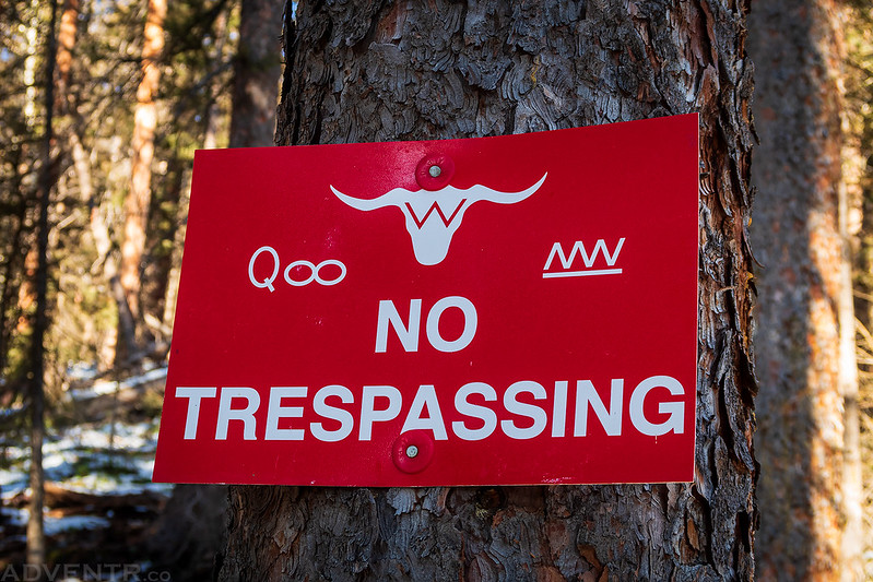
I spotted a couple of these signs that were nailed to trees along the way and made sure to stay behind them.
Once I reached the South Ridge there was a good view over to Dolores Peak and Middle Peak.
After climbing the south ridge for a little ways, I finally had a good close look of the summit.
San Miguel Mountains
A closer look at Middle Peak and Dunn Peak.
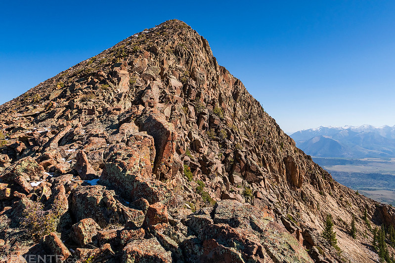
Here’s a look at the rocky ridge I would be following the rest of the way to the summit. There was a little snow and ice mixed in with the talus, but it was easy to avoid and I didn’t need to use microspikes

Almost there! It was fun easy hiking.
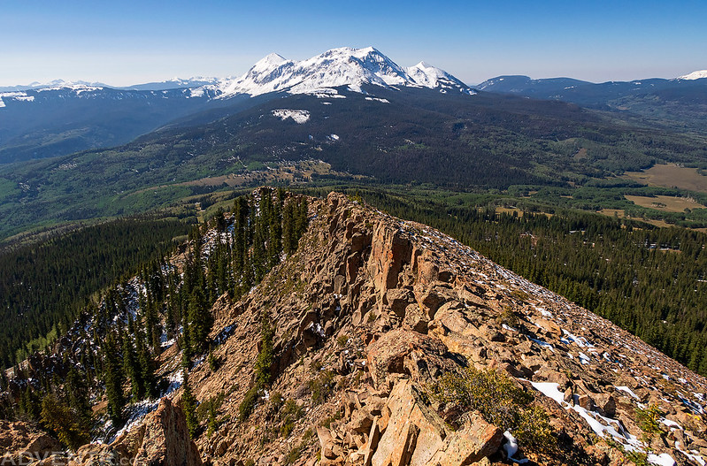
Looking back down the ridge with the San Miguel Mountains in the background.
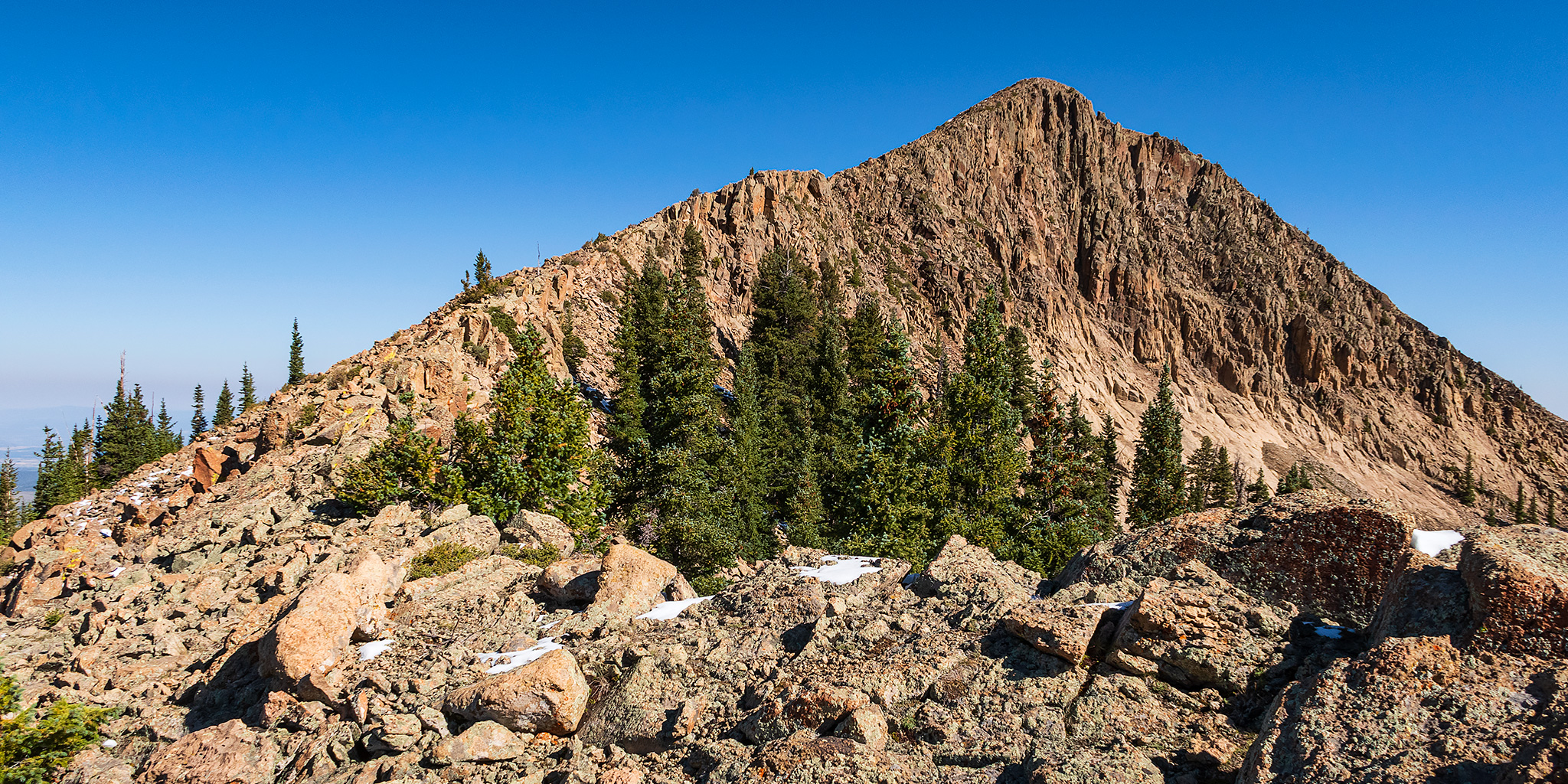
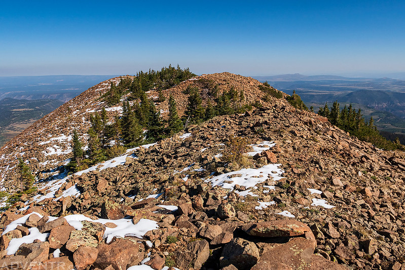
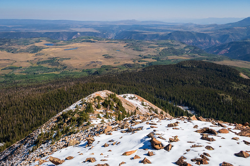
Once I was on the top of the ridge it was just a short walk to the actual summit, which is the small bump to the right of the trees.
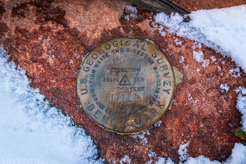
I had to brush some snow off so I could take a look at the benchmark. Little Cone, 1952
Groundhog Mountain and Lone Cone were on the horizon over Beaver Park to the southwest.

The north end of the peak had a couple of larger cairns built, so I walked over to check them out.

Looking down the North Ridge over Specie Mesa to Leopard Creek Canyon, which is the same place I pulled over for a photo of the top of Little Cone the evening before. As you can see, there was a bit of smoke in the air this morning.
After spending a little time on the summit it was time to start hiking back down the ridge.

Here’s one last look at Little Cone before I returned into the trees and didn’t bother to take any other photos during my hike back.
