Monday, January 2, 2017

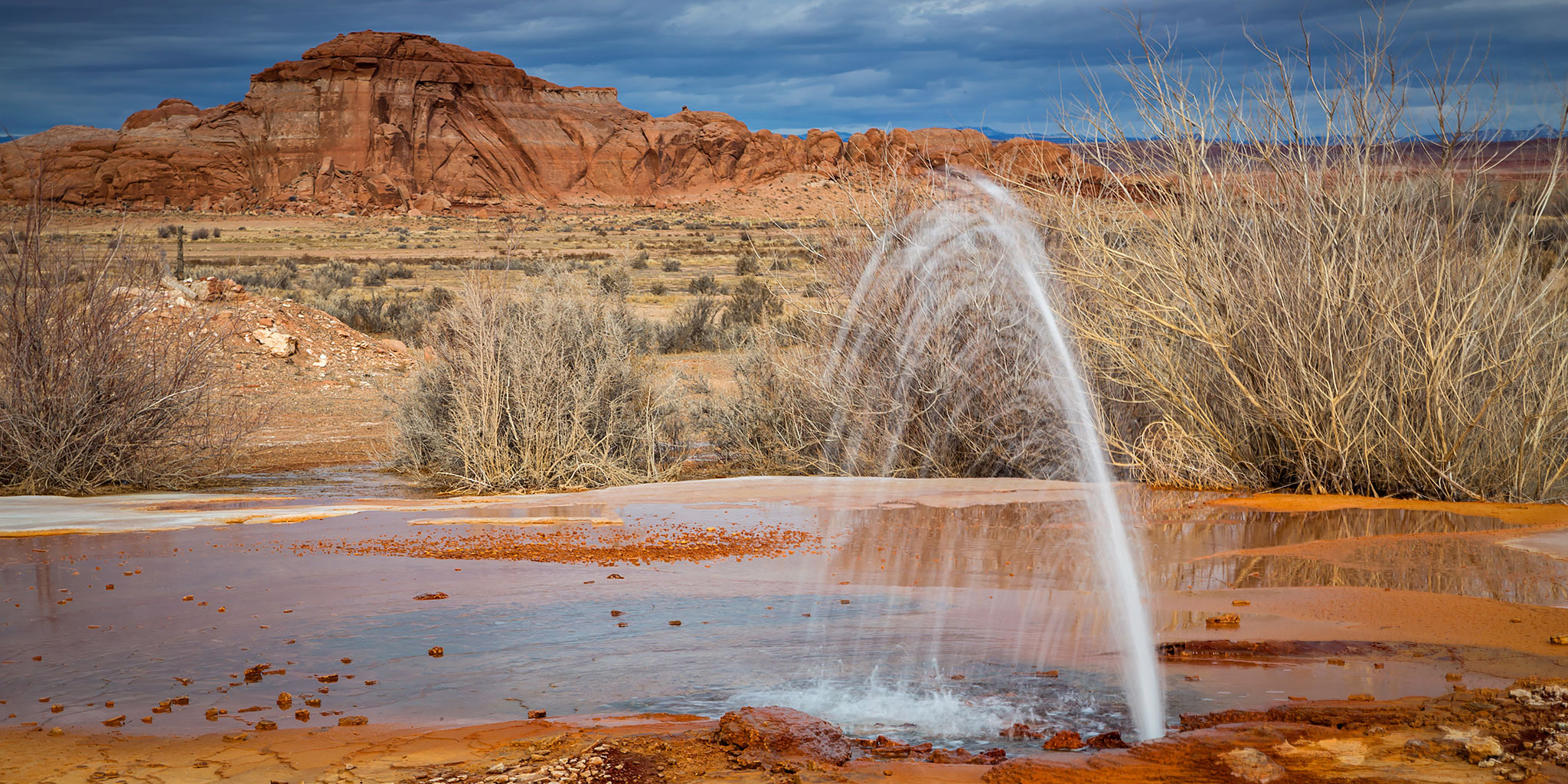
The Champagne Geyser erupts at the old Chaffin Ranch near the San Rafael River.
Since I stayed close to home the past two days, I decided that wanted to venture over the state line into Utah today, but I still didn’t want to travel too far. It’s a pretty short and easy drive from Grand Junction to Green River, so I thought I’d head south from there on the Green River Road to revisit some sites I haven’t been to in many years and also try to stop at a few new ones. I contacted Marty on Saturday evening to see if he was free, and then we made plans to meet in Green River at 7:30 this morning. As I was getting close to Green River on I-70 I could see that the Gunnison Valley was filled with a thick fog and I thought that this might make things interesting for us. After meeting up with Marty and topping off my fuel tank we headed south into the fog on the Green River Road.
The fog was thick in Green River as I topped off my fuel tank.

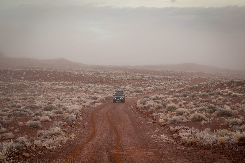
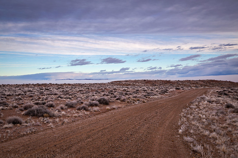
Not much of a view as we left town on the Green River Road.
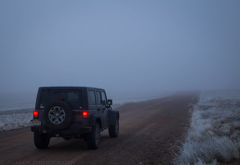
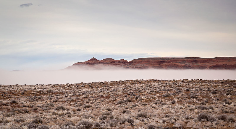
Marty following me. You can see that hoarfrost was covering most of the vegetation in the desert.

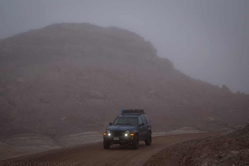
Eventually, we were able to see some of the nearby landscape through the fog…

When we reached the top of the Horse Bench, we were just high enough to get above the fog for a short distance and it seemed that the top of the fog was around 4400-4500 feet. My original plan was to search for some rock art along the San Rafael River, but with the current fog situation I decided it would be a better idea to continue driving out to Keg Point first since it was closer to 5000 feet in elevation and we would be able to stay above the clouds. Then we hoped that the fog would dissipate before we headed back to Green River and could make some stops at the lower elevation.
Starting to climb out of the fog onto the Horse Bench.
We just barely got above the fog for a little bit when we reached the top of the Horse Bench.
The only sliver of blue sky we would see all day. You can just barely see the San Rafael Reef poking out of the clouds on the horizon.
Frost on the front of my Jeep.

A distant island in the fog.

As soon as we got above the fog for good the temperature was about 20 degrees warmer, but there was also a constant cold wind that made it feel much colder than it was out. When we reached the end of the road on Keg Point we started our hike out to visit Colonnade Arch. It had been about seven years since the last time I visited this arch and Marty had never made the hike to it before. I had hoped the conditions would be better for some photos today, but we were stuck with an overcast sky for most of the day. I guess that means I’ll have to return yet again!
On our way to Colonnade Arch we stopped at this nice arch.

I liked the pothole covered in ice below this small arch.

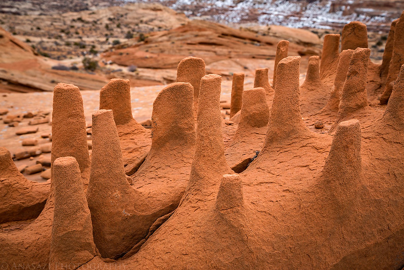
This sandstone formation is very unusual.

The Dragon’s Teeth
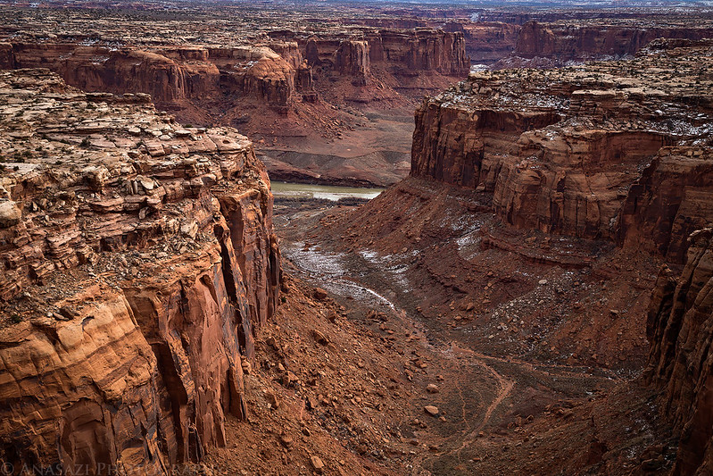
Looking down Twomile Canyon to the Green River.
Our first look at Colonnade Arch.

Always a nice view from the inside.

I had missed this nearby arch on previous visits.

After returning to our vehicles we started the drive back to Green River. We could see that the fog in the distance was quickly disappearing by now, so we took a short hike along the San Rafael River to find a few petroglyphs.
This was the nice panel of petroglyphs I was looking for. At first I spotted them from above, but I had to go below to take some photos.

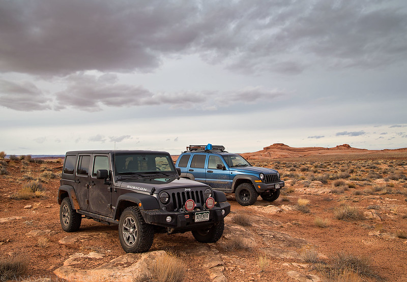
Jeeps in the San Rafael Desert.
Before heading back to town, we stopped at the old Chaffin Ranch to check out the Champagne Geyser. It was spouting water on and off while we were there, but the wind was really blowing it around after it got higher than a few feet.
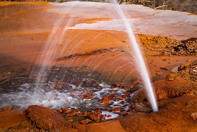
Nice color and textures from the minerals in the water.


Just one last photo of the Horse Bench Reservoir before we finished the drive back into town.

Great pictures. I had my San Rafael Swell Topo maps out last night getting ready to plan our spring break adventure and your pictures got me really excited. The only place I have “explored” in the Swell is Goblin Valley and a hike in Horsethief Canyon. If you were to recommend another area for me and the family to spend 4 days in the Swell, what would it be? I’ll be self supported with a 4X4 and moderate desert experience.
Great Blog by the way.
Since you’ve never been, I would highly recommend spending at least a day or two exploring Buckhorn Wash. Lots of great scenery there, plus dinosaur tracks, rock art, historic places and inscriptions. There’s plenty more to see and do along the San Rafael Reef near Goblin valley, too…slot canyons (Little Wild Horse Canyon) and more rock art. One last place I would highly recommend is camping at The Wedge Overlook…great views over the Little Grand Canyon. Hopefully these suggestions help…there’s a lot of great places in the Swell and four days should give you plenty of time to enjoy some of them!