The Monument from Top to Bottom | Black Ridge Loop
Saturday & Sunday, March 28-29, 2015
After completing a traverse across the face of the Colorado National Monument last year I decided that I wanted to put together a longer loop through the Monument to hike this year. The route I strung together begins at the Kodels Canyon trailhead outside of the Monument near Fruita and climbs up the historic Fruita Dugway trail where it connects with the Black Ridge Trail. The Black Ridge trail is the highest trail in the Colorado National Monument topping out at just over 6,700 feet. Since the trailhead is at about 4,700 feet, this route ascends over 2,000 feet of elevation gain while climbing from the lower part of the Monument to the higher part. After following the Black Ridge Trail to it’s end at the Upper Liberty Cap trailhead we would then follow the entire Liberty Cap trail back down to the Wildwood trailhead. Since this route is about 18 miles in length, I thought it would make a nice overnight backpacking trip so that we could take our time and spend a night in the Monument. I stopped by the Visitor’s Center on Friday and picked up a backcountry camping permit so that we could start the hike bright and early on Saturday morning.
Driving past the Fruita entrance as the sun came up for the day.
Colorado National Monument by IntrepidXJ, on Flickr
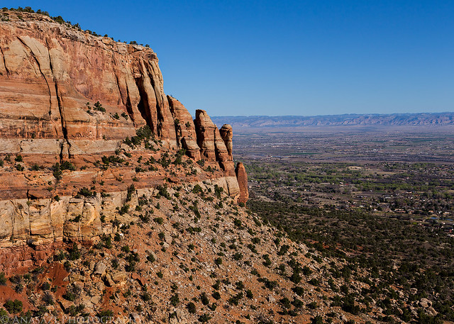
View of the red rock cliffs from the Kodels Canyon trailhead.
Trailhead View by IntrepidXJ, on Flickr
Following the Kodels Canyon trail outside of the Monument to the Fruita Dugway.
Early Trail by IntrepidXJ, on Flickr
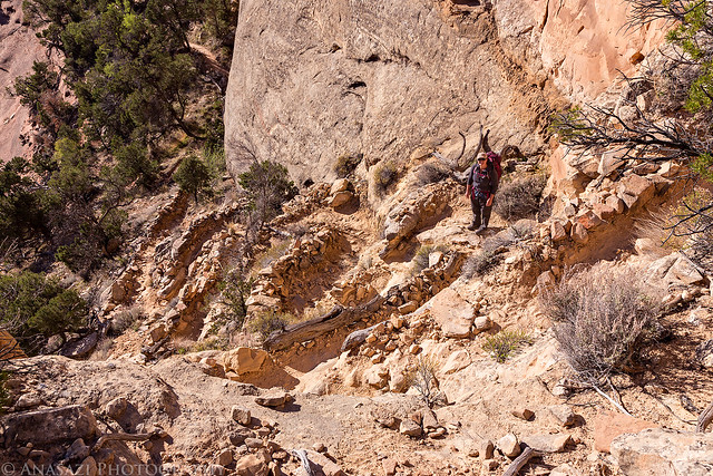
This photo was taken after climbing the steepest part of the entire trail, which climbed up on the left side of this sandstone dome.
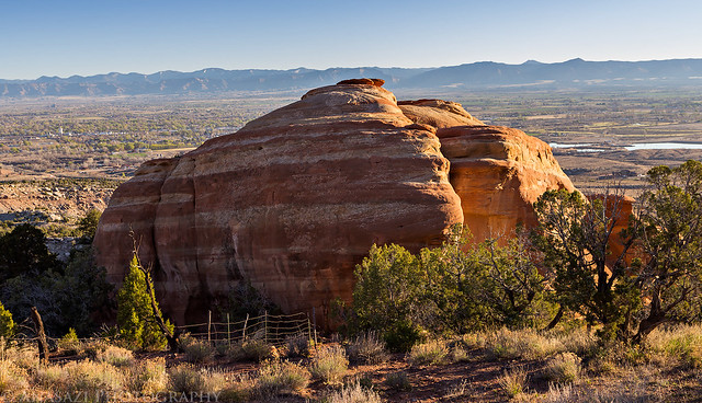
Fruita Dugway Climb by IntrepidXJ, on Flickr
There is a nice overlook of Kodels Canyon as you climb the Fruita Dugway.
Kodels Canyon Overlook by IntrepidXJ, on Flickr
Diane stops to take in the view from the historic Fruita Dugway trail.
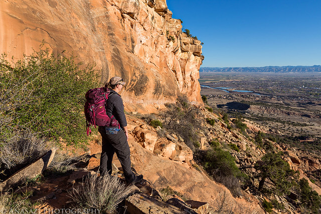
Fruita Dugway Backpacking by IntrepidXJ, on Flickr
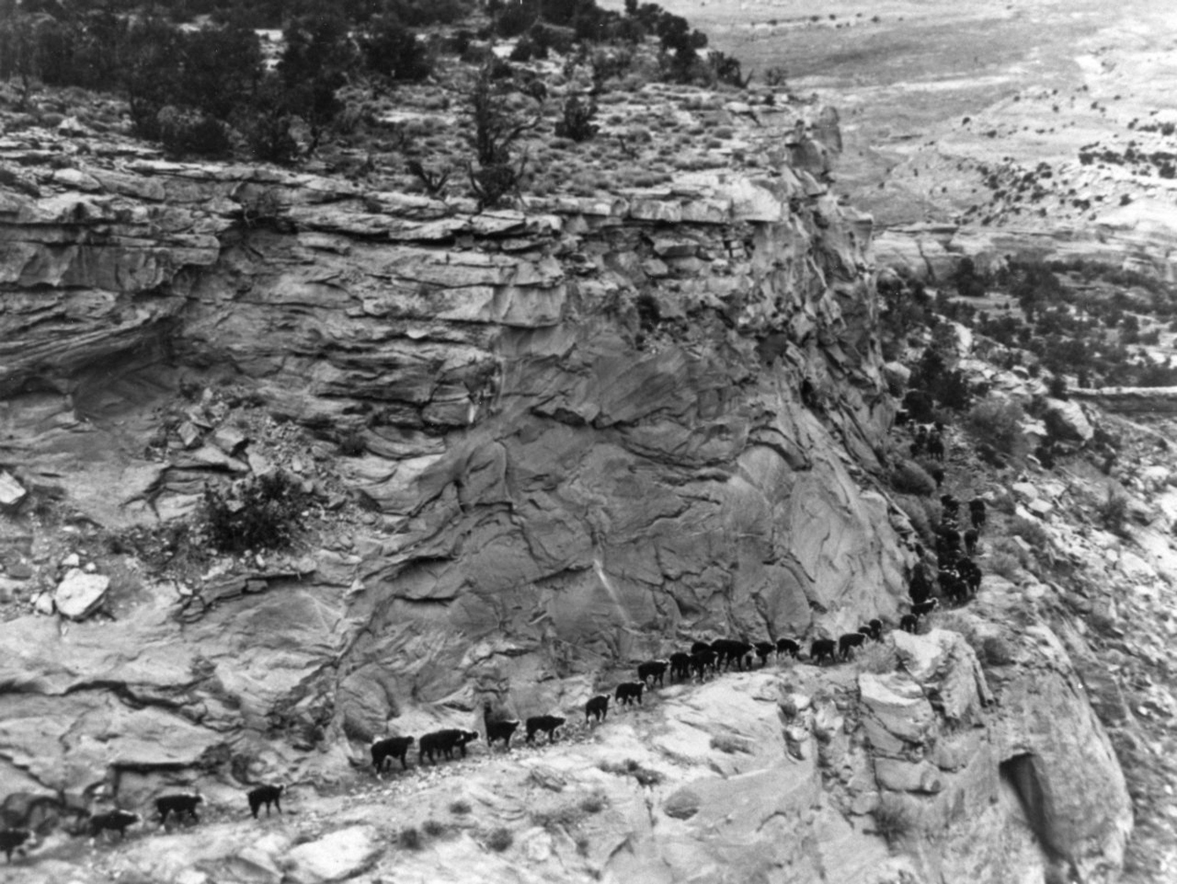
Here is a historic photo of the Fruita Dugway which was not only used as a cattle trail to get cows up and down from their summer range on Piñon Mesa, but also aided in the construction of the Fruita Aqueduct that would bring fresh water down to Fruita throughout the early 1900’s.
A nice little tree growing in a shallow alcove along the trail.
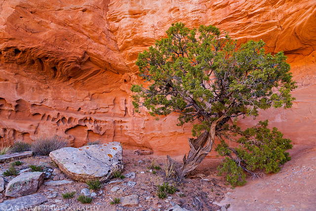
Alcove Tree by IntrepidXJ, on Flickr
After crossing through a shallow canyon, the trail briefly follows the rim of a road-cut above Rim Rock Drive. Most people driving below don’t even know there is a trail up here.
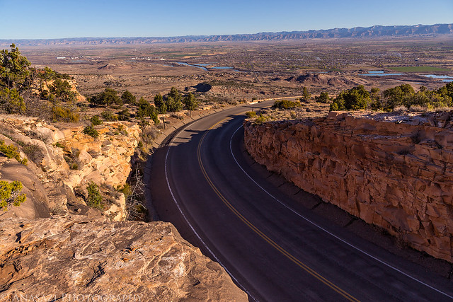
Rim Rock Drive by IntrepidXJ, on Flickr
A short section of the Fruita Dugway follows this natural ledge.
The Ledge by IntrepidXJ, on Flickr
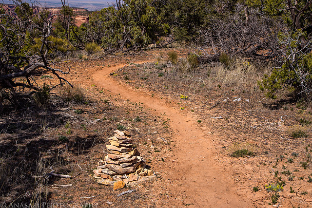
During the first couple of miles the route enters and leaves the park boundary a few times.
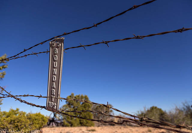
Entrance by IntrepidXJ, on Flickr
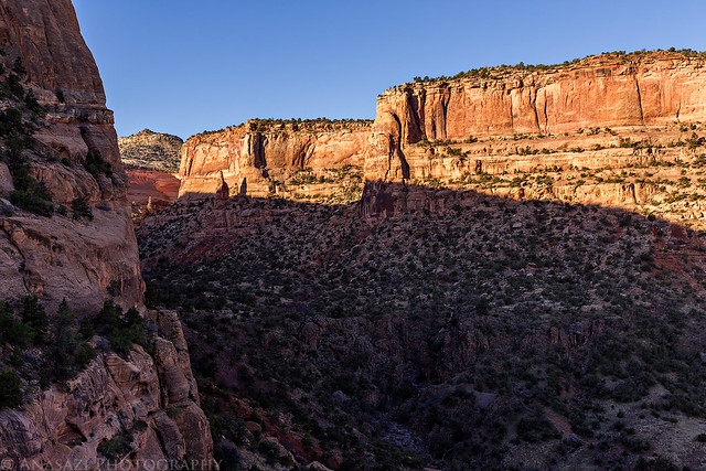
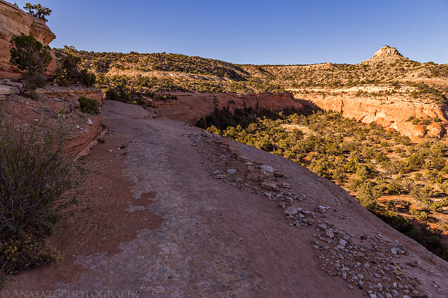
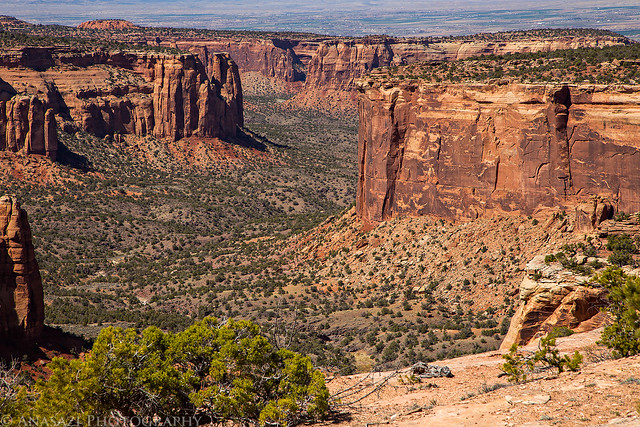
A distant view of Devils Canyon from the Black Ridge Trail.
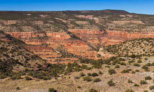
Devils Canyon by IntrepidXJ, on Flickr
Diane crosses a narrow land bridge that separates two canyon systems.
Land Bridge by IntrepidXJ, on Flickr
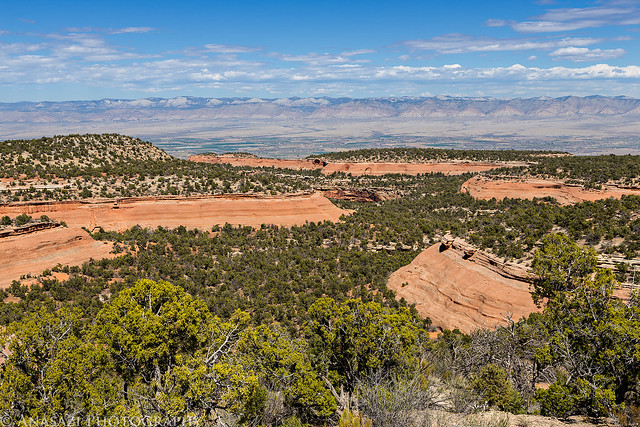
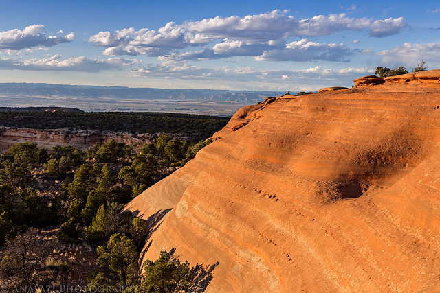
View from the Black Ridge Trail high above the Grand Valley.
Black Ridge Trail by IntrepidXJ, on Flickr
Earlier in the trip report I mentioned how the Fruita Dugway was partly created to help build the Fruita Aqueduct which brought clean mountain water down from Piñon Mesa to the City of Fruita in 1907. The original aqueduct was 23 miles long and constructed of wooden pipe and crossed through what is now part of the Colorado National Monument. When the Colorado National Monument was created in 1911, the National Park Service and the City of Fruita reached an agreement that would allow the pipeline to stay. During the Great Depression while the Civilian Conservation Corps (C.C.C.) was building Rim Rock Drive through the park there was an agreement that in return for ten percent of the water that flowed through the pipeline, the Work Progress Administration would replace the wooden pipe within the boundaries of the park with cast iron pipe. While the aqueduct no longer provides water to Fruita, remains of the pipe can still be found on the west side of the Monument. While we were hiking across the Black Ridge Trail we made a few short detours to visit a few remains of the historic Fruita Aqueduct.
Wood boards cover old valves for the cast iron pipe through the Monument.
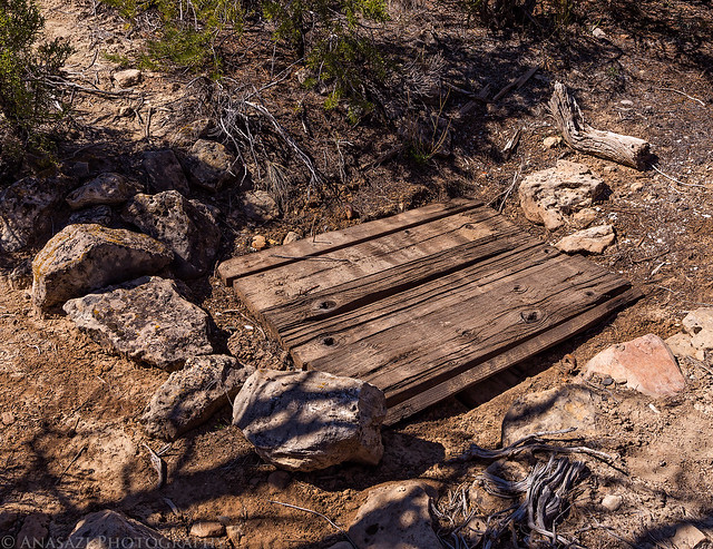
Covered by IntrepidXJ, on Flickr
Here’s a few of the old valves from a different location. Between the previous location and this one there was also a section of exposed cast iron pipe that was visible.
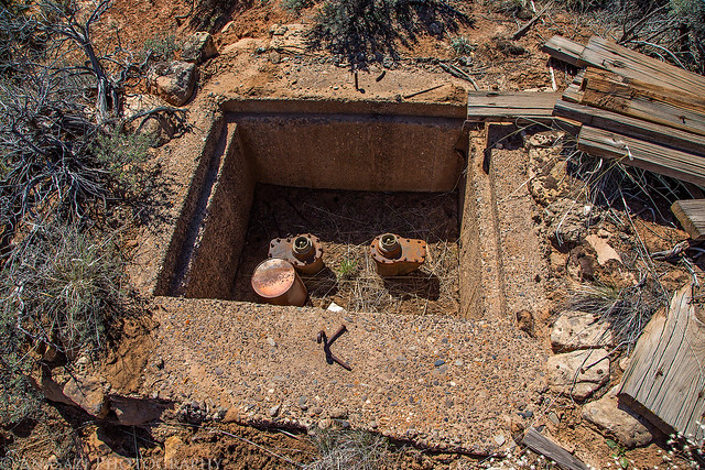
Open by IntrepidXJ, on Flickr
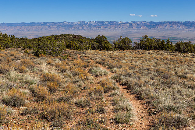
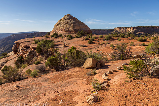
After stopping for a short break at the Upper Liberty Cap Trailhead, we continued our hike across Monument Mesa for a few more miles. Our end destination for the evening is visible in this view.
End in Sight by IntrepidXJ, on Flickr
Leaving the main trail towards Otto’s Bathtub.
Trail to Camp by IntrepidXJ, on Flickr
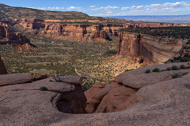
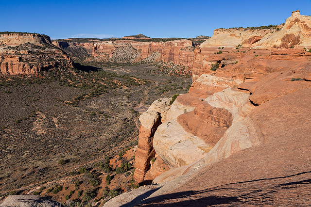
Nice view over Monument Canyon from the trail.
Monument Canyon by IntrepidXJ, on Flickr
We finally reached Otto’s Bathtub and took off our packs so we could relax for the rest of the evening.
Otto’s Bathtub by IntrepidXJ, on Flickr
Stairs carved into the sandstone that allowed access into Otto’s Bathtub.
Carved Stairs by IntrepidXJ, on Flickr
Diane rests up after following me for over 13 miles and 2,000 feet of elevation gain while carrying a heavy pack today. Surprisingly, we actually weren’t as tired as we thought we would be from this longer hike. Shortly after arriving, the wind picked up pretty strongly for the rest of the evening.
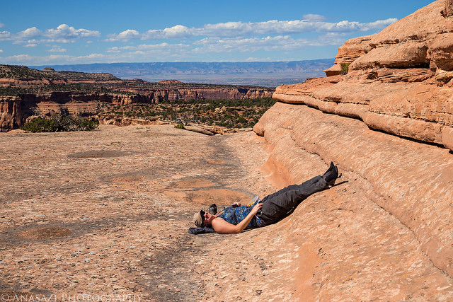
Rest Time by IntrepidXJ, on Flickr
After relaxing and taking a short nap I wandered around the sandstone and took a few photos until sunset. We would not see anyone else all evening.
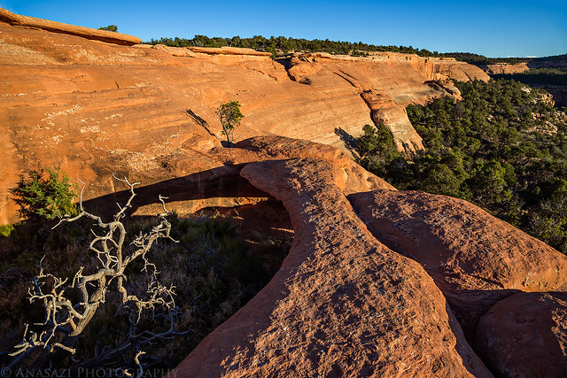
A small arch I like to photograph when I visit this area.
Little Arch by IntrepidXJ, on Flickr
My shadow standing on the arch.
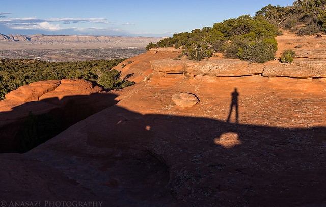
On the Arch by IntrepidXJ, on Flickr
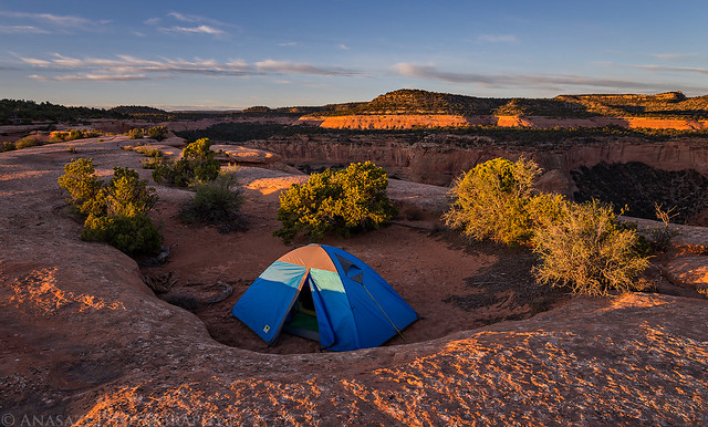
I originally had hoped to camp out on the flat sandstone up here, but since it was pretty windy out we decided to setup a tent to try and block some of the wind for the night. We waited until shortly before sunset to set it up hoping that the wind would die down. It didn’t. There were no rocks at all in the area that we could use to hold down the tent on the sandstone, so we found a shallow depression filled with sand to set it up in. The depression helped to keep some of the wind at bay, too.
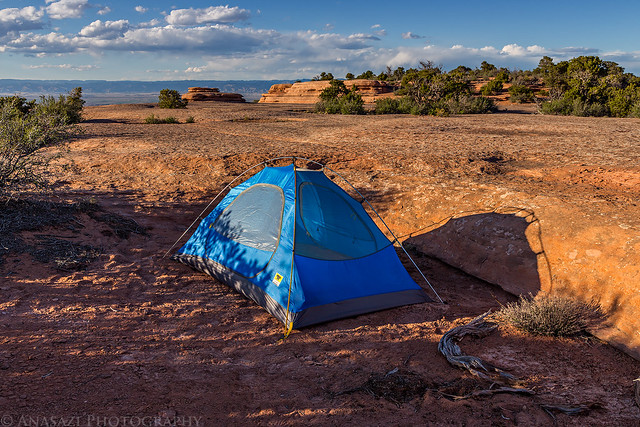
Monument Mesa Camp by IntrepidXJ, on Flickr
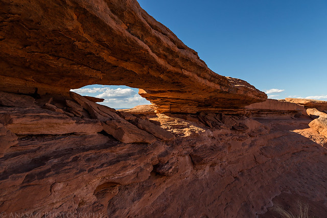
The top of Otto’s Arch before sunset.
Otto’s Arch by IntrepidXJ, on Flickr
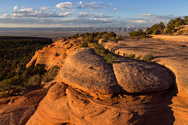
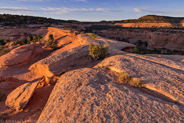
Warm light on the sandstone with a few clouds in the sky.
Edge by IntrepidXJ, on Flickr
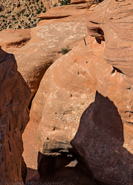
A lot of potholes up here.
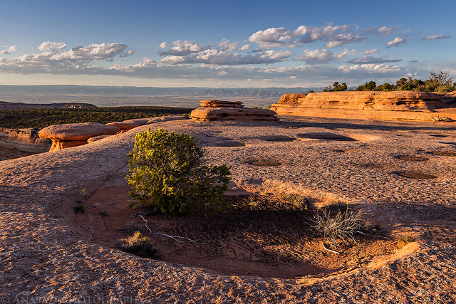
Pothole Evening by IntrepidXJ, on Flickr
Monument Mesa Sunset by IntrepidXJ, on Flickr
Last light on the Book Cliffs across the Grand Valley. It’s kind of funny that we had hiked over 13 miles today and setup camp on Monument Mesa, yet we could still see our house from up here 🙂
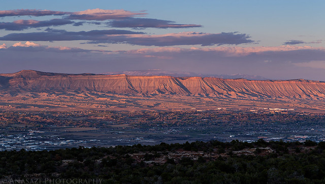
Book Cliffs Sunset by IntrepidXJ, on Flickr
Unfortunately, the wind did not die down after the sun went down, so I ended up putting the rainfly on the tent to help block the wind and keep the blowing sand out. It definitely helped, but I still had a tough time getting to sleep with the strong wind blowing around us. I did eventually fall asleep and when I woke up later during the night I noticed that the wind had finally died down. I woke up with the sunrise and got up to take a few photos.
The sun strikes Black Ridge over Monument Canyon.
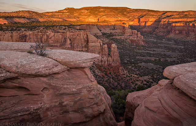
Black Ridge Sunrise by IntrepidXJ, on Flickr
Our campsite in the morning.
Morning Camp by IntrepidXJ, on Flickr
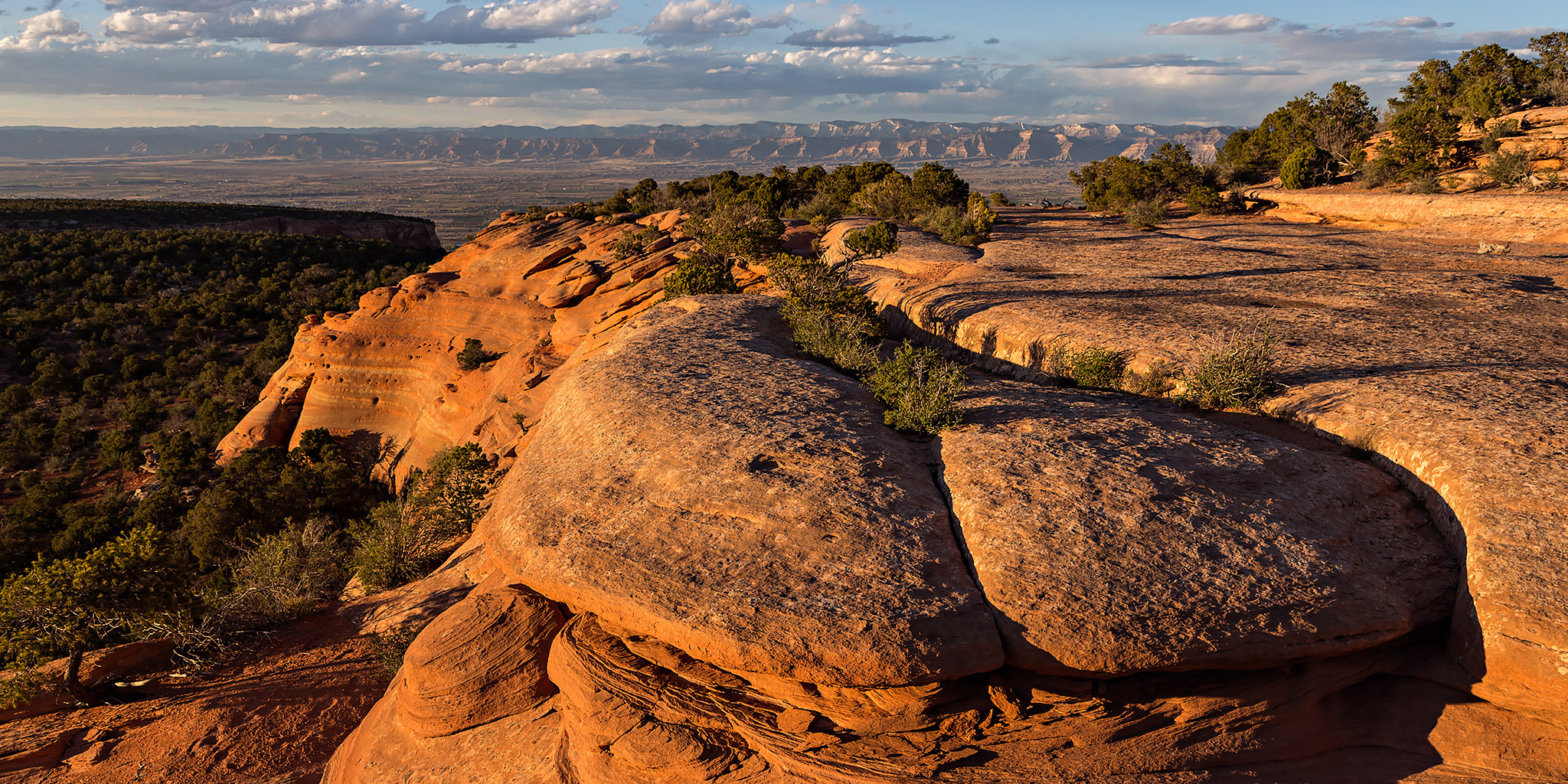
Warm morning light on sandstone.
On Top by IntrepidXJ, on Flickr
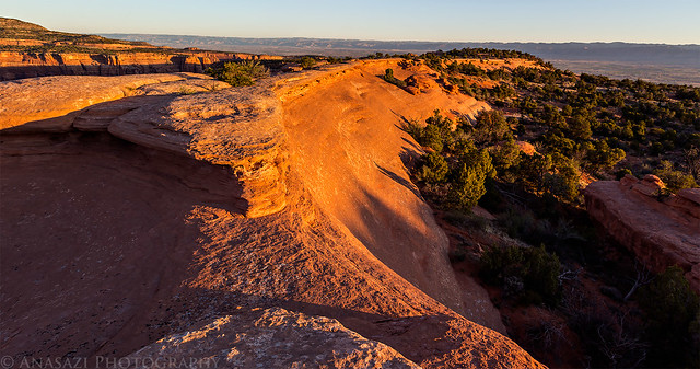
Sandstone Sunrise by IntrepidXJ, on Flickr
After taking a few photos we packed up camp, had a little breakfast and were on our way back to the Liberty Cap trail by 8:00am. Today would be a much shorter day of hiking with only 5 miles left to reach Diane’s car at the Wildwood Trailhead.
Our shadows on the sandstone as we left the Otto’s Bathtub area.
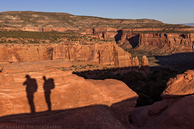
Backpacker Shadows by IntrepidXJ, on Flickr
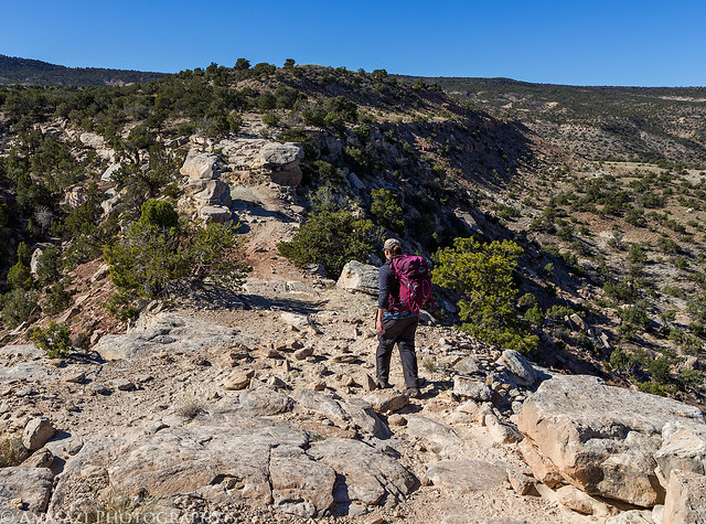
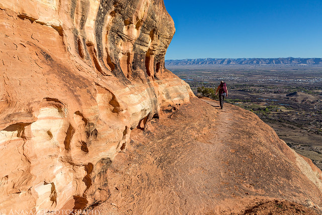
Diane descends the switchbacks off the edge of the mesa as we start our descent to the Wildwood Trailhead.
Switchbacks by IntrepidXJ, on Flickr
Approaching Liberty Cap.
Liberty Cap by IntrepidXJ, on Flickr
Overlooking Ute Canyon near Liberty Cap.
Ute Canyon by IntrepidXJ, on Flickr
Descending back down into the Grand Valley.
Descent by IntrepidXJ, on Flickr
Grand Valley by IntrepidXJ, on Flickr
Below is the GPS track from our hike including a few waypoints along the way. You can download a copy of the route if you would like to try it for yourself.