
Saturday, November 1, 2014
Winter Camp Ridge is an obscure place located north of Arches National Park near The Highlands. Most people bypass this area as they are heading elsewhere in the region, but I always seem to be drawn back to this location every so often. My first time here was when I was out exploring the backroads of the Yellow Cat area and took the sandy two-track onto Winter Camp Ridge to see where it went. The road ended up bringing me to the Arches National Park boundary not too far from Delicate Arch. Since that first trip I have always wanted to try and hike to Delicate Arch from this road. That’s what Diane and I planned to attempt this weekend.
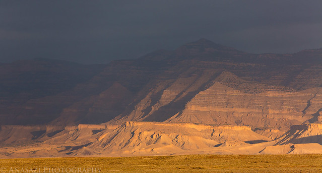
We woke up early and left home before sunrise to drive west on I-70. Shortly after entering Utah we watched the sun rise through the clouds on the Book Cliffs to the north.
There were some nice clouds with spotlight from the sunrise on the distant Book Cliffs.
Edge of the Storm by IntrepidXJ, on Flickr
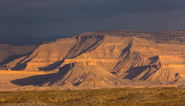
Book Cliffs Light by IntrepidXJ, on Flickr
As we followed the Yellow Cat Road onto The Highlands we watched the sun break free of the clouds.
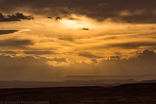
Clearing Clouds by IntrepidXJ, on Flickr
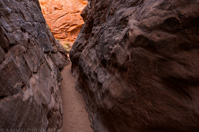
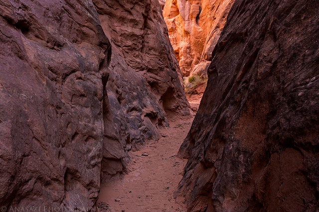
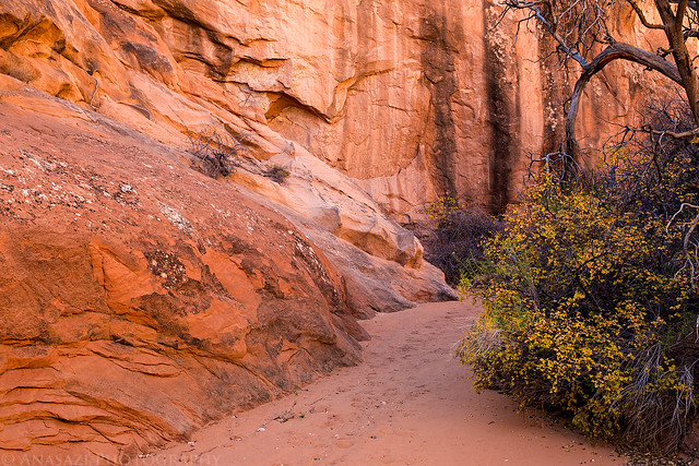
On one of my first visits to this area I discovered a short walk-in slot canyon that has become more popular in recent years that I wanted to return to so I could try and photograph it better. We started the day with a hike into this short but scenic slot canyon.
Entering the start of the narrows.
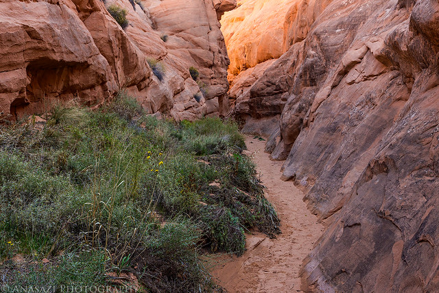
Entrance by IntrepidXJ, on Flickr
Narrow Path by IntrepidXJ, on Flickr
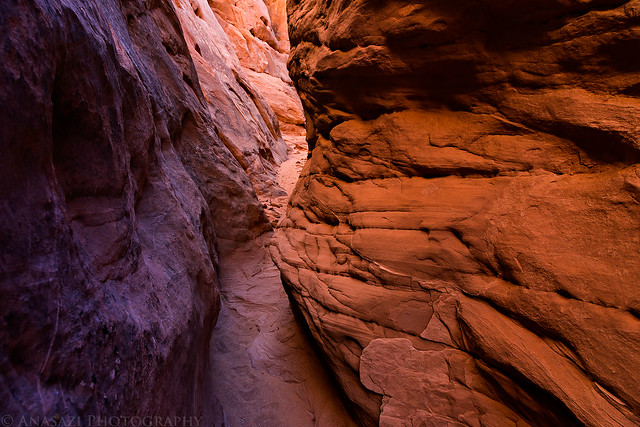
There was some nice reflected light around each corner.
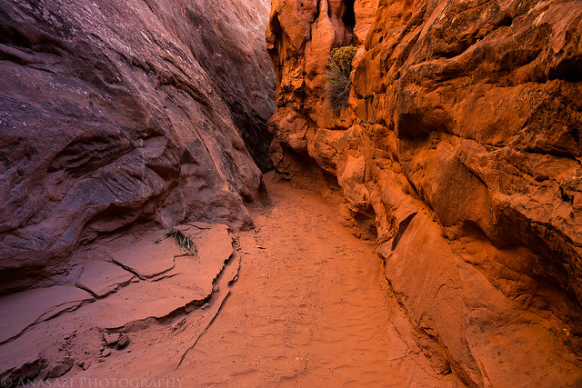
Two Tone by IntrepidXJ, on Flickr
At the end of the slot where it boxed up and was it’s deepest and darkest.
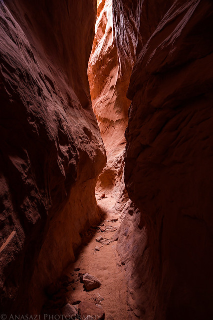
Dark Passage by IntrepidXJ, on Flickr
A nice glow coming from around the corner.
Side Canyon Glow by IntrepidXJ, on Flickr
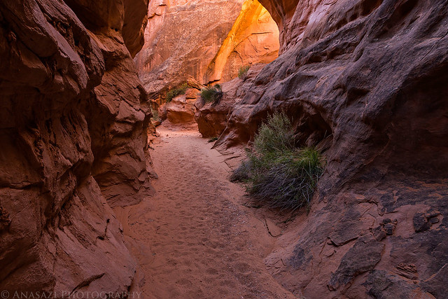
The light was even better on our way back out.
Into the Light by IntrepidXJ, on Flickr
Around the Bend by IntrepidXJ, on Flickr
Slot by IntrepidXJ, on Flickr
Diane enjoyed the short hike.
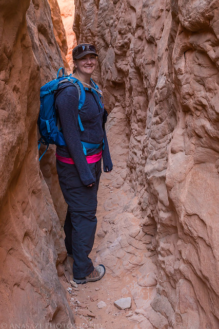
In a Slot by IntrepidXJ, on Flickr
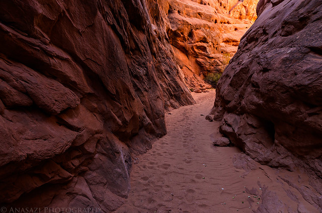
Leaving the narrowest part of the canyon.
Winter Camp Wash by IntrepidXJ, on Flickr
Returning to my Jeep on Winter Camp Ridge. While we were in the slot canyon the wind had picked up and kicked a lot of dust into the sky. Sand also rained down on us in parts of the canyon from above.
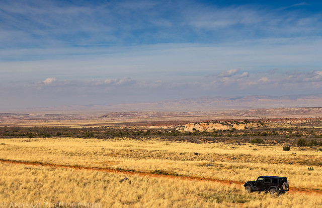
Winter Camp Ridge by IntrepidXJ, on Flickr
After our first hike we finished the drive to the end of the road at the Arches National Park boundary and went to check on a geocache I hid out here in 2010. Diane and I had visited this geocache earlier this year and it appeared that no one else had found it since then.
Yep, it’s still there.
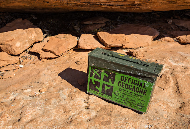
Still There by IntrepidXJ, on Flickr
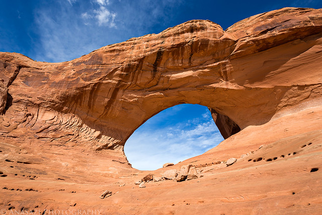
We were planning on setting up camp near the end of the road, but since it was so windy out we decided to hold off on setting up our tent until later in the day. Instead we headed back to start on our second short hike of the day. It has been a while since I’d been out to Covert Arch, so we hiked out to that impressive arch next.
Diane is standing under Covert Arch to add a little scale. It’s a pretty good-sized arch.
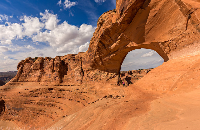
Covert Diane by IntrepidXJ, on Flickr
Covert by IntrepidXJ, on Flickr
Underneath the arch.
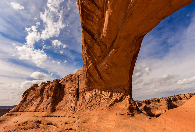
Under Covert by IntrepidXJ, on Flickr
View from the other side of the arch over the Lost Spring Canyon area and towards Devil’s Garden in Arches National Park.
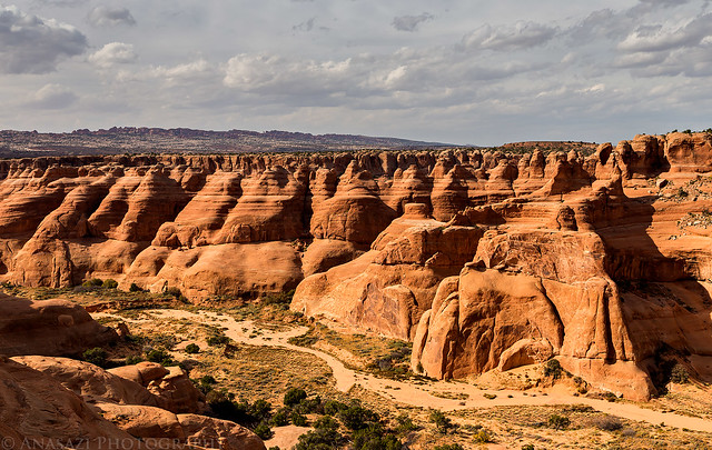
Lost Spring View by IntrepidXJ, on Flickr
As we were hiking back to my Jeep from Covert Arch we noticed that the winds still had not let up and were blowing at around 35-40mph. We weren’t really looking forward to camping in these windy conditions and still had a few hours left in the day, so I suggested that we cancel the overnight trip and hike to Delicate Arch this evening before heading back home for the night. Luckily we weren’t far from home which made it an easy decision. We drove back to the end of the road and started our hike to Delicate Arch.
When we first arrived at Delicate Arch there were surprisingly few people around and Diane wanted a photo under the arch. A large group of people showed up shortly after I took this photo.
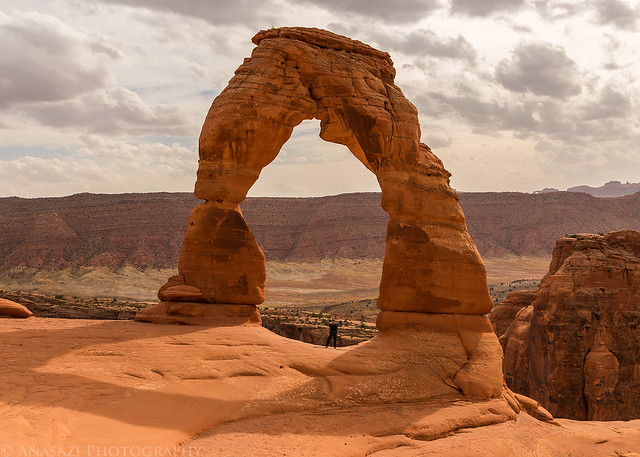
Diane Under Delicate Arch by IntrepidXJ, on Flickr
View from the other side of Delicate Arch.
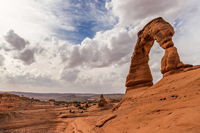
Deilcate Arch by IntrepidXJ, on Flickr
It turns out that hiking to the arch from this area is not only about the same distance as the normal trail from the Wolfe Ranch, it’s also a lot easier and quicker since there isn’t much elevation gain. I think I’ll be hiking to Delicate Arch from this area from now on when I’m not already in the park!
We made it to the arch much quicker than we thought it would take, so we sat down and rested while figuring out what to do. It was still very windy out and sunset was still a few hours away so we decided to hike back out and head home so we could get an early dinner.
Thank you for your gorgeous images and for sharing your trip! I am in love with that region and have never heard of Covert arch before. I am taking my 4th trip to Moab from Northern CA in a couple weeks and would love to know how you got from the Covert arch area to Delicate arch. I have not seen the arch from the angle you posted.
Thank you and blessings!