Sunday, April 13, 2014
My original plan for the day was to hike the Fruita Dugway trail first thing in the morning. I woke up early and was out the door well before the sun came up with hopes of catching a nice sunrise from the trail. I knew that rain was in the forecast for the day but I thought it might hold off for a few more hours after checking the forecast and weather maps before leaving my house. I was wrong. As I neared the trailhead just outside of Fruita the skies opened up and a very heavy rain began to fall, which was accompanied by strong winds and a little lightning. I would not be hiking anywhere local this morning, so I turned around and drove back home.
After getting some chores done around the house I happened to look outside in the afternoon and noticed that the sun had come out. I checked the weather again and it looked like I might be able to get the hike in after all. I drove back to the trailhead and started hiking up the Fruita Dugway trail. The beginning was a little muddy in places from the rain that morning, but I soon left the mud behind for sand and rock. I really wasn’t sure what to expect from this trail since I had never seen any good photos from this area, but I really ended up enjoying this hike. I had seen part of the trail many times before from the Historic Trail overlook in the Colorado National Monument along Rim Rock Drive before, but had never put it high on my hiking list. I think that was a mistake.
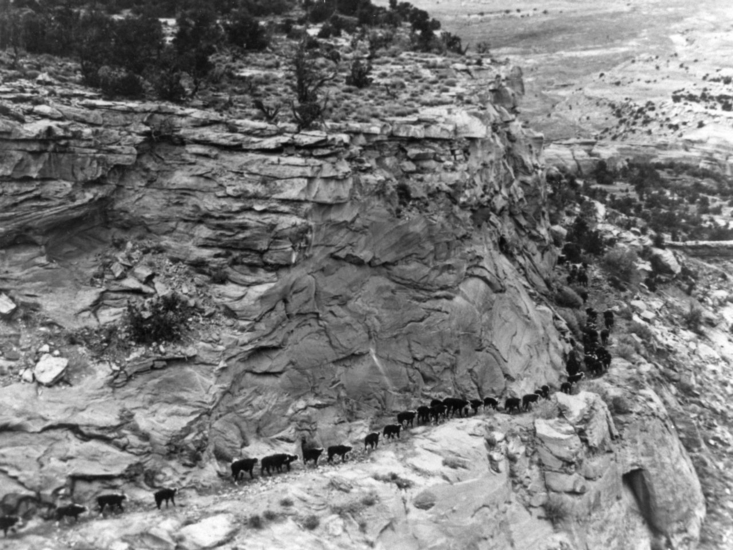
The original use of this historic trail was by Grand Valley and Glade Park ranchers who would drive their cattle up and down the trail to reach their winter and summer ranges. The trail was later improved in 1907 to help build the Fruita Pipeline which would bring clean drinking water from reservoirs on Pinon Mesa to the city of Fruita. Here’s an old photo of cattle on the portion of the trail visible from the overlook along the road.
Here are some photos from my hike…
Following the trail towards Kodels Canyon.
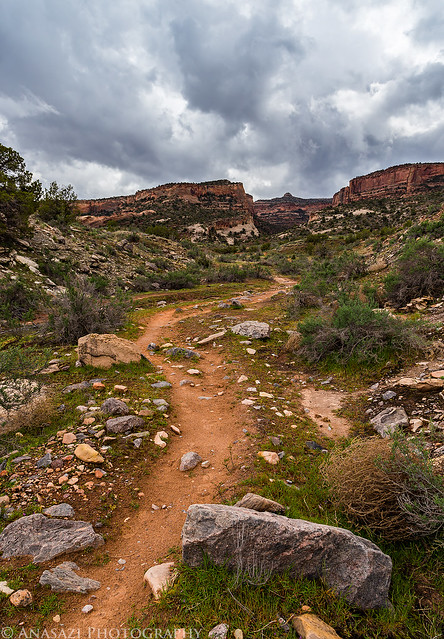
Kodels Trail by IntrepidXJ, on Flickr
The steepest part of the trail climbing up towards the Monument.
The Climb by IntrepidXJ, on Flickr
At the Colorado National Monument boundary.
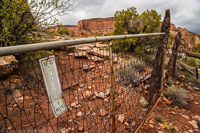
US Boundary by IntrepidXJ, on Flickr
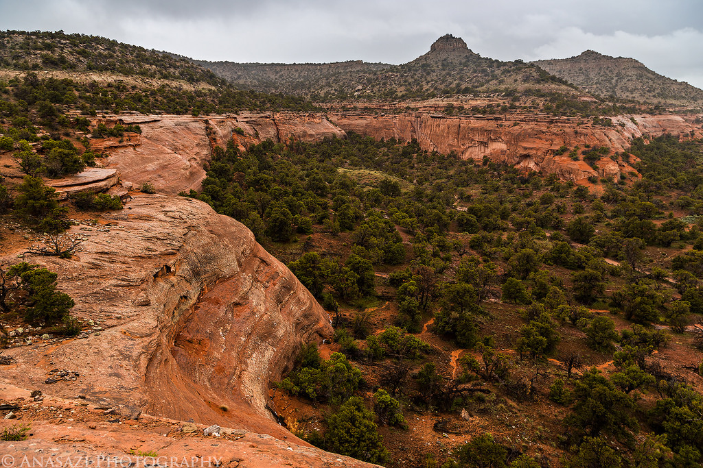
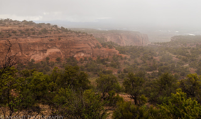
A beautiful view into Kodels Canyon from the trail.
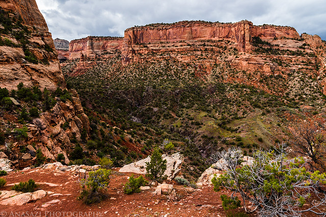
Kodels Canyon by IntrepidXJ, on Flickr
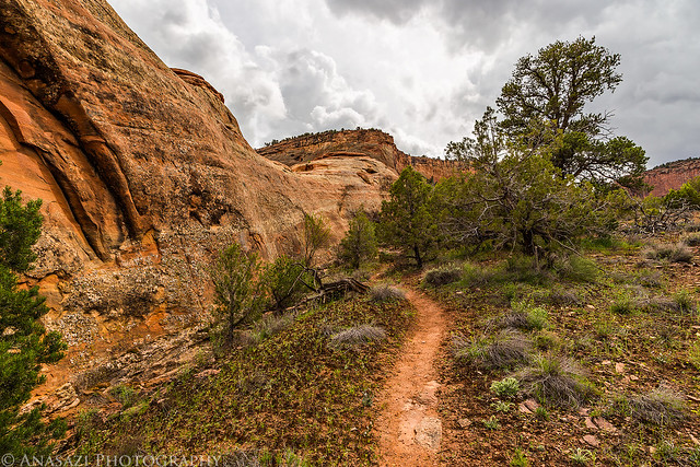
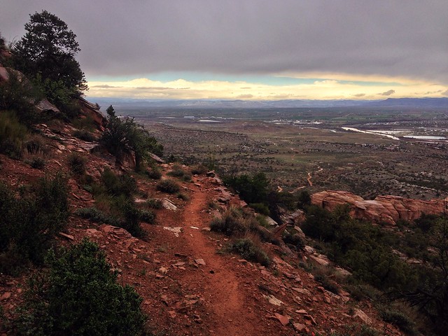
Following the trail along the ledge that is visible from the overlook along Rim Rock Drive.
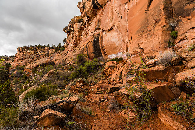
Dugway Trail by IntrepidXJ, on Flickr
At about this time the rain and lightning started again so I found refuge in a large alcove to keep dry and wait out the storm. I waited for a while and it didn’t seem like the rain would be letting up any time soon, so I put my camera away and put on my rain gear. I took a few photos with my iPhone while I explored the remaining section of the trail that would meet up with Rim Rock Drive. There was some interesting scenery around here and I’m looking forward to returning with my camera in better weather in the near future. Here’s a few photos I took with my phone in the rain…
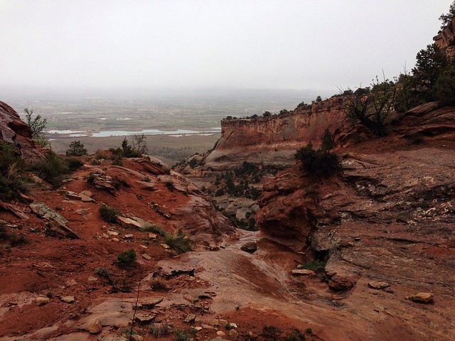
View down on Rim Rock Drive in the storm.
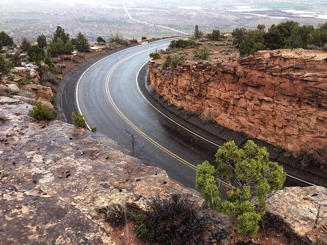
Road by IntrepidXJ, on Flickr
Tree in an alcove.
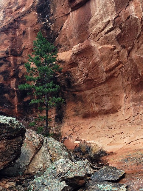
Alcove Tree by IntrepidXJ, on Flickr
Rain in a shallow canyon.
Switchback Canyon by IntrepidXJ, on Flickr
Rock fall along the old trail.
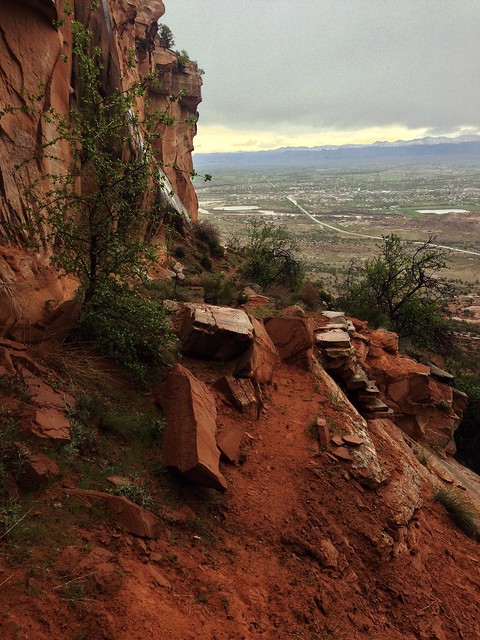
Rockfall by IntrepidXJ, on Flickr
View of the alcove I waited out the storm in.
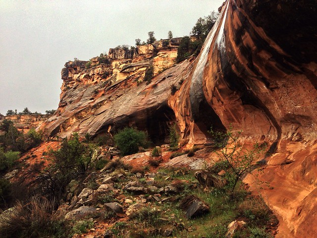
Alcove by IntrepidXJ, on Flickr
Hiking back down in the rain.
Dugway Trail by IntrepidXJ, on Flickr
While I was in the alcove trying to wait out the storm, there must have been enough rain above me to cause a small waterfall over part of the alcove I was in. Luckily, the part of the alcove I was in stayed dry. It was cool to watch this small flash flood from above. Here’s a quick video I took with my phone.
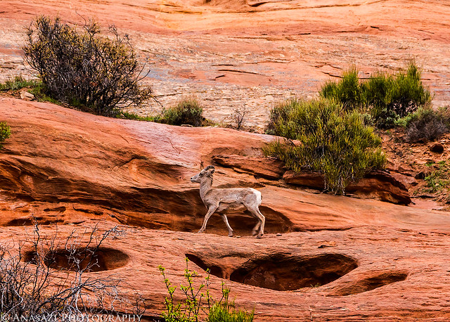
After meeting up with the road I decided to hike back down to the trailhead and come back another day when it wasn’t raining. However, by the time I reached my Jeep at the bottom the rain had stopped again and I wanted to finish the trail. I drove back up into the Monument to finish the trail from where it had met up with Rim Rock Drive. As I neared the tunnels I was stopped by a large group of bighorn sheep crossing the road. My camera was still in my backpack and it took me too long to get it out. By that time most of the sheep were too far away for a decent photo. I did managed to get a couple of photos…
Sheep Above by IntrepidXJ, on Flickr
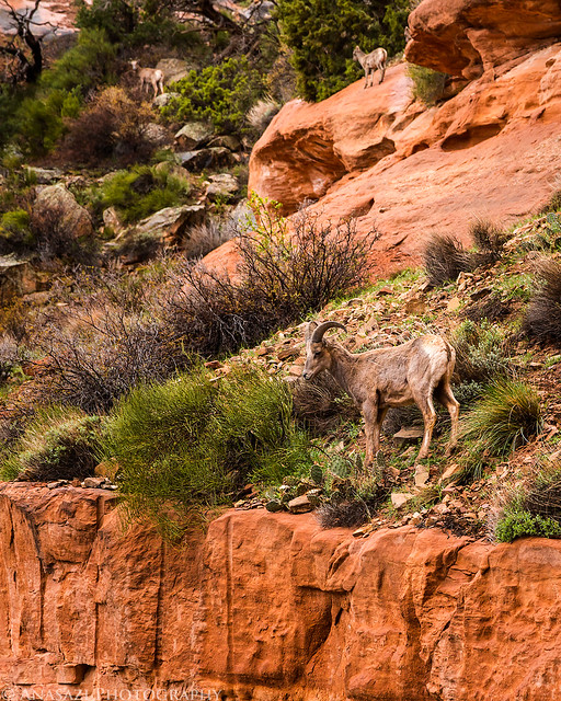
Three Sheep by IntrepidXJ, on Flickr
I parked along the road and started hiking the rest of the trail. It figures that shortly after I started hiking again it started to snow. It wasn’t enough to get me or my camera soaked this time, so I continued.
A great view over the upper reaches of Kodels Canyon. I’m going to have to come back to this area when the light is better and it’s not snowing.

Upper Kodels by IntrepidXJ, on Flickr
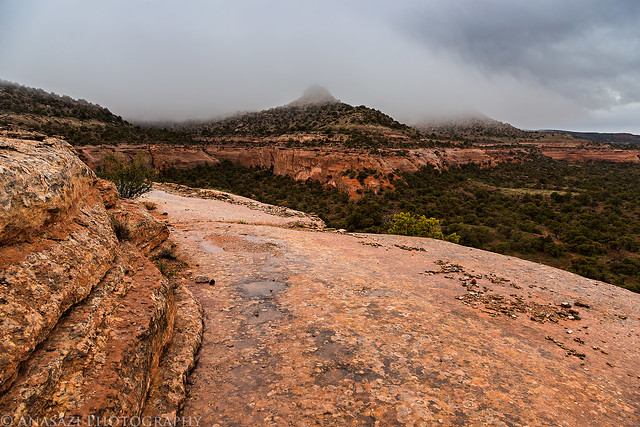
A snowstorm obscures the view.
Snowstorm by IntrepidXJ, on Flickr
A cool sandstone shelf section of the old route.
Sandstone Bench by IntrepidXJ, on Flickr
This is definitely a hike I am going to have to return to in better weather. Even with the rain and snow, I still had a great time today!