
Stud Horse Point, Water in The Wave & The North Rim of the Grand Canyon
Labor Day Weekend | Friday – Monday, August 31 – September 3, 2012
The phrase ‘once in a blue moon’ has long been used to describe rare or absurd happenings, which is definitely how I would classify this extended weekend trip. As an added bonus, this weekend was also host to a Blue Moon on Friday night, which won’t happen again until 2015. A few months ago I scored another set of permits to Coyote Buttes North, and after asking Amanda if she wanted to go again (she declined since she knew she would probably be working that weekend), I asked Jared if he would like to come along for the weekend. He was up for the adventure, so we planned the weekend around our trip to The Wave.
I only worked a half day on Friday so that we could leave a bit early and make it down to the area in time to catch the sunset. Jared drove down from the Salt Lake area to meet me at my house so he could load his gear into my Jeep and drive down with me. Once the Jeep was packed, we hit the pavement and started driving south. Very quickly into the drive I noticed my Jeep was feeling pretty bouncy whenever we hit a bump. It turns out one of my rear shocks was bad and causing this little issue. A bad shock is far from a reason to cancel a trip, but I did have to drive a little bit slower on the highways than I would have liked…just to be on the safe side.
As we reached Page after our long drive, a storm was approaching the area over the Vermilion Cliffs and creating some scenic conditions. We found a place to pull of the road and take a few photos. There were crepuscular rays filtering down through the clouds over the Vermilion Cliffs.
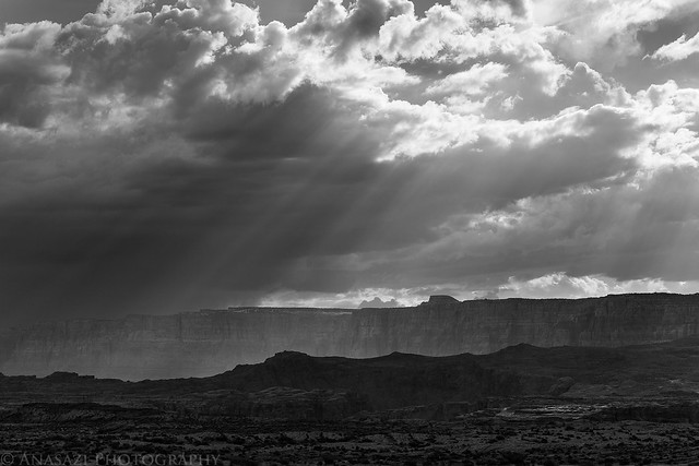
Rays by IntrepidXJ, on Flickr
Rain was falling in the distance and lit up by sunlight.
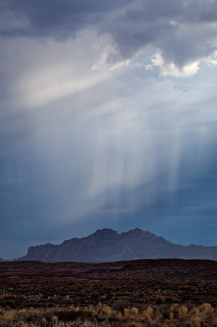
Rain by IntrepidXJ, on Flickr
We grabbed a very quick dinner in Page and tried to continue to our destination on Stud House Point for the sunset, but along the way we started seeing a lot of interesting light and lightning from the approaching storm, so we made a detour to the Wahweap Overlook so we could take a few photos.
Light striking the bands of cliffs in Lake Powell.
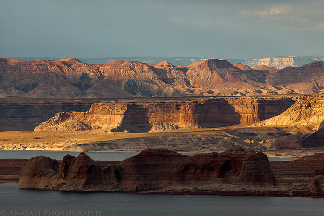
Layers of Light by IntrepidXJ, on Flickr
My only decent photo of lightning all weekend.
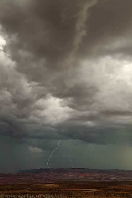
Vermilion Lightning by IntrepidXJ, on Flickr
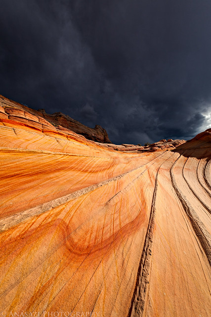
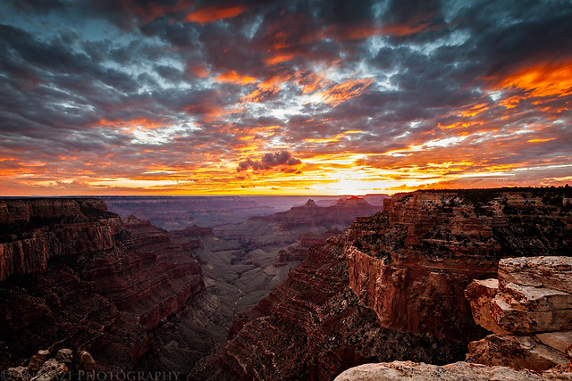
After trying to get some decent lightning photos from the Wahweap Overlook we decided to try and make it to Stud Horse Point in time for sunset. It was close, but we did make it there in time. As we arrived it started to rain, but I put on my rain jacket and still tried to take some photos, even with the lightning and thunder nearby.
There were just too many clouds in the sky that blocked the sunset, but there was a very short window of time when a little light got through.
Stud Horse Point Sunset by IntrepidXJ, on Flickr
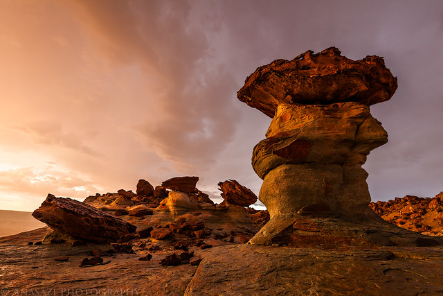
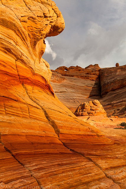
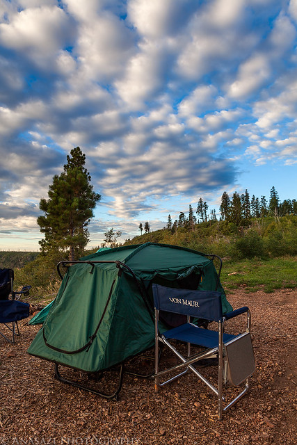
When the sun was down we sat in the Jeep and waited for the rain to stop so that we could setup camp. I’d guess we waited between 30-60 minutes before that happened. When the rain was done and camp was setup we waited for the clouds to clear so we could try to get some photos of the hoodoos under the light of the Blue Moon. It didn’t take long before we were both taking photos of these interesting formations under the moonlight.
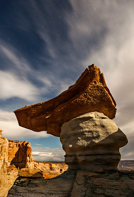
Stars & Clouds by IntrepidXJ, on Flickr
Otherworldly by IntrepidXJ, on Flickr

Alien Landscape by IntrepidXJ, on Flickr
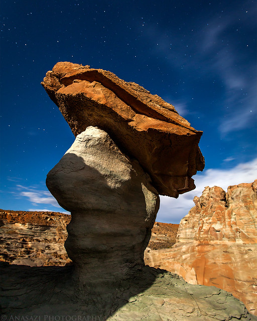
We stayed up until about midnight taking photos under the moonlight before finally going to bed. Even with our late night, we were up the next morning in time to catch the sunrise. There were no clouds in the sky above to help add color to the scene, but there was a little golden light striking the formations.
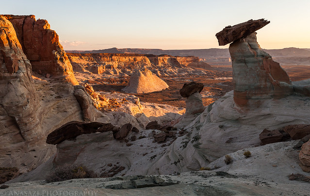
Golden Hour by IntrepidXJ, on Flickr
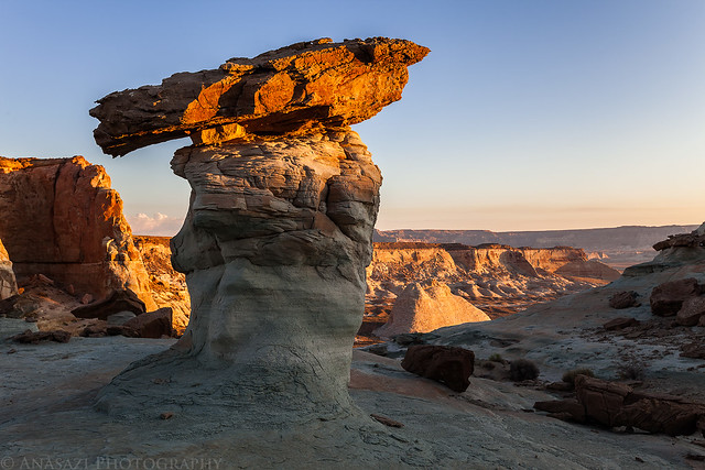
Morning by IntrepidXJ, on Flickr
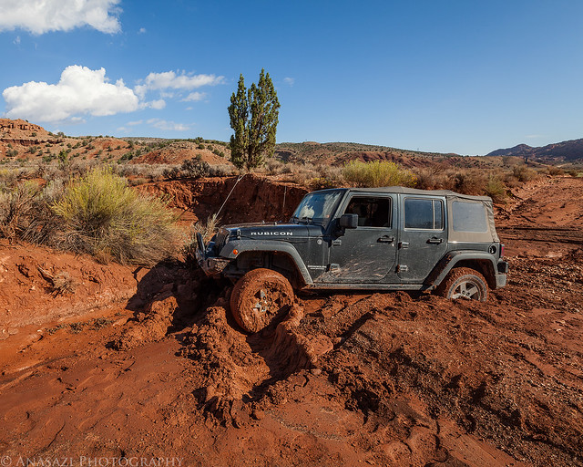
When the sun was up, we had a quick breakfast, packed up camp, and then made our way to House Rock Valley Road so that we could get to the Wire Pass Trailhead. Apparently, this area received quite a bit more rain than we did on Stud Horse Point the previous night because many of the small wash crossings had cut into the road a little in places. We ran into our first issue when we reached the Buckskin Wash crossing and found that it was completely washed out. The cutbanks were about 2 feet tall, which would normally cause no problems for my Jeep to get through, but as I walked across the wash I sunk in some of the quickest quicksand I have ever come across. With nothing to winch to nearby, there was no way I was trying to get across here in my Jeep!
Buckskin Crossing by IntrepidXJ, on Flickr
Before admitting defeat, we noticed that there was another side road to the left that went to another crossing of Buckskin Wash that looked much better. We took that side road and easily crossed the wash just a little bit further downstream. However, less than a quarter mile later we came across another badly washed out section of the road, but it didn’t look as bad as the Buckskin Wash crossing we had just bypassed. There was another cutbank here, but the bottom of the wash was solid ground which would pose no problems for the Jeep. As I walked around the crossing before driving across it, I didn’t find any soft ground that I thought would be a problem for the Jeep. So I got back in the Jeep and went to drive cross. I used a little momentum to get up over the cutbank, but as soon as my front tires crested the top, they sunk into some quicksand and the belly of my Jeep settled on the firmer surface of the cutbank. My rear tires also dug themselves into some holes. The Jeep was stuck and not moving under it’s own power…
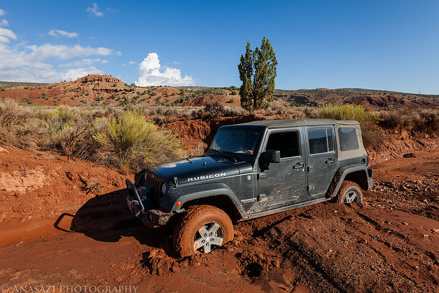
Quicksand! by IntrepidXJ, on Flickr
First we tried grabbing a bunch of rocks and placing them behind all the tires so that I could try and back out. This method has worked well for me in the past, but did absolutely nothing this time. As I placed rocks behind the passenger side front tire, they would just disappear into the soupy quicksand! Next we looked around for a suitable anchor to hook my winch up to. We contemplated wrapping a tow strap around a bunch of sagebrush, but we doubted it would hold. The only tree that was possibly big enough to hold the weight of the Jeep was right behind the Jeep. It was also on the edge of the wash, so we feared that it might just pull right out of the dirt if it didn’t have good roots. With no other options I hooked the winch to the tree and hoped that it would hold and swing my Jeep around backwards. Luckily, with the winch rope hooked up to the tree, it fit in the small gap between the top of the front bumper and the bottom of the fender flare. I was concerned about ripping off my fender flare by pulling the Jeep at this angle, but the rope barely touched it as we pulled. That couldn’t have worked out any better!
Here’s a photo Jared took as I was winching my Jeep around.
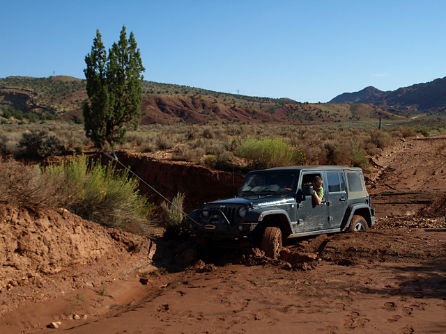
Quicksand Recovery by xjblue, on Flickr
Surprisingly, the small tree on the side of the wash never even budged and my Jeep slowly spun around until all four wheels were on the solid ground in the bottom of the wash. This recovery worked out perfectly. In the photo below you can see the tire grooves in the deep quicksand that had trapped us.
Getting Out by IntrepidXJ, on Flickr
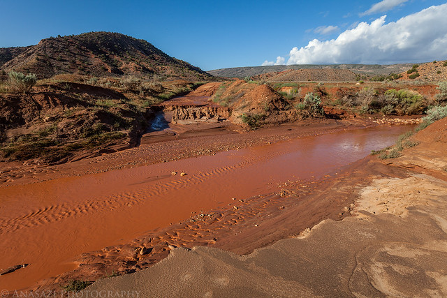
With no other options to get around this crossing, we headed back north to the highway and drove through Kanab to make our way south to the other end of the House Rock Valley Road. This route was well out of our way, but also less likely to be washed out. We eventually made it to the Wire Pass trailhead and started hiking much later than we had originally planned. As we hiked across the desert we noticed that there were pools of water everywhere from the recent rains. That really got me excited as I have always wanted to visit The Wave when it was full of water.
Pretty soon we reached the entrance to The Wave.
Entrance by IntrepidXJ, on Flickr
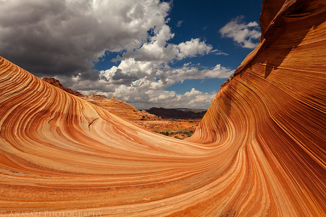
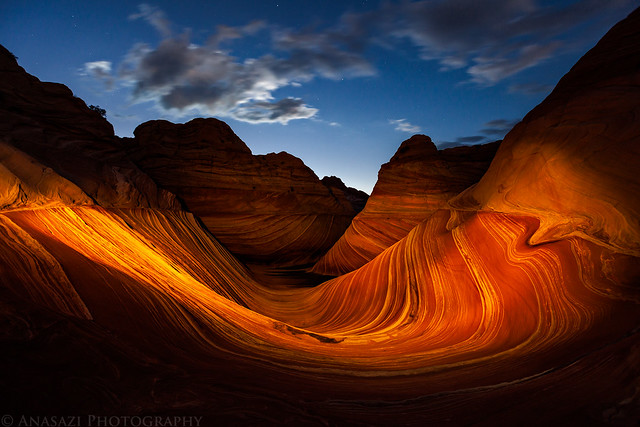
After hiking into The Wave I was pleasantly surprised to find a large pool of water. I quickly got out my tripod and started to take a few photos while the water was calm. I’m glad I did, because during the rest of the day the wind would pick up a little bit and I would not find the pool this calm again.
Water in the Wave by IntrepidXJ, on Flickr
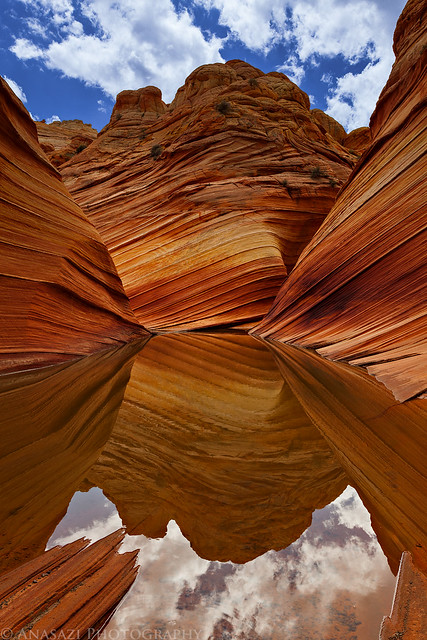
A closer look at the reflection for a more abstract photo.
Wave Reflection by IntrepidXJ, on Flickr
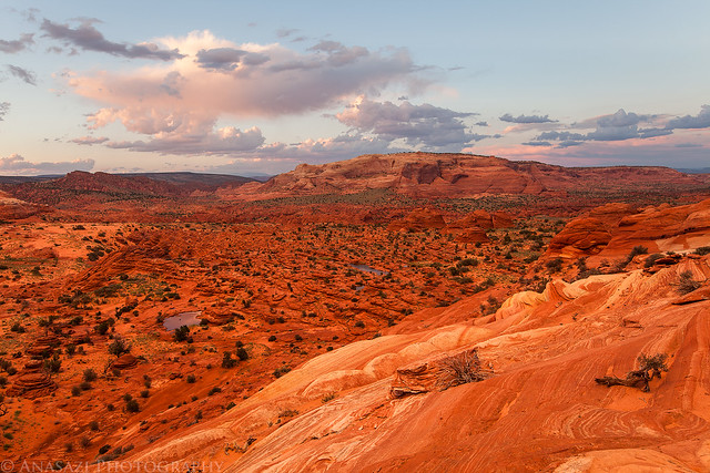
Since we were blessed with nice partly cloudy skies all day, I wanted to return to Sand Cove, which I had visited back in May with clear blue skies.
I just love these lines here.
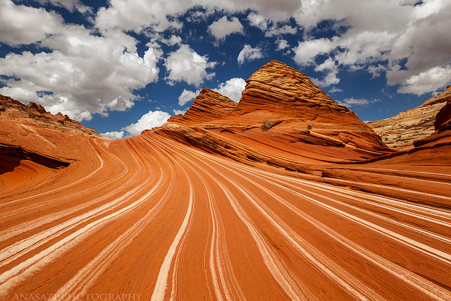
The Racetrack by IntrepidXJ, on Flickr
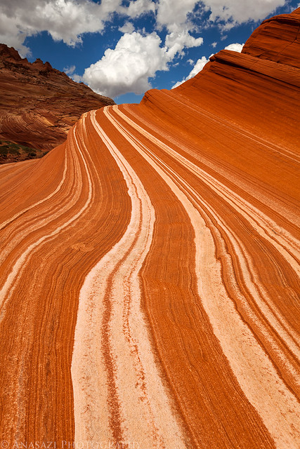
Racing Stripes by IntrepidXJ, on Flickr
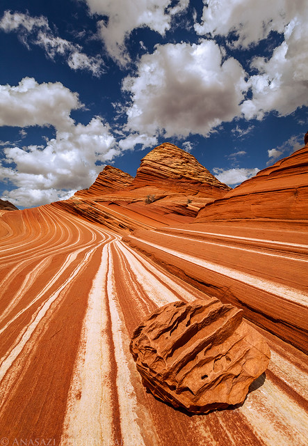
Merge by IntrepidXJ, on Flickr
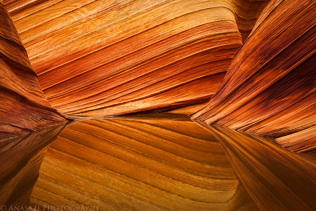
There were pools of water everywhere, so I made sure to keep an eye out for interesting reflections.
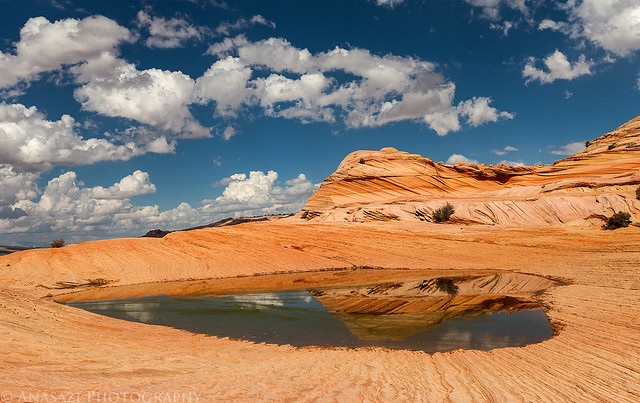
Second Wave Reflection by IntrepidXJ, on Flickr
Later in the evening, some darker storm clouds moved in to the area. We even got a few on and off sprinkles of rain, but nothing that soaked us. There were still enough breaks in the clouds to let sunlight through on occasion. I really love a sunlit foreground with dark clouds in the sky.
Dark Cloud by IntrepidXJ, on Flickr
I have never really got a good photo of Top Rock Arch before, but now I have a couple to choose from.
Top Rock Arch by IntrepidXJ, on Flickr
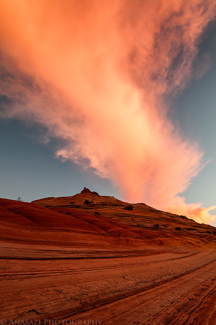
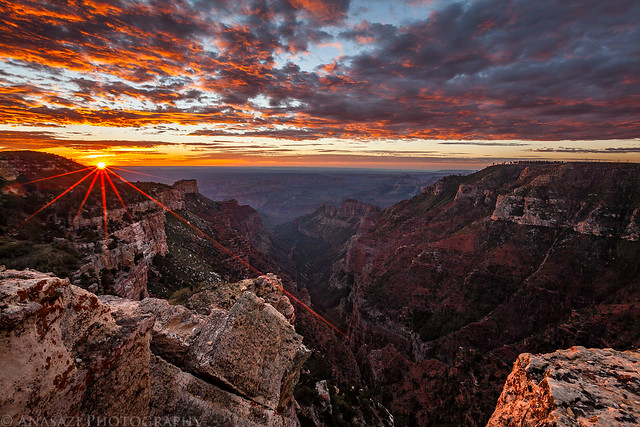
A sunburst as the sun dips below the surrounding cliffs for the evening.
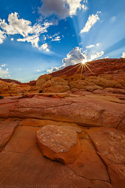
Burst by IntrepidXJ, on Flickr
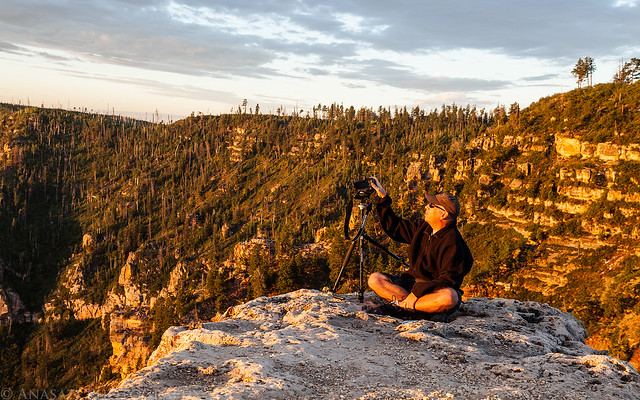
Jared photographs the remaining sunlight high up on Top Rock as the darkness slowly creeps upwards toward him.
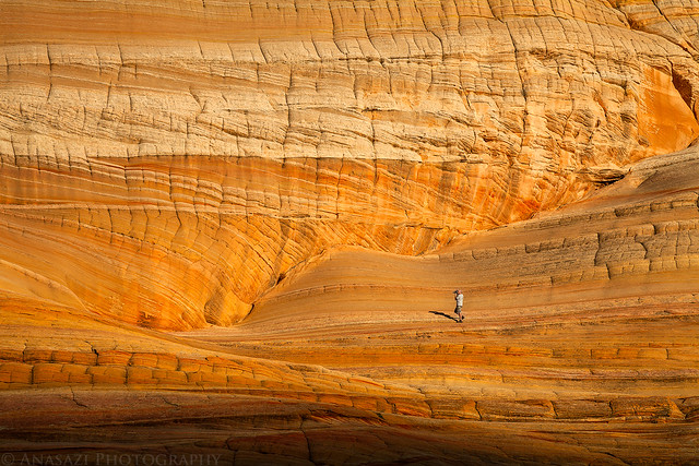
Jared for Scale by IntrepidXJ, on Flickr
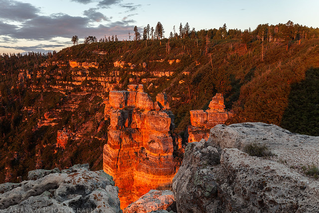
Setting sunlight catches the tops of a few teepees and the distant cliff in North Coyote Buttes.
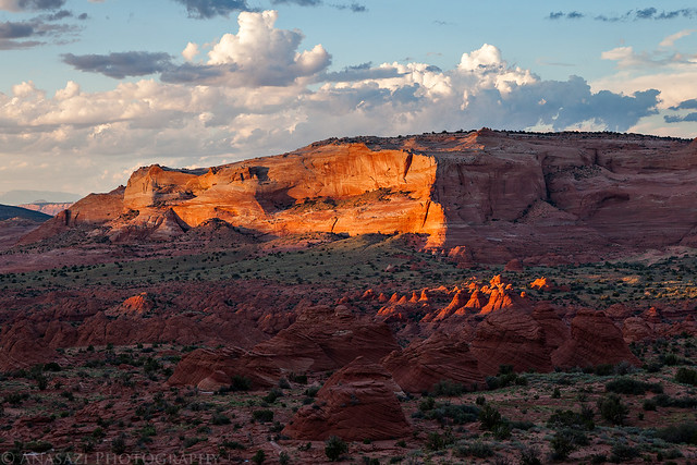
Catching Light by IntrepidXJ, on Flickr
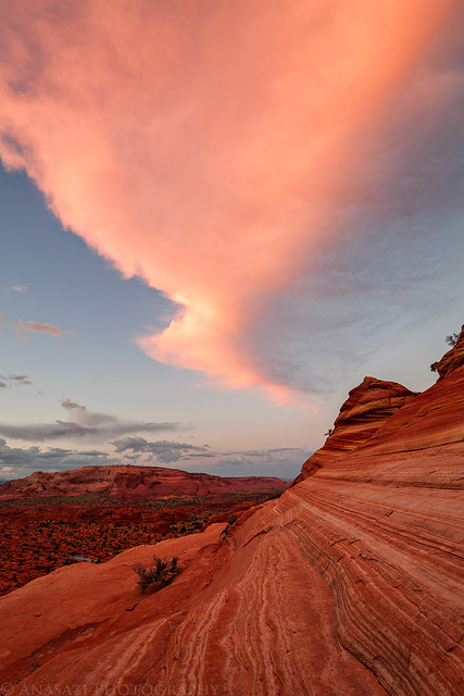
As the sun was setting, the light reflected off of a large cloud above us which gave us a very red/pink glow for a few minutes.
Coyote Buttes North by IntrepidXJ, on Flickr
This was part of the large cloud reflecting the setting sunlight back down to us. It kind of looks like the sandstone butte is erupting.
Eruption by IntrepidXJ, on Flickr
Looking the other direction at the same cloud.
Pink by IntrepidXJ, on Flickr
Once the sun was down we waited around for the moon to rise so that we could try taking some night photos of The Wave. Two other guys from Germany also stayed to do the same. Unfortunately, as we were waiting a large storm cloud rolled in just to the south and east of us. We were on the edge of it and didn’t get any rain, but it blocked the moonlight we were waiting for. We were able to see some lightning flashes, but they were pretty far away since we never heard the thunder.
One of the guys from Germany had a light with some colored filters that he was playing with while we were waiting for the moon, so I snapped this shot while he was experimenting with it.
The Wave at Night by IntrepidXJ, on Flickr
When we finally gave up on waiting for the moon Jared and I hiked back with the two guys from Germany. After hiking about a mile I thought I heard someone yelling for ‘help’ so we all got quiet and listened more closely. We heard it again. We called out to see what the problem was and ended up locating a lost hiker from Canada. We had actually met this guy earlier at The Wave. He had left early with plenty of time to make it back to the trailhead before the sun went down, but on his way back he managed to get lost and then it got dark out. He had plenty of water, but no flashlight or warmer clothes with him. He saw our lights as we were hiking back and found his way over to us. I guess he was pretty lucky that we stayed as late as we did, or he might have been out there all night! He did have a walkie-talkie with him to communicate with his friends at the trailhead that did not have a permit, so before he found us he had contacted them and had them drive out to find cell phone signal so they could call 911 for help. He hiked with us back to the trailhead. When we reached the trailhead around 11:00pm, Jared and I waited with him for about 45 minutes to see if his friends would show up soon. He insisted that he would be OK and that we should go to camp and get some sleep, so we drove about two miles down to road to the State Line Campground, setup camp and went to bed. I was pretty tired and fell asleep quickly, but Jared told me in the morning that he saw two vehicles pass the campground a little while later and then return the same way. We assume that was the lost hiker’s friends picking him up.
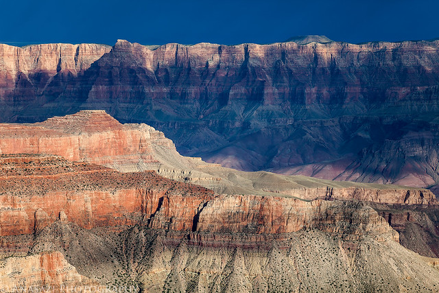
Since it was a long day, we slept in the following morning and skipped trying to catch the sunrise. When we finally got up we had a quick breakfast, loaded up the Jeep and started driving towards the North Rim of the Grand Canyon. We topped off the fuel tank in Jacob Lake before making our way out to a couple of viewpoints in the Kaibab National Forest outside of Grand Canyon National Park.
We first stopped at Timp Point along the Rainbow Rim Trail, and then made our way up to North Timp Point. I preferred the view from North Timp and took this photo of Steamboat Mountain from there. We ran into a group of mountain bikers on the Rainbow Rim Trail- I might need to bring my bike with me next time 😉
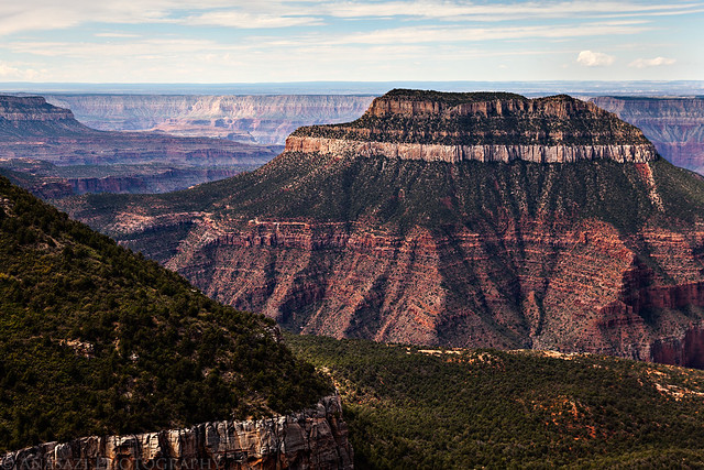
Steamboat Mountain by IntrepidXJ, on Flickr
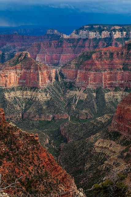
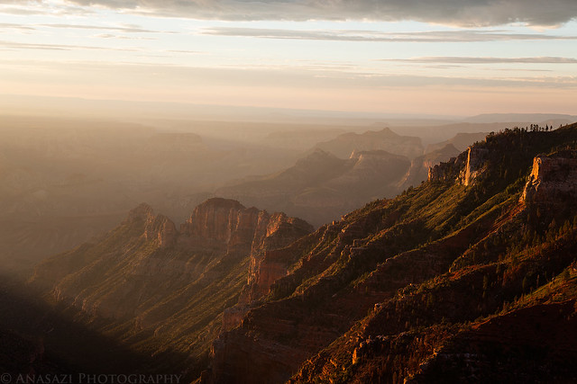
After checking out the viewpoints outside of the park, we continued the drive to the Grand Canyon Lodge on the North Rim and took in the views from there.
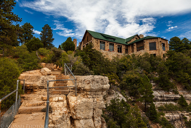
Grand Canyon Lodge by IntrepidXJ, on Flickr
A view from Bright Angel Point near the Lodge.
Bright Angel Point by IntrepidXJ, on Flickr
As we walked through the Grand Canyon Lodge we smelled the food from the restaurant. We were pretty hungry at this point and decided to have lunch here before continuing our journey. The food was OK, but the views from our table were spectacular!
After lunch we took the road out to Point Imperial. Here’s a view out over Nankoweap Creek from up there.
Nankoweap Creek by IntrepidXJ, on Flickr
Jared taking a photo from Point Imperial with storms in the distance.
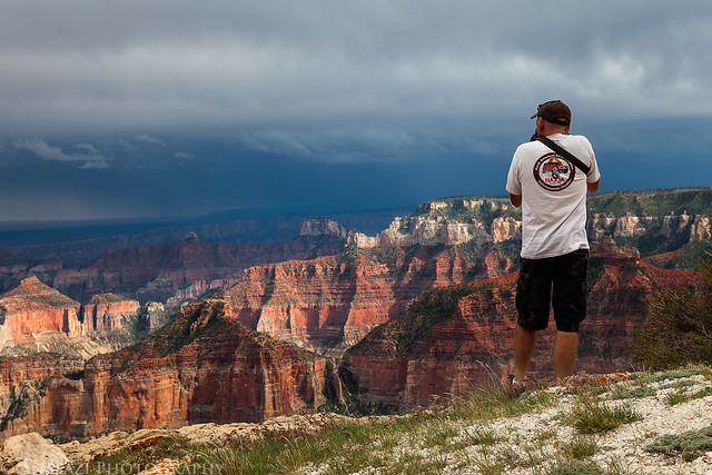
Photographing from Point Imperial by IntrepidXJ, on Flickr
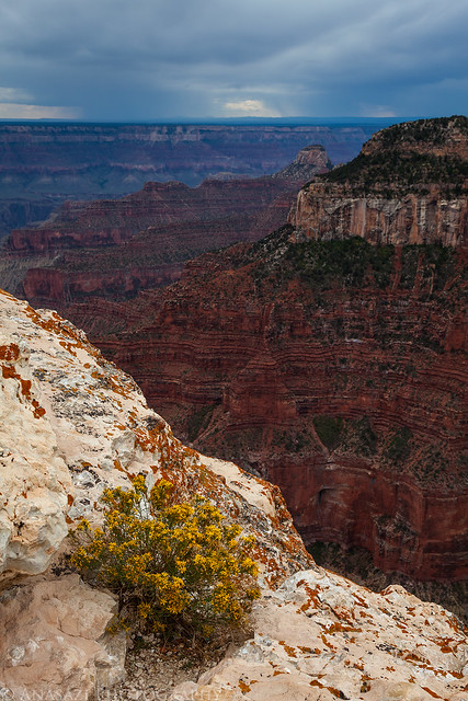
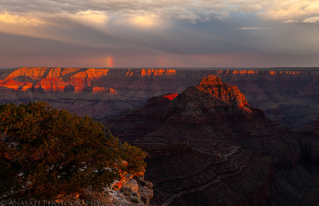
When we stopped at the Walhalla Overlook we were treated to some amazing spotted light in the canyons below.

Unkar Creek by IntrepidXJ, on Flickr
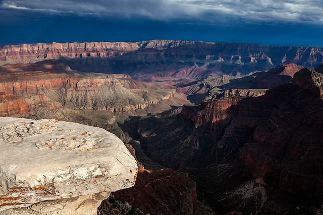
Walhalla Overlook by IntrepidXJ, on Flickr
Spotted Light by IntrepidXJ, on Flickr
We weren’t expecting to visit any ruins on this trip, and were surprised to find the Walhalla Glades Pueblo nearby. We just had to stop for a look see!
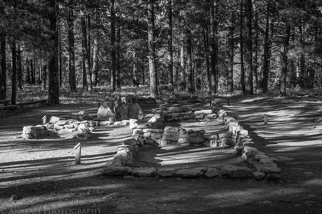
Walhalla Glades Pueblo by IntrepidXJ, on Flickr
Then we hiked to a small granary that wasn’t too far away.
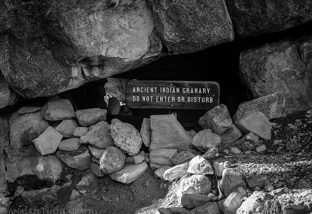
Do Not Disturb by IntrepidXJ, on Flickr
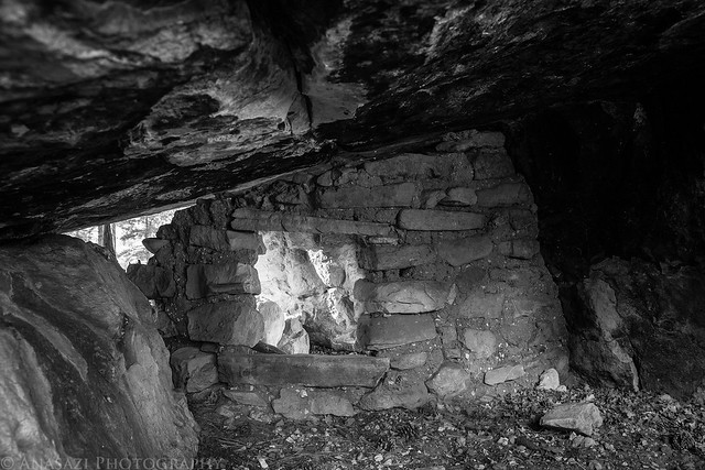
Hidden Granary by IntrepidXJ, on Flickr
Finally we reached Cape Royal, which was our destination for the sunset this evening. We hiked out to the overlook, took in the view and waited for the sun to set. There were some really nice clouds in the sky with a gap on the western horizon, so I had a feeling it was going to be a good one.
Nice clouds above and sun rays in the distance.
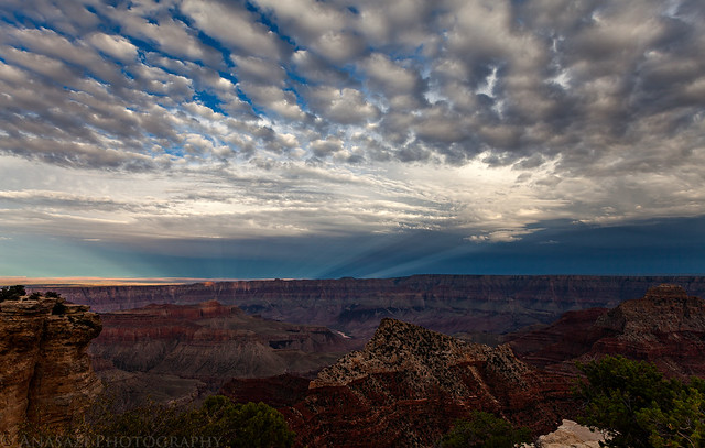
Rays & Clouds by IntrepidXJ, on Flickr
We even got to see a small rainbow on the South Rim.
South Rim Rainbow by IntrepidXJ, on Flickr
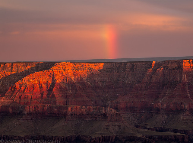
Short Rainbow by IntrepidXJ, on Flickr
A great sunset over Wotans Throne below.
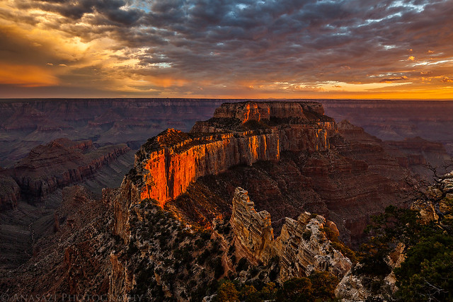
Royalty by IntrepidXJ, on Flickr
Once the sunlight was no longer striking Wotans Throne, I quickly grabbed my camera and tripod, hopped over a fence and made my way out to another view of the canyon just in time to catch the sun dip below the horizon. I only got off one shot before the sun was gone, and I’m glad it turned out well.
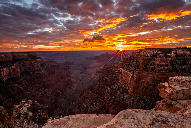
Majestic by IntrepidXJ, on Flickr
Then I took this photo right after the sun was below the horizon but the sky was still lit up with color.
Grand Sunset by IntrepidXJ, on Flickr
Jared and I stayed well past dark again, trying to take some photos during dusk and then of some distant lightning that was just too far away. We hiked back in the dark and were the last vehicle left in the parking lot. We weren’t sure where we were going to camp, but needed to get outside of the park in order to find a spot. As I drove out Jared looked over our maps and suggested we head over to the Nankoweap Trailhead near the Saddle Mountain Wilderness and Seiber Point which was just on the boundary of the park. From the map it looked like it might offer some good views for sunrise, so we drove there in the dark. We found a nice campsite right on the edge of the canyon, setup camp and went to sleep.
The following morning we woke up shortly before sunrise and viewed our surroundings to find a place to setup and take some photos from. We found a nice outcropping of rock that offered a nice view, so we hiked up to it and waited for the sun.
The sunrise did not disappoint!
Seiber Point Sunrise by IntrepidXJ, on Flickr
Warm morning light on the cliffs around us. Our campsite was actually just out of the frame on the right side of this photo.
Seiber Point Light by IntrepidXJ, on Flickr
Jared taking photos in the nice light.
Jared in the Light by IntrepidXJ, on Flickr
It was a little hazy in the canyon, but the sunlight just flooded in anyway.
Flood of Light by IntrepidXJ, on Flickr
There were some nice clouds above our camp when we hiked back.
Saddle Mountain Camp by IntrepidXJ, on Flickr
After breaking down camp we decided to skip eating in camp and drove to Nedra’s Too in Kanab for an awesome breakfast. From there it was a long drive back home to end our extended weekend. It turned out to be an amazing weekend with a lot of adventure thrown in. The conditions and weather were excellent for photography and camping, plus we never even really got caught in one of the passing storms. Weekends like this only come around once in a blue moon!
Stunning photos! Thanks for sharing!
Thank you Julie!
Magnifique !
Great photos!!
I have to tell you that my family and I were there that weekend with permits to go to the Wave on Sunday 2 September but due to the problems you encountered at Buckskin Wash we were unable to do it (no Jeep 4×4 for us). Rather than to take the route you took, we decided to go on to the North Rim of the Grand Canyon and had an excellent day of hiking. Looking at your pictures of The Wave I wish I would have gone they way you did. Well, only one more reason to try to get to go again.
Great blog and photos. I will come back and read more of your backpacking and hiking experiences. Have you done any on the Grand Gulch area? That is one are I want to go a hike next Spring or Fall.
Sincerely,
Francisco
Thank you Francisco. I have done a few day hikes in Grand Gulch and will actually be returning there in 2 weeks.
Great!!
I hope you will share your experience and your pictures. I am interested to know which time of the year you prefer, and recommend, going to hike that area. Have a great time!
Of course I will share my experience and photos on this website 😉 I prefer to spend the spring and fall in that area because of the great weather. Mild winters are good, too, but it’s usually too hot in the summer, even though I do occasionally go in the summer and just deal with the heat.
so glad to find your blog and pics. I am planning an itinerary for a hiking trip to UT and AZ next year. Long way off, I know, but I really wanted a cabin in Zion and they were booked up earlier. I didn’t want to come in July or Aug. so sept it is.
we plan to hike the narrows top down, after that I’m unsure. I dont know whether to go to House Rock Valley (the original plan) or north to Kolob and Bryce. it is nice to find the blog of someone who knows the area. I’ll be back. : )
Randy,
That was some trip! Epic, really!
Thanks John, it was an amazing trip!
You had the utmost amazing Wave experience and pictures!! Please call me up next time if you get another permit!
Thanks Melissa! It was an amazing weekend that I won’t soon forget. I did manage to get another permit to The Wave for November, but unfortunately I was only able to get 1 this time….so I’ll be on my own.